Untitled from Joshua Cohen on Vimeo.
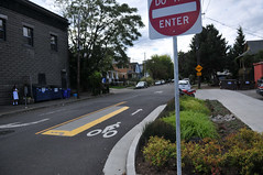
The opening of the Spokane Street bike boulevard in December 2009 was a bigger deal than you might have thought. It marked not just a new bike-friendly street, but a new era in how PBOT approaches the development of our bikeway network. With dedicated funding, a 15 miles per year commitment, and a team of very smart and dedicated neighborhood transportation safety and engineering staffers, PBOT embarked on a major effort to make residential streets more pleasant and comfortable for walking and biking.
While you can quibble (I have, and we should) with their prioritizing of backstreets over working for higher-profile, physical separation on central city arterials and commercial main streets, the focus and effort PBOT is making on neighborhood streets is laudable and very exciting.
A few months ago, our friend Joshua Cohen of Fat Pencil Studio approached us with an offer to do illustration work for BikePortland. We thought his skills would be perfect to help us tell the story of Portland’s past and future progress on neighborhood streets. The animation above (link here) is the result of a collaboration between BikePortland, Cohen and his crew, and PBOT staffer Greg Raisman.
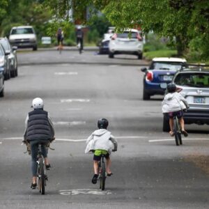
At their current pace, in just few short years, 80% of every Portland household will live within just a 1/2 mile of a neighborhood greenway. Since I’ve been covering bikes in this city, I don’t think I’ve ever seen PBOT be so focused on any one initiative. Their work to add landscaping, slow speeds down, improve crossings, and make biking more efficient, is helping make every part of our city more livable and humane.
Check out their website for a project in your neighborhood and get involved with the effort by attending open houses and staying tuned to BikePortland for project updates.
Thanks again to Joshua and Jason at Fat Pencil Studio for making this animation possible.


Thanks for reading.
BikePortland has served this community with independent community journalism since 2005. We rely on subscriptions from readers like you to survive. Your financial support is vital in keeping this valuable resource alive and well.
Please subscribe today to strengthen and expand our work.
This is a fantastic presentation, way to go Joshua, Greg & BikePortland!
I especially like how it breaks down the greenway plan in digestible, bite-sized chunks. The greenways are truly the backbone of our network and account for about 75% of my bike routes.
I share the hope that PBOT will also focus concurrently on the infamous gaps in our network, which are often not on residential streets. With about 20% of Portlanders using a bicycle for transportation, we should be supporting them both on and off our neighborhood greenways.
awesome! I never knew when each segment went in…
and surprisingly I thought we already had more coverage than we do… I guess I mistake the more pleasant bike routes for greenways…
Solid, clear, and very helpful. Nice work!
This is a very illustrative piece of work – nicely done, Fat Pencil. I was happy to learn that NW Thurman St is on PBOT’s list for neighborhood greenway transformation. Thurman dead-ends into the Leif Erickson trail in Forest Park, so this greenway will provide a direct link from the city streets to a major recreational trail (for hikers, joggers, and mountain bikers).
Great job, Joshua and Fat Pencil! Just breaking the familiar bikeway map into an animated timeline does wonders.
Thanks Joshua, Jason, and Jonathan
I’m impressed with the work of Fat Pencil Studio
Very effective story telling – soon finding a real low-stress bicycle facility in Portland will be as easy as finding transit – love the network – thanks
Sure sign that I’m a dork—that presentation gave me tingles up my spine.
I hope the new greenways have lower-stress crossings of large streets than the existing ones do. I would not take my mom on the SE 40s bikeway, or NE Tillamook/Hancock, or even SE 15th.
excellent point, alex. crossings are often overlooked.
Meh. I still see streets with cars, sewer grates and blind corners. Drivers will still not see you as they back out of their driveways. You can still get right hooked. People will still pile leaves on the streets in fall. You can’t go very fast since you will have a stop sign or traffic signal every other block. The safety benefits are illusory. An inattentive driver at 20MPH can kill or maim you with the same efficiency of one at 25 MPH. How many drive at 25 MPH religiously now? How many police resources are enforcing the existing neighborhood limits currently?
I contend that this plan won’t make very much difference for the dollars spent. The funny thing is that $5-6 / gallon gasoline will thin auto traffic and sharrows scream “BIKES LEGALLY ON ROADWAY” far more effectively and cheaply than expensive bio-swales, mini-roundabouts, and bikey signage.
I still think that PBOT is all about show projects rather than building a system that makes bikes more efficient for commuting than cars.
Geeze, still no love for Brooklyn (river to SE 17th, SE Powell to SE Holgate)– even all the way out to the bounds of the future!
I’d like to see the city fix SE Milwaukie Ave and SE 17th. Make one for busy cars (probably industrial SE 17th) and the other bike/ped/family friendly (Milwaukie Ave). This is, after all, what they did just across 99E to the south for those very same streets!
Or if we can’t make Milwaukie Ave family friendly, then at least put in a greenway SOMEWHERE in Brooklyn. It could be 9th to connect to the Powell Blvd ped bridge; or even better I’d dodge the steep hill on 9th and instead go with SE 13th and connect with the Powell crosswalk.
…. but IMO the real solution is to just make Milwaukie Ave friendly for families, bike riders, etc. Let PSU students ride to school on Milwaukie safely, let kids cross Milwaukie Ave to get to Winterhaven Elementary. We don’t need 2 busy streets within 5 blocks of each other!