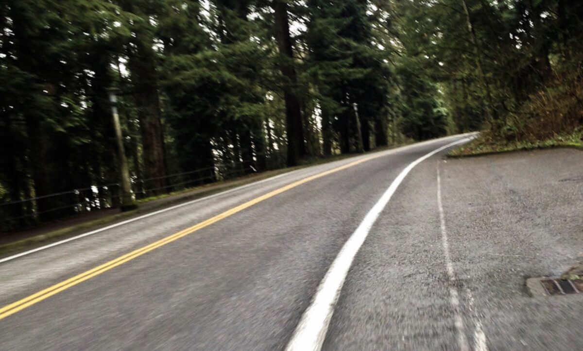
One of the most beautiful bike routes in Portland is even more likely to stay that way thanks to a listing on the National Historic Register.
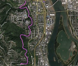
Earlier this month, Friends of Terwilliger announced their effort to officially designate this beloved parkway was successful. The historic designation applies to 115 acres of the Parkway from Duniway Park to SW Capitol Highway (see map below).
You likely know Terwilliger as a great way to escape the city for quick rides into the West Hills (it’s been part of my Council Crest loop for years) or as a relatively low-stress north-south connection into downtown. For many people who work and visit OHSU medical facilities, it’s a welcome alternative to the freeway-like conditions on SW Barbur just to the east.
Advertisement

But did you know that Terwilliger is also part of a 2.5 mile “lineal forest corridor” first envisioned by John Olmsted in the late 19th century and opened to traffic in 1914?
Here’s a snip from the Friends’ historic register listing application that was sent to the National Parks Service last year:
“A pedestrian or driver experiencing the parkway experiences the curves of the parkway or the views from the pedestrian path much the same as was intended by the Olmsted brothers and Portland Park Superintendent Emanuel Mische. The uniform and continuous character of the roadway and the regular cadence of the light poles create a kinetic experience as one moves along it and they tie together the various experiences of expansion and contraction, of views, enclosing forest, open lawns, and screened development from one end to the other with little interruption from cross streets or stops… Winding along the hillside, the roadway alignment is laid out with a focus on grace and ease. To provide for contemplative but safe motoring given the conditions, the steepest grade is only 6%, and the sharpest curve has an outside radius of 200 feet.”
Not mentioned in that description are the swooping bike lanes that run along both sides of the 36-foot wide roadway. They’re not nearly as nice or safe as the 9-foot wide pathway used by walkers and runners (and some bike riders), but they’re better than nothing. And the curves and beauty of Terwilliger also act as a traffic calming device that help keep driver speeds and behaviors in check.
Friends of Terwilliger President Anton Vetterlein said, “The listing establishes a heightened level of review and protection for projects in the parkway which is critical considering that OHSU and city bureaus are frequently doing work that affects park property and the roadway through it.”
It will be interesting to see how or if the listing impacts future roadway changes.
— Jonathan Maus: (503) 706-8804, @jonathan_maus on Twitter and jonathan@bikeportland.org
— Get our headlines delivered to your inbox.
— Support this independent community media outlet with a one-time contribution or monthly subscription.


Thanks for reading.
BikePortland has served this community with independent community journalism since 2005. We rely on subscriptions from readers like you to survive. Your financial support is vital in keeping this valuable resource alive and well.
Please subscribe today to strengthen and expand our work.
When/if the Max line SW extension happens it’ll be interesting to see how this impacts those plans. I’m pretty sure the most recent design called for a funicular or tram through the parkway.
I believe the elevator with skybridge option was preferred over the second tram or funicular options to link SW Corridor to OHSU. The preferred option came in at a fraction of the cost of competing options.
I suspect that one of the main reasons that Friends of Terwilliger applied for the historic designation was the unstated agenda of using it as a tool to try to block the installation of trams, funiculars or skybridges to link a future SW Corridor transit project to OHSU.
Maybe, but OHSU seems to see the writing on the wall and has done most of their recent building at the SW Waterfront.
Wow! Love it!
Sideshow Bob would be proud.
Protection for this gem is certainly welcome. I always considered myself fortunate to have this street on my daily commute to downtown. My only concern is what this might potentially mean for future street safety improvements. Is the current condition now “sacred” and can’t be changed? For example, the segment along Duniway Park including the Terwilliger/Sam Jackson intersection at is far from ideal for cyclists with a combination of heavy traffic, speeding, and substandard or no bike lanes. A safer solution would probably mean some modest street and/or pathway widening. Would this still be allowed?
Historic listing doesn’t afford any real protection. The only difference would be that if federal money were involved in some proposed change, then the NEPA analysis would give special attention to the historic listing. It still wouldn’t stop changes, but increase focus on them and possibly earn some additional mitigation. (Similar process might exist for state money, but I’m less familiar.)
Great commuting route. Sweeping turns going down (watch for cars stopping to turn into OHSU), nice climb going up, some good views on the way.