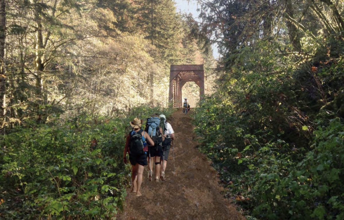
Before all 86 blissful miles of the Salmonberry Trail is ready to roll and walk on, all 86 miles must be studied, probed, and plotted. Now, thanks to an injection of new funding, planning for the final two remaining sections of the trail can be completed.
The Washington County Visitors Association (WCVA) and Tillamook County both announced last week they’ll pitch in $175,000 each toward the effort.
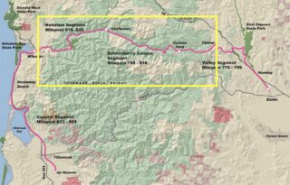
When complete, the Salmonberry Trail will follow the route of the defunct Portland of Tillamook Bay Railroad from north of Banks in Washington County, westward to the Oregon Coast through the Tillamook State Forest and then along the coast south of the city of Tillamook. The trail is broken up into four planning segments. Two of them — the “coast” and “valley” sections — already have completed master plans. This new funding will help fund planning of the remaining “canyon” and “river” segments (see yellow box in map at right).
Advertisement
Among deliverables for the master plan are analyses of the impacts and constraints of a future trail, as well as potential cost estimates. The study will also determine whether existing tunnels and rail bridges can be re-used or whether they must be replaced.
The effort to build the Salmonberry is led by the Salmonberry Trail Intergovernmental Agency, a coalition of public and private agencies and organizations.
2019 was a big year for the project. The City of Tillamook cut the ribbon on the first paved section of the trail and a nonprofit Salmonberry Trail Foundation was created to help push the project forward.
Learn more at SalmonberryTrail.org.
— Jonathan Maus: (503) 706-8804, @jonathan_maus on Twitter and jonathan@bikeportland.org
— Get our headlines delivered to your inbox.
— Support this independent community media outlet with a one-time contribution or monthly subscription.




Thanks for reading.
BikePortland has served this community with independent community journalism since 2005. We rely on subscriptions from readers like you to survive. Your financial support is vital in keeping this valuable resource alive and well.
Please subscribe today to strengthen and expand our work.
This is fabulous news. Tis project is going to be even more transformational than the excellent Stub Stewart trail and enhancements.
I know it is only in the planning stages, but I though the goal was for it to be a paved Rails to Trails project, offering a safe way for bicyclists to connect to the coast?
The rendering shows a dirt trail, which would be useless for a touring bike etc.
Can anyone offer any perspective here?
AFAIK Adam that was never the goal. There’s no way in heck this effort would ever be supported enough if there was a mandate that the path was paved the whole way. .. And IMO that would be a bad idea. Pavement is not good for the type of remote conditions much of this trail will be. There will be some paved sections but the vast majority will be unpaved. Also keep in mind that I don’t think we can expect the entirety to be bike-able. There might be sections only open for hiking and/or horses. And in those cases, hopefully there’s a way for bicycle users to detour around so there can be a continuous route. There’s a lot still to be determined! We’re still years away from major sections being completed.
My bad.
I feel like all of the literature I’ve seen sbout this project has complained about the lack of safe wsus to bike to the coast, and then thrown the Salmonberry project in the same article. So it’s hard not to draw the conclusion this project was supposed to be a traditional rails to trails project.
Also, it is constantly linked in articles to the Banks Vernonia Trail, and touted as some sort of eventual extension of it.
Clearly if it ends up being essentially little more than a hiking trail or mountain biking trail, the association with a proper, paved rails to trails project seems somewhat tenuous.
Unlearn pavement. Why would this need to be paved? Gravel and dirt would be great. Have you noticed how well the paved Banks Vernonia path is cared for? It is full of craters and mini jumps of rooted pavement. Can you imagine what would happen to this if it were paved? Plus the cost! You can ride drop bar bikes on dirt roads and gravel. In fact its pretty fun.
Nope it is going to be some kind of soft surface.
I’ve toured countless gravel and dirt miles on touring bike – not a problem.
It will be a mud pit for most of the winter. This section of the coast range gets over 100 inches of rain per year, and almost all of it in October through June. I hope they do gravel, and consider drainage issues.
Page 50 of the Concept Plan Final provides some ideas for potential surfaces.
1980 – Roads are for cars! Quit being so greedy, cyclists!
2020 – Trails are for hikers! Quit being so greedy, cyclists!
I think a mix of rough/gravel surfaces and pavement were always in the project statements and coverage from what i remember reading.
An entirely paved route would certainly make this more accessible to traditional touring cyclists, but would also increase the cost substantially. The Valley segment (Portland-ish to coast) is very remote and would be difficult to maintain. There is a reason the old railroad line was decommissioned. Hardpack gravel (I’m thinking along the lines of Iron Horse/western part of the JWPT in WA) would be ideal, with small clusters of primitive campsites every 10 to 20 miles. It’s quite do-able on a touring bike. A mostly dirt route would also add to the feeling of being “out there”.
Kudos to the team behind this. Building the support and demand from the community is crucial and with their leadership it seems to be coming along nicely.
Off topic, but amazing how much can be spent on studies and plans. Poster child is $140 million for CRC with not a shovel of dirt moved. I’d put Forest Park efforts in same category: each public effort brings out the hating park neighbors who push it back farther than we push it forward, so money spent just moves us backward. But it’s also amazing how much people can accomplish for next to nothing when building and clearing trails – thank you!
It should be the stated goal of the plan to pave the entire route. In addition to people on road bikes having the dirt section of trail would close it off to people with ADA needs. It would also limit people on roller-blades, skateboards and scooters. Given that there is NO safe way to currently access the Oregon coast without a car it’s not an unreasonable request to make the ONLY proposed route accessible to all.
People with “ADA needs” are going to go self-powered on a 50 mile trail through what is essentially a wilderness area, with no services, including cell coverage?
Let me introduce you to my friend Ian.
https://www.iansride.com/
But YES! People with disabilities do use such facilities. More importantly without paved surfaces, it will never be an option for people with disabilities to even attempt.
As someone who has hiked several portions of the Salmonberry rail before it was closed to public access – paving the entire thing is a pipe dream.
There are multiple large washouts, some easily 50 feet across and 25 feet deep. Most of the route is not easily accessible to motorized vehicles or machinery. The cost to install and maintain 86 miles of paved roadway in a remote area would be astronomical.
Not to mention, if we’re at all thinking about being sustainable and not destroying the natural environment, slapping down tons of asphalt in the middle of a forest is just a terribly way to do that.
I’m all for making beautiful natural areas as accessible as possible, but paving them is incredibly unsustainable.
I love the idea of someday connecting the Salmonberry Trail, the Banks-Vernonia Trail, the Crown-Zellerbach Trail, and a new Portland-Scappoose bikeway along Hwy 30/the Willamette to get an unbroken bikeway from Portland to the coast.
Someday ….
Also a lot – per the surface quality – depends on how much the project builders can maintain and protect the original well compacted rail road cinder bed…what ever the floods did not ruin
There exists an excellent, comparatively safe way to access the coast by bicycle right now!
The Nestucca River route. There are excellent maps on line.
Basically, take the MAX to Government Center, pedal a few miles to Forest Grove, on some back roads down south to Carlton and then onto a glorious, albeit steep route along the Nestucca River road. From Carlton to Beaver at the 101 you won’t see more than 20 cars.
Good campsites w/running water along the way.
Along 101 North for 4 miles then over to Cape Lookout for an overnight.
Third day you can pedal into Tillamook and take the Wave bus back into Portland.
I’ve done this trip 4-5 times and look forward to doing it again this Spring.
It may not be a stated goal, but I got the impression that the soft surface was a way to start getting people out there, and depending on usage and the services that spring up to serve trail users a full hard surface was a long term goal.
I think another good analog would be the Trail of the Hiawatha in N Idaho/Montana. It’s all unpaved, but a very fine crushed rock surface. 99% of people take mountain bikes to do it, but a road bike with 25c tires would honestly have no problems. A bus based forestry dept concession even offers shuttle services, something I could see on the Salmonberry.
The one thing I want to hear about is actually laying trail, even if just in segments. Build from Tillamook to Wheeler and Banks to Timber. Both offer many new possible loops and places to explore before they start tackling the deep canyon sections where all the massive storm damage is.
That’s excellent news!
Do you have any update on leadership of the Foundation? I was really excited about its future when I did the Pedalpalooza ride, but Kambury appears to have left her position in August of last year.
I’m also curious if anyone is working on the Council Creek project that would connect Hillsboro to Banks. Last summer I heard it was stuck in low-priority local politics limbo without anyone pushing it.