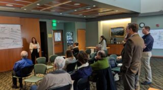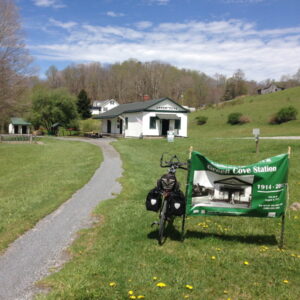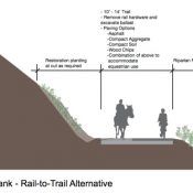
(Photo: Chas Hundley)
This story is from Chas Hundley, editor of the Gales Creek Journal. It was first published by Salmonberry Magazine.
A long-planned evolution in the development of the Salmonberry Trail took its first steps recently with the announcement by the Tillamook Forest Heritage Trust that the Salmonberry Trail Foundation would be formed.
The foundation will take over assisting with Salmonberry Trail development from the Tillamook Forest Heritage Trust (TFHT), a nonprofit established in 1999 to push for the development of the Tillamook Forest Center located along the Wilson River Highway in the Tillamook State Forest.
With the Salmonberry Trail, the trust found itself once again assisting in a major project in the state forest, supplying staff and their legal status as a nonprofit to the Salmonberry Trail Intergovernmental Agency (STIA), the governing body that is tasked with building the Salmonberry Trail.

Advertisement
In a letter to STIA dated November 10, 2018, Nels Gabbert, Chair of the Tillamook Forest Heritage Trust, said that the time for the nonprofit to get back to its core mission was now.
“In the early days of organizing for the Salmonberry Trail, the existing non-profit Tillamook Forest Heritage Trust agreed to provide temporary capacity and energy for start-up fundraising efforts to compliment the Salmonberry Trail Intergovernmental Agency (STIA) mission of developing the trail. The Trust was well positioned for this start-up role given its primary focus on the state-owned forests of the Oregon Coast Range, and its existing governance as a supporting organization to the Oregon Department of Forestry, one of the state agencies leading STIA.”
Alana Kambury, Communications and Outreach Director for TFHT, has been tasked with the development of the foundation, and in an email to the Banks Post/Gales Creek Journal, said that she expects the foundation will receive nonprofit status from Oregon and the IRS as early as May 2019.
The trust, with a mission “To acquire, obtain and maintain funds, materials or labor for donation in the development, operation, management and maintenance of The Salmonberry Trail,” according to Kambury, is identifying board members, seeking partnerships with organizations with similar interests in the Salmonberry Trail, and identifying funding sources.
For inquiries, email Alana Kambury at alana@salmonberrytrail.org.
— Chas Hundley, @chashundley on Twitter and GalesCreekJournal.com.
Never miss a story. Sign-up for the daily BP Headlines email.
BikePortland needs your support.


Thanks for reading.
BikePortland has served this community with independent community journalism since 2005. We rely on subscriptions from readers like you to survive. Your financial support is vital in keeping this valuable resource alive and well.
Please subscribe today to strengthen and expand our work.
Will it connect to Portland?
The Salmonberry trail begins in Banks. Part of the organizations mission is to create equitable access to the trailhead. Alana presented at the last NWTA meeting and she talked about working with transit to get to the trailhead, so either ride from the MAX (which is a nice ride on mostly low traffic roads) or working out something with local transit agencies to get people and bikes to trailhead – Banks has some frustrations about the amount of traffic the trail generates in their community.
to make it an epic you could ride leif, to germantown, down to 30 out to skappose, then up the crown zellerbach trail to Vernonia and then back to stubb stewart which should connect into phase 1 of the Salmonberry trail. You know just to make it a mixed surface EPIC.
Too bad Banks has turned “sour” on the “traffic” that the trail generates. Imagine Banks without the trail (like before it was fininshed, I remember.) I doubt the Thriftway would have stayed this long. There is limited transit…but way too limited to be a any help to get to the trailhead. Sounds like an opportunity similar to the Gorge once things get rolling.
Park in North Plains and ride there…heck park at Liberty High School in Hillsboro and ride from there too. Leave the parking at the BV trailhead to the runners, and families. There are a ton of low traffic mixed surface roads to get out to Banks.
there will always be grumbling from some locals when you have this type of influx of people from outside the area using a new resource like the B/V. that’s why it’s so important to have a nonprofit like this… They would be natural allies who could organize and show up to work with locals and smooth out issues. And IMO for every story about a local Banks resident who isn’t happy with the trail traffic, I’m sure there are several more of locals who absolutely love it. In fact, I know about a local family who was mad about the B/V… But only because they couldn’t access it safely/easily from their parcel.. So the dad hopped in his tractor and cut a new path right to it!
That Thriftway is the primary grocery for Banks and the surrounding area – trailhead traffic has never been crucial to their profitability. It’s great to have them there, but if the trail went away tomorrow, Thriftway would still be there.
Best of luck to this group. I’m betting that the amount of money to make this route work and survive the same floods that destroyed the rail line multiple times in the final decade that it was open to trains will be far more than the state will be willing to pay. I have ridden the gravel roads all over the area around Reehers/Cochran/Salmonberry area for over 20 years and the route is in very poor condition. I think it would be a lot easier and cost effective to use some gravel roads to skip the part of the old rail line that is always trashed by floods by building one or two bridges over the Salmonberry to avoid that area. While it is nice to have the low grade route, pedestrians and bikes can tackle steeper grades than trains which opens up more options for the route that are more sustainable and cheaper.
Building bridges for anything may be a complete non-starter. There are fishing advocacy groups that are adamantly against anything impacting the riparian zone or which might place or disturbs pilings in the water. This came up several times during public meetings during the initial planning phase, and this project is much more on their radar than on that of local bicycle or hiker advocacy groups.
Reading the recently released Valley Segment Final Report Plan https://www.salmonberrytrail.org/trail-news/2019/1/16/valley-planning-completed It’s pretty clear that the heavily damaged canyon segment would certainly be the last phase to be completed and is likely decades away. Many of us over 40 may never get to ride the full route in our lifetimes.
The trestles and tunnels in that section would be the crown jewels of the full trail though. And worth connecting, even if the trail goes on a new alignment to avoid currently heavily damaged sections/potential future problems (the plans extensively map erosion/landslide hazard areas). From the plan: “The locations of this [storm] damage also suggests that
sections of the future Canyon Trail may have to be aligned outside of the rail right-of-way.” Keep in mind though that many of your proposed logging road alternates would not match he ADA compliant trail grades that need to be accommodated for government funding.
The salve to this timeframe is that development of most of both the coastal and valley segments of the trail will likely come much earlier providing many miles of trail to ride as separate experiences in the intervening years. The valley segment would provide a number of loop options from Banks of varying lengths by combining with the BV trail (the two would diverge at Manning). Connections between the two trails would be on Fisher/Bacona Rds. A new connector trail in SSSP and Timber Rd. between Timber and just S. of Vernonia. And the coastal section would be spectacular even if linear between Tillamook and Wheeler.
FYI, the last sentence of paragraph 2 refers to Jon’s comment above, not to the article itself.
Is any part of the trail currently open? It’s really confusing. I’ve thought about going out there, but their web site says clearly, “… what’s out there now is just not ready — nor is it safe or legal — for public access.”
Is there a section that is currently open and/or available for public access? Comments on here make it sound like something is open in Banks.
The part in Banks is the beginning of the existing Banks-Vernonia trail. This trail would branch off from that and head west.
The short answer is “no”. The dotted lines on the map at the top of the story are mostly old railroad line. In the Reehers camp area near Timber has 10+ foot high trees growing in the middle of the tracks. The brush is thick enough that it could take an hour to cover a mile in some areas. Cell coverage is little to none.
Your confusion probably comes from the fact that Banks will be the trailhead for two separate trails (and originally two separate railways). The currently completed and open paved 20 mile trail north to Vernonia and this future planned trail west to the coast which is still an overgrown and abandoned railbed.
As the two rail right of ways parallel each other just a few feet apart for the first 4 miles or so out of Banks, the planned Salmonberry trail will initially just use the existing Banks-Vernonia trail for that section (with the trail getting widened and improved). Later on there are plans to turn the parallel RoW into a soft surface trail.
So no, You can’t ride any portion of the “Salmonberry” trail. But you can ride all of the Banks-Vernonia trail, the first 4 miles of which will be shared with it someday.
The section above Banks is snowy now but fun to ride with the whole family. You will want to have at least 28 mm tires, a lite snack, a cute jacket ..and bring ID so we can identify your scattered bones in the spring melt.