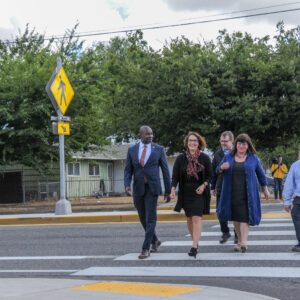
Portland’s regional transit agency wants to know more about what it’s like to walk to its buses and trains. TriMet launched an update to their Pedestrian Plan today and embarked on an update of their 2011 Pedestrian Network Analysis.
TriMet’s existing Pedestrian Network Analysis identified a host of issues and prioritized 10 dangerous hotspots for transit users. “The Pedestrian Plan takes this effort one step further by looking at our entire service district using new data and methods,” read a statement released today. Here’s more from TriMet:
The Pedestrian Plan will be developed with input from local government agencies and the community, with equity, safety, and demand as guiding principles. Based on feedback from surveys and community meetings, we will identify overarching values to create guidelines that help decision-makers prioritize projects. Incorporating the ideas of both community organizations and government agencies ensures that the Plan is responsive to community needs and is in line with the region’s transit goals.
Advertisement
This planning effort begins with an online survey questions like, “What makes it hard for you to walk to or from your nearest bus stop, or MAX or WES station?” In the coming months TriMet will host several “stakeholder fourms”. A draft plan is due by March 2020 and a final plan by May that same year. Learn more at TriMet.org/walk.
— Jonathan Maus: (503) 706-8804, @jonathan_maus on Twitter and jonathan@bikeportland.org
— Get our headlines delivered to your inbox.
— Support this independent community media outlet with a one-time contribution or monthly subscription.


Thanks for reading.
BikePortland has served this community with independent community journalism since 2005. We rely on subscriptions from readers like you to survive. Your financial support is vital in keeping this valuable resource alive and well.
Please subscribe today to strengthen and expand our work.
Small edit, but I think the title should read “kicks off” instead of “kicks of”.
thanks Eric. fixing that.
Well good for them! I still recall noting to a now retired PBOT staffer that the MAX stations along the Banfield Freeway are all but inaccessible by bike! I used to ride over to Hollywood via SE/NE 47th…over 20 years ago an adventure and still an adventure today by the looks of it!
TriMet supposedly began a conceptual design effort for Hollywood TC in 2016 (before the incident occurred). Hope we hear more about those plans soon because that station is long overdue for a renovation.
I hear the new Hollywood TC bus area will be a privately developed building using the air rights with a transit center in the basement. Sounds good! lol
The MAX platform just got about half a million “upgrade” -mostly new elevator system, paint and more security cameras, so I can’t see that being altered any time soon.
Huge risk and opportunity there. If they can activate the space, this could be a huge improvement. If they cram it in a dark basement, though, it could make things much worse. It’s pretty bad right now with the abandoned retail store just to the west. I would hope that any work on that site would also include construction of the Sullivan’s Gulch trail between NE Sandy and NE 47th. The ROW is already graded, they just need to alter fencing and pave it.
The station in Hollywood is fairly accessible, especially from the south.
The city has a plan to fix access to the 60th station.
82nd is a mess, and there it would take a lot of traffic calming to make it better.
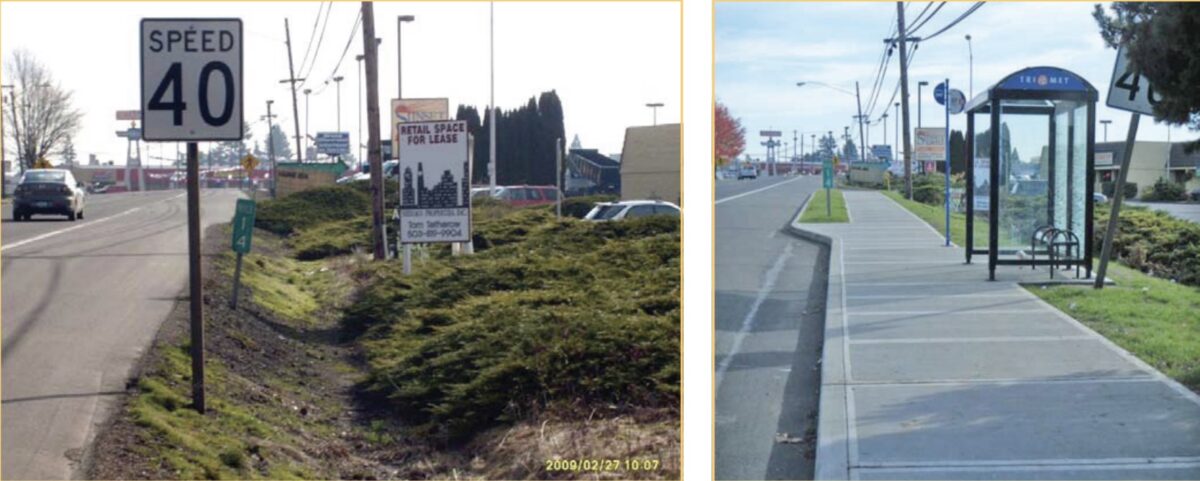
Yes much better. But the Washington County inspector / engineer should relocate the speed limit sign for visibility.
It would be nice if they shoveled the platforms when it snows.
This right here. Transit is by far the best option when it snows or there’s ice (IMO) and yet the barrier to actually reach the bus stops and/or MAX stations is so high due to the lack of clearing the sidewalks and MUPs by both TriMET and PBOT.
That “before” photo is crazy.
Next step is to be able to use the “after” photo as a new “before”, with a new “after” photo showing the 40 mph sign straightened up and the vegetation trimmed that’s blocking people from seeing it.