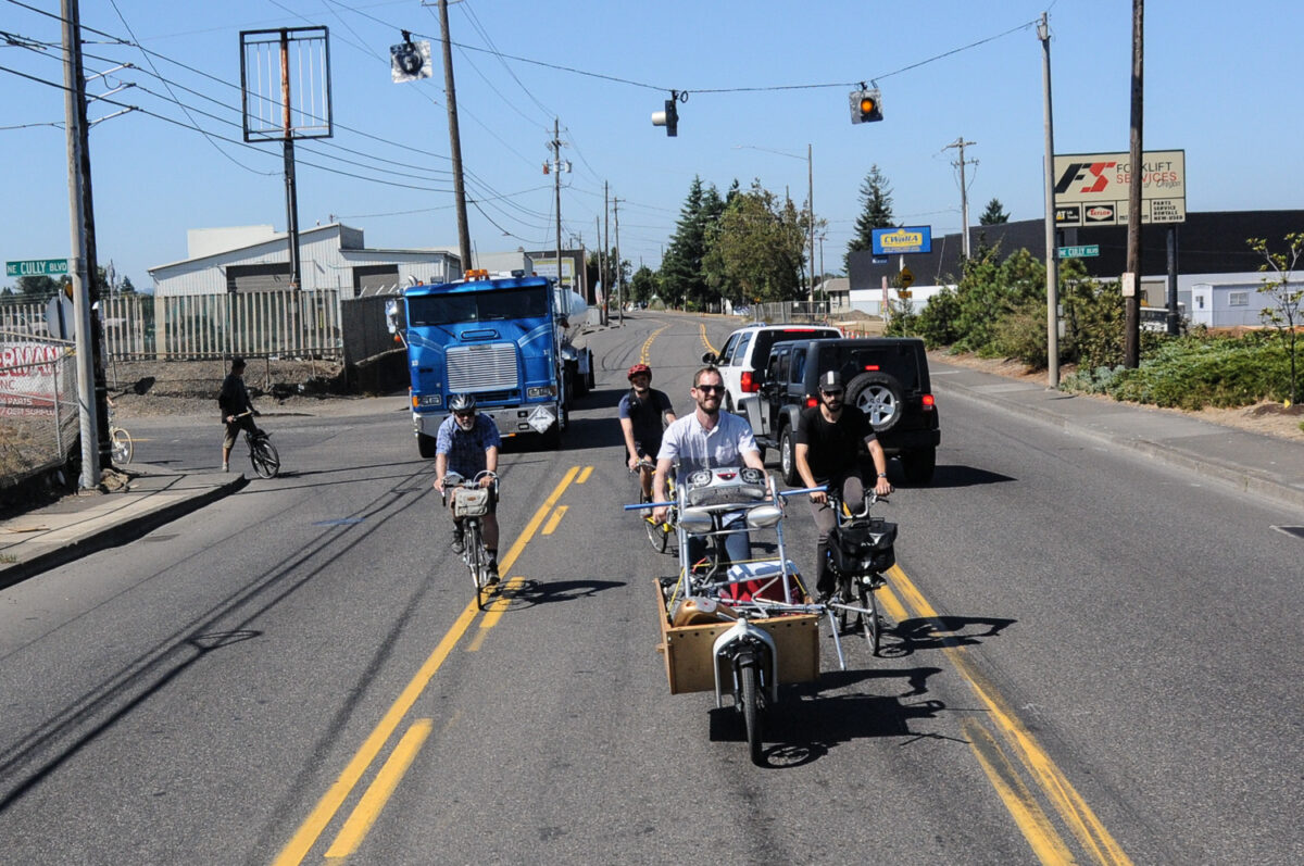
(Photos: J. Maus/BikePortland)
It’s that time again when our regional elected government needs help deciding which transportation projects to fund with a pot of federal dollars known as regional flexible funds. This opportunity only comes around once every three years, so it’s a golden opportunity to nab some cash for important projects.

This time around there’s about $43 million to spend and 23 projects have been proposed from the tri-county region (Washington, Clackamas and Multnomah). Metro has already done some technical evaluation and scoring based on four core funding principles: “advancing social equity”, “improving safety”, “implementing the region’s Climate Smart Strategy”, and “managing congestion”.
Now they need to hear what you think.
These funds are highly competitive because their “flexible” nature means governments have more discretion over how they’re used. With far more funding requested than available, Metro won’t be able to fund all of them. That also means public feedback can play an outsized role in what makes the final cut.
The Portland Bureau of Transportation submitted eight projects (as seen in the graphic below) worth about $36 million and the majority of them have significant bicycling elements.
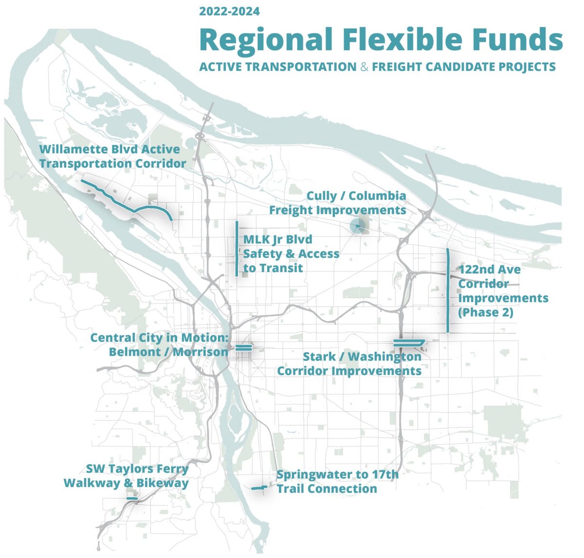
Below are PBOT’s project summaries along with a few others from around the region that caught my eye (see the full list and descriptions here). (Note: I’ve also included the Metro evaluation score graphic for each PBOT project. Here’s what they say about it: “Points further from the center of the chart show greater opportunity or benefit in the four policy priority areas. The project’s opportunity score measured the level of need in the policy area, while the benefit score measured how well the project addressed the need.”)
M1: 122nd Avenue active transportation
122nd Avenue: Sandy Boulevard to Burnside Street
Sponsor: City of Portland
Requested amount: $4,543,700
Total project cost: $6,491,000
Purpose: Project development, construction
Description: Constructs high-priority enhanced pedestrian crossings, bikeway improvements, and enhanced transit improvements along 122nd Avenue
M3: Belmont/Morrison biking and walking
Belmont and Morrison streets: Water Avenue to 13th Avenue
Sponsor: City of Portland
Requested amount: $4,523,400
Total project cost: $6,462,000
Purpose: Project development, construction
Description: Constructs pedestrian crossings, protected bike lanes and enhanced transit improvements along the Belmont/Morrison couplet in the Central Eastside.
M 4: Columbia/Cully freight
Columbia Boulevard: Cully Boulevard and Alderwood Road intersections
Sponsor: City of Portland
Requested amount: $3,434,193
Total project cost: $5,084,193
Purpose: Project development, construction
Description: Constructs intersection improvements at Northeast Columbia Boulevard at Cully Boulevard and Alderwood Road to enhance freight movement, including a new traffic signal, turn lanes and railroad crossing improvements. Includes separated sidewalks and multiuse path.
M6: MLK Boulevard safety and access to transit
MLK Boulevard: Cook Street to Highland Street
Sponsor: City of Portland
Requested amount: $4,123,000
Total project cost: $4,723,000
Purpose: Project development, construction
Description: Constructs high-priority enhanced pedestrian crossings and signal upgrades along Northeast Martin Luther King Jr Boulevard to improve walking and biking safety and access to transit.
M8 Springwater Trail to 17th Avenue Trail
Springwater Corridor: 13th Avenue to 19th Avenue
Sponsor: City of Portland
Requested amount: $5,534,000
Total project cost: $6,534,000
Purpose: Project development, construction
Description: Extends the Springwater Trail from 13th Avenue to 17th Avenue and extends the 17th Avenue Trail from St Andrews Place to Linn Street, connecting to the Springwater Corridor.
Advertisement
M9: Stark/Washington biking and walking
Stark and Washington streets: 92nd Avenue to 109th Avenue
Sponsor: City of Portland
Requested amount: $5,332,000
Total project cost: $6,532,000
Purpose: Project development, construction
Description: Implements roadway safety redesign and constructs enhanced pedestrian crossings, transit priority improvements, and protected bikeways in the Stark/Washington couplet in Gateway.
M10 Taylors Ferry Road transit access safety
Taylors Ferry Road: 49th Avenue to Capitol Highway
Sponsor: City of Portland
Requested amount: $3,676,000
Total project cost: $4,276,000
Purpose: Project development, construction
Description: Constructs high-priority walking and biking connections on West Taylors Ferry Road to provide active transportation access to Southwest Corridor light rail station areas.
M11: Willamette Boulevard active transportation
Willamette Boulevard: Richmond Avenue to Rosa Parks Way
Sponsor: City of Portland
Requested amount: $4,456,000
Total project cost: $6,106,000
Purpose: Project development, construction
Description: Enhances existing bike lanes along Willamette Boulevard from Rosa Parks Way to Ida Avenue and extends bike lanes from Ida to Richmond Avenue. Incorporates pedestrian crossings, intersection improvements and transit access improvements.
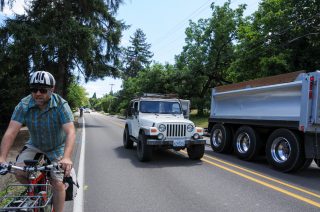
C3: Highway 43 biking and walking
OR43 (Willamette Dr): Mapleton Drive to Barlow Street
Sponsor: City of West Linn
Requested amount: $6,468,000
Total project cost: $9,240,000
Purpose: Construction
Description: Provides continuation of grade-separated protected sidewalks and bike paths along Highway 43 from Mapleton Drive to Barlow Street. Creates walking and biking safeguards at intersections with raised corner bike refuge islands, multiuse marked crossings and other improvements.
C5: Monroe Greenway
Monroe Street Greenway: 21st Avenue to Linwood Avenue
Sponsor: City of Milwaukie
Requested amount: $3,860,788
Total project cost: $10,182,688
Purpose: Construction
Description: Creates a neighborhood greenway for safer walking and biking on Monroe Street. Connects Milwaukie’s central neighborhoods with downtown, the Trolley Trail, the 17th Avenue bikeway to the west, and the Clackamas Regional Center to the east.
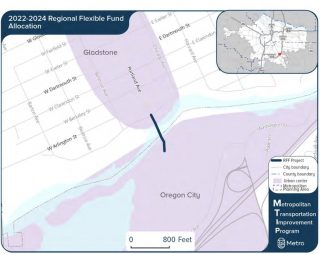
C6: Trolley Trail Bridge replacement
Trolley Trail Bridge over Clackamas River: Portland Avenue to Clackamas River Greenway Trail
Sponsor: City of Gladstone
Requested amount: $1,228,800
Total project cost: $1,375,800
Purpose: Project development
Description: Plans, engineers and provides cost estimate for constructing a new walking and biking bridge connecting downtown Gladstone and downtown Oregon City.
W4: Cornelius Pass biking and walking bridge
Cornelius Pass Road pedestrian/bike crossing of US26: extension to Rock Creek Trail
Sponsor: Washington County
Requested amount: $628,110
Total project cost: $700,000
Purpose: Project development
Description: Designs a walking and biking bridge over Highway 26 just east of the Cornelius Pass Road interchange, filling a gap between the Rock Creek Trail and Cornelius Pass cycletrack and sidewalk.
You have from now until October 7th to get your comments in. An easy way to do it is via this handy survey. Or you can email transportation@oregonmetro.gov.
— Jonathan Maus: (503) 706-8804, @jonathan_maus on Twitter and jonathan@bikeportland.org
Never miss a story. Sign-up for the daily BP Headlines email.
BikePortland needs your support.



Thanks for reading.
BikePortland has served this community with independent community journalism since 2005. We rely on subscriptions from readers like you to survive. Your financial support is vital in keeping this valuable resource alive and well.
Please subscribe today to strengthen and expand our work.
Is the picture next to W4 correct? Am I just confused where Cornelius pass is?
Somehow I don’t recall Oregon City being in Washington County, but in Clackamas, but I live in NC so what do I know?
Oregon City moved a few years ago.
haha very funny david and HK. Fixed the graphic.
Not sure I see the value of W4 given the Rock Creek trail under pass just a mile east. A better use of funds would be an Evergreen cycle track west to the Cornelius Pass cycle track.
Stph
The existing underpass just ends at Rock Creek Blvd. leaving you to find your way through neighborhoods to the rest of the trail. It’s not an optimal system connection.
The proposed segment and bridge would directly link the existing Corn Pass cycletrack, that currently just ends right at a crossing of an intimidating US 26 onramp, to the end of the west Rock Creek Trail spur. It will also open up future rail-trial options to at least West Union on the abandoned rail RoW north of the freeway and someday possibly to Phillips Rd. and beyond. Another major trail connection right at this location will be the northern trailhead of the Hillsboro Crescent Park Greenway that will soon have its first segments built going west from the Hillsboro Stadium.
For those of us who can remember the train trestle bridge over US 26 next to the Corn Pass overpass until the mid-90’s, this project would also restore that crossing for active transportation and maximize the value of acquiring all the RoW for a trial in the first place. I put it as my highest priority in my response.
Additional enhancements to Willamette are very exciting, especially extending infrastructure all the way to Richmond. Still, the stretch beyond Richmond to the northwest is a mess (for all users). Anyone know of plans to fix that?
Preliminary greenway work in planning stage. Willamette-Reno-Central-Bruce.
Excellent, thanks for the info. I’d rather see the bike track on Lombard extend a few more blocks, so it could be accessed from Reno directly. But definitely the right idea to tie Willamette to Lombard.
Milwaukie and Clackamas County are so ready for the Monroe Greenway!! It would be Milwaukie’s first Neighborhood Greenway, with two more laid out in the TSP. Only 12 years in the making.
Columbia/Cully would finally close the gap between Portland and PDX!
Would it? You mean on Cully and Alderwood, I assume? The project descriptions are so sparse, I didn’t know what to make of “multi-use path.” I just figured since it’s a freight/stoplight project, they meant they’d install a tiny disconnected segment of multi-use path to no-where at those intersections, only, and thus ranked the project badly in my comments. Is there more information somewhere?
The project would include a short multi-use path on the north side from Cully to Alderwood. That’s required per the Bike Bill since the project also widens Columbia Blvd to put in turn pockets. The path will connect eventually to a planned multi-use path on the west side of Alderwood up to Cornfoot that Parks & Rec is going to build.
Gary B, there aren’t a ton of design details, but here’s the full application for the Columbia/Cully project that would connect Cully and Alderwood with a MUP: https://www.oregonmetro.gov/sites/default/files/2019/08/27/full-app-Columbia-Cully-freight.pdf
The Se Uplift Neighborhood Coalition endorsed the Stark-Washington Streetscape and the Springwater to 17th connection. We did not offer support for Belmont-Morrison because the board felt that through an equity lens the other two projects are more critical. The Springwater extension more for regional needs to augment and nearly complete the trail, the couplet project for obvious safety reasons as that region is WAY overbuilt with capacity/205 Access and it’s recent lane expansion being the priority. Safety for all other models is an afterthought. Belmont-Morrison is part of CCIM, since downtown usually gets what it needs, eventually, we assume it will get funded some other way.
The Monroe Greenway is critical. Milwaukie applied for funding last round and just missed it. They have committed significantly more local resources to the project this round and deserve funding. I also think the Willamette project is exciting as well. It sets us up well for a future Swan island connection to the North Portland Greenway Trail if that ever gets built where we need more multi-modal routes as the recent train collision with the Going Street overpass has made abundantly clear.
Can someone explain the routing of the Springwater/17th connection? Why does it detour a block north on 17th instead of cross 17th at Ochocco?
It’s because the owner of that short line railroad adamantly opposes a trail crossing of 17th adjacent the railroad, and unfortunately he has veto power over it under state law.
He also has some sort of device in his pickup truck that allows him to activate the train crossing on 17th. I’ve witnessed it’s use when there’s a lot of oncoming traffic and he needs to make a left onto Ochoco. Seriously.
Those octagons are the weirdest graphics ever–astrological.
https://en.wikipedia.org/wiki/Radar_chart
Hi all — thanks for the great comments on the RFFA project submissions!
I wanted to add on to Jonathan’s post that Metro Council will be hearing public testimony on the projects next Thursday evening, Sept. 26 at 5:00 p.m. Please come and share your thoughts and opinions with our region’s elected officials.
You can get more details on the public comment period at oregonmetro.gov/rffa.
The Metro website says “Metro Council meeting Thursday, September 26, 2019 – 2:00pm to 5:00pm” so is the hearing on the RFFA grants from 2-5pm or at 5pm?
https://www.oregonmetro.gov/events/metro-council-meeting/2019-09-26
The RFFA public hearing is after the Metro Council meeting, and begins at 5:00 p.m.
Southwest Neighborhoods, Inc. coalition and several neighborhood associations strongly support the M10 SW Taylors Ferry Road walkway and bikeway project. We need to retrofit our roadways in SW to make walking and biking safer because there is so little walking and biking infrastructure today. This project is a key connector to the West Portland Town Center and Barbur Transit Center, a key link to Washington County, and ties into the upcoming sidewalk and bike improvements on SW Capitol Highway. If we are going to reduce greenhouse gases related to transportation in SW we need better infrastructure to get people out of their cars. Please show your support for the one RFFA project proposed in SW Portland!