(Photos: J. Maus/BikePortland)
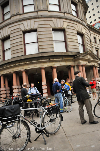
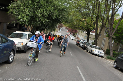
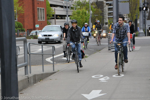
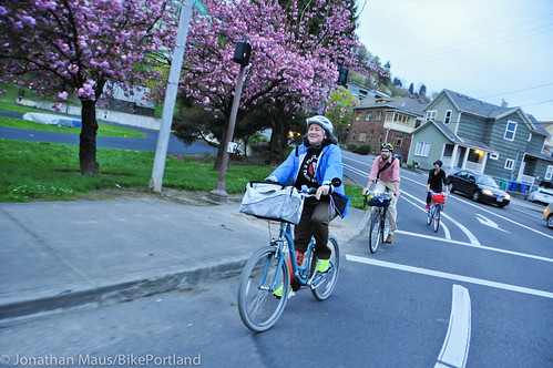
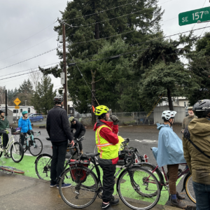
Tuesday night I took part in the annual bike facility tour led by Portland Bureau of Transportation bike coordinator Roger Geller. Once a year, instead of sitting around a table on the second floor of City Hall discussing projects and policies, members of PBOT’s Bicycle Advisory Committee (BAC) get on their bikes. The goal of the tours is to see the good, the bad, and the ugly of current conditions and discuss how things might look in the future.
Past rides have covered northeast Portland, the central city, and east Portland. Tuesday’s ride was focused on southwest Portland.
Here’s a map of our route with notes by Geller (PDF here):
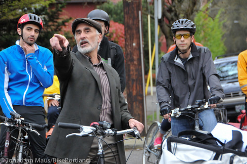
This is the fourth time I’ve followed Geller around on one of these tours. And in some ways, he’s the perfect guide (although I wish he’d slow down a bit!). Mr. Geller has been working on bicycle planning at PBOT since 1994, so he’s been around the block a few times. He’s also the official staff liaison to the BAC, so there’s a certain rapport and respect that’s been established between him and the committee members over the years. Other notables on the ride included: Ian Stude, the director of transportation and parking services at Portland State University; Nick Falbo, urban planner with Alta Planning + Design and SE Foster area neighborhood activist; Joshua Cohen from Fat Pencil Studio; Jeff Owen, the active transportation planner at TriMet; Roger Averbeck, stalwart southwest Portland neighborhood advocate; Carl Larson, advocate with the Bicycle Transportation Alliance; Rob Sadowsky, executive director of the BTA; and Suzanne Veaudry Casaus, chair of the BAC.
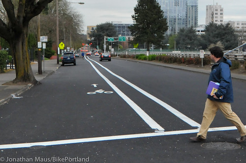
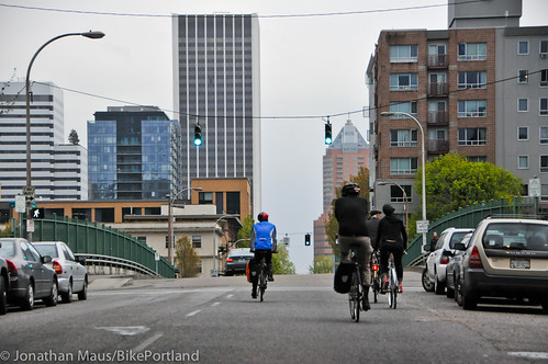
We started the tour in front of City Hall and headed westbound on SW Jefferson. For such a key westbound route, several of us noted how the bike lanes on Jefferson are pretty narrow. As we crossed I-405 the bike lane switches to the left to make room for a right-turn only lane at SW 14th (see below). Geller said there’s a proposal on the table to get rid of that lane, add on-street auto parking and install a bike box.
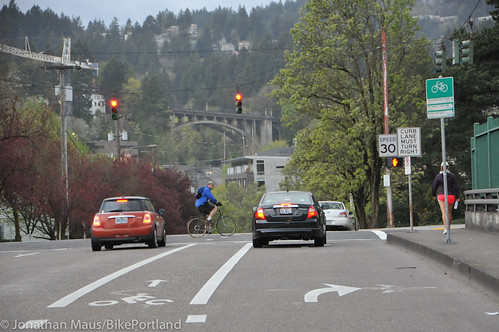
We also noted the newly painted buffered-bike lanes on SW 14th (I’ll share more about that project soon in a separate post)…
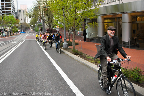
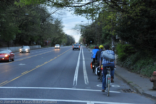
We then made a u-turn and headed eastbound on Columbia. This one-way street would make a nice bikeway couplet with Jefferson; but it currently has no bikeway facility of any kind so we took the lane…
The next facility we sampled was the bike lane on SW 13th. It’s nice to have it, but the presence of freeway on-ramps and abrupt dropping of the bike lane leave something to be desired. From 13th, we explored SW 12th. Similar to Jefferson/Columbia, 13th and 12th could be a great bikeway couplet that would enable good cross-town connections. Despite its meager left-side bike lane, we all rode in the right lane (which is technically illegal!) and noticed how much space is available for a wide — possibly even protected — bike lane. (PBOT had a plan a two years ago that would have done exactly this, but opposition from business interests tanked the project.)
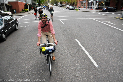
From there we rolled east to SW 5th, where we then headed south toward where the new MAX Orange Line is being constructed. I generally avoid SW 5th because I don’t like sharing the narrow lane with people in cars. But south of Jefferson it has a bike lane. This could make it a good connection to southwest Portland; but the bike lane isn’t as good as it could be. South of Mill, the bike lane is routed onto the sidewalk to avoid a streetcar stop (a stop Geller said was supposed to only be temporary). This is a high volume walking area so putting bikes into the mix isn’t the best solution.
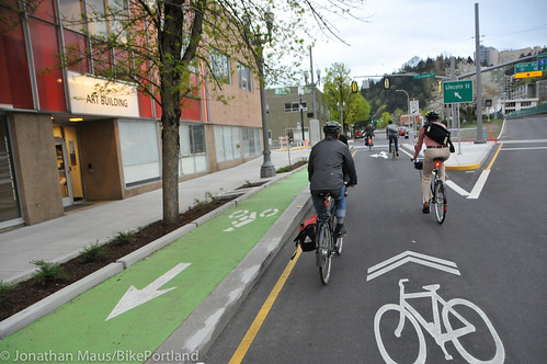
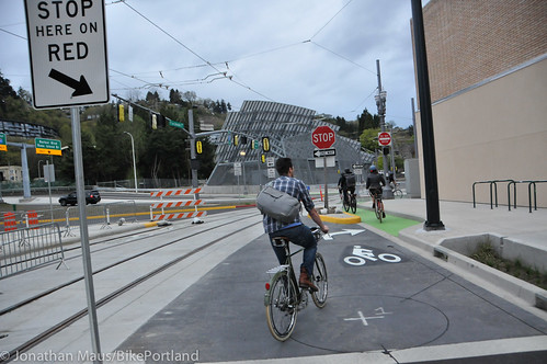
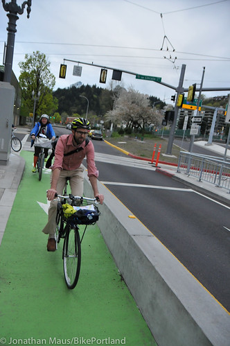
The bike lane begins again and takes you all the way to SW Jackson where TriMet has been busy creating new bike markings and facilities along with the new MAX line. We looked into the bike-related changes along the new MAX line last month; but this was the first time I’d actually seen some of it in person.
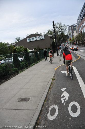
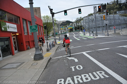
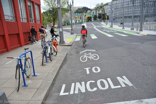
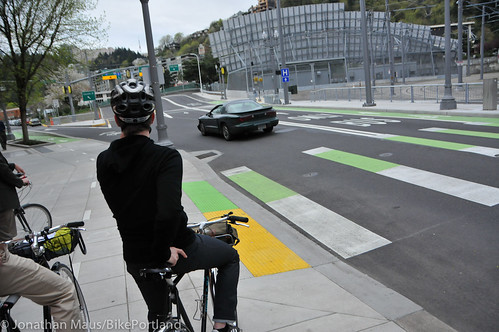
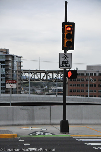
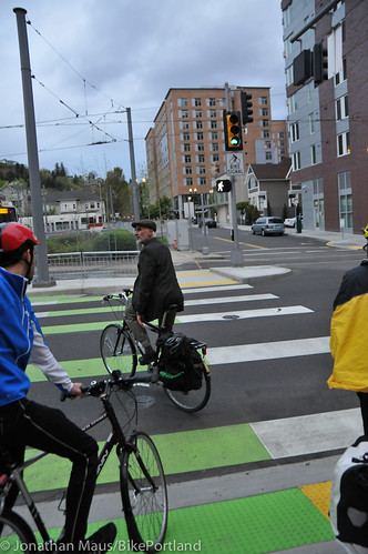
As you approach Jackson on a bike you’re greeted with big pavement markings that say “To Barbur” or “To Lincoln”. To get to Barbur, you’re directed up onto the sidewalk. You then use a new bike-only crosswalk and bike-only signal to cross 5th and connect to the bike lane on the right side of the street.
The bikeways should be simpler and more direct. Geller put it best when he said, “This is a very complicated area. It’s just weird.” That being said, Geller added that while it’s confusing the first time around, people are likely to figure it out. Eventually.
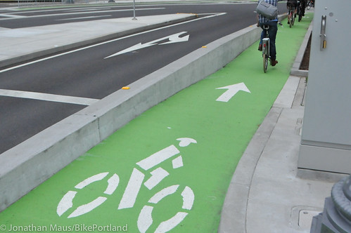
Interesting to note that these new facilities show PBOT’s new standard of using the color yellow for walking and green for bicycling. You can see this in the design of the curb ramps and crosswalk striping below…
At Jackson, if you continue south on the left side of the street and follow the “To Lincoln” pavement marking, you’re put into a shared lane. You then follow sharrows to head eastbound on Lincoln until you get to Naito.
Just before Naito, we took a right and headed south on SW 1st. This could be a good north-south connection, but it doesn’t connect safely to Barbur and the bike lane drops after SW Arthur. Geller wondered whether this street could use additional bike lanes and/or sharrows.
We the made a u-turn and headed back to SW Lincoln. We turned right on Lincoln and came to Naito Parkway, where the new MAX line will continue on a nice, new bridge. Unfortunately bikes won’t. Geller said it would have been a complex engineering task and an additional $5 million “we didn’t have” to include a bikeway on the bridge. So instead, bikes are directed onto a new, 14-foot wide multi-use path along Naito to the east side of Harrison to make the connection to south Waterfront.
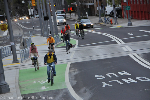
From Naito, we made a u-turn and headed back up Lincoln to try out the new, short section of contra-flow protected bike lane that takes you back to SW Jackson. We then crossed 5th and headed south on Barbur.
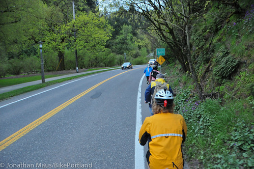
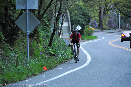
Geller wanted to show us the bike lanes on SW Terwilliger. Currently, they’re quite narrow and Terwilliger is a high-volume road (for both biking and driving). Geller said there are discussions underway to widen the outbound (toward OHSU) bike lane by removing the inbound (toward downtown) lane and replacing it with a wider, separated path in adjacent Duniway Park.
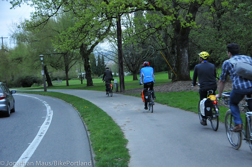
We then rode a ways out on SW Barbur to sample the buffered bike lanes before heading back into downtown. I peeled off at this point, but others continued down into South Waterfront. Before the ride ended, they passed by the soon-to-be opened pathway that will connect the end of the SW Moody cycletrack to Harbor street near Tom McCall Waterfront Park (thus avoiding the zig-zagging through the Riverplace district).
I hope you enjoyed this little tour. I learned a lot, as I usually do when I hang out with Geller and the folks on the BAC. I also realized there are a lot of bikeway issues bubbling up in southwest Portland these days, so stay tuned for more coverage.
CORRECTION: The original version of this story said that bicycle traffic would be directed onto a “sidewalk” at Naito and Lincoln to connect to SE Harrison. That was wrong. TriMet/PBOT have built a new, 14-foot wide path to make the connection into south Waterfront.





Thanks for reading.
BikePortland has served this community with independent community journalism since 2005. We rely on subscriptions from readers like you to survive. Your financial support is vital in keeping this valuable resource alive and well.
Please subscribe today to strengthen and expand our work.
Hi Jonathan, Thanks for covering the BAC ride. One correction: ODOT was not “vehemently” opposed to the bike signal crossing 5th Ave at Jackson. They were opposed to more typical crossing treatments at Jackson for the crossing of 6th Avenue because of its proximity to the I-405 off-ramp. Currently there is a z-crossing of the trackway, but not crosswalk marking nor pedestrian signal of any type. Also, I doubt I used the word “vehemently”…
got it Roger. Thanks for the clarification. I’ll make some edits to the story right away. And I think your actual words were “they really didn’t want it” or something like that.
Roger,
Are there any plans to extend the new path on Naito (between Lincoln and Harrison) to Waterfront Park?
It depends on what you mean by “plans”. The Portland Bicycle Plan for 2030 identifies that as a desired pathway connection, so yes, there are “plans”. Just no current funding or focus on that.
Great recap! Sorry I missed out on this. Some cool new facilities but a lot of the same old problems.
“Interesting to note that these new facilities show PBOT’s new standard of using the color yellow for walking and green for bicycling. ”
You can see these too at the crossing where the SW Moody cycle path meets the MAX. Any details on the pathway that will connect the end of the SW Moody cycletrack to Harbor street near Tom McCall Waterfront Park?
Yes, we have a design that is in process. What details are you interested in?
To be fair on Terwilliger, looks like you only rode up to the stop light and back. I’d be against removing the bike lane going towards downtown. That shared path would have to be extremely upgraded and widened (decent amount of foot traffic in that area). Biggest complaint there is that the bike lane is always full of gravel. There are miles more of Terwilliger with pretty decent bike lanes, nice rolling hills and great scenery/views.
I agree. Bikes going down the hill, including the section by Duniway Park, go too fast to safely share a path with pedestrians.
I rarely use the bike lane going 25 down the hill toward Duniway Park/Downtown. To put downhill bike traffic on a sidewalk with pedestrians would be a big mistake. Unless it were “optional”…but that would require a change to Oregon law.
Yes, one plan would be to construct a new pathway through the park that would create separate spaces for people walking and bicycling. This treatment would extend only from Sheridan to the intersection with Sam Jackson. We haven’t worked out all the details yet. The outbound direction would then have the width of both existing bike lanes creating a wide buffered lane. We would also ideally place an actuation button for the signal at Sam Jackson/Terwilliger so that a person bicycling could get a left turn (bicycle only) indication to head up Terwilliger. Again, details not yet worked out, but that’s the concept.
Where can we find more info on the new SW 5th cycle track? Can we use it to get into downtown coming north on Terwilliger? I hate how the nice bike lane suddenly disappears northbound where Terwilliger becomes SW 6th.
The sidewalk trip around the streetcar stop should go away when we double-track that section soon.
Unfortunately, the word from PBOT is the plan has changed. Relocation of the streetcar stop has been deleted from the scope of work for the double-tracking project on SW Montgomery.
Could someone please provide a better explanation and perhaps a map of exactly what the bike connections between the new Caruthers Street bridge and downtown are going to look like? I’m very concerned about the potential lack of direct access to and from the new bridge on the west side of the river.
ThnX!
We’re working on it Buzz. Part of the issue is that much of it isn’t open yet and it’s very hard to understand how a bikeway will work until it’s actually open and on the ground. That being said, thanks for your patience while we work to bring you more info on this.
When you get off the new bridge, you turn north onto the Moody cycle track. Then, at Sheridan, you have a choice. Either stay on Moody to get to Waterfront Park via Riverplace, or transition to a new off-street path (technically not open to the public yet, but that didn’t stop us during the ride!). This path heads north, pretty much following the PMLR transit guideway west of the substation, to the Harrison/Harbor Drive intersection. Then you use the existing Harrison bike lanes to Naito, where a new off-street path has been constructed on the east side of the street between Harrison and Lincoln. Finally, you cross Naito at the new Lincoln signal, and continue west on Lincoln towards PSU.
It’s all a bit convoluted, and the Harrison/Harbor Drive intersection is especially concerning because the path pretty much joins the intersection at an angle where it’s difficult to see how cyclists could safely transition between Harrison and the path, without putting themselves at risk. I’m not sure if bike signals are going to be installed here, but they definitely should.
I wonder how often we will see “scofflaw” cyclists bombing down the new MAX flyover from Lincoln to shave a few minutes off of their trip down to the new bridge. As long as a train or bus isn’t nearby, it would be a quick, safe, (but illegal) jaunt.
I hear it has already been done, but I wouldn’t personally know anything about that….
I do not support removal of bike lanes for routing onto sidewalks and MUPs. MUPs in high-use central city core areas are not always great options for regular cycle commuting. Sidewalks are just wrong. Sure, if you are on a short trip to the market and you are riding a few blocks, no problem, but if you need to get to work MUPs can become too busy with other users to be a viable commuting option. And MUPs are great for walking your dog and jogging and other recreations. I had a near miss on the Eastbank Esplanade MUP recently when a jogger (not looking, headphones in) pulled a full U-turn right in front of me in the most unexpected place – nearly causing serious injury to both of us. As the sun comes out, this seems to be more and more of an issue. I’ll be taking the lane on 11th Ave and 20th Ave from now on whenever the weather is nice. High density areas need good through-routes so people can get to work in a reasonable amount of time. I support bike lanes on arterials and through streets – we need more of them, not less. It is hard to want to get behind these jig-saw puzzles of connectors and unaligned “bike ways” that the city keeps putting up on out of the way, severely broken and cracked pavement streets . But, I am looking at the choice between driving my car or riding my bike to work, and the cycle routes are getting more and more crowded with more and more traffic stops/lights/oddball city designs on sidewalks, etc. Being forced off a bike lane and onto a MUP or sidewalk is problematic and generally not preferred. The city continues to have a bit of an identity crisis with respect to bicycle infrastructure which is split over recreation or transportation, as well as, moving people efficiently or moving people safely. Trying to have it both ways results in putting up a lot of sub-standard and un-connected (and in some cases really expensive) new infrastructure and the city needs to re-think their strategy and try to get the most bang for the budgets that they do have. As long as city continues to refuse to eliminate free parking on streets and won’t pay to widen streets and move utility poles and trees in parking strips, we will continue to have a patchwork of mostly unappealing (or really expensive) new cycle infrastructure.
What is your solution for Terwilleger in that section? Just keep the narrow bike lanes? Downhill sharrows?
Didn’t this article really only identify the uphill bike lane as an issue? Is there an issue with the downhill one?
Both of them are really narrow (although the uphill is worse), and the downhill is often full of gravel. I guess the problem is more with overall road width. You aren’t going to widen the roadway, so you are either stuck with narrow bike lanes, or you need to find another option.
They are still both ridden a lot. I’m sure we could get more ridership with other formats. But it really isn’t that horrible right now. Maintaining the overgrowth taking over part of the Eastbound bike lane would also help.
Bike lanes on Terwilliger are not that narrow. But if they are in the city’s opinion, they can reduce the width of the car lanes, slow the car traffic down with speed bumps or other means, or narrow the sidewalk to make room for wider bike lanes. Terwilliger doesn’t really see much truck traffic, so narrow lanes are not that big of a deal – relatively speaking to the rest of the city where 2 and 3 foot bike lanes are common. And Tri-met drivers could learn to slow down a bit when they pass cyclists at narrow junctures.
About gravel – they should spend our money on a street sweeper and pay somebody to use it – if they put gravel on the road it will also end up on the MUP and there is no MUP sweeper. So, a MUP will have no maintenance which is worse than almost none.
I’m not sure if you have actually ridden south in this section. As you can see in the picture, the lane is extremely narrow. The lanes are already 11ft, so you cannot really narrow them further, or add speed bumps, because ambulances use this as an emergency route to the hospital. “narrowing the sidewalk and widening the road” is basically what they would do if they added a northbound cycle track. The only difference is that instead of a bike lane on the road, you have a bike lane that is elevated slightly, providing more of a safety buffer between you and the traffic.
I ride this exact spot ~340 times a year and disagree. I’m going to bring the tape measure tomorrow…
IMO, given the volume of bike traffic on Terwilliger the last thing that needs to be done is to force cyclists who already use the bike lane/vehicle lane to ride on a poorly maintained and pedestrian filled mup. Build a mup for those who want/need it…but please…please…do not remove bike lanes.
While on the tour Roger Geller mentioned that the widened path may have user separation between bicyclists and pedestrians. This would be a good idea, for all of the reasons you mentioned.
If bicycles and pedestrians are merely separated by a line of paint or a narrow strip of grass I would be really nervous about pedestrians wandering into the bike lane where bikes could easily be going 20-25mph. I’ll probably end up just taking the lane if this is what happens. On the other hand, a MUP in the park going uphill with a buffered bike lane going down could work well, speed-wise, though it could also be confusing, especially at the intersections where it transitioned back to bike lanes.
The new crossing of SW 5th from the contra lane is sort of confusing. It takes a few times crossing to get used to the common bike & pedestrian crossing.
If one doesn’t frequent this route on a bike often, I could see how someone might say that it is confusing. The wayfinding doesn’t make it as easy to understand as it could.
That said, it is still a welcome addition.
I think the City recognizes your concerns. On the ride, Roger said that the hope was users would figure out the layout by the second time they go through the area.
Chris S:
I have given up biking in the Pearl, largely because of issues with preemption by Portland Streetcar, Inc.
But I still walk there, and remain greatly confused by the sidewalk detour at 13th & Lovejoy, which seems not to have been fixed at all.
What is the plan?
Jim Lee
What are the issues with preemption?
Jim, there’s no longer an active bike lane there, so bikes aren’t using the detour. What would you like done?
Does anyone know if the SW bike path connecting Washington Park to NW 24th (crossing Burnside) will be getting any love at some point? This is the path that gets so much bike traffic but is really rough and routes us off the pavement alongside a gate and then drops us at the light and we have to push the walk button to get it to activate.
Sharrows on all streets, please.
Thank you.
“narrowing the sidewalk and widening the road” is basically what they would do if they added a northbound cycle track. The only difference is that instead of a bike lane on the road, you have a bike lane that is elevated slightly, providing more of a safety buffer between you and the traffic.
I agree. Bikes going down the hill, including the section by Duniway Park, go too fast to safely share a path with pedestrians.Great post.
Great post and very informative. if you are on a short trip to the market and you are riding a few blocks, no problem, but if you need to get to work MUPs can become too busy with other users to be a viable commuting option.