PedPDX, Portland’s Citywide Pedestrian Plan, released it’s three-year status report (PDF) this week and project manager Gena Gastaldi presented highlights to the Portland Bureau of Transportation’s (PBOT) Pedestrian Advisory Committee via Zoom last night.
Like the Bike Plan and Freight Plan, PedPDX structures the city’s modal transportation goals (for walking, in this case) and the strategies for reaching them for the next 20 years.
What has always been impressive about PedPDX from the time it was adopted in 2019 has been its collection and cataloging of pedestrian-related data. For example, it inventoried sidewalk coverage on all of Portland’s major streets—no sidewalks, sidewalk on one side, sidewalk on both sides. That alone is an impressive piece of work and an important resource. They also collected data on crossing deficiencies and gaps.
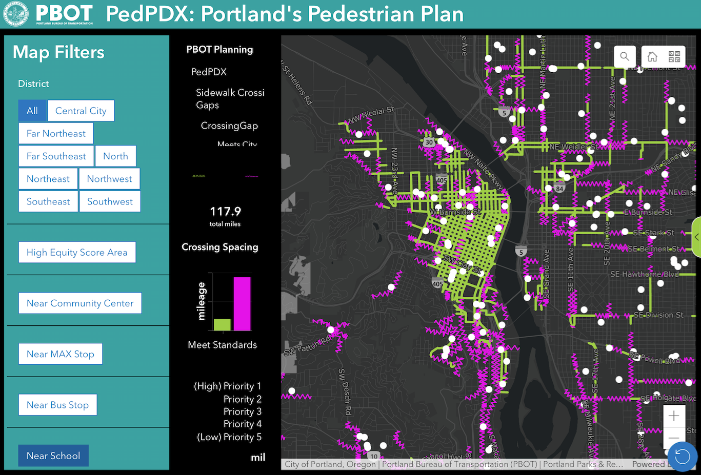
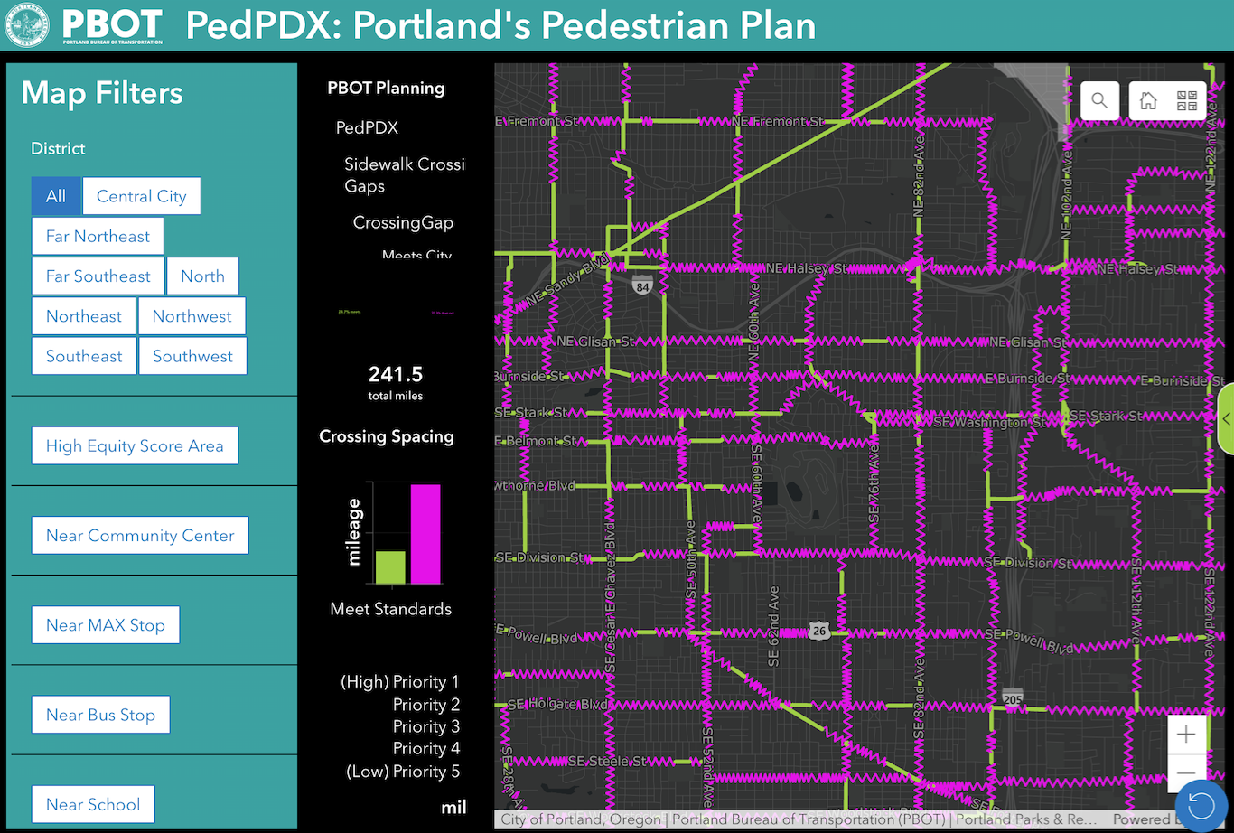
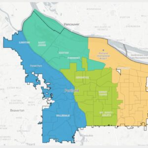
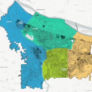
What Gastaldi was most enthusiastic about last night was the newly-released online sidewalk completeness and crossing gaps maps and the GIS tool for investigating that data. Her enthusiasm was infectious, I’ve spent the last hour banging around with GIS features and am hooked. The tool let’s you overlay important features like schools, transportation stops and community centers. It’s another helpful way to visualize our city.
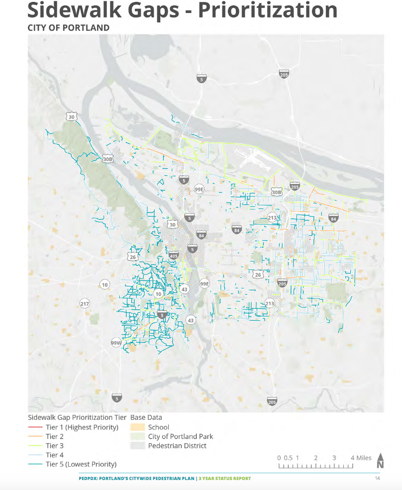


PedPDX’s other significant effort was to rank Portland’s streets according to their need for improvements. Part of this involved prioritizing sidewalk and crossing improvements across the city. These prioritizations inform the selection and design of the city’s capital projects and pedestrian-related programs and activities, so internally PedPDX is foundational to PBOT’s decision-making processes.
In the past, I’ve publicly criticized the methods used to prioritize streets. And I still think that they are overly-complicated and prone to “mathiness.” But the end result is fine, probably because there is such a strong correlation between PBOT’s equity matrix and Portland’s unsafe streets that any number of approaches would have arrived at a similar ranking.
PedPDX is not a sidewalk-building program, however, so the statistics presented are a total of all construction—public and private—from all revenue sources over the past three years (although there can be up to a nine-month lag between project completion and entry into the map database). The three-year update reported these key performance measures:
Implementation or adoption of new policies and guidelines in the PedPDX Implementation Toolbox:
- Of the 67 actions described in PedPDX, two are considered complete, 43 are in progress, and 22 have no action to report.
Percentage of the Pedestrian Priority Network with sidewalk gaps / miles of walkway built:
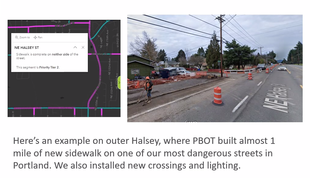
- From 2019 to 2022, the percentage of the Pedestrian Priority Network with sidewalk gaps (sidewalk on neither or one side) has decreased 3.4%, from 43.1% to 39.8%; Since 2019, about 34 miles of sidewalk have been built in Portland through both capital projects and private development. Additionally, 8.5 miles of our highest priority (tiers 1-3) sidewalk gaps (sidewalk on neither or one side) were made complete by adding sidewalks to both sides of the street.
Percentage of the Pedestrian Priority Network with crossing gaps / number of crossings improved:
- From 2019 to 2022, the percentage of the Pedestrian Priority Network with crossing gaps has decreased 7.3%, from 79.8% to 72.4%. This decrease does not take into account the 13.4 miles of streets that do not meet transit stop spacing requirements
- Since 2019, 2,084 crossings have been installed (or restriped to high visibility crosswalks) and 98 deficient crossings have been brought up to city standards.
PedPDX has always been information-rich and the project website continues to deliver in this regard. One can learn a lot about Portland by spending some time exploring this work.


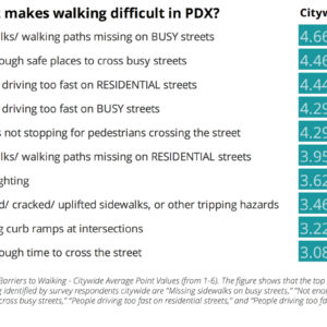
Thanks for reading.
BikePortland has served this community with independent community journalism since 2005. We rely on subscriptions from readers like you to survive. Your financial support is vital in keeping this valuable resource alive and well.
Please subscribe today to strengthen and expand our work.
Why are so many dead end streets that only have a couple houses on them in SW are marked as needing sidewalks? Many of them work very well as shared streets.
Just because it is marked as a sidewalk gap, that doesn’t necessarily mean it “needs sidewalks.” PedPDX has standards for shared streets, and they can be used as an alternative. But until a street is officially designated a shared street, with 15mph signs and other signage, it remains on this map.
This is cruel: PedPDX – “you SOOO need a sidewalk!!” Development Review and engineers: “You can’t have one!”
I live south of NE Broadway, the lack of crossings mean I basically never walk by businesses on the north side even though it’s a longtime passion and I can literally see it from my house. When I do cross its usually with a destination in mind so no chance to check businesses out. The insanely dangerous conditions also mean few walks up and down the street.
Truly wish Portland walked the literal walk instead of emulating stroady cities.