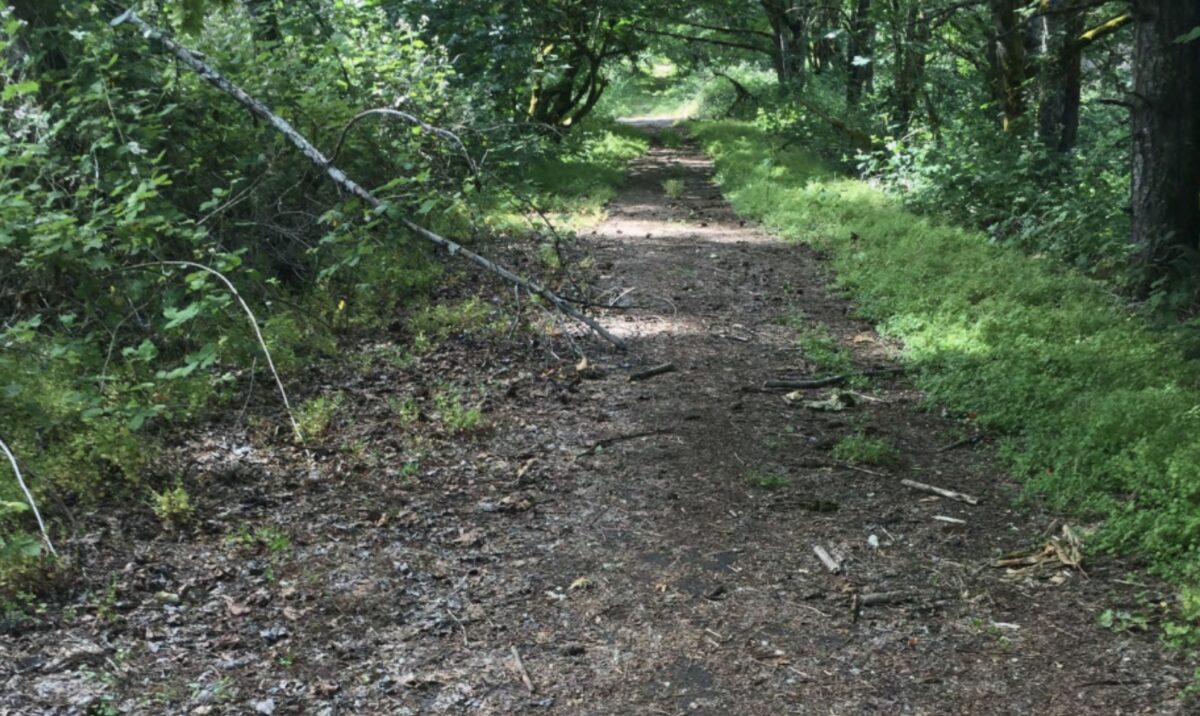
(Photo: City of Canby)
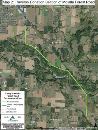
The City of Canby needs to hear your support for a project that will revive a key section of the historic Molalla Forest Road. The Traverso section of the MFR runs 3.5 miles south of Canby along the Molalla River.
This defunct logging road will someday run about 15 miles north-south between Canby and the Molalla River Recreation Area. Currently the City of Canby is embarking on a project to gauge public interest and design the future carfree path. Here’s more from the City of Canby:
“This project will explore trail ideas along the Traverso section of the MFR and set the City up for future work to design and construct improvements. Trail improvements on the Traverso section would provide a scenic and historic trail for residents to walk, bike, or ride horses. The full vision for the Molalla River Pathway includes future connections to the City of Molalla and points south, improve a historic connection between the Cities of Canby and Molalla while also providing an alternative transportation route largely free of high-speed traffic. The Pathway could also improve local access to the Molalla River.”
Advertisement
The nonprofit Northwest Trail Alliance says today (Friday, January 15th) is the final day to take the city’s online survey and share your comment of support for the project.
From here, Canby will create a draft plan of the project which will go to Canby City Council for a vote and potential adoption.
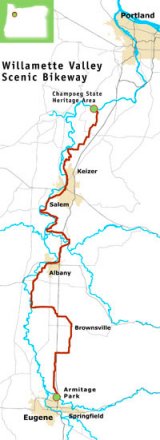
In addition to major benefits for folks who live near the new path, this project would create an important link to existing routes through Canby that connect to Champoeg State Park and the Willamette Valley Scenic Bikeway.
For more about this project, check out this coverage from a local news outlet in Canby. And don’t forget to take the online tour and leave a comment.
— Jonathan Maus: (503) 706-8804, @jonathan_maus on Twitter and jonathan@bikeportland.org
— Get our headlines delivered to your inbox.
— Support this independent community media outlet with a one-time contribution or monthly subscription.



Thanks for reading.
BikePortland has served this community with independent community journalism since 2005. We rely on subscriptions from readers like you to survive. Your financial support is vital in keeping this valuable resource alive and well.
Please subscribe today to strengthen and expand our work.
Thanks for posting. Nice online tour of trail. Comment left.
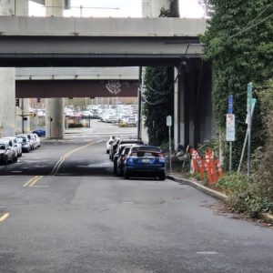
I am so excited for this. Does the picture above generally represent the current state of the ROW? If so, not much work needed to get this up and running.
I’m not sure because I don’t have first-hand knowledge of the area. But judging from photos on the online tour site, some areas are in much better shape than this. At this point, it’s not about the work needed to get it up and running, it’s about giving City of Canby planners the support they’ll need to move forward against any potential opposition that might spring up.
From my experience advocating for trails, potential opposition is optimistic. It is almost always a difficult and lengthy battle. The idea that a trail is as essential as a road is still not even close to becoming a cultural norm.
So many valuable paths get killed, Corvallis to Albany is a pretty dangerous ride at the moment. They got a tiger grant and were moving forward on a separated path, but a couple property owners along the route managed to gin up some anti bike types and kill it. It will be decades before we have a safe route between the two towns now.
Looks like there is some significant work/money needed to fix the bridge connections across the Molalla River. In the project details they mentioned a 60 ft gap between the north end of the existing bridge deck and the shoreline. Guessing that will be several million for a new bridge, even if it is pre-fab.
Thanks for getting this up – better late than too late. I’ve completed the survey and encourage others to take the time. I tried to explore this segment 15 years ago hoping for a safe connection to the Molalla canyon beyond Molalla and figured it had been taken over by private property owners. Did not realize there were washouts and trail destruction complicating access.
I’ve enjoyed the section of this corridor from Molalla to the Avon bridge. Most of this is now posted with some of it taken over by grazing and a big section following the Molalla R across from Dickie Praire Rd now closed to the public by a logging company. This segment is actually usable except for a couple of gates and the notices, and would require minimal work to reclaim for public use in a rustic state. And it makes for great access to the section above the Avon bridge with connections out of the canyon on Trout Cr and Horse Creek Rds. With access reestablished the interest in improving the condition of this corridor will follow
Grew up in Molalla running the forest road between Molalla and the Molalla river corridor. This would be awesome
Thought of you when I read this.
Thanks BP for posting these details, only takes about 5-10 minutes to complete survey, and sign up for email updates. I hope this proposal is successful, but always potential for backlash from nearby property owners and residents too willing to focus on perceived ‘negative impacts’, like with the Yamhill proposal. Perhaps proposals need to focus on other regional successes, Crown-Zellerbach being one, and of course Banks-Vernonia. Not to mention some up in WA State. These projects can work for locals, and ‘outsiders’. With recent news of the Empire State Trail (NY), and The North Woods Trail (MN-WI-MI), Oregon needs to work on getting more and varied trails on the map and in our backyard.
That’s a great website for the project. The scrolling site navigation with the linked background map makes for a good tour.
The article states that there will be “major benefits” to those who live near the proposed path. Someone should explain what those benefits might be as the residents that live around the proposed path, on both sides of the river, do not want it. It is an area outside of city police juristiction and very rarely patrolled by the county Sheriff. Then again, maybe some “Portland-style” impromptu campgrounds could be just the thing to beautify the surrounding rural areas now too
If I thought you were asking the question honestly, I’d say, look at other trails in the Valley. Revenue (gas, food, etc.) from us Portlanders and ‘outsiders’ is one benefit, as well as a place for those in and around Molalla to recreate. The “campers” comment is, well, unsubstantiated, to say the least. I’ve never seen one camp set up on Banks-Vernonia, CZ, or the Roe River Trail. Never. Campers go where there’s resources, and Portland has resources, that’s why people are here. These trails benefit the entire region IMO.
Here are the benefits in general. Let me know if you need more info. Out of the dozens of trails I’ve seen go in, almost every one had local resistance. After a few years, pretty much everybody realized how amazing a resource a trail becomes.