2016 will be a big year for the Historic Columbia River Highway. The legendary road was a scenic precursor to Interstate 84 when it opened 100 years ago, but it fell into disrepair and was largely forgotten until the past decade or so when an effort to rebuild it as a (mostly) walking and biking path took hold. Proponents of the highway hoped to have all 73 miles of the original route from Troutdale to The Dalles completed by this year in time for a big centennial celebration. While they’re about 10 miles short of their goal, the celebration will still happen and there’s more progress this month as construction begins on a new 1.3-mile section of the trail.
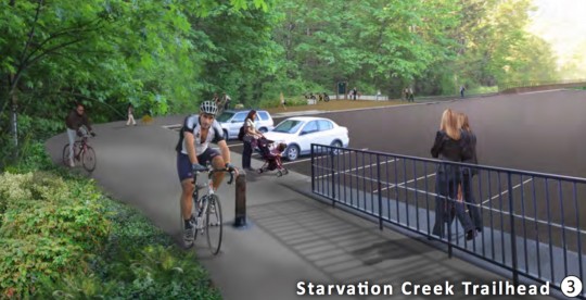
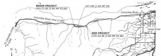
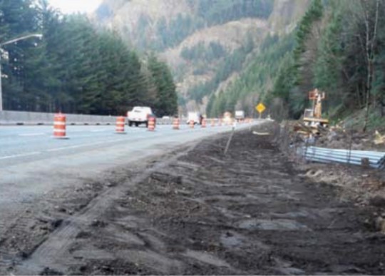
The new section of trail starts about seven miles west of Hood River and will go from Lindsey Creek to the Starvation Creek trailhead. The new path will be paved and the project includes a 50-foot bridge, a waterfall viewing area, trailhead improvements at Starvation creek, and more.
Advertisement
This part of the project should be completed by late September of this year.
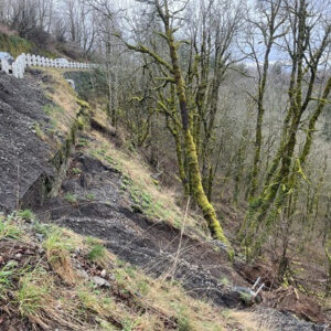
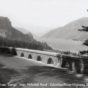
As the Historic Highway becomes ever so closer to completion, the most challenging sections remain unfunded and unplanned: getting through Mitchell Point and around Shellrock Mountain. Those final five miles are estimated to cost over $30 million and could require a tunnel and rock-blasting to punch the path through to Hood River.
You can get involved with this project through the Friends of the Historic Columbia River Highway and get project updates and more information at HistoricHighwayStateTrail.org.
— Jonathan Maus, (503) 706-8804 – jonathan@bikeportland.org
BikePortland can’t survive without paid subscribers. Please sign up today.



Thanks for reading.
BikePortland has served this community with independent community journalism since 2005. We rely on subscriptions from readers like you to survive. Your financial support is vital in keeping this valuable resource alive and well.
Please subscribe today to strengthen and expand our work.
I had no idea parts of this project weren’t funded yet 🙁
I wonder how much farther they could have built the trail if they didn’t have to make giant parking lots.
ironically they probably couldn’t get any money for the project at all UNLESS they built some parking spaces… because the government wouldn’t fund a project without them.
On related note… Have you explored this project much? I’ve seen some of the new trailheads and have yet to see what I would describe as a “giant” parking lot.
If you’re referring to the Starvation Creek Trailhead image, there’s already a parking lot there. Not everyone travels to this area by bike, some folks may drive and walk the route.
I would say the vast majority drive, park and recreate. Which is sensible.
Most people couple their outdoor activities with car use.
Indeed, our Scout Troop is riding 20 miles of the HCRH next month, starting in Cascade Locks. Not exactly practical for us to start 56 miles away.
“…the most challenging sections remain unfunded and unplanned: getting through Mitchell Point and around Shellrock Mountain.”
I’m still eager to see how this will be conquered, much less funded. There are significant geographical challenges here east of the Wygant Trail, let alone passing Mitchell Point. I’ve traversed the power line right of way just south of here, but it’s got some really steep pitches, and the rain and frost reshape it pretty much every year anyway.
Good point Pete, The structures at the entrances of the Mosier Twin Tunnels are rock fall catchment. Along the eastern portion of the Gorge the cliffs are always sloughing off bits. (and by bits, I mean rocks big enough to cause serious and likely permanent, damage) I suspect the design and construction of this portion will be costly.
$30 million is such short money in the calculus of infrastructure building for any type of infrastructure except cycling. Sad, the state of those affairs, but encouraging they’re making progress nonetheless.
Has anyone tried cycling out the old highway as far as the bridge of the gods? What’s it like? Safe ish? I’m thinking to access some Columbia Wilderness areas by bike this summer.
It was fine but I’ll probably never do it again (note: I have very little tolerance for mixing with many cars; I’m a greenway and MUP only kind of guy in Portland). Lots of traffic between Troutdale and Ainsworth State Park (a little past Multnomah) on a rural type highway with no space for bikes. After that it was super nice, although there is a staircase to deal with. Once you cross the BOTG Highway 14 was kind of harrowing for me although there is a shoulder for almost all of it. Great scenery of course but I would trade it in a minute to mix with fewer cars. My personal preference is for gravel roads in the middle of nowhere; unfortunately, it seems you have to ride on some nasty rural highways to get any of that around here (except for Leif Ericson which I love but gets monotonous).
What is the source of funding for this and other trail segments?
My guess is that some of the funding is from the voter-approved dedication of lottery funds to parks (Measure 76) but there are probably multiple sources.