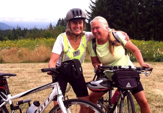
(Photos courtesy Jen Sotolongo)
[This story was written by Jen Sotolongo, a Clackamas County tourism development specialist. It first appeared in the Clackamas County Bicycle Tourism Newsletter and is being used with her permission.]
Using a combination of biking and public transportation, Laura Foster, author of the beloved Portland Hill Walks (Timber Press, 2005) wanted to make the trek to Timberline Lodge without a car. Learning that her childhood friend Ellen Schulte would be in town for an Oregon fix, Laura hatches a plan for a four-day bike adventure.
As kids in the 1970s, Laura and Ellen explored the country roads west of their Illinois hometown. After years on hand-me-down wheels, in seventh grade they saved up their babysitting money to purchase a matching pair of Schwinn Collegiates for $70 apiece.
—
As kids in the 1970s, Laura and Ellen explored the country roads west of their Illinois hometown. After years on hand-me-down wheels, in seventh grade they saved up their babysitting money to purchase a matching pair of Schwinn Collegiates for $70 apiece. Though neither had ridden much in the past 15 or so years, Laura wanted to travel at a pace a bit faster than walking, hence the impetus for this 130-mile ride.
The original plan would take the women from Laura’s house, about 15 hilly miles northwest of downtown, to Oxbow Regional Park using a combination of TriMet MAX light rail and bikes. They would then continue to Welches on the second day and Timberline Lodge on the third. On the final day of the trip, Laura and Ellen would take transit back to Portland: the Mount Hood Express, SAM (Sandy Transit), and MAX, and then they would then ride the final 15 miles back to Laura’s home.
On day one, by the time Laura and Ellen reached the Nob Hill neighborhood in northwest Portland, their legs were still felt fresh and they had plenty of energy, so they skipped the planned MAX ride to Gresham and rode out the Springwater Corridor instead. In Gresham, they stopped for lunch at Nicholas Café, with enough leftovers for dinner, before continuing on to Oxbow Park where they swam in the Sandy River before seting up camp for the night. With abundant refueling options along the urban route, the two women had no trouble finding water and food during the first day of the ride.
The following morning, the ladies headed the nine miles from Oxbow to the Tollgate Inn, their breakfast destination. After a couple of six-egg omelets (with three eggs going into a to-go bag), Laura and Ellen continued through downtown Sandy about a mile to Organic Sandy where they purchased a few more items for lunch (since provisions are nonexistent on the 20 or so miles on Ten Eyck, Marmot and Barlow Trail roads between Sandy and Welches).
After climbing and descending the Devil’s Backbone, the bane of Oregon Trail pioneers, Laura and Ellen enjoyed a well-deserved pint of beer at Brightwood Tavern in Brightwood, a great old-time watering hole. From there, the women headed for check-in and showers at the Cabins Creekside in Welches. From there they walked to a delicious dinner at the Rendezvous Grill.
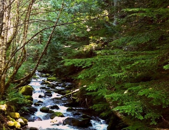
Day three brought on the gravel grinding along Still Creek Road from Rhododendron to Still Creek Campground, just below Government Camp. The road gains 2600′ in elevation over 14 miles. Although riding on thicker hybrid tires, the gravel made travel tough and Laura noted that the only other riders they saw along the road were mountain bikers riding downhill. Though the surface made for a bit of a grueling ride, Laura and Ellen enjoyed the abundant huckleberries and thimbleberries lining the road and cooling off in Still Creek, which followed the road.
The end of the 14-mile slog brought the women to Still Creek Campground in Government Camp where they caught a ride on the Mt. Hood Express to Timberline Lodge. Operating a smaller bus that afternoon, the only two bike racks available were occupied by mountain bikers who would ride the bus up to Timberline to bomb back down and repeat the process over and over. The larger bus can hold 12 bikes at a time. Luckily for Laura and Ellen, the driver allowed them to bring their bikes directly on the bus.
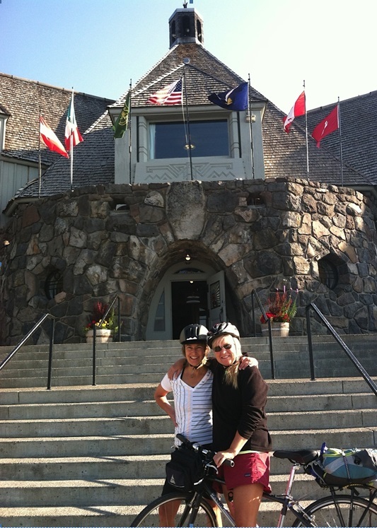
The short ride dropped the ladies off at the famed Timberline Lodge where they were instructed to bring their bikes to a locked area under the pool. Not knowing what the next day would bring, Laura and Ellen enjoyed relaxing at the lodge before the return trip home.
On Monday morning, the women packed up and got back on their bikes, heading down West Leg Road and enjoyed six miles of almost no cars, passing through numerous ski runs to Government Camp. The women fueled up for the day at the Huckleberry Inn and caught the Mount Hood Express bus from Government Camp to Sandy.
Arriving in Sandy with plenty of energy left in their tanks, the women decided to make their way back home on two wheels instead of the original plan of taking SAM — the Sandy to Gresham bus — and MAX to Portland. The downhill grade on the Springwater Corridor much of the way made for a quick and easy ride. The temperatures that day reached the low 90s, so before the women crossed the Hawthorne Bridge, they plunged into the Willamette River off a dock near the bridge that was packed with swimmers, kayakers, SUPers and rowers.
From there, Laura and Ellen’s ride got a little less pleasant as they pedaled on Highway 30 during a hot, noisy rush hour, back to Laura’s 20-acre property beyond Forest Park to fully relax and take in the journey they’d accomplished.
Laura said between biking and public transportation, getting to Timberline Lodge from Portland was simple and a great adventure.
Laura also shared a few notes of advice:
Finding bike racks proved tricky, but they made do with fences or other sign posts to lock their bikes. She stressed the importance of carrying plenty of food and water for the back roads, between Sandy and Welches.
She did also note that though a lovely park, riders may want to consider an alternative route that avoids the 1,000 foot climb out of Oxbow Regional Park, by continuing on to Boring and Sandy from Gresham and staying in the Best Western in Sandy.
Looking back at the ride, Laura said it was a “leap of faith” in her and Ellen’s abilities. If it weren’t for a few local bike shops that helped her along the way, she said, she would have never made “the transition from timid to triumphant.”
“Stefan at River City Bicycles gave his expert advice on bike touring essentials and gave me a better route from Oxbow to Sandy than the one I’d mapped out. Twenty-first Avenue Bikes fixed my broken front brake in two minutes after the cable came loose while bombing down NW Thompson Road. And Pedal Bike Tours loaned Ellen an awesome bike for the ride.”
— For more on transit options around Mt. Hood, see our post about it from back in July.




Thanks for reading.
BikePortland has served this community with independent community journalism since 2005. We rely on subscriptions from readers like you to survive. Your financial support is vital in keeping this valuable resource alive and well.
Please subscribe today to strengthen and expand our work.
Still Creek Road is an excellent, quiet way up the mountain. One of my favorite roads anywhere. But the surface can be a challenge if you have narrow tires and aren’t a confident bike handler.
My friend Joe and I explored another option back in July: the Old Mount Hood Loop Highway. This road was constructed right around the time the HCRH was being built, and with a similar philosophy — excursion driving. Much of the road was overlayed by US 26 back in the 50’s, but there are several segments still existing that you can take instead of the highway for the steepest parts of the climb between Rhododendron and Government Camp.
The three segments on the west side of the mountain are the Kiwanis Camp Road (aka NFD 2639), the paved switchbacks that you can access via the Laurel Hill Trail, and the paved road near the Enid Lake nordic ski area. All three segments used to be one contiguous segment until they dynamited 2 parts of Laurel Hill to grade US 26. The pavement is in remarkably good shape for a disused, 70 year old road.
The Kiwanis Camp Road segment is still open to cars, but dead ends at the Little Zig Zag Falls trailhead. You can continue across the bridge past the trailhead on a bike, though, until the road dead-ends at a guard rail on the north side of US 26. If you scramble across the highway and up the first 75 feet of the Laurel Hill trail, you emerge onto pristine pavement that you can continue on over Laurel Hill (dodging fallen trees and the occasional cracked pavement) to another point overlooking US 26, where you can clearly see how they blew a gap in the ridge to route the highway through, and where the road picks up again on the other side. The Mount Hood Loop Highway had a temporary alignment that connected it up with US 26 that you can take down to the road again, cross it, and if you scramble up the bank on the other side, backtracking to the north, you can pick up the pavement again for the third stretch of extant road. Unfortunately, there’s a half mile or so that the forest service jackhammered up, presumably to prevent people from mistakenly driving up to the dead-end above US 26, which is a bummer to get around on a bike. This segment emerges at US 26 just across the highway from the entrance to Skibowl.
If you look at Google Maps with either the satellite image or the terrain layer, you can still see the road’s old right of way. From looking at it, you can clearly see that what is now the Ski Bowl parking lot and the business loop through Government Camp used to be part of the old road. But even the three segments that I described above have pavement that is in surprisingly good shape (other than the jackhammered section.) A significant stretch could be easily restored as a multi-use path by clearing some gravel and tree matter, doing some modest pavement repair, and building 2 bridges across US 26. This would be an amazing asset for human-powered tourism on Mount Hood — while the idea of pedaling up a mountain is definitely daunting, it would be a huge step up in terms of comfort to be able to pedal the steepest part of the climb on a quiet, beautiful path versus riding on the highway with cars zooming by at 65 mph. Keep in mind that as a road of the same vintage as the HCRH, it was engineered to what I call “Model T grade,” that is, it never gets steep enough to make a Model T overheat, just like the gorge highway. So it would actually be accessible to a wider range of fitness levels than you might assume.
There are two other remaining segments of the Old Mount Hood Loop Highway that are navigable by bike. One goes from the US 26/OR 35 junction to the top of Barlow Pass. It’s marked at the bottom with a sign indicating the “Pioneer Woman’s Grave.” The second goes from the Mount Hood Meadows nordic ski area to the top of Bennett Pass, and includes a very pretty stone bridge over Sahalie Falls. If you’re pedaling around Mount Hood, both are excellent opportunities to take a break from the main highways, particularly in the uphill direction.
Sketch this up in a map, and you’ll win 100 Internet points.
DON”T! ..its a secret..shush!
How many of you here have, um, um , mountain bikes? https://www.youtube.com/watch?v=wEew7gi5iM0
I ride up Still Creek Road all the time to mountain bike back down. It is singletrack bliss all the way back to the car, except for a bit of time on the Pioneer Bridle Trail at the bottom. If I have the time and my legs agree, I ride the old road up to Timberline Lodge for a longer descent that begins with the new Timberline to Town Trail. Great stuff.
This Summer I also “discovered” the Eureka Peak Trail along Still Creek Road. It can be accessed from the top via gravel road, and is a bomber of a descent. I love riding this area.
The bus now makes it possible to do multiple descents, on the cheap.
This sounds amazing – thankyou for sharing Michael!
Could you elaborate further regarding the sorts of bikes that could handle Still Creek Road? What would it be comparable to here in Portland? Leif Erikson/Saltzman? Or is it way worse than that? Is it just potholed? Or a lot of gravel? Your advice is welcomed!
Thanks so much for reposting this, Jonathan! I hope Laura and Ellen’s experience shows how easy it is for both seasoned and less-experienced cyclists to tackle this ride.
And, I cannot take credit for the photos. I was merely the supplier. Laura sent them all to me to publish in the newsletter.
All of Laura’s guide books are beloved. By me, at least.
This story gives me a happy. Thanks for sharing.
We spent three days in The Dalles following your bicycle tourism report earlier this summer and we’ll be spending some days on this route as well. Thanks very much for posting this!
I rode up to Timberline Lodge this summer from Portland for first time ever. My experience was mixed.
Springwater section to Boring was very pleasant.
Road from Boring to Highway 26 was narrow with zero shoulder, but traffic wasn’t too hairy, so nothing too bad.
Highway 26 – much of it had very wide shoulder. Mind-rottingly dull though, and traffic thundering past you the whole way. My personal idea of hell.
Once I got to the part of Highway 26 where it kicks up and starts heading up grade to Government Camp and Mount Hood was where the “fun” began!!
ODOT had repaved the road, but had done that thing that makes me want to murder the lot of them – only paved half way across the very narrow shoulder, with the seam running right along the middle of the shoulder where people bike.
The shoulder was only perhaps two or three feet in places, four in wider sections, and the seam of the new paving work they had done ran RIGHT down the middle of it. It made it nigh impossible to bike on the shoulder without my bike skidding all over the place and jumping from one side of the shoulder to the other.
Add to that the extensive gravel all over the road (do they ever sweep that shoulder?) and it was not only unpleasant, but really unsafe.
I can’t believe this route is marketed as a bike route. It scared the hell out of me for sections of it.
I remember everybody kicking up a stink when ODOT repaved Highway 101 and did the same abysmal thing with the shoulder there – only paving halfway across.
An alternate route to the “hell” portion can be crossing 26 just after Boring, making your way through Dodge Park, and then on towards Marmot/Barlow trail road. Really heavenly riding!
And then I guess you would need to snake along 26 for a couple miles before hitting Still Creek. Or better yet, ride over Lolo Pass towards Hood River for an awesome day of riding.
Good to know. Can you access Timberline Lodge from that side, or would you need to divert back onto Hwy 26? (I would assume the latter).
I don’t think you can access Timberline from Lolo Pass road with out doing quite a bit of hiking. You do intersect the Pacific Crest trail at some point if I remember correctly. The Still Creek route though brings you all the way to Gov’t Camp without any more 26.
there are back roads from Sandy to Welches. Look up Marmot Rd, that route is beautiful but hard.
Wonderful story, and very inspiring to me personally as I prepare for a transit-enabled multi-day tour starting later next week.
By the way, I agree Still Creek Road is a great way up to Government Camp.