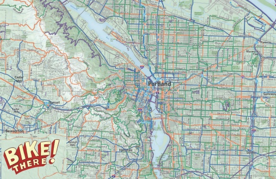
Detail of Bike There! map.
For those who still rely on printed maps, the best one for the entire region’s cycling routes is Metro’s Bike There! map. First published in 1983, the agency is currently working on a major update for the 9th edition and they want your help to make it the best one ever.
Metro has launched an online survey to learn more about how people navigate the region by bike. The survey asks you to rank the importance of the map’s various features, asks about your use (or not) of various GPS mapping services (hmm, wonder what Metro could be up to?).
The new map is set for release in 2015. You can buy a copy for $9 at bike shops throughout the region. To take the survey and learn more about the Bike There! map, visit OregonMetro.gov.

")


Thanks for reading.
BikePortland has served this community with independent community journalism since 2005. We rely on subscriptions from readers like you to survive. Your financial support is vital in keeping this valuable resource alive and well.
Please subscribe today to strengthen and expand our work.
Can we have a .kml for Google Earth like we did a few years ago?
Can we get an offline electronic version?
I’d honestly buy both but I like having access to the level of finite detail that cannot be included on a paper map without frying people’s minds.
When the 9.0 hits and the cell towers, etc, are down, paper maps will come in handy while we’re all evacuating via cargo bike.
at that point the lines on the pavement won’t matter and all vehicles will be using all roads in any manner they can…
that’s when separate infrastructure would be best… no panicked drivers clogging the bike paths during disasters… but I’m guessing people would just plow through the riders with their cars… or maybe I’ve seen too many disaster movies…
Bike maps may not be the best tool in an emergency regional evacuation…
As then the bike lanes will be filled with debris and all roads will be “bike lanes”…assuming the Hollywood movie grid lock allows space for bikes to flee other than the car free trails.
Remember to bring your crossbow and machete; no one is making new ammo in the zombie apocalypse.
I loved, loved, loved the Google Earth overlay, and I miss it a lot now that I just use Google Maps. IMO the bike route information currently in Google Maps is substantially inferior.
I’d like to see ‘ghost bike’ markers everywhere a cyclist had been killed.
Alert the touring crowd that if they are going thru Oregon City they’ll b hitting some major hills (or brave 99 w/ no road shoulders).
saypdx: Presumably, you want to scare people away from biking, which will only make it more dangerous for those who do bike. Ghost bikes are a bad idea.
Meanwhile, I’d like to see a marker for every dangling modifier that has mangled both logic and the English language: “First published in 1983, the agency is currently working on […]”