PBOT’s North Williams Traffic Operations Safety Project is heating up again — both the public process and the public spotlight.
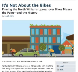
The project found its way onto the cover of this week’s edition of The Portland Mercury. Reporter Sarah Mirk took a historical look at the Albina neighborhood and, given its history of racism and development, she arrived at the conclusion that the project is “Not about the bikes.”
Here’s a key quote in Mirk’s story that I think sums up feelings of some people in the community. It comes from Midge Purcell, policy director of the Urban League of Portland (a non-profit that advocates for African Americans):
“The City of Portland’s policies want to encourage increased cycling and environmental friendliness,” she continues. “That’s all very well and good. But when people feel that those values are imposed upon them, especially when there’s been all the other historic impositions on the community, then it really does become about a lot more than just putting in a bicycle lane. In a lot of ways, this is a real test. To see whether some of the lessons have been learned from previous projects where the outcomes have been really, really poor.”
Bicycling Magazine also has a freelancer working on a story about the project. I’ve been in contact with him and last week went on a ride with the reporter, stakeholder advisory committee (SAC) member Michelle DePass, and PBOT project manager Ellen Vanderslice (who by the way is retiring on April 27th).
Speaking of outcomes for this project, the project’s SAC adopted their “Top Ten Outcomes and Measures” at a meeting on February 7th. Having the entire, 26-member SAC agree to a set of outcomes is a key tool the group will use to evaluate potential engineering solutions.
Interestingly, while concerns about motor vehicle parking capacity and increased congestion have been a part of opposition toward reducing the street to one standard vehicle lane, none of the outcomes related to those issues were adopted onto the top ten list.
Previous drafts of the outcomes list included items such as: “Motor vehicle congestion in the corridor is not significantly increased,” “Average travel times for motor vehicles during peak hours is not significantly increased,” and “The supply of on-street motor vehicle parking in the project corridor is maintained.”
If any of those outcomes would have been adopted, it would have constrained the SACs ability to recommend certain solutions — especially a solution that included less road space for motor vehicles. Instead, the adopted outcomes set the stage for a SAC recommendation that favors safety of humans over convenience of private vehicle travel.
Here is a list of the top ten desired outcomes:
- Increase convenient pedestrian opportunities to safely cross Williams
- Mitigate conflicts between all modes
- Reduce motor vehicle speeds
- Improve visibility of pedestrians
- Reduce the risk of cyclists being struck by opening vehicle doors
- Create opportunities for people bicycling to pass other cyclists without entering the motor vehicle travel lane
- Manage conflict between bus and bicycle operations
- Reduce all crashes in the N Williams corridor
- Maintain or improve ease of transitions bicyclists making turns
- Maintain access and operability for TriMet LIFT vehicles and private lift‐equipped vans
The SAC is just days away from putting some actual engineering designs through their filter of outcomes. Speaking at the PBOT Bicycle Advisory Committee on Tuesday, City Traffic Engineer Rob Burchfield said he plans to share four “conceptual options for improvements” with the SAC this week.
“The goal is to bring the process to a close before the end of the fiscal year [June 30th].”
— Rob Burchfield, PBOT
The SAC has met monthly since February 2011 (except for July, when the process took a one month breather), but, with the process having dragged on for over a year, the pace is set to quicken. PBOT has announced four extra meetings between now and April 3rd, “In the interest of developing a recommendation… by the summer construction season.”
Whatever recommendation the SAC comes up with, whether or not there’s enough money to pay for them remains to be seen. As Mirk reported in The Mercury article, the entire budget for the project is only $370,000 and 25 percent of it has already gone toward planning and public involvement. That leaves $277,500 for a two mile long project that is likely to include a mix of new paint striping, signage, and crosswalks. New traffic signals have been discussed, but at about $200-250,000 a piece, they are unlikely to be feasible with limited funding.
With money extremely tight at PBOT right now, the agency says they need this process to come to a close before the end of the fiscal year (June 30th). That warning is likely due to a lack of confidence that the money would continue to be available in next year’s budget.
Some have speculated that new development — especially the New Seasons Market — might come with new money in the form of System Development Charges (SDCs). SDCs are fees paid by developers to off-set impacts their new buildings have on the transportation system. However, PBOT told the SAC at their last meeting that SDCs won’t be available for this project (it’s complicated, something about it not being on an already-adopted City Council list and about the Eastside Streetcar and Milwaukie Light Rail projects already sucking up all the available SDC funds).
The SAC meets again this coming Tuesday where, after months of long-winded (yet important) debates about process and principles, they’ll finally be ready to roll up their sleeves and get to work deciding what actual changes to implement. I have a feeling there are some contentious discussions ahead. Just like there were back in May 2011, there are still strong feelings on both sides of the one-lane debate.
Hopefully this time around, given the expanded process and stronger involvement of all parties, the discussion will result in a positive outcome. Stay tuned.


Thanks for reading.
BikePortland has served this community with independent community journalism since 2005. We rely on subscriptions from readers like you to survive. Your financial support is vital in keeping this valuable resource alive and well.
Please subscribe today to strengthen and expand our work.
A quarter million bucks for a traffic light?!
$200,000 to move a pole? Maybe we need to find ways to do some of this stuff a little cheaper?
I like the top ten list. Maybe this has wider applicability?
250k for a traffic signal is actually fairly conservative. No matter where you are in the US, signals are expensive. That’s one of the reasons that engineers and planners have been looking more towards traffic calming, roundabouts and other solutions to speed and conflicts.
Thanks for highlighting that quote from the Urban League. I really wish Ms Mirk had followed up a bit further on that. I get the impression from some people that they’d rather just remove the bike lanes and not have to deal with people on bikes at all. Is that what, “a real test” is? Flexing political muscle to delay and endanger people on bikes to preserve two car sized lanes?
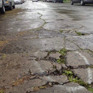
The Super Mario Kart power-up items in the bike lane are in desperate need of re-painting
a major reason this is a significant vehicle route (bikes & cars) is that is has few stops
choking it up with stop signs or lights is going to more than just make it safe – it will make it less enticing to commute on this path
is that a secondary benefit the neighborhood is looking for?
I’ve all but completely stopped using Williams during rush times. Interstate completes my particular route just fine, so I am one who has at least been deterred from taking this route any more. Here’s hoping something happens eventually, one day, perhaps, maybe. I for one am done with it for now.
regardless of the recently adopted outcomes, you can be sure there are still decision-makers at PBOT who still feel strongly that “Motor vehicle congestion in the corridor is not significantly increased,” “Average travel times for motor vehicles during peak hours is not significantly increased,” and “The supply of on-street motor vehicle parking in the project corridor is maintained.”
unless i am very much mistaken, the previous draft from which jonathan grabbed those items was generated by PBoT, not by the SAC task force. good on them for not incorporating those suggestions in their list. the project has the word “safety” in its name, for pete’s sake. how does maintaining existing (unsafe) levels of service serve safety?
i have been cycling this route for the last 10yrs and have never particularly felt this was an unsafe corridor, and have been somewhat mystified at all the energy here.
sure, it could get tweaked here and there, and i’ll appreciate those tweaks, but there are waaay more deserving corridors for attention.
“…the Eastside Streetcar and Milwaukie Light Rail projects already sucking up all the available SDC funds.”
yet another unintended consequence of our civic leaders’ knee jerk support for the streetcar.
Exactly.
Regarding Streetcar and Milwaukie LR, I’m curious how much of each project is funded. With both House and Senate transportation bills removing support for both Active Transportation *and* transit, will those projects be able to be completed if either bill becomes law? Does the city/region have a backup plan if funding dries up mid-project? And if not, WHY NOT? It’s painfully obvious that we are now in a far more challenging funding environment than we were 5 years ago, and there are no indications that the funding situation will change significantly (except possibly for the worse) in the next 5 years, or longer.
The big-bill projects seem to be about to become part of the past, and the transition period will be tough. I’d like to know what my local and state governments are doing to ensure we don’t end up with a plethora of half-finished boondoggles and millions of wasted dollars.
In 1990 or thereabouts there were over 700 abandoned houses in inner NE Portland, and the City kicked off the Albina Plan with more meetings, process and input than you can image in order to reverse the massive disinvestment there.
In 1999 the Interstate Corridor Urban Renewal Area was created with a bonding capacity of $300 Million, $30M of which was for Interstate MAX. Williams is at the heart of the Albina Plan and within the Interstate URA. The Citizens Advisory Committee for ICURA meets every quarter up the street at OAME. There have been resources there for 10 years for neighborhood economic development, housing rehabilitation and transportation projects (check out Russell St., Killingsworth Str. and Denver Avenue in Kenton).
Too bad that the usually thorough Ms Mirk missed this part of the story. Williams should be made safe for all users, which means lower auto speeds, which means one lane just like Vancouver. End of story.
There are some pretty interesting comments over at the Mercury web site that essentially say that it wasn’t only poor black neighborhoods that were targeted by 60s and 70s style urban renewal, but poor white neighborhoods as well. Examples given included Lents (I-205 construction) and that part of southeast downtown south of the Koin tower and Keller Auditorium, as well as west downtown and parts of Goose Hollow (I-405 and Hwy 26 tunnel construction).
I was struck by the similarities between what Mirk heard from some people on Williams about values being forced on them (which are things I’ve heard as well) and what I’ve heard from people in East Portland – specifically around the Holgate bike lanes controversy.
I think there are some similarities between the pushback on Holgate and Williams. Both places have a lot of skepticism and distrust of the City in general and a bike project gave them the opening to air those grievances. Both places also have some residents that don’t share the fondness with bicycling that PBOT has.
You hit it on the head, Lenny.
Safety = lower motor vehicle speeds = one lane.
Let’s move in that direction, just as we already accomplished on Vancouver. The designation of this street is a “neighborhood collector”, not serving through trips… which is what we have with two lanes.
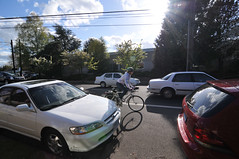
I see it every day at the end near Killingsworth. The speeds are 10-15 MPH more than than posted. And every day I hear honking, and on a neighborhood collector? What’s the honking for… unsafe driving!
it’ll truly be sad if nothing gets done here. it may also signal to the city to spend money where it’s welcomed and less controversial. I saw this on a rezoning effort that the city planned for my neighborhood. Due to a few anti-change gadflies, the city abandoned the effort and left us hanging. We just can’t afford long drawn-out public processes like these when budgets don’t even allow enough for basic maintenance.
Frankly, speaking as a van-driver and cyclist living in the Albina neighborhood, I don’t understand driver’s complaints about their commute times being adversely affected by any changes to Vancouver/Williams.
As far as I am concerned, Van/W is a bus/bike corridor. I am never going that route with my van if I can help it. It’s slow as hell what with all the bikes and the buses. When you’re finally close enough to Rose Q, there’s often a 30min pile up because of the lights that prioritize buses and bikes.
This is all good when I’m on my bike or the bus, but I’ll take my van down MLK or Interstate any day. Why not do more to discourage cars from from trying to commute via Van/W (it is not smart), instead of trying to pander to needs that aren’t being met as it is?
Before you get your knickers in a twist, I live a block off Vancouver. Yeah it would be my first choice–but I find that Vancouver takes so much longer that it’s actually more economical to drive the extra several blocks to MLK. This doesn’t bother me.
Freeway construction through Portland destroyed the Goose Hollow neighborhood (former PSU student “ghetto”) as well as Albina and the neighborhoods along I-5 in north Portland. The Ross Island ramps to old Harbor Drive (still there) pretty much did in South Portland. The Eastbank Freeway degraded the Central Eastside and made Waterfront Park an ugly visual experience at best. Even ODOT recognized it as a mistake in the 60’s.
“Urban renewal” did in the Jewish, Italian and Gipsy communities south of downtown. This list goes on.
Portland stopped building freeways in the 70’s (soon to resume with the CRC?) at the demand of neighborhoods in SE and NW.
While we have the unpleasant distinction of being the most racist northern city in America, that began to be addressed in inner NE Portland with the Albina Plan, the reconstruction of MLK and Alberta (led by an African American developer). The Interstate Corridor URA’s founding document is explicit in calling out the sorry history of urban renewal in inner NE and calls for extra effort to hold harmless the most vulnerable residents and businesses with URA resources.
Ironically it was at the request of an elderly Africian American ICURA CAC member that the Transportation Subcommittee took up the question of how to make Williams safe to cross. This project should honor that need by slowing traffic via a single traffic lane.
Two final thoughts: 1. making a community attractive attracts new residents, investment, businesses. What’s the alternative? 2. Inner NE was in the end the last affordable close insector of the city.
And a couple more things: during my tenure on the ICURA CAC I heard more than a few times resentment about the original bike lanes on Williams/Vancouver which I believe were striped in the 90’s under Mia’s watch. I can’t speak to how thorough the process was for that. But it left some bad feelings.
The model for streetscape project process is the lower Russell Street improvements (also Killingsworth and Denver), done with a TGM grant and PDC money. PBOT did a ton of outreach, several community walks and discussions were held, all of which resulted in some compromises and a relatively painless project. Ellen Vanderlice came up with the concept/design of truck friendly curb extensions among other things.
Its too bad that a similar route was not taken with Williams/Vancovuer especially as it takes off as a commercial district. There has been resistance to streetscape improvement projects based on the view that they advance gentrification. Probably true.
It is a fair question to ask how PDC’s Interstate Corridor URA has performed in getting resources to the community’s most at risk residents and businesses. PDC’s outreach is limited by the requirement that tax increment funds be used for “bricks & morter” only. So access to programs is easier for “20 somethings” with college degrees than for long time residents lacking a computer. By law 30% of URA funds must be dedicated to housing, and that is for affordable housing…an admittedly broad concept. URA funds were used for New Columbia and the reconstruction of the housing off Vancouver north of Alberta St. Current members of the ICURA CAC would know how well other programs like housing rehab, downpayment loans, etc. have been distributed. The CAC’s Housing Subcommittee was an on and off affair, the blame for which can be shared by both PDC staff and the community.
More or less the same “level of participation” question applies for small business loans like Storefront Improvement, Development Opportunity grants, etc. Access to capital remains a challenge for small businesses that are just hanging on. But the Interstate URA still is in effect and has lots of resources, so it not too late to move it to better fulfill its written obligation to the most at risk segments of the inner NE Portland community.
A couple of thoughts on the top ten list:
“Reduce all crashes in the N Williams corridor”
You can reduce some crashes, or you can eliminate all crashes, but how do you “reduce all” crashes?
“Mitigate conflicts between all modes”,
“Manage conflict between bus and bicycle operations”
How are these different? They seem to be the same thing. If so, they should be condensed to make room for a unique 10th point.