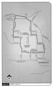
Rubber To The Road is a two-volume set of guide books (first published in 1998 by David Guettler and compiled by Peter Marsh) that detail some of the Portland area’s very best road rides. It was one of the first books on biking I picked up when I moved to town.
Now, the books are set to go digital with a new website (RubberToTheRoad.com of course), new rides, and new features.
According to a mention in the River City Bicycles newsletter, the shop is collaborating on the project with pro cyclist and writer Jacob Erker.
Erker told River City,
“When I moved here a couple of years ago, The Rubber to the Road books essentially became my training program. They were a phenomenal tool for discovering incredible, forest covered, quiet roads all over the area. I’m very excited to increase the visibility of the fantastic riding around Portland by bringing it online.”
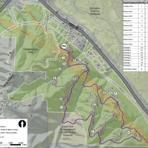
Slated for the new website will be interactive maps, more detailed ride descriptions (where to get water, food, etc…) and the route maps will be offered for download in a GPS-friendly format.
Stay tuned to RubberToTheRoad.com for developments and check out this month’s “Rubber to the Road Featured Ride” at RiverCityBicycles.com.


Thanks for reading.
BikePortland has served this community with independent community journalism since 2005. We rely on subscriptions from readers like you to survive. Your financial support is vital in keeping this valuable resource alive and well.
Please subscribe today to strengthen and expand our work.
Funny, Jonathon, but I’d been meaning to write you about setting up a new discussion forum where readers could post ride reviews. I’ve participated for a couple of years at a very good portland hiking site, PortlandHikers.ORG that does a fantastic job of integrating editorial areas, discussion forums, and hike reports. Personally, I think bikeportland would do a much better job of integrating all aspects of the local riding scene than a site oriented to one guidebook and sponsored by one bike shop.
Maybe you could at least start a discussion forum focused on “Ride/Route/Trip Reviews?” For instance, I did informal trip reports to cycling friends after my Sunriver vacation in July, and after my coast loop tour earlier this month. It’d be nice to have a centralized forum to post these to here at bikeportland.org. Its easy to publish the google maps routes using free tools available at bikely.com or Gmap-Pedometer.com.
“Maybe you could at least start a discussion forum focused on “Ride/Route/Trip Reviews?”
I’ve got a “Route info” section in the Forums that gets a lot of traffic. I realize it is low-tech, but at least it’s a way to share and get feedback/tips on routes.
I would love to develop a more robust tool like the hiking one you mentioned.. but it requires time and money.. both of which are in short supply in my life.
what I need is a very good web developer(s) that can help me with tech stuff and add new features to the site.
Let me start off by saying I really like these books. They are very useful and have gotten me biking in places I wouldn’t have thought to ride. However, I’ve used these books numerous times over the past few months and several issues have repeatedly surfaced. The biggest is that the maps are inadequately labeled; some roads are excluded while others are unnamed. I understand things change, but I know some of these roads existed before 1998. The other big problem is that it is sometimes hard to tell which direction one should turn at an intersection. I’ve made several wrong turns and not realized it for several miles. My suggestion for the website would be to have a printable cue sheet (left on Happiness road (.3 miles) right on Bliss Blvd….) to accompany the ride description and maps. For now, I’ll just have to start googling it (it makes me feel dirty writing that 🙂
Many of the routes do need to be updated for changes in road names and in some cases the routes should be changed altogether since there has been a tremendous amount of growth in the outer areas. Some rides in the Tualitin/Sherwood areas are impractical now due to the amount of traffic. Otherwise great books!
This should be a great update to these books. I was the author of the second edition, which includes some pretty long, complex routes. I agree that many of the options, in both volumes, but certainly Vol. II, are now not highly recommended due to increased car traffic, or major road modifications. Also, do keep in mind that the maps were created before much of the current technology was available–Google Street View, Map My Ride, Etc–so there are certain shortcomings inherent in them. They were also created on a limited (tiny!) budget, and as such had real design constraints. That said, enjoy, and keep riding!