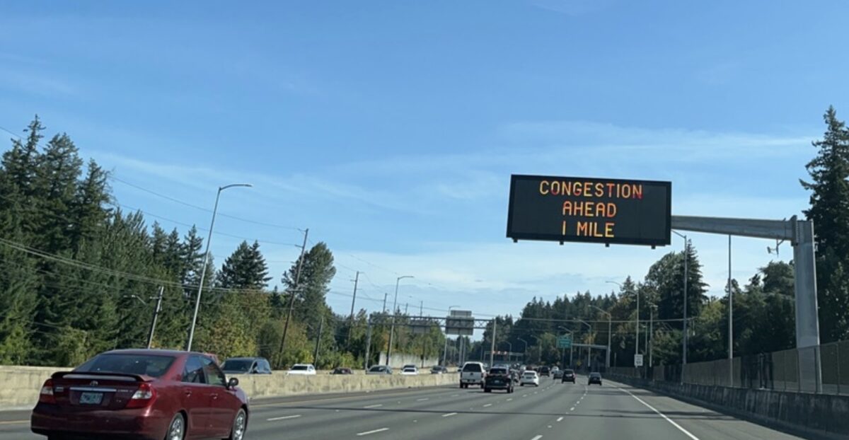
I don’t have much reason to drive on Highway 26 anymore, now that I no longer have a dog who requires regular grooming. So I can’t tell you how long Oregon Department of Transportation’s reader board has been warning about congestion. But happily for drivers, the warning is actionable. If you are heading downtown, it is placed just before the Sylvan exit. What fool wouldn’t cut through local streets to avoid back-up at the tunnel?
ODOT installed its first Dynamic Message Signs (DMS) less than a decade ago after studying how the technology worked in other cities. What they learned was that the reader boards significantly reduced the number of crashes in those cities, and could hopefully improve Portland’s “unpredictable commute times.” A 2014 Oregonian article mentions that they would also give drivers “a chance to choose an alternate route.”
The “choosing an alternate route” part is becoming a bigger issue now with congestion pricing schemes under discussion and with neighborhoods worried that toll avoidance will lead to more cut through traffic on local streets.
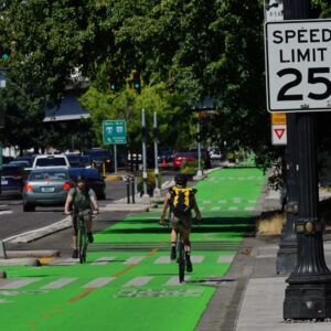
Portland Bureau of Transportation’s (PBOT) response to area traffic has a push-me-pull-me aspect to it. Over the past few years, the bureau has installed traffic calming along several cut-through routes. At the same time, however, it has also maintained the speed limit on those residential streets at 25 mph, even though the streets lack bike facilities or sidewalks in many places.
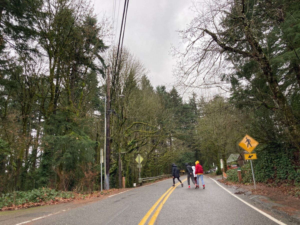
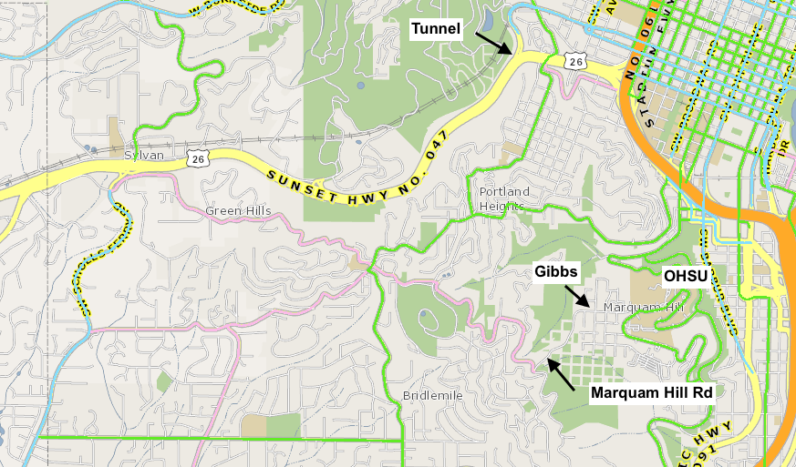
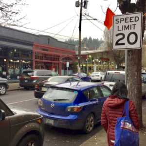
Even on select local streets, PBOT has taken exception to its “20 is Plenty” speed reduction program and maintained a 25 mph posted speed. Where do you find those hand-picked exemptions? On the route from the Sylvan exit to OHSU: Marquam Hill Rd and Gibbs St.
Fairmount to Gibbs is the only route for people riding a bike or walking to campus from the neighborhoods to the west. Yet, as BikePortland recently reported, PBOT’s Development Review department ruled against a new development building sidewalks on its SW Gibbs Street frontage.
Maybe there is something like this going on in your neighborhood too. It is sure to become a more important concern as congestion pricing rolls out. But we aren’t starting from neutral. The purpose, in part, of these reader boards appears to be to encourage cut-through routing. And PBOT seems to be accommodating it with higher speed limits in some places.




Thanks for reading.
BikePortland has served this community with independent community journalism since 2005. We rely on subscriptions from readers like you to survive. Your financial support is vital in keeping this valuable resource alive and well.
Please subscribe today to strengthen and expand our work.
Legally speaking, I remain baffled that PBOT leaves ANY local service or collector (i.e. “non-arterial”) streets in residence districts posted at faster than 20 MPH. There is a law and ordinance that dictate.
I don’t have ‘congestion ahead’ signs in my neighborhood but every weekday afternoon has hundreds of motorists driving down the N Central “greenway” to avoid Lombard. Lots of Washington plates blowing stop signs to cross N Central too. Super dangerous.
Somehow people are managing to ignore the beg barrel telling them to please go 15mph. What would have thought it?
I regularly visit a friend who lives on Willamette, just south of St John’s bridge. People drive like nuts on that street.
As long as the streets are wide and it feels safe driving fast, people will continue to do so. That article about Helsinki and the narrowed lanes should be informative for city leaders. If you want less speeding then prioritize design that makes speeding harder. It is unrealistic to assume people will go the speed limit when the street “tells” you you can go much faster
N Willamette is a living testament to how little Portland cares about road safety and VisionZero. After Jason Barnes was killed by a speeding motorist, zero action was taken to slow motorist down on the street. I go through that intersection a lot on foot and I’d say 1 in 20 motorist stop for predestrians and maybe 1 in 10 aren’t speeding.
Agreed, this feels like a conclusion in search of a cause. The ‘Congestion Ahead’ signs are for safety. A freeway should flow at high speed, when a section of it often does not a warning for people is a good idea.
I have gotten off 26 to use side streets before, but my information has always come from checking traffic beforehand, via an app, or just looking ahead a bit on a hill or curve and using logic to say “oh, that looks way worse than usual”.
By the time ODOT warns me of Congestion Ahead, my phone has already picked an alternate route! I remember the Bad Old Days when Waze was directing drivers up fun little streets like Chesapeak or La View
If we want to make cut-throughs unenticing, the design of side streets is the place to do it. Chicanes, diverters, plantings, dead ends. Make it a hassle to drive more than three blocks in a straight line.
Ironically southwest has a head start on unenticing side streets, with twisty narrow roads, bad sight lines, limited alternatives and ambiguous use of space (no sidewalks!). At this very moment there’s a backup in the tunnel — Google maps tells me it’s 11min from Sylvan to OHSU via 26, 12min via Scholls/Patton/Broadway, and 14min via Humphrey/Fairmount/Gibbs. Yeah that’s 14min where I’m not stuck in stop-go traffic (which is a bargain I would take TBH) but my apps probably won’t direct me that way.
Wait, you would spend an extra 3 minutes and burn more fuel to avoid some traffic on the freeway?
There should be a toll put on that OHSU cut-thru. What other apartment projects are prohibited from sidewalk construction in Portland or even Multnomah County besides that new one on Gibbs?
Rick, there doesn’t seem to be an official policy, but 4 ft of packed shoulder seems to have become the default frontage improvement for SW developments.
It was intended as a joke (haha) but I do really hate freeways
I used to take back roads all the time before navigation (used my Thomas Guide) just to avoid stop-and-go freeway traffic. It was mainly a great way to avoid the stress of it all and the road rage of others, even if it took significantly longer (and wasn’t in a hurry). Bonus: it became a great way to discover many hidden secrets about all those side roads: tiny little businesses and restaurants I would patron, magnificent vistas I’d pull over at, and better intuitive understandings with the “lay of the land” in the region. The side roads I was taking were generally more rural or remote and not neighborhood streets.
These days, I just avoid driving altogether if I can. If I must, I avoid peak hours as best I can. And when considering a new job – the commute matters. If I can’t do it via mass transit or bike, I’m not as likely to take the job. At my worst, I had a 54 mile commute (and where a lot of these exploratory trips came from). That was madness.
Love your comment! A few years back, googlemaps had a feature that displayed historical route times. So you could pick a route and specific date and time, and see how much time it actually took to drive it.
Using that feature, I plugged in several dates for AM peak traffic and two different routes — from hwy26 at the Sylvan exit to Keller Auditorium via hwy26, and same start and stop points via Humphrey/Patton/Bway. I saw enough to convince myself that the two routes had reached equilibrium time-wise.
Earlier this week, I checked route times again and results were mixed. Credit the pandemic.
My feeling is that 25 mph is OK if pedestrians are protected somehow; most of the 25 mph collectors in SW lack sidewalks or pedestrian protection.
Gibbs is egregious because it is a designated local street which is rapidly densifying; the uphill portion lacks sidewalks; whoever sets speeds at PBOT chose to hand-select it as an exemption from the “20 is plenty” program; it’s a few hundred feet from the city’s largest employer, OHSU; OHSU has outstanding commute-mode percentages with many employees using transit or biking/walking; and developers are willing to build sidewalks.
Yeah, I’m not sure advocates were thinking when they wanted congestive pricing, especially when ODOT’s answer has mostly been, “take other roads.” Quite frankly, as PBOT reduces roads for other types of uses and forms, I’d much rather like the traffic to be on the freeway tbh. Maybe the city can toss up a Congestive Toll on Flavel Dr, Johnson Creek, or 82nd to match what ODOT is doing lol. At some point, we have to think about the dynamics of these asks and the little jingle that gets tossed around for Joe C.
if speed limits are lowered, drivers won’t care. The solution is to make these roads hostile to cars. Introduce speed bumps to slow cars down. Narrow the lanes to lower the margin of error drivers have. If a bus goes through, increase the frequency of buses, both increasing the chance to get stuck behind them, and encouraging riding.
Strictly enforce speed limits with a radar and place RFID tags license plate stickers so authorities can identify you even if you hide your license plate.
Actually no, that could be easily abused by PPB, stalkers, etc (but it’s not like they couldn’t get that data from Google Maps/Waze/Your insurance company).
Lisa, please forgive me for taking liberty with the title of your article. Here is a snapshot of a sign I took in 2014 and again in 2019. The sign always got me to slow down. Also, see the comment I added to my 2019 snap.