(See full map below)
Remember Cycle Wild? They’re the local non-profit that organizes and promotes bike-camping trips from Portland. We went along with them for a ride back in 2009 and learned just how easy it is to pack up some gear, start pedaling, and get away from it all — without having to drive a car.
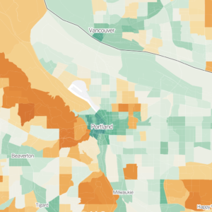
Cycle Wild founder and ring-leader Matt Picio just published a very cool map (see it below) that anyone with a glimmer of bike adventure in their hearts will appreciate. It’s a map of campsites within Portland’s “rideshed.” Picio defines a rideshed as, “anywhere you can ride a loaded bike on a summer day.” Typically, that distance is about 75 at the most, but thanks to MAX light rail, Portland’s rideshed is much further.
According to Picio, there are well over 150 designated campgrounds within 75 miles of Portland. His map currently includes 168 campsites. Check it out below and visit Cycle Wild’s Where to Camp page to learn more…
View Portland Rideshed Campsites in a larger map


Thanks for reading.
BikePortland has served this community with independent community journalism since 2005. We rely on subscriptions from readers like you to survive. Your financial support is vital in keeping this valuable resource alive and well.
Please subscribe today to strengthen and expand our work.
So rad, this is awesome Matt!
Matt rules. That is all.
This has saved me a lot of time in the future.
+1
How cool is that! I hope I can align some tuits to go on a bike camping trip this year. Oh, and what’s that I see about a wedding? 🙂
This is genius. Hopefully people can add their own spots they discover. Also, wonder why Baja California isn’t on there. Thats where the sun is shining on me right now after leaving Portland.
We’re happy to add spots that users submit after we’ve field-checked them. While Cycle Wild can’t guarantee that the map information is 100% accurate, we’ve taken every effort to make it as accurate as possible – so we unfortunately can’t allow additions to appear on the map without being field-checked first.
As for Baja – sorry, this only covers the Portland Rideshed. While some of us would LOVE Baja to be inside the Portland Rideshed, we haven’t figured out a way to do that yet which doesn’t involve a massive movement of the San Andreas fault.
Incredibly useful map. Thanks CW!
Awesome, Matt. When they write the history of bicycling in pdx, your place in it is assured.
Now, if it would just snow so I could make some hot chocolate and dream over this map………..
Happy-making.
Nice work Matt…there a android app for that? 🙂
Tourbiker, find me an app writer who’ll work for recognition instead of money, and we’ll totally do it – I’d love to see an app for Android and iPhone.
Way to de-mystify the way to take off for an easy adventure. Thanks for all your good work on this!
Thanks for the kind words, all – check back occasionally, because I’ll be adding information to each of the site pushpins: number of sites, annual vs. seasonal, reservation vs. first-come first-served, and links to the campground websites. I thought it was more important to post the map with the locations rather than waiting a couple months while I finished gathering the data.
The trick with getting all of this is that the information is scattered across so many sources. The campgrounds span more than 6 counties, 4 state agencies, 2 federal agencies (including 3 separate National Forests), 2 private utility companies, and a few one-off sources. There are print books which consolidate all these sources, but in some cases the campgrounds listed in them have closed, changed, or don’t list the most recent additions. We’re going to do our best to keep the list up-to-date to provide the best information possible for people who are looking to go camping.
Thanks Matt!
Another great resource while traveling for bike camping is the AllStays Camp & RV App for the iPhone/ Touch.
And for your future map upgrade…it would be great to know how ‘bike friendly’ the camp site is…if the tent site surface is pavement, gravel, sand, grass; if the bike camp site is separated from the RV sites (noise and lights) and if there is water or showers.
Thanks 2x
Todd, we hope to get some of that information on there – and if anyone has specific suggestions as to what basic info should appear when you click on the pushpin, email matt.picio “at” cyclewild.org and I will try to incorporate as many of your suggestions as I can.
This is fantastic! I’m now inspired to take some car-free camping trips this summer, for the first time. Oh, the possibilities …
don’t forget horning’s hideout in north plains!
http://horningshideout.com/
This newer venue, is located 27 miles across the river in Brush Prairie, Washington. The country roads allow for a gorgeous trip. The park is open to the public during Spring and Summer. Camping is available as well as good eating, horse rides, pedal boating and forest hikes. Check it out!