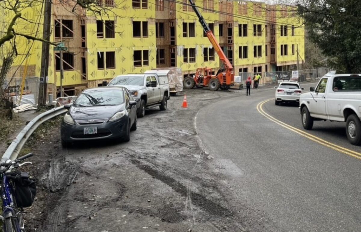
Last week BikePortland wrote about the Homestead neighborhood’s struggle to get a sidewalk built on the frontage of a new 43-unit apartment building under construction on SW Gibbs Street near OHSU. Neighborhood advocates were surprised to discover that the City of Portland does not count pedestrians and cyclists when determining the traffic impacts of developments which trigger a Land Use review.
This situation is interesting in that the developer is working cooperatively with the neighborhood association, and was willing to build a sidewalk, but could not get the permission from the Portland Bureau of Transportation (PBOT). This brings up a larger issue about how Portland will ever build the sidewalks (or bikeways for that matter) we need in this and other parts of town.
This case on Gibbs is such an important illustration of a problem that we felt it deserved a closer look. So take your blood pressure pill and get ready for some wonkery as this article dives deeper into what happens when the city only counts car traffic.
This loophole calls into question how sidewalks and bike routes will ever be built in the areas of town that don’t already have them, like in southwest and east Portland.
Background
First a little wonky background about getting permission to build. Zoning changes, land divisions and new buildings which will increase the density of people living in an area require a Traffic Impact Study (TIS). It is provided and paid for by the developer, who contracts the work out to a traffic engineering consultant. (Keep in mind the consultant’s compensation is not independent of the developer, so there is a possible incentive for the engineer to present information in a way that is favorable to the person paying them.)
The next step in the process is that PBOT reviews and signs off on the consultant’s transportation study, and delivers its report to the Bureau of Development Services, which collects reviews from up to seven bureaus as part of the building permit application process. The review and sign-off are the responsibility of PBOT’s Development Review section.
The Gibbs case
Let’s take a peek at the Gibbs case specifically. The analyses of car traffic for the TIS are most certainly correct, but when it comes to walking and biking, the errors of omission in the overall report are — well, grab that pill.
The consultant applied standard Trip Generation formulas to determine how many more cars would be on the roads due to the 43 new units. The impact of the additional cars is measured by how much longer drivers will have to wait at nearby intersections.
Specifically, impact is defined by administrative rule TRN-10.27, which states that the added cars from a new development shouldn’t degrade the Level of Service (LOS) at nearby signalized or stop-controlled intersections below LOS “D” and “E,” respectively. Roughly, that means that a driver should not have to wait longer than a minute at an intersection. If a new development adds enough cars to the road to degrade service to unacceptable levels, then the city requires the developer to mitigate the impact.
The Gibbs TIS concluded that the additional car trips generated by the new building wouldn’t push the LOS at nearby intersections below the D and E level. Development Review concurred:
. . . the applicant submitted a Transportation Impact Study (TIS), professionally prepared by ———, to support the transportation-related approval criteria, in which PBOT reviewed and agreed with the conclusions that the transportation-related approval criteria are satisfied.
Beyond the TIS, however, the developer must also show that the area transportation system is “capable of supporting the proposed development in addition to the existing uses in the area,” (Section 33.641.020 of city code) Although that section of code lists evaluation factors which do include impacts to pedestrian and cyclists, it was modified in 2018 to introduce a giant loophole:
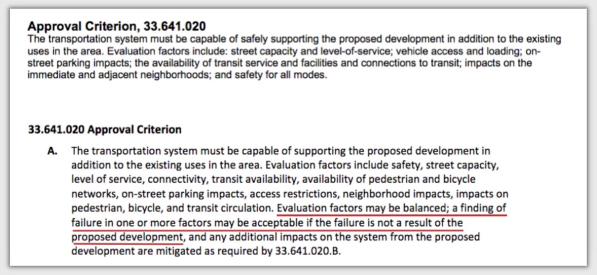
See the loophole? (It’s underlined in red.) Basically, if the area doesn’t already have bike and pedestrian facilities, it’s not the fault of the new guy on the block, and he is allowed to fail along with everyone else.
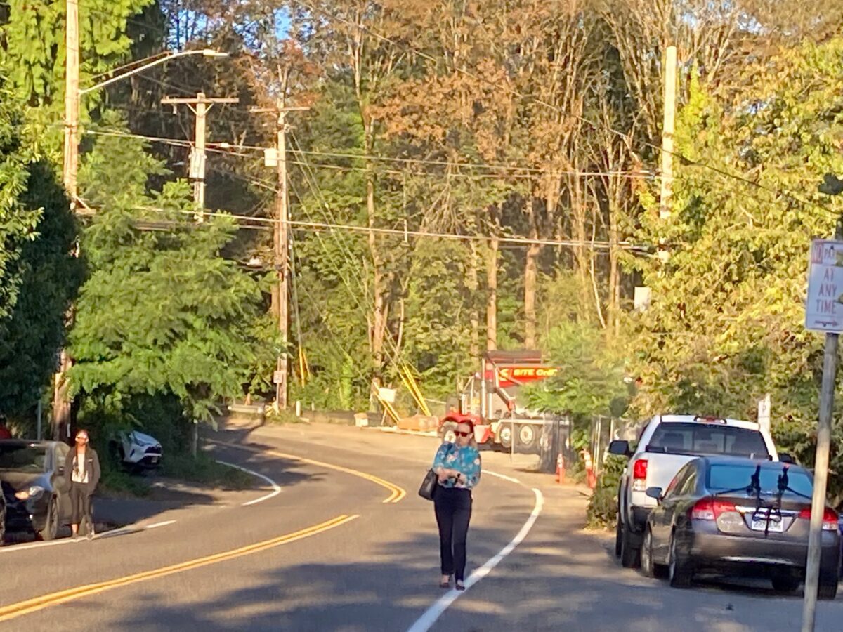
The inconsistency is that Portland city code Title 17.28.020 states that developers are responsible for “constructing, reconstructing, maintaining and repairing the sidewalks, curbs, driveways” on the streets that abut their property. But the new, “balanced” wording of Title 33.641.010 lets property owners off the hook. This new wording calls into question how sidewalks and bike routes will ever be built in the areas of town that don’t already have them, like in southwest and east Portland.
This absence of specific requirements for pedestrian and bike facilities leads to motivated reasoning in the resulting transportation system analysis. I’ll pick one of several possible examples from the Gibbs transportation report:
Sidewalks are partially complete along nearby area roadways. When sidewalks are not available along local streets, roadways speeds (posted and statutory speeds of 20 mph to 25 mph) and traffic volumes are generally lower, allowing pedestrians the ability to safely and comfortably walk along roadway shoulders when necessary.
In truth, 2018 and 2014 PBOT traffic counts on SW Marquam Hill Rd (just uphill from the development) reported traffic volumes between 3,000 and 4,000 vehicles per day, with 87% of the downhill vehicles traveling above the posted speed of 25 mph, and the 85th percentile traveling at 33 mph.
The full case file presented to the Hearings Officer shows that Ed Fischer, the president of the Homestead Neighborhood Association, contacted a PBOT planner who works outside of the Development Review section. The planner told him that “this is definitely in the range of traffic where we’d like to see a separated walkway to support pedestrian travel.”
Moreover, this street segment has been identified as needing a sidewalk by PedPDX, the citywide pedestrian master plan. It is also Southwest in Motion project BP-07 and Transportation System Plan project 90049.2. In other words, at least two different groups of transportation professionals have recognized the need for active transportation infrastructure at this location.
None of that—the existing traffic counts and speeds, the project lists—made it into the Gibbs Transportation Report (although neighbors brought some of this up, so that information is part of the record).
Nevertheless, the PBOT review concluded that
Therefore, based on the evidence included in the record, the applicant has demonstrated to PBOT’s satisfaction that the transportation system is capable of supporting the proposed use in addition to the existing uses in the area
What it all means
Southwest has the least sidewalk coverage of any area in Portland, and also the highest percentage of uncompleted bike network. Although PBOT has not openly stated it, the de facto sidewalk requirement for new development in southwest appears to have become a six-foot wide gravel shoulder at-grade with the roadway.
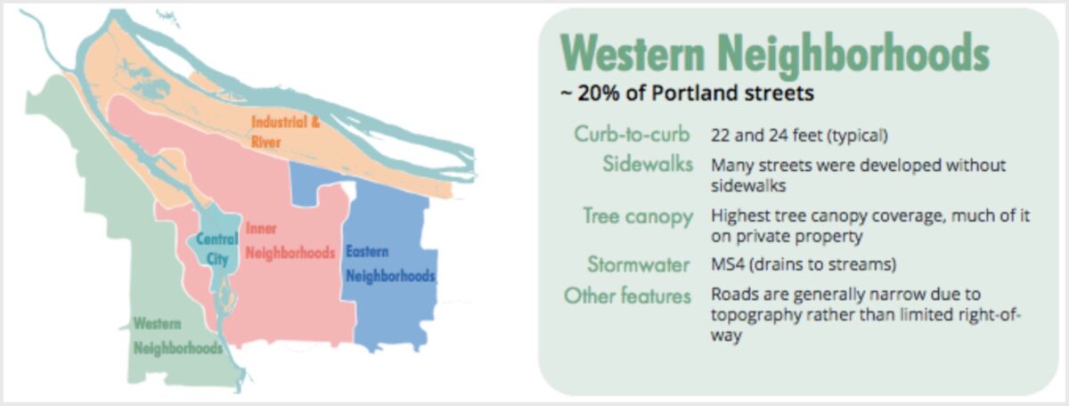
There are reasons why this is so. As the Streets 2035 plan points out, the southwest has the narrowest roads in the city, and also lacks formal stormwater facilities (the Big Pipe does not serve southwest past downtown). Sidewalks need to drain their stormwater runoff into a pipe, holding tank or treatment facility, and those are not available in most of southwest Portland.
It would be helpful, and serve to avoid a lot of conflict, and probably speed up the building permit process, if the City of Portland would clearly and proactively state how it plans to safely accommodate people on foot and on bike in the southwest region and other areas of town which currently lack critical transportation infrastructure.
Next week: BikePortland talks to Commissioner Carmen Rubio’s office about the work they are doing to streamline the building permit process.
