There’s a new cycling route to the Portland International Airport (PDX).
Last Friday, TriMet quietly removed barricades from a 1.1-mile stretch of a protected bike path that takes riders directly to the end of the MAX light rail line and PDX terminal. The path was partially funded by the Port of Portland as part of TriMet’s “A Better Red” project, a $215 million investment into the MAX Red Line.
In addition to an extension of the Red Line in Washington County, A Better Red added a second track to sections of the line between Gateway Transit Center and the airport. The project also comes with two new sections of bike path: One from Gateway Transit Center to Gateway Green Bike Park adjacent to I-205, and the other on NE Cargo Road from just west of NE 82nd to the PDX terminal. The new Gateway Green path and all other elements of A Better Red are expected to be complete later this summer, but TriMet has opened the new path to the airport.
The path was built by TriMet and Port of Portland, who provided $2.3 million in funding. The Port seized the opportunity of TriMet’s project to realize their vision of a new path on the south side of Airport Way along the MAX line that was a key part of the Port’s 2014 Portland International Airport Bicycle & Pedestrian Master Plan.


I took a closer look at the new path on Saturday. I found it to be a welcome addition to the bike network, but it needs better connections to existing facilities. (Watch the video above for more.)
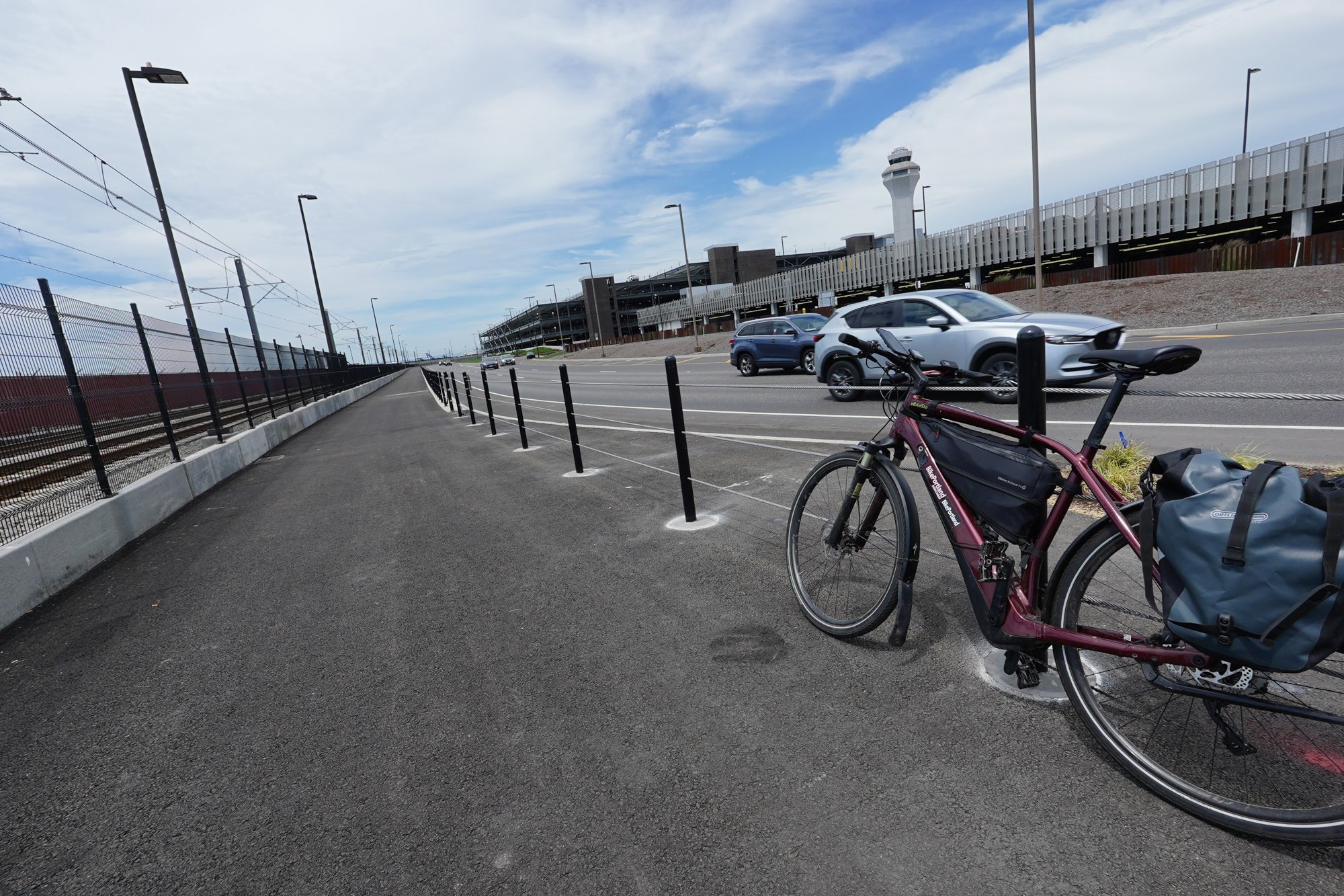
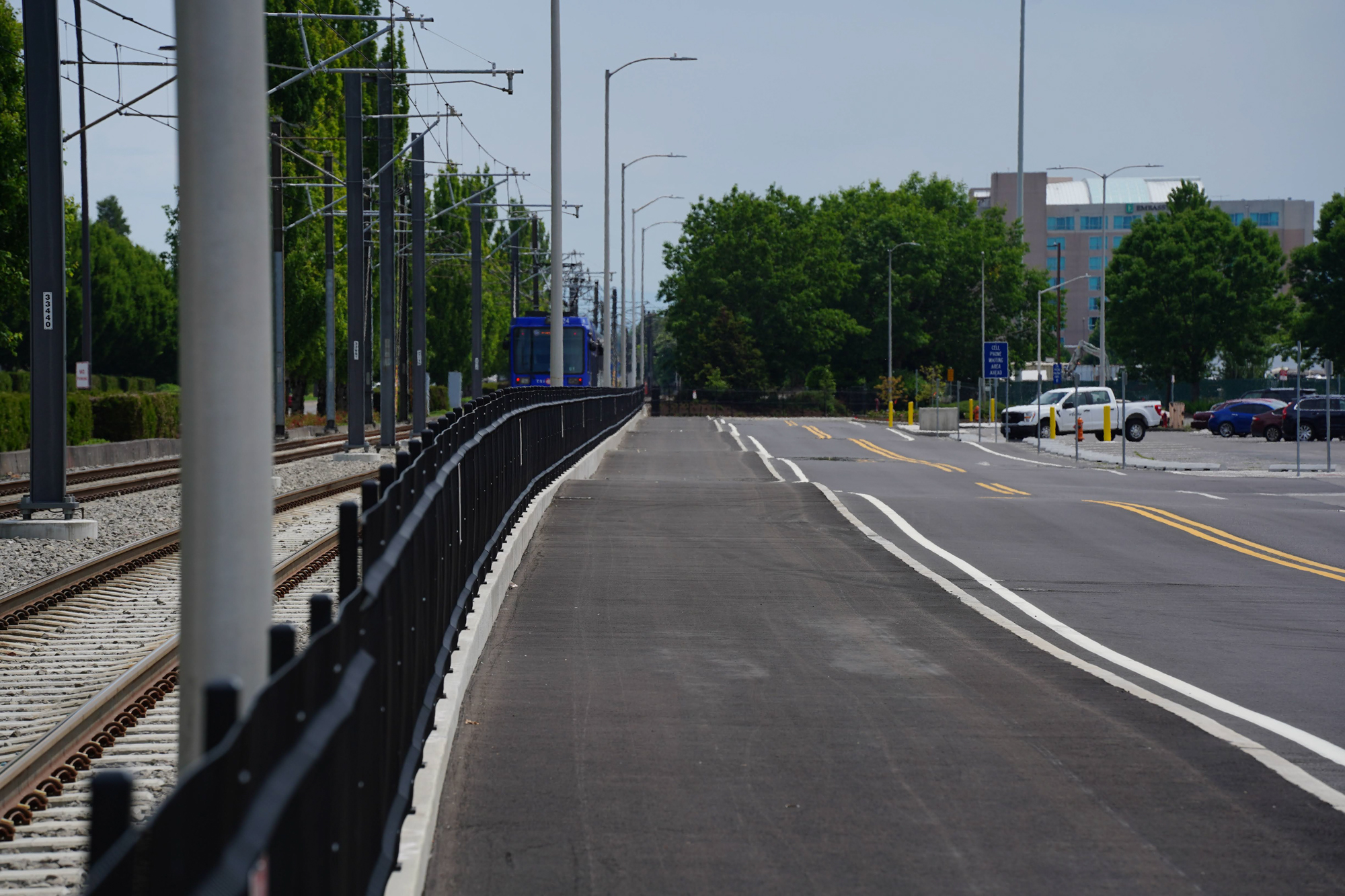
The old bike route to PDX required bicycle users to cross the wide and busy intersection of NE Airport Way and 82nd, then share lanes with car users on a frontage road before connecting to a half-mile path that ended on the north side of the terminal. The new route connects to an existing sidewalk/path near the airport’s designated cell phone waiting area and shopping center on NE Air Cargo Rd. The new path is bi-directional, wider, longer, and provides more protection from other road users. It also connects to a bike parking area near an entrance to the terminal.


Unfortunately the new path isn’t well-connected to existing infrastructure and we’re still a few major pieces away from having a bike route to the airport that’s safe, easy-to-use, and convenient for a broad slice of existing and potential riders.
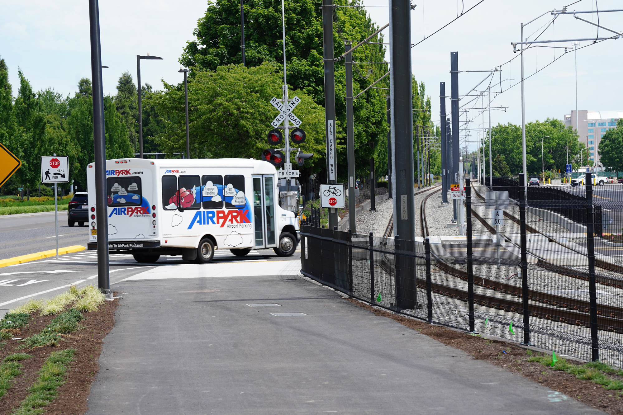
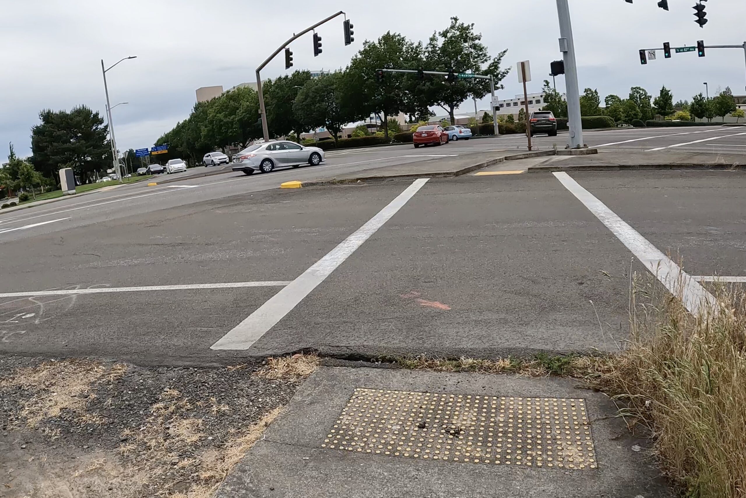
As I rode on NE Alderwood toward 82nd Ave, I wasn’t sure where the new path began. I relied on signage or other design cues that I hoped would make it obvious, but I was disappointed. After a few wrong turns near the intersection of 82nd and Air Cargo Rd, I got up onto the sidewalk to check a map and emails on my phone. Once I found it where the new path began, I crossed 82nd in a painted crosswalk, navigated a slip lane (there are two at this intersection), and made my way onto the sidewalk on the northeast corner of NE 82nd Ave and Air Cargo Rd. I headed northwest past wide, busy driveways of a gas station, mini-mart, and fast food outlets and eventually found the start of the path.
Directing bicycle riders onto a sidewalk (even if it’s wide) with busy driveways is no way to introduce them to a protected path. Hopefully TriMet/the Portland will add more signage (including pavement markings) to let riders know they are in the right place and let drivers know they are crossing an important regional bikeway.
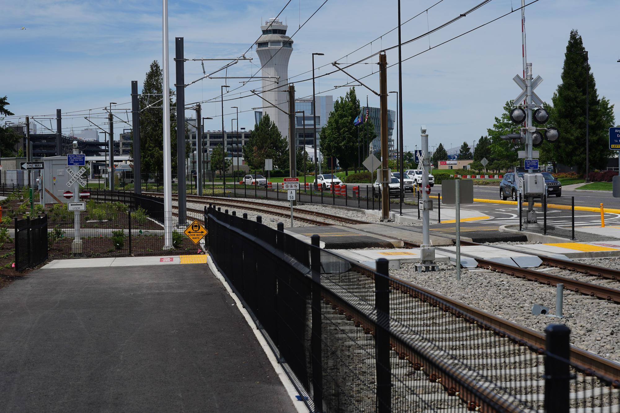
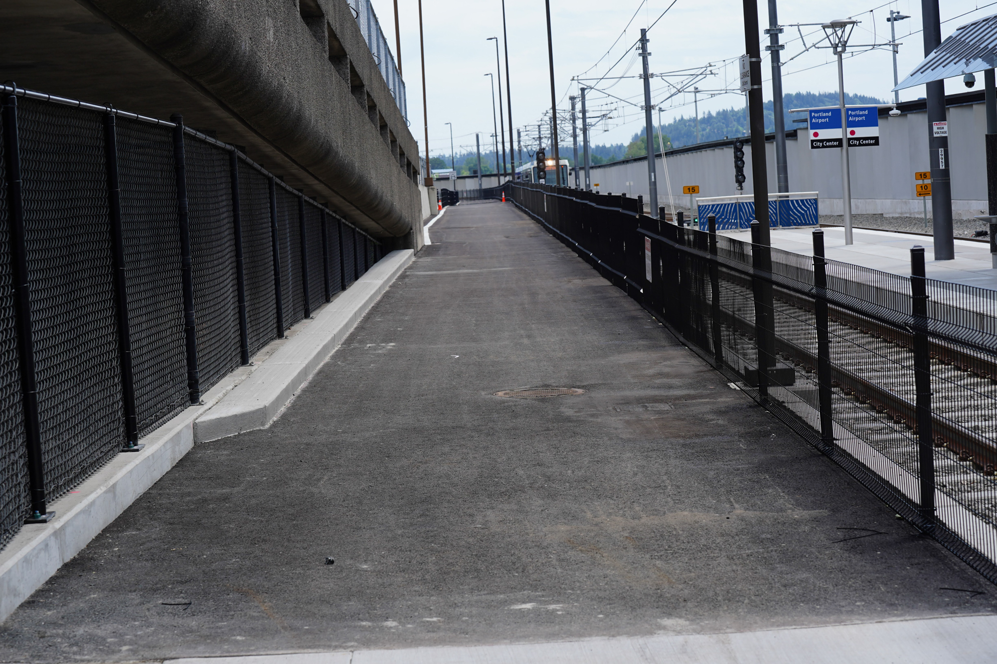
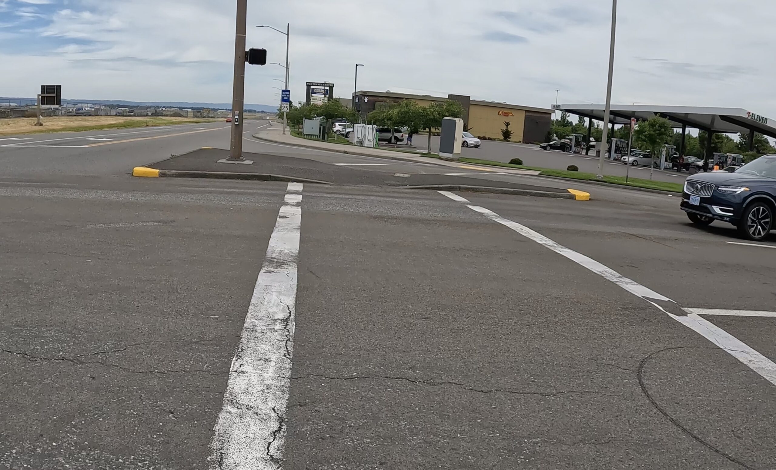
The path begins at NE Air Cargo Ct., a small but busy road that provides access to the PDX cell phone waiting area and rideshare driver parking lot. Again, more signage and perhaps an enhanced crossing is needed here to let drivers know this is more than just another crosswalk. Once I was finally on the new path, my blood pressure dropped and I could relax a bit. I looked up and saw a “PDX Terminal” bikeway network sign and knew I was in the right place.
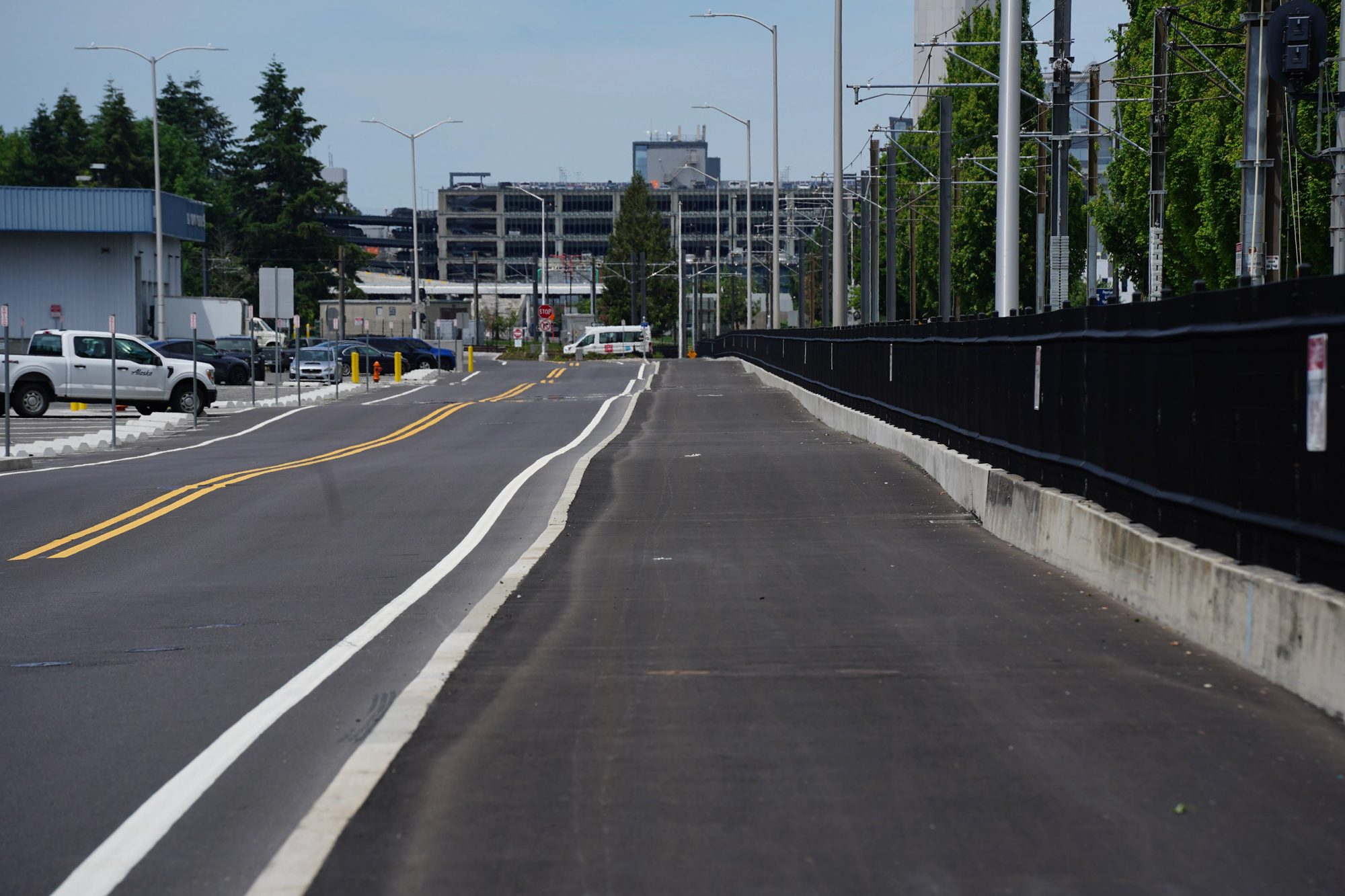
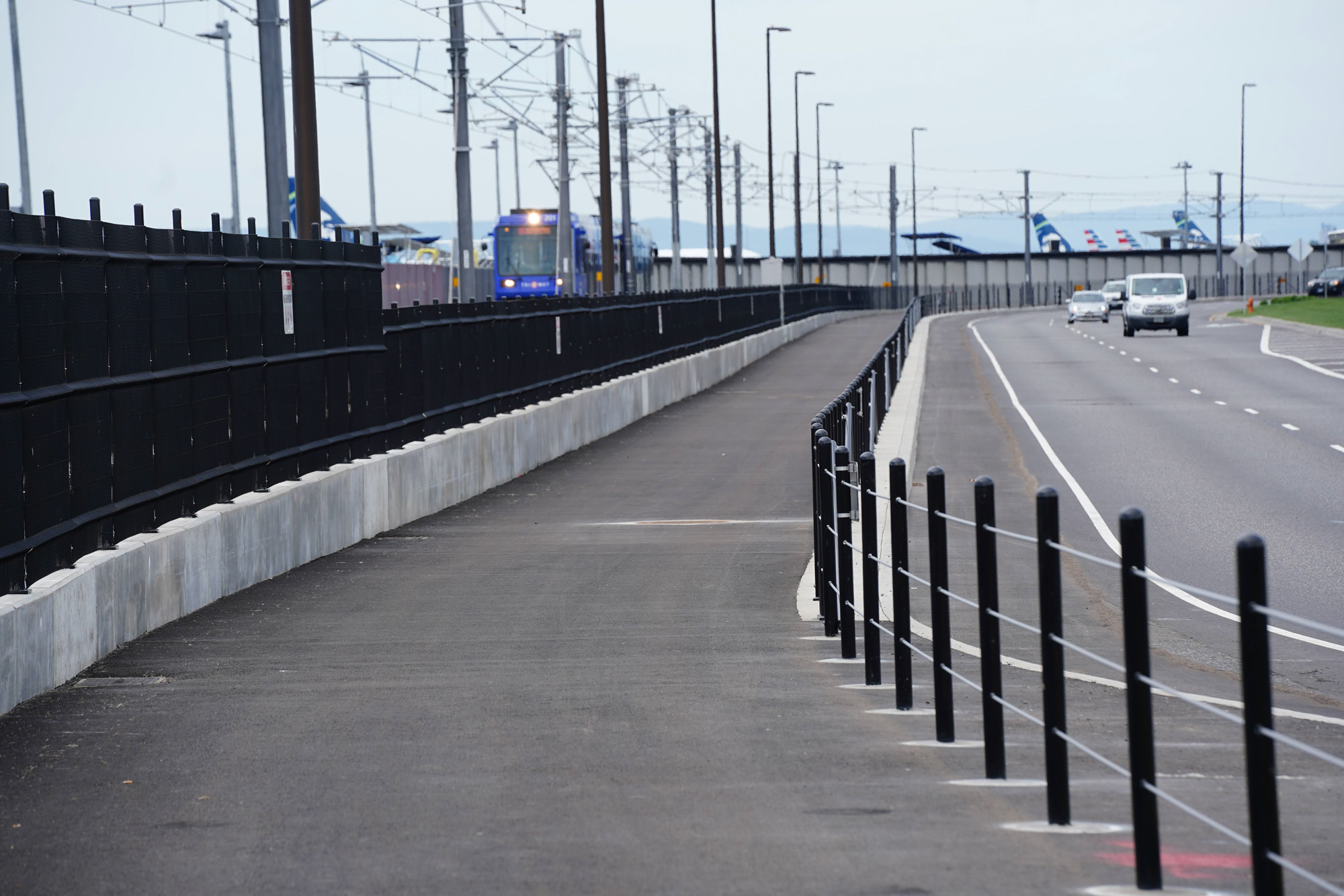
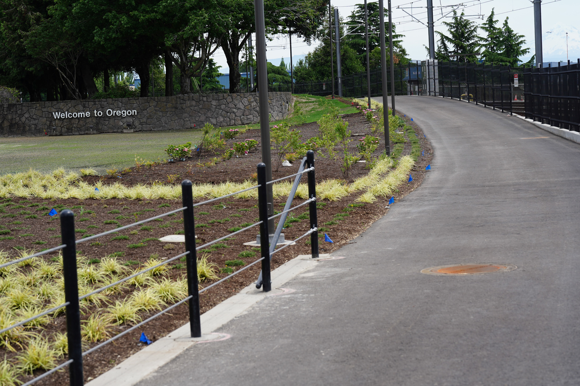
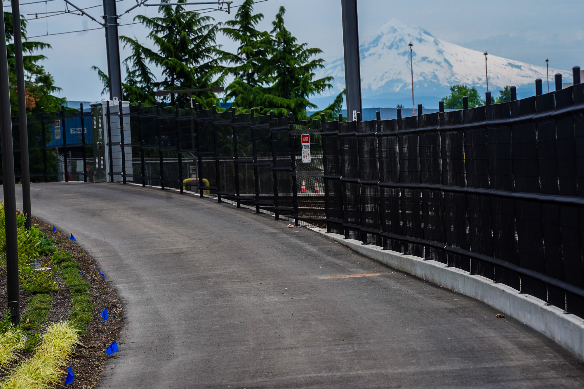
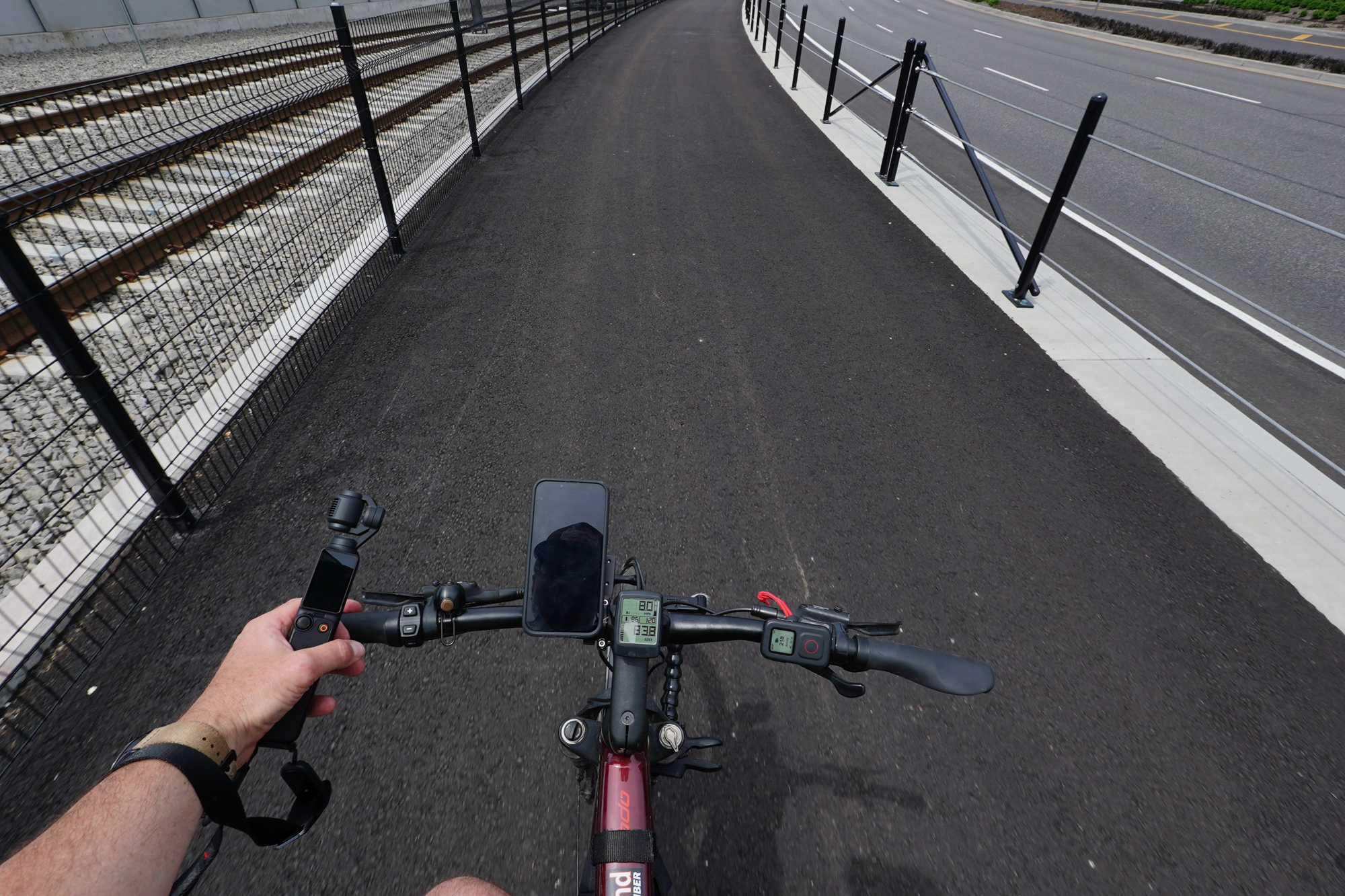
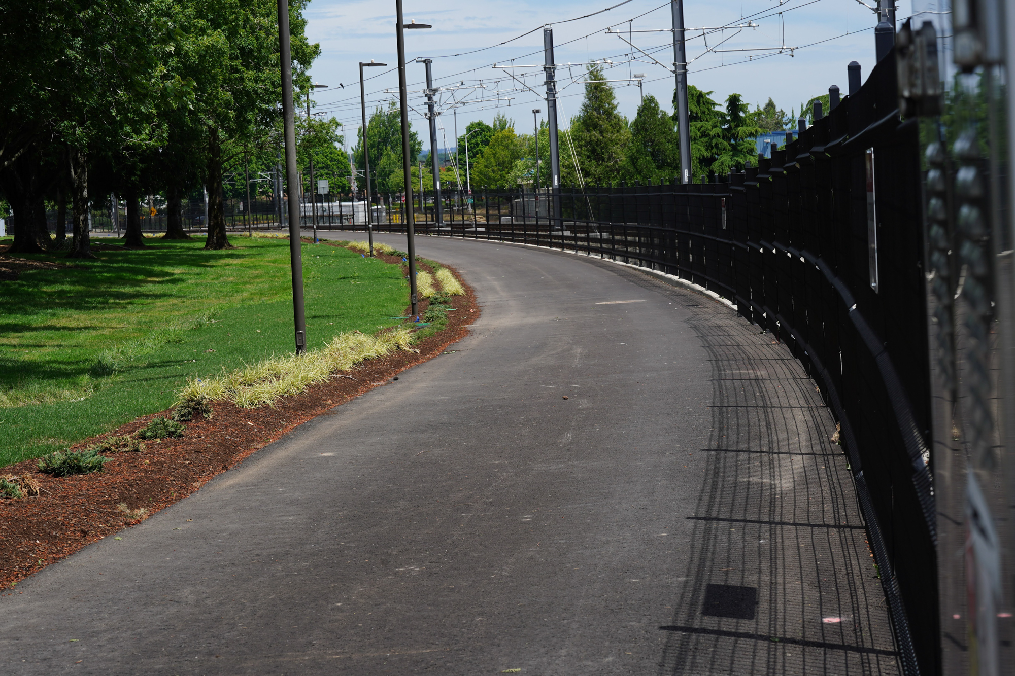
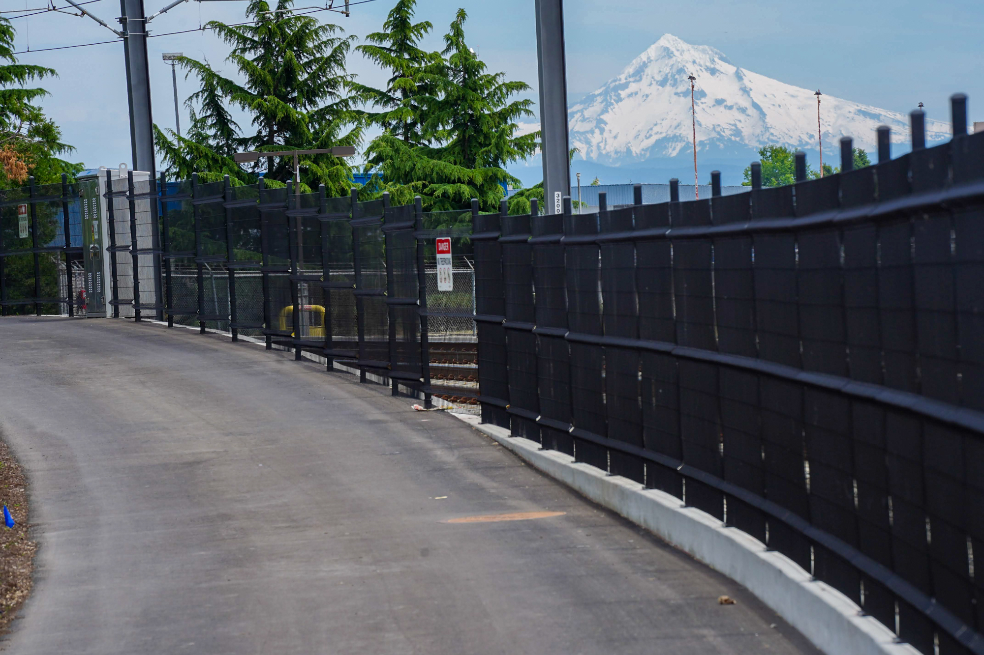
The new path is separated from other lanes via a standard curb. The width felt adequate at about 10-12 feet wide, although I was the only person out there so I couldn’t judge what it would be like with opposing bike traffic. A bit further north the path is directly adjacent to the MAX line and becomes an above-grade facility on its own raised track. About half-way on the path it crosses the MAX rails (“We really want to stress the importance of safety,” a TriMet official emailed me about the crossing). After the crossing is where the new path gets really nice. There’s a grove of trees (beyond the “Welcome to Oregon” sign and those wooden horses you’ve seen when you drive home from the airport) and grass. On one side you’ve got runways and airplanes next to light rail tracks, and on the other you’ve got the busy traffic lanes and the airport.
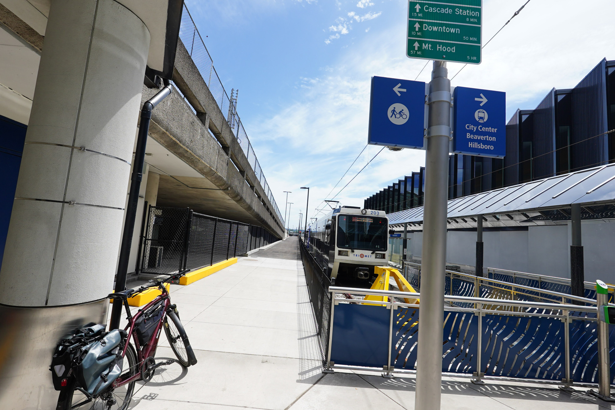
This final section of the path feels safe and separated and there’s a lot of interesting stuff to look at. The path is separated from multiple lanes of car users by heavy-duty steel posts and cables. Eventually the path ends into the airport MAX station. Just a few hundred yards away from the end of the path are a few bike corrals at a designated bike parking area. Keep in mind there are hundreds of employees at the Airport, so many of the users of this path will be shift workers. For travelers who need secure, long-term bike parking, the airport needs better options. There’s a gated bike parking area on the opposite side of the terminal, but I haven’t seen it for many years and I’m unsure of its status.
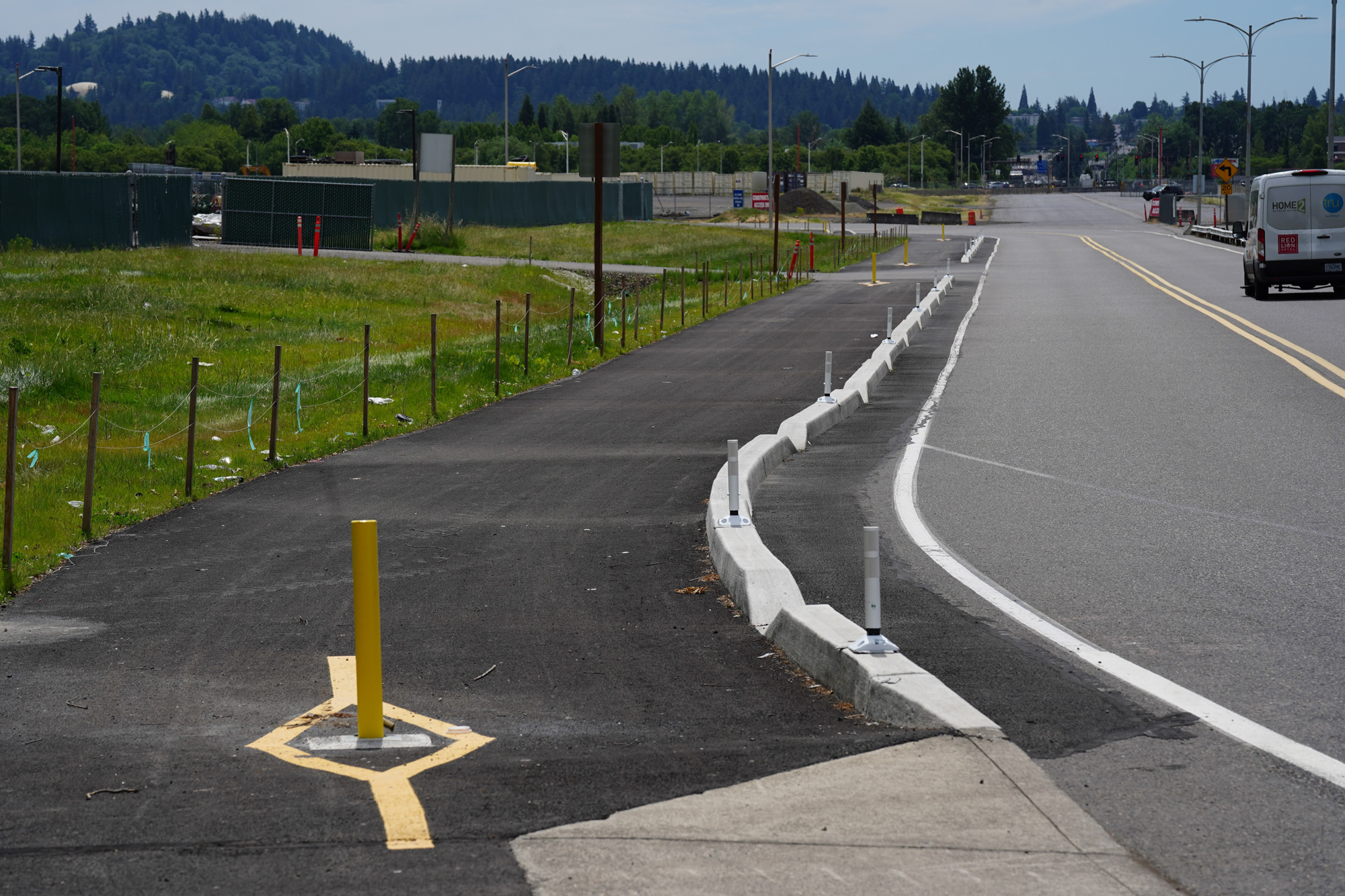
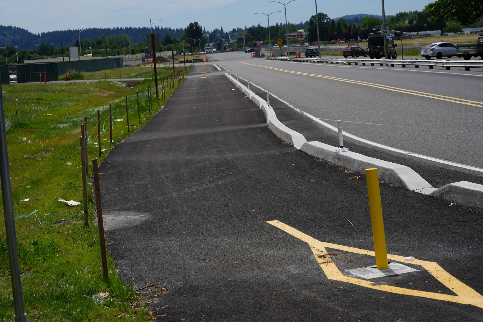
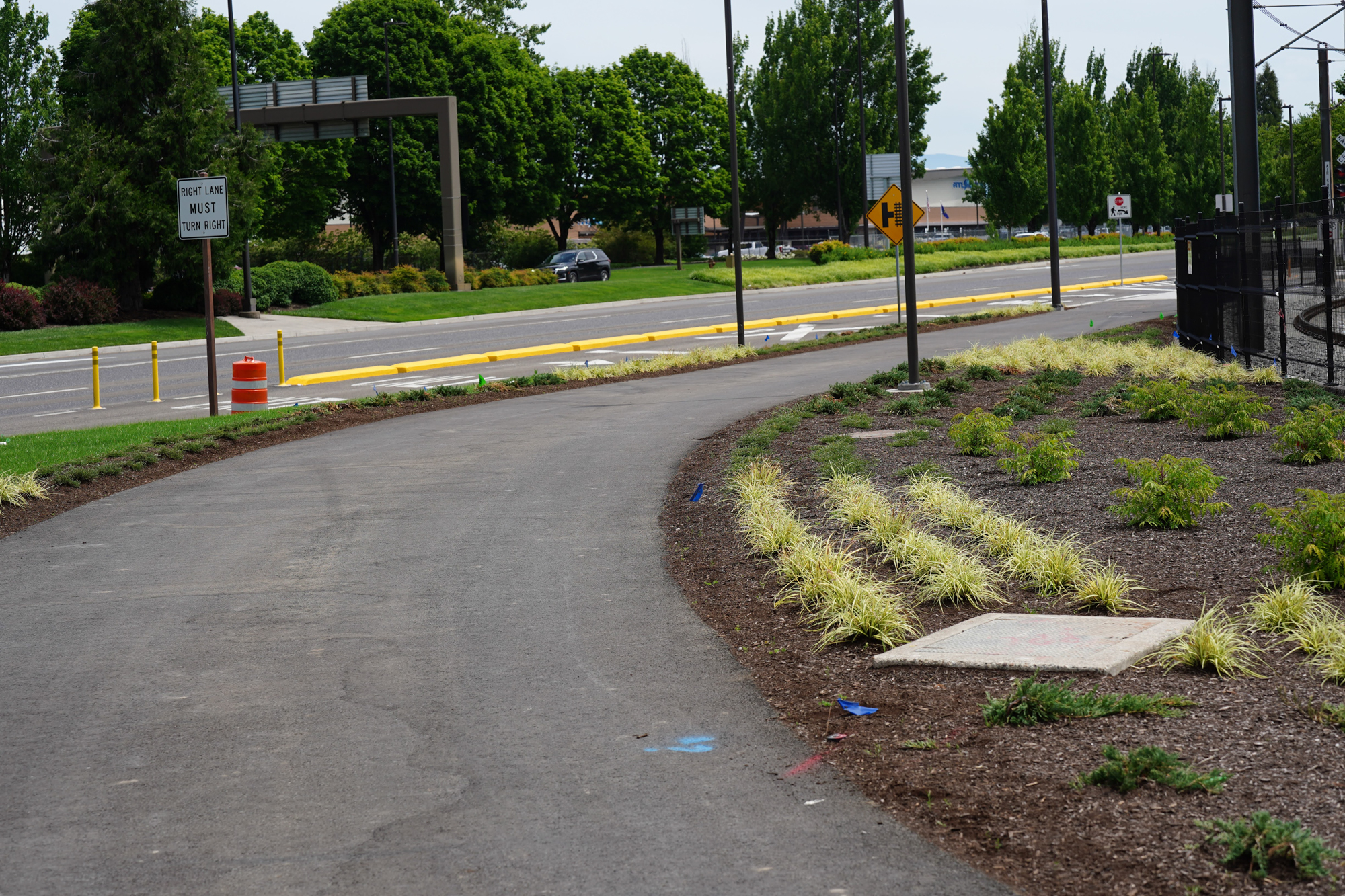
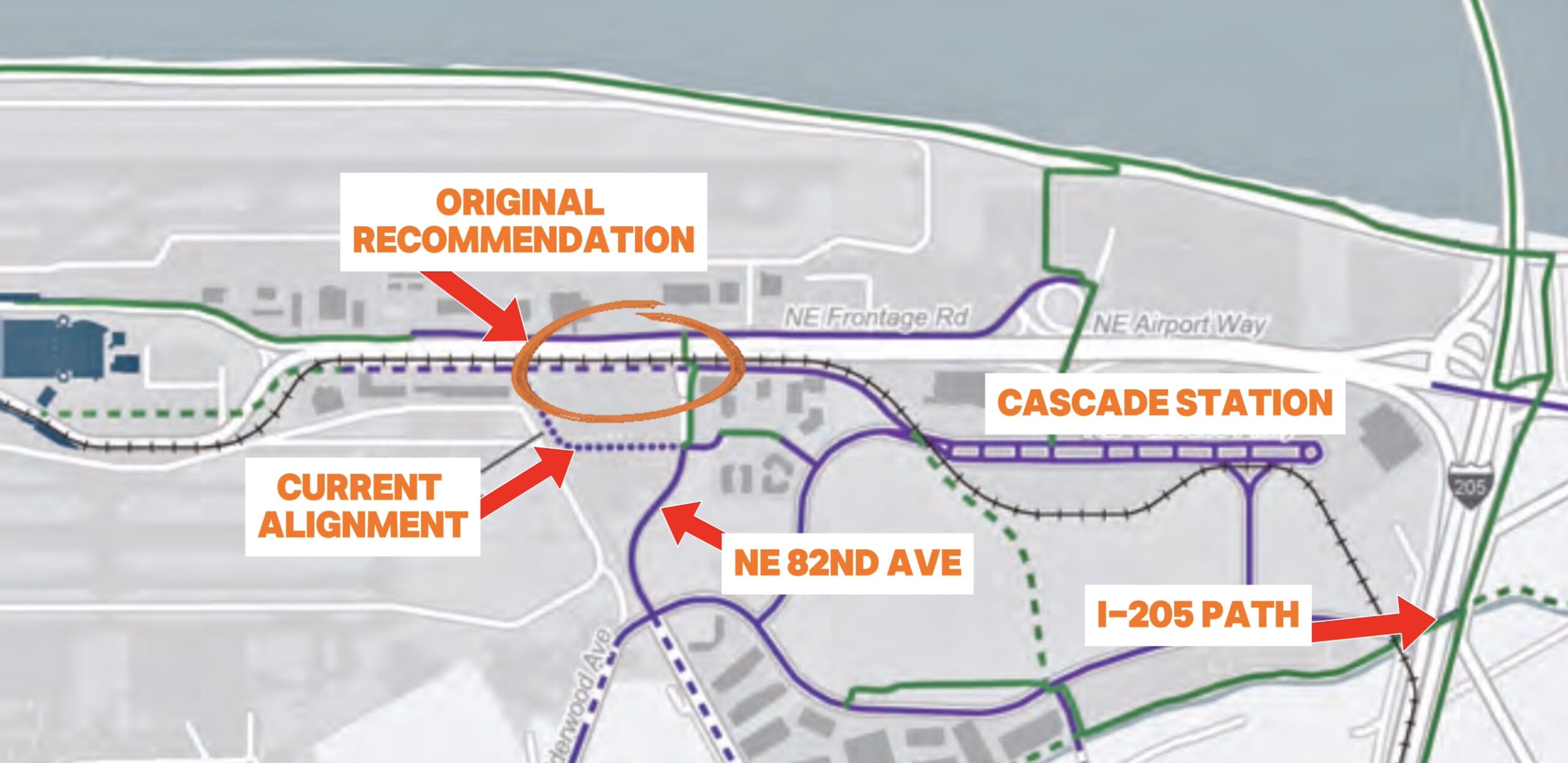
It’s also notable that the southern part of the new path veers away from the MAX tracks and Airport Way and instead goes along Air Cargo Rd and the new Travel Center development. That wasn’t the original plan. As you can see in the graphic above, the 2014 plan included a more direct route that would connect this new path to an existing path along Airport Way with a better connection to Cascade Station shopping center and other paths.
According to the Port, the 2014 recommendation is no longer in the plans. Port Media Relations Manager Allison Ferre told BikePortland they built the sidewalk on NE Air Cargo Rd with the intention that the new path would connect to it. As for why they chose to route the new path away from the MAX line along Airport Way, Ferre said, “The existing bike/pedestrian network converges at 82nd Ave and Air Cargo Rd, so the plan is to keep that as the focal point for practical and safety reasons (separate from vehicle traffic on Airport Way).”
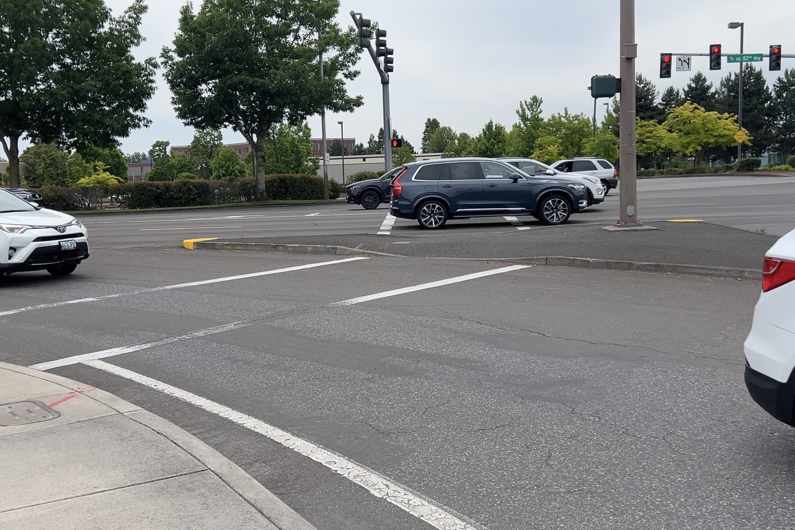
If that’s the case, we must improve the 82nd Ave/Air Cargo Rd intersection. Currently it’s a mess (see above) and shows zero regard for bicycle travel. There are two slip lanes which add to the stress. It’s not enough to make islands of good bikeways when 95% of riders can’t swim.
Overall, this is a nice addition to the airport biking network and TriMet, Metro, and the Port should be applauded for making it happen! I can’t wait for the new path coming to NE Cornfoot Rd in 2026 and other improvements planned in the coming years. There’s no reason we can’t have safe and convenient bike connections to the airport from existing neighborhood bikeways in the Parkrose, Cully, and Woodlawn neighborhoods.