By the time most people know what’s going on, the decisions have largely been made. At least that’s how things often go.
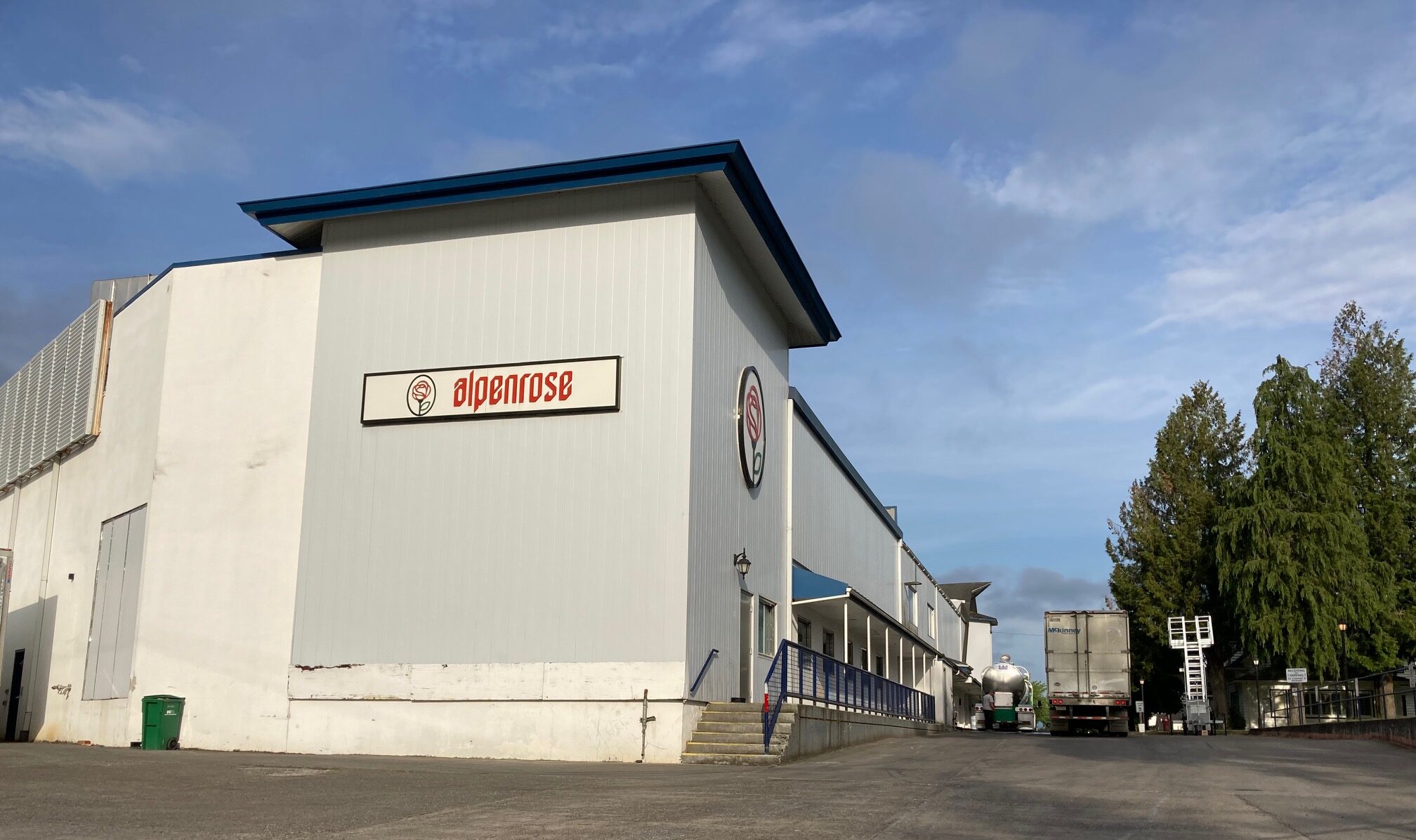
It applies to a lot of situations, but I happen to be thinking of development and land use, specifically the proposed housing project on the site of the 51-acre former Alpenrose Dairy, in the Hayhurst neighborhood of southwest Portland.
When BikePortland last wrote about Alpenrose a few months ago, preliminary plans for the site had just been made public, and word was out that the developer was about to initiate the Public Works Alternative Review (PWAR) process. What’s the PWAR? It might seem a bit in-the-weeds, but it’s also a key step in whether or not this development will have good bicycling and walking facilities. And just this week, the City of Portland made a decision that bodes well for those facilities.

Public Works Alternative Review decision
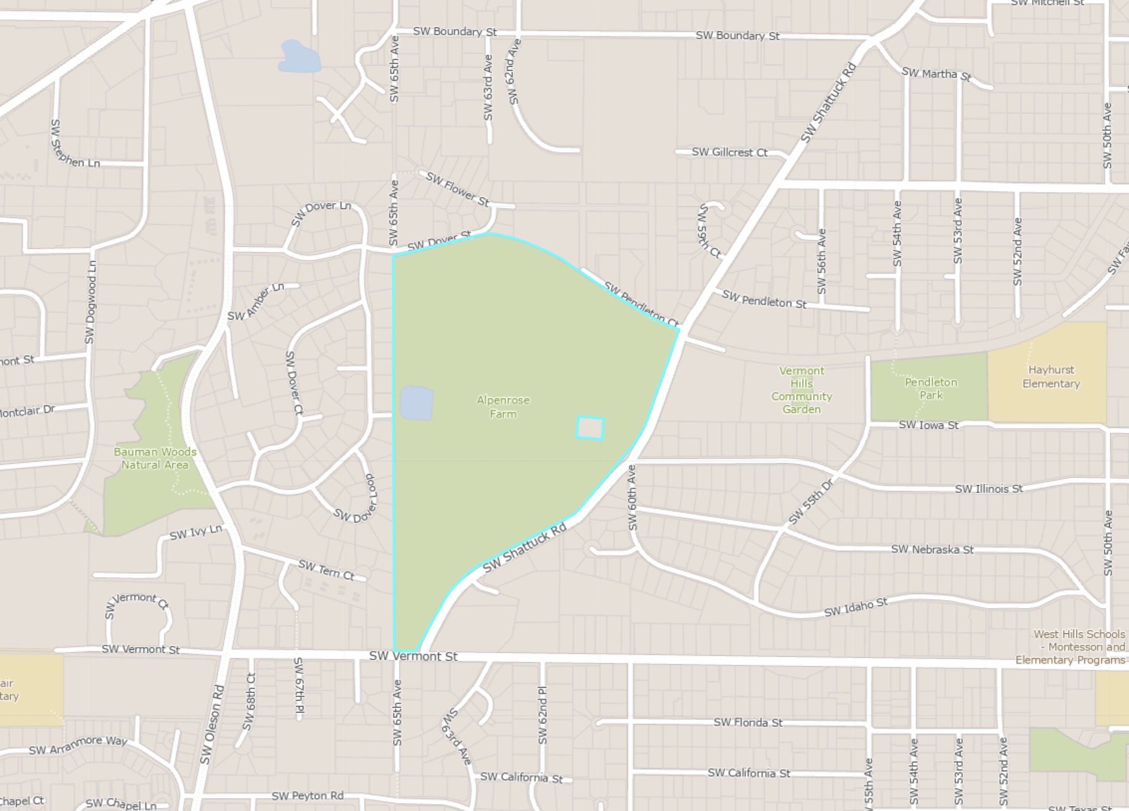
The news is that the City of Portland Public Works permitting group has released a decision in response to the developer’s request to submit frontage plans (sidewalks, bike lanes and trails) that differ from the “full standard frontage improvements” usually required by the city.
Lost yet? Briefly, new development is required by city ordinance to build improvements along all the places where the property abuts the right-of-way — the frontages. In some locations, however, the right-of-way is not wide enough, or there are topological constraints, making it difficult or overly expensive to fulfill the city’s frontage requirements. In these cases, the developer can request to build an alternative to the standard, and this request initiates the Public Works Alternative Review process.
That may seem like more than you want to know, but those frontage decisions are what determine whether you will have a safe place to walk or ride a bicycle.
What happened this week is that the city has written a positive decision in response to the developer’s proposed frontage requests, including the multi-use path on the west side of Shattuck Rd. And although I’ve been focused on plans for Shattuck, the decision also mentioned the Red Electric Trail to the north, and changes on Vermont St. That’s a big deal, often sidewalks and bike lanes die in alternative review. But, so far, it looks like the area immediately surrounding the property will be well-served by new facilities.
Here’s what the PWAR decision form says about the Red Electric Trail:
“Given the slopes, the presence of mature protected natural resources, and the proposal to build the Red Electric Trail as a through pedestrian and bicycle connection, the committee supports the applicant’s proposal. Building the paved public trail through the site instead of building disconnected improvements at the existing right of way grade will greatly reduce impacts to natural resources while providing a substantial public benefit for the city’s priority modes of walking and cycling.”

The decision has come with conditions. It is an approval of concepts, not of specific engineering, and further details will need to be worked out. But at this stage of the process, this is a good outcome for the bike lanes, sidewalks and paths which will border the property. That doesn’t mean everybody, or even most people, are going to be happy. Neighbors are very concerned about car traffic impacts, not only in the immediate vicinity, but further north at the intersections of SW Shattuck and Oleson with Beaverton-Hillsdale Highway (BHH). And even though the frontages of the site will have new facilities, those sidewalks and bike lanes will not continue past the boundary of the property. That means that the nice new multi-use path on Shattuck will end long before the road reaches BHH to the north.
We will cover more about neighborhood reactions (which are predominantly about traffic, but also concern the design of the subdivision) after a “Community Conversation” meeting later this month.
If you want to dive deeper into this important project, two community groups have been doing an outstanding job of tracking the planning process and keeping the public informed, the Hayhurst Neighborhood Association and the Friends of Alpenrose (FoA). To the extent that they are well-informed, neighbors can thank these volunteers. Friends of Alpenrose will be hosting a “Community Conversation about Transportation in Southwest Portland,” on June 24. Metro Councilor Duncan Hwang and State Representative Dacia Grayber will lead the conversation, with other regional and city officials present, and they will “talk about how the transportation planning process works.”
Being informed about what’s happening is much, much better than wandering down the road and wondering what the bulldozers are all about. For current information on how things are moving along, the Friends of Alpenrose provides timely updates. The City of Portland also regularly uploads permitting and other information which you can access through Portland Maps.
We’re keeping a close eye on this project as it moves along the process. Stay tuned.
— View a PDF of the PWAR decision below.