
(Photo: Emily Guise)
(Text by Emily Guise and Catie Gould, photos by Ted Timmons)
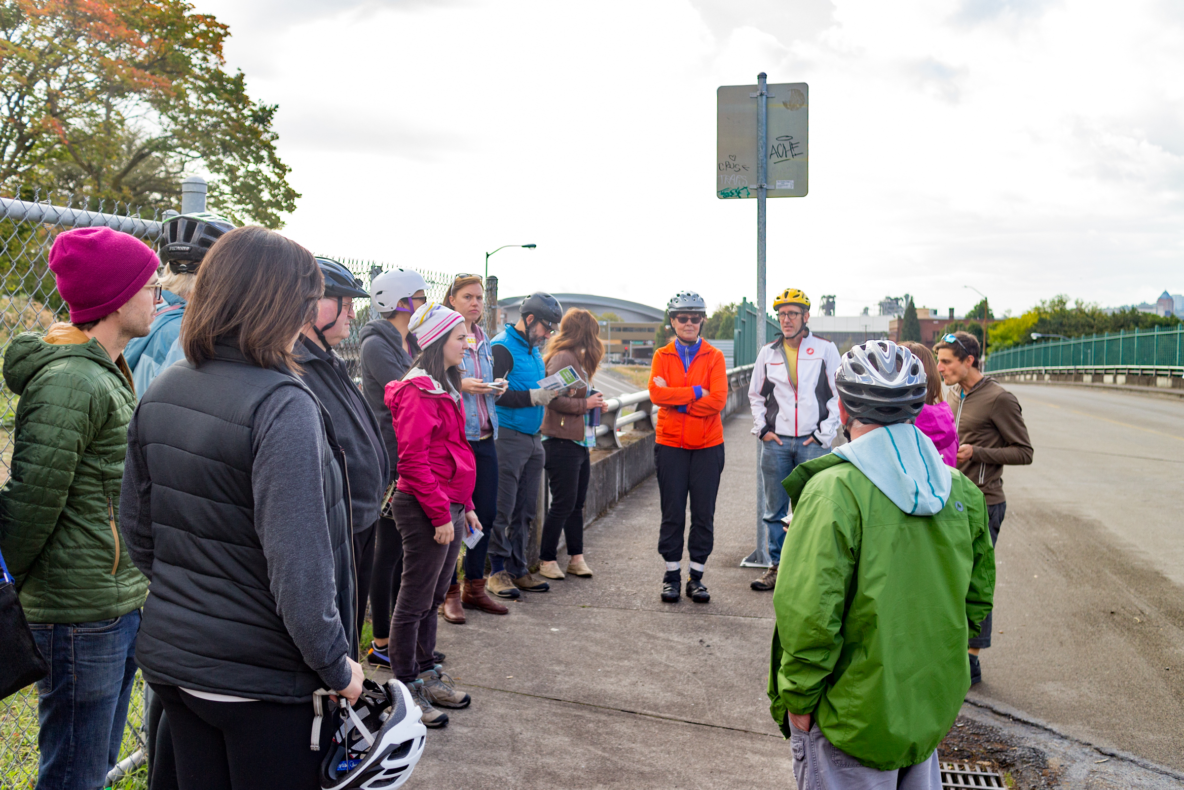
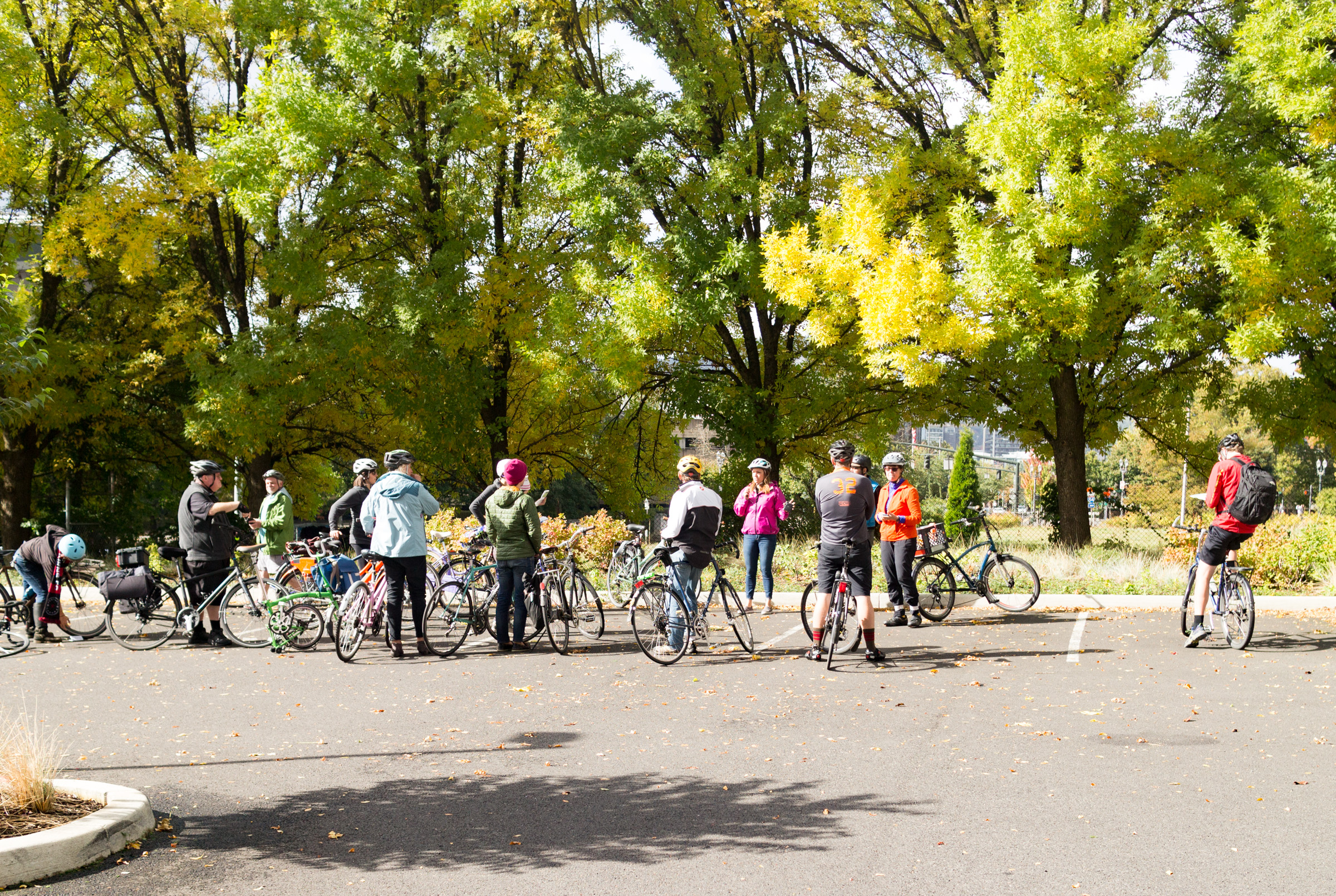
On a bright and showery Saturday morning this past weekend, ODOT hosted biking and walking tours of the changes planned to go with the I-5 Rose Quarter Project. ODOT officials including Region 1 Planner Megan Channell and Transit and Active Transportation Liaison Jessica Horning teamed up with Doug Zenn, a consultant for HDR, Inc. (a construction firm) to lead a bike tour of the area, while other ODOT staffers led a walking tour.
This was a great opportunity for a hands-on look at the proposed surface street changes we shared in detail on Friday. Here’s what we saw and learned…
Flint Avenue Bridge
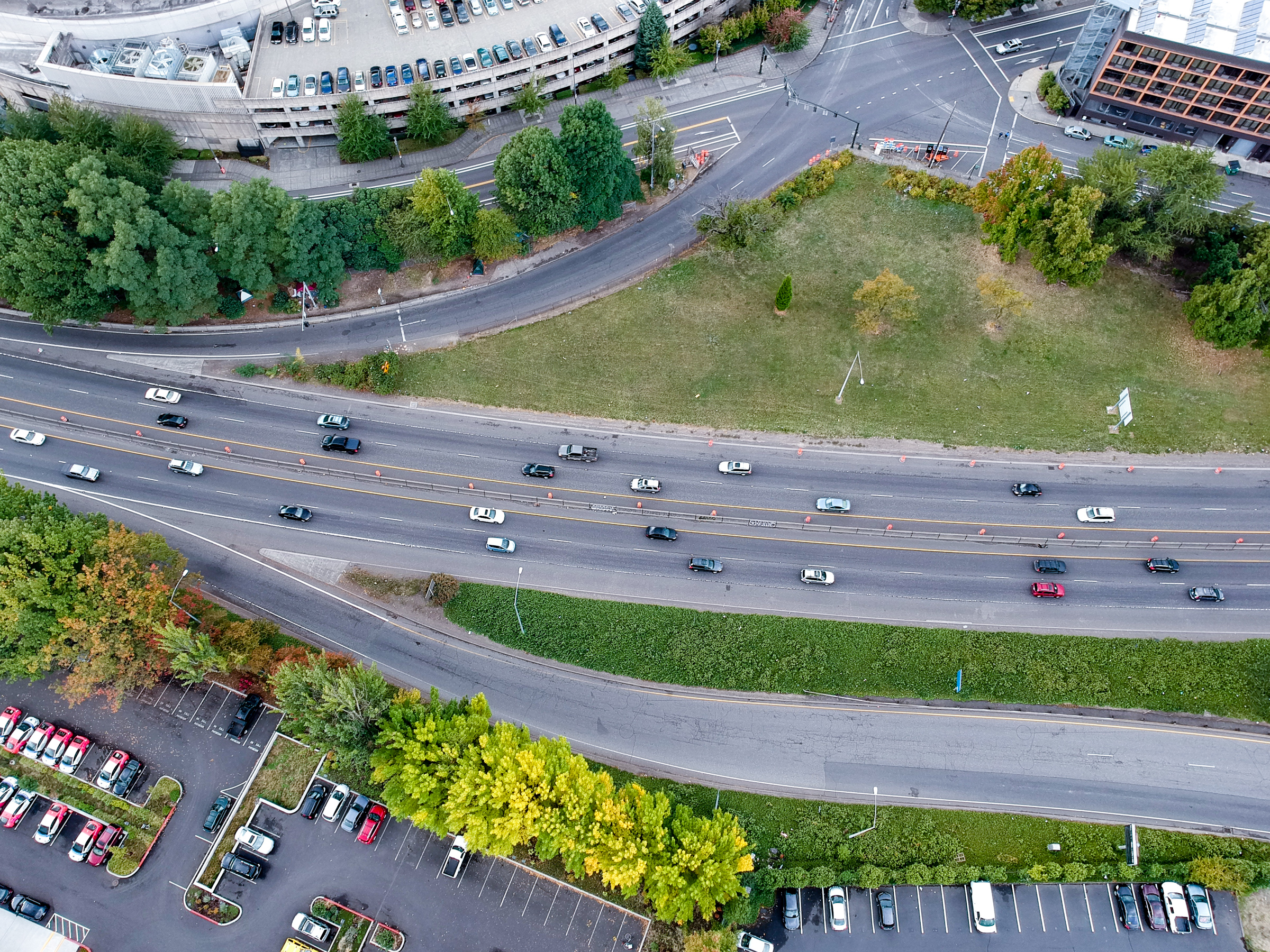
(Photo: Ted Timmons)
Channell admitted that ODOT hasn’t evaluated the approaches to see if it could meet [ADA] requirements.
About 15 people pedaled out of the Stingray Cafe parking lot and headed north on Flint Ave to the first stop of the ride. To accommodate the highway widening, this bridge is scheduled to be removed, and new bridge to replace it will be built running east-west to connect N Dixon and N Hancock St. Flint Ave will end at Tillamook St and southbound riders will have to use N. Vancouver Ave.
A participant asked if the project is about increasing connectivity, why trade one street for another? ODOT’s rationale for the new Hancock-Dixon Bridge is that the area is lacking in east-west connections compared to north-south. Taking out Flint Ave was part of the 2012 plans and has not been changed since. The Hancock-Dixon Bridge is far enough south of Flint that the both could feasibly exist and would provide more options for moving around the area.
The Hancock-Dixon Bridge wouldn’t be a direct connection to the Broadway Bridge, as it would direct a person on a bike onto Dixon, which parallels Broadway, and then another turn would be needed to get back onto Broadway.
There’s significant elevation difference on the two sides of the highway that the bridge would have to span. Upon being asked by Chris Smith, Portland Planning Commissioner, if the grade would meet ADA requirements of a 5% grade, Channell admitted that ODOT hasn’t evaluated the approaches to see if it could meet these requirements.
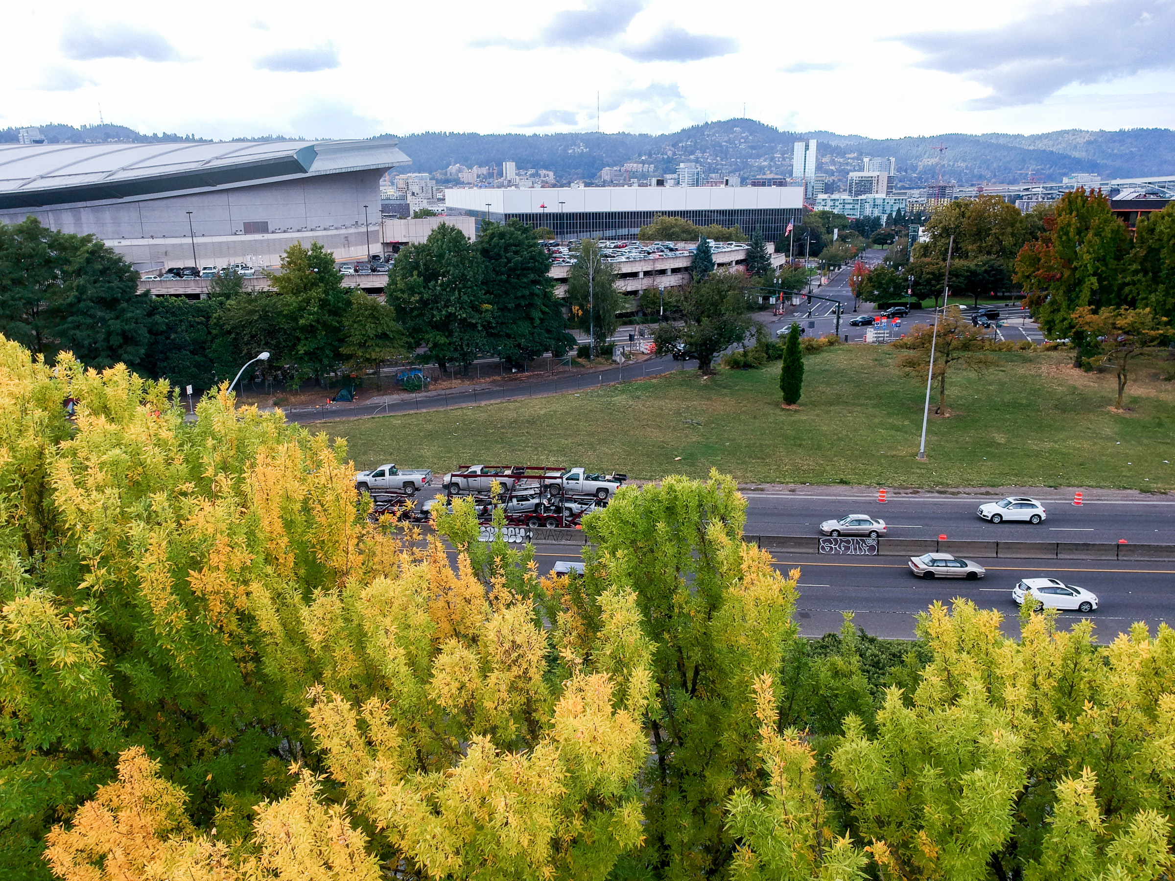
Highway Covers
The cost of the covers are included into the walking and biking improvements.
Many people asked about the highway caps, which ODOT labelled as highway covers. The current design shows two irregularly shaped covers instead of a continuous one spanning multiple blocks. ODOT explained that freeway covers over 800 feet long are considered tunnels and triggers additional regulations including: new restrictions on the movement of hazardous materials, additional ventilation, and height requirements.
Currently the covers planned won’t be able to support the weight of buildings and are designated as public park or plaza space. To support the additional weight of new buildings, Channell said covers would need deeper foundations and a taller structure, creating more community impacts. ODOT did not provide numbers about how much taller the covers would need to be or their cost.
The cost of the covers are included into the walking and biking improvements, which are considered local. ODOT will be paying for the columns and highway widening. Channell claimed that the $450 million will be split 50/50 between bike and walk improvements and the highway, but at this point there is still no official breakdown of costs.
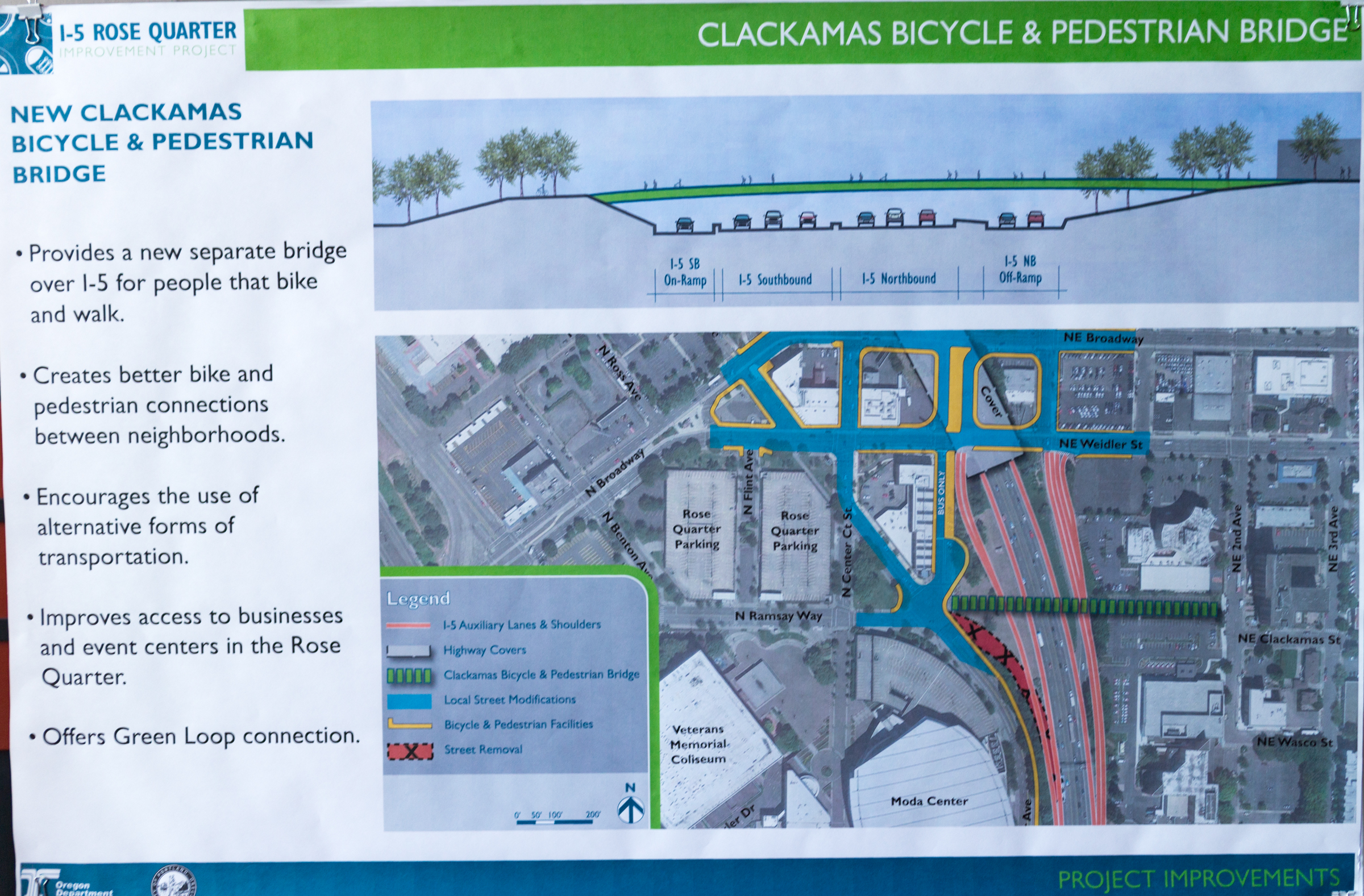
Wheeler Ave and Clackamas Bridge

Next, we rolled over to the intersection of NE Wheeler Ave, N Winning Way, and N Williams Ave, right by the I-5 on-ramp, where the western landing for the proposed Clackamas biking and walking bridge would be. The new connection into the Lloyd would be more modern and wider than older carfree bridges like the ones currently at Failing or Bryant streets, although there is no bridge design to show yet. There is no determination at this time if emergency vehicles could use this route, according to ODOT.
The current I-5 South on-ramp would be relocated northward to NE Weidler St. ODOT engineers say that removing the on-ramp will shorten the number of blocks people will have to drive to get to the ramp, and should reduce the number of turns people are making in the area, thereby reducing congestion.
No cover is planned in this area since I-5 is so close to grade level. To implement a cover, the road would have to be sunk to make enough clearance. The number of lanes to cross would increase to 8 (freeway and ramp) from 5 in the current configuration.
Advertisement

N. Williams Ave
Since this was planned in 2012 before the Williams bike lane shifted over to the left, it may need to be re-designed.
Continuing north on N. Williams, other significant changes are planned here. The block of Williams between Wheeler and N. Weidler is planned to be a bike, walk, and transit space only, with a short stretch open so that residents of the Madrona Studios will be able to access the parking garage there. There is a planned raised 2-way cycletrack on Williams on the block between Weidler and Broadway, but since this was planned in 2012 before the Williams bike lane shifted over to the left, it may need to be re-designed.
In that same block on Williams between Broadway and Weidler, a new lane southbound for cars queuing up for the southbound on ramp is planned. This lane is shorter than the previous 3 block loop but as Channell pointed out, the ramp is longer than before.
The land in the block immediately adjacent, bounded by Williams, Weidler, Broadway and NE Victoria Ave, is planned to be completely covered by a highway cover. ODOT proposes to turn it into a park or public plaza. Currently a Sherwin-Williams store sits on the site, which ODOT is negotiating to buy. Streets surrounding this block are on and off ramps for the freeway, so a a challenge is that people walking would have to cross significant vehicle traffic to access the public space.
Improved bike facilities for Broadway and Wielder were discussed but it was noted that the latest Broadway Plan was written in 1997 and hasn’t been updated since. Ride participants noted that improvements to bike infrastructure on Broadway and Weidler would be necessary to reduce conflicts with highway bound vehicles.
Rodney Ave
On Rodney, it was just a short stop. Since it parallels N. Williams and N. Vancouver, NE Rodney Ave will see an improved connection from the Hancock Dixon Bridge.
NE Clackamas from the Lloyd side
The eastern landing for the Clackamas bike and ped bridge will be in the last lane of the Crowne Plaza hotel parking lot and will then connect with NE 2nd Avenue. This uses a right-of-way that the city already has, though it will take parking away from Legacy Health.
Takeaways
ODOT repeated throughout the tour that the bike and ped plans are only 5-10% complete and they are looking for feedback. They are currently working off of the plan that came out of the 2012 design process.
The project will be undergoing an Environmental Assessment which will take 1.5 years to complete (next summer). Upon completion there will be more public comment periods and possible further environmental studies depending on the findings.
— Emily Guise and Catie Gould (text), Ted Timmons (photos)
Never miss a story. Sign-up for the daily BP Headlines email.
BikePortland needs your support.