
(Photos: J. Maus/BikePortland)
Four years after planning work got underway and seven years after it was funded, the City of Portland will officially open the 20s Bikeway today.
“The 20s Bikeway provides a seamless, low-stress cycling path… that serves a broad range of cyclists.”
— PBOT
At an event slated for 11:00 am, City Commissioner Dan Saltzman and Bureau of Transportation Director Leah Treat will join neighborhood advocates to mark the (near) completion of the project, which they refer to as a, “world class route for biking and walking.”
The 20s Bikeway is a new connection in our network that spans over nine miles north-to-south between the Springwater Corridor at its southern end and NE Lombard in the north (view map PDF here). With a budget of around $4.5 million (funded by a Metro/ODOT grant and transportation system development charges), the bikeway is a mix of striped bike lanes (some protected, some not), neighborhood greenway treatments, and updated crossings of major streets.
Here’s more about the new route from PBOT:
The importance of this route starts with its north-south orientation. Most of the bicycle network is currently oriented in an east-west direction, where it can use a dense and continuous network of local streets. Portland’s north-south street network is more difficult to traverse on bike: the streets are often interrupted by dead ends and dogleg routes, there are major barriers with few places to cross, such Interstate 84, and because there are more busy arterial streets to cross. The 20s Bikeway provides a seamless, low-stress cycling path through these obstacles that serves a broad range of cyclists.
The new route connects to a large number of neighborhoods and destinations. More than 35,000 residents, including 5,500 school-aged children, live within a quarter mile of the route. It travels through 13 neighborhoods and six commercial districts, and provides access to 14 parks and 12 schools. Along the way, it intersects with 14 existing east-west bikeways and six more that are planned.
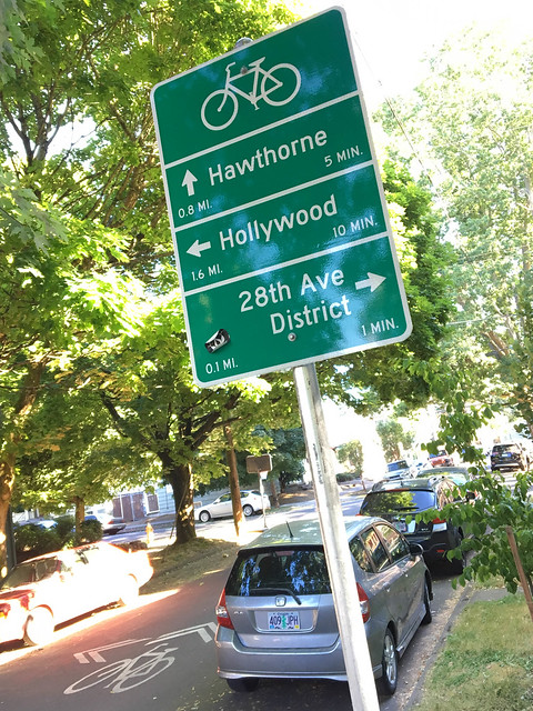
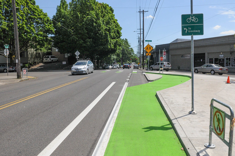
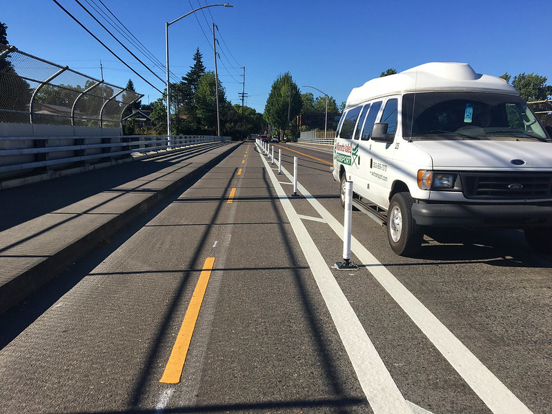
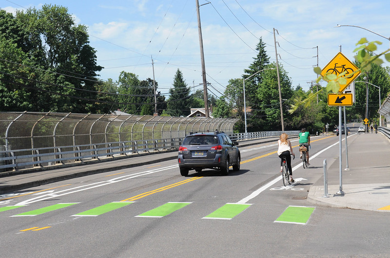
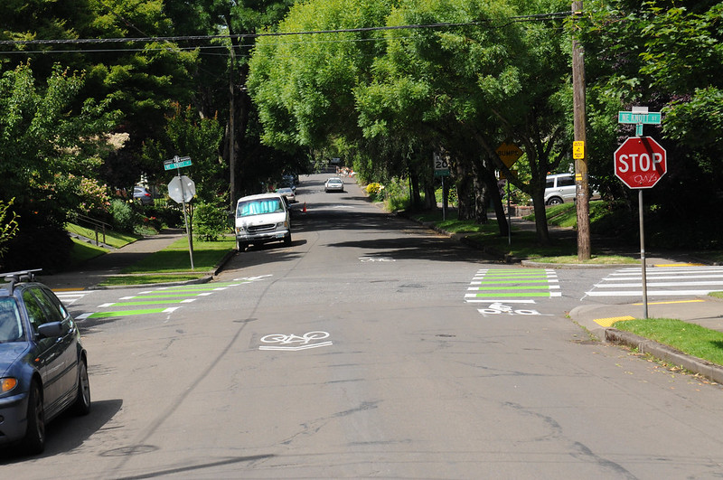
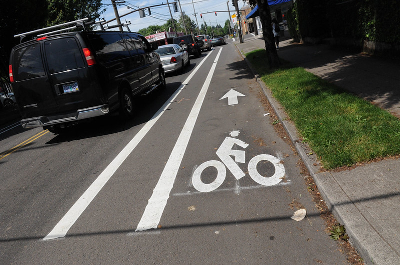
To make the route an enjoyable bicycling experience for people of all ages and abilities, the project used a broad range of roadway improvements to ensure safety and convenience for the public. It improved 17 crossings of busy arterial streets, with benefits for people walking and biking. More than two-thirds of the route uses low-traffic volume and low-traffic speed residential streets that have been calmed to the latest Portland standards for neighborhood greenways. The other third of the route uses neighborhood collector streets that have been upgraded with bike lanes, most with buffered bike lanes and several segments with protected bike lanes.
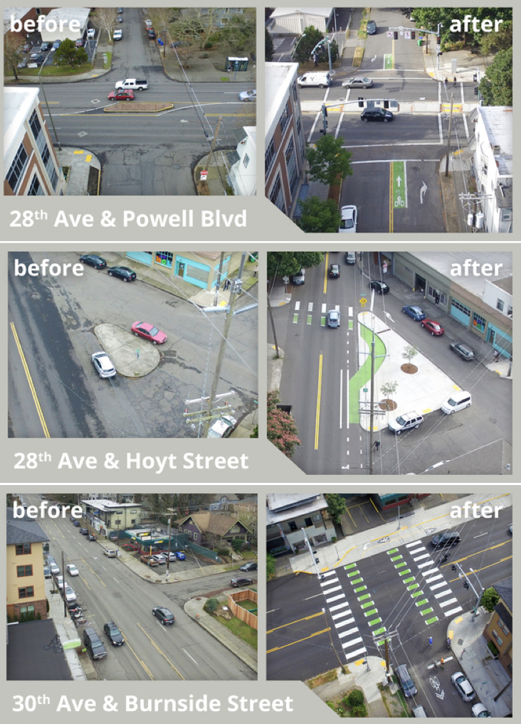
The City has also released these before-and-after images of key crossings:
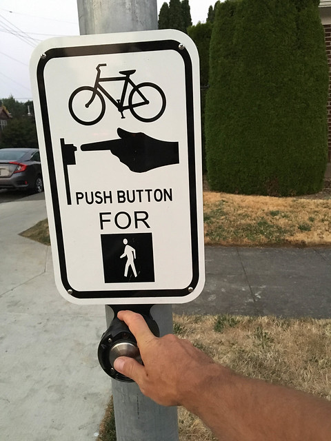
I’ve ridden the new route several times in the past month or so. Given the dearth of north-south bike connections, it’s really nice to have a route I can rely on. The presence of sharrows and signage alone means I can just follow the breadcrumbs without having to think much. And the updated crossings are crucial. With a mix of bike-only signals, beg buttons, cross-bikes, median islands, and flashing beacons — the risk and stress has gone way down.
Overall, the design isn’t what I’d refer to as “world-class”. The route zig-zags far too often. This was done to get to safer/easier crossings of major streets. One consequence is that if you’re not paying attention to the signage and sharrows you’ll end up at the crossing of a busy street off the route — and without any safety improvements. The biggest annoyance is how the route avoids the 28th Avenue commercial district. As many of you recall, this was a huge debate between activists who wanted the route to be on 28th and PBOT who was unwilling to stand up to some of the business owners who value on-street auto parking more than safe access for bicycle riders.
Here’s what it looks like headed southbound just before the commercial district begins:

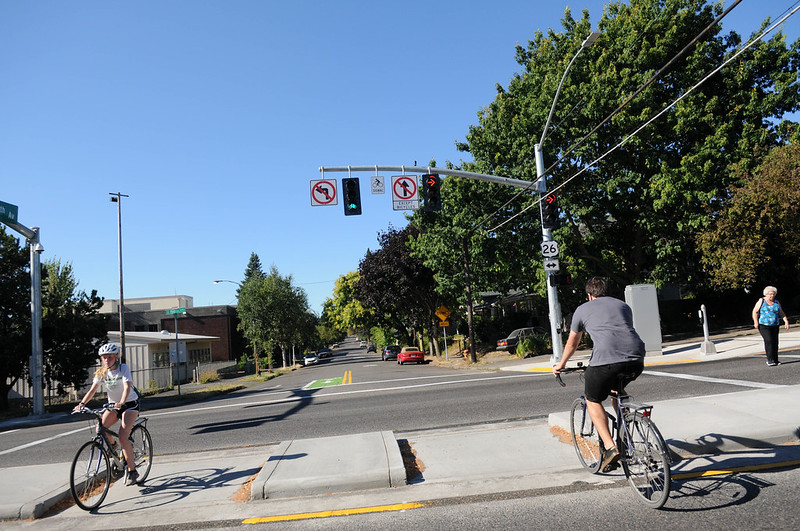
One of the bright spots is the new crossing of SE Powell at 28th. Very few people typically use 28th in this location, instead opting for the narrow — and infamously dangerous — bike lane on 26th. This new crossing was part of a grand bargain between ODOT and PBOT. As we reported, ODOT said they’d only approve PBOT’s permit for a new signalized crossing at 28th if the City promised to remove the existing bike lane on 26th. PBOT sources have told us that was a bad deal and they are reluctant to remove the bike lane on 26th. The current compromise is that PBOT will monitor traffic on both streets through the end of this year and share the findings with ODOT. “Remedies could include the removal of the bike lane on 26th,” PBOT shared with BikePortland on July 7th, “if it is determined that bike lane usage on 26th has significantly decreased.”
Here’s a video of the crossing headed southbound:
Advertisement

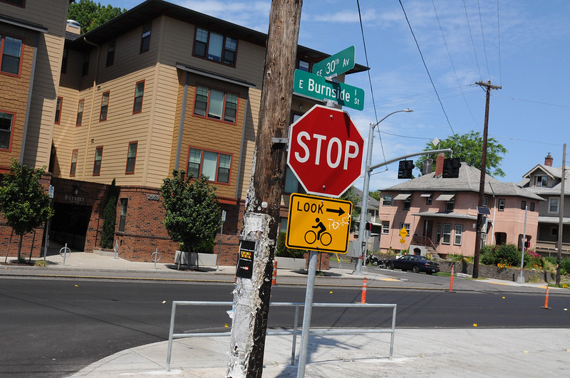
Today’s press conference takes place at the intersection of Burnside and 30th. This is another location where PBOT has designed a new crossing to help people manage the off-set intersection. The updates consist of a bike-only signal, green cross-bike striping, and a 2-way cycletrack on the south side of Burnside. It’s a little awkward getting onto the cycletrack in the northbound direction. But once you get oriented, this is a nice improvement that provides a huge safety benefit for bicycle users.
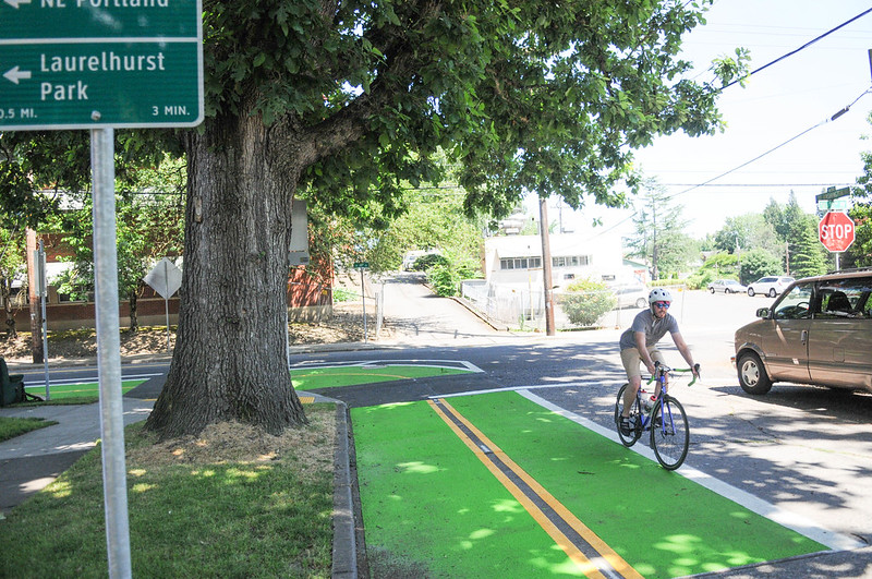
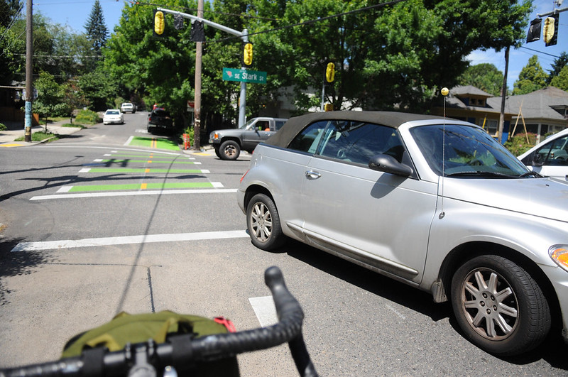
Another interesting section is the design of 30th and Stark. Headed northbound one block before Stark, riders are directed onto a 2-way protected (with green paint and plastic wands) bike lane on the west side of 30th. There’s a new bike-only signal phase at Stark that runs on a sensor. It’s unconventional to have two directions of bicycle traffic on one side of the street — so it’s a bit unsettling when people in cars turn southbound from Stark as you sit in the road waiting for the light.
See photos of this section and others below…

I’ll be using this new bikeway a lot. Have you ridden it yet? How does it feel to you?
You can take a closer look at all the changes and get questions answered from PBOT on their 20s Bikeway Ride on Tuesday (8/29).
— Jonathan Maus: (503) 706-8804, @jonathan_maus on Twitter and jonathan@bikeportland.org
Never miss a story. Sign-up for the daily BP Headlines email.
BikePortland needs your support.