
The Portland Bureau of Transportation (PBOT) released its progress report for the Southwest in Motion (SWIM) plan last month and announced that nine projects and 21 crossing enhancements have been completed since the plan was adopted in December, 2019.
The report opened by noting that “less of the planned bike network has been built in Southwest Portland compared to other areas in the city.” 29% of the southwest’s network has been built compared to 54% in the Central City and 42% citywide.
As BikePortland previously reported, SWIM stakeholders have been frustrated over the delay of the plan’s two-year progress report, which they expected in the fall of 2021, and also with the difficulty in keeping track of project implementation due to outdated information on the website. The progress report includes maps and lists of completed and In-progress projects and appears to address these issues.

With so little funding and less in the future why can’t the taxpayers and customers be involved in how it gets spent?
– Keith Liden, cycling advocate
Also included in last month’s announcement was a survey requesting input to help select the next round of projects to be implemented. The survey lists eight potential projects and requests that the respondent select their top three. (A couple of the projects are bicycle infrastructure improvements.)
The survey might be an attempt to address the community’s feeling of being shut out from ongoing project selection and design. In a letter earlier this year, stakeholders had expressed concerns over “having virtually no knowledge or involvement in project prioritization, selection, or design until they are announced.”
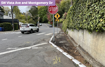
Bicycle advocate, Keith Liden (featured in a recent BikePortland post about the bike lane gap at SW 6th Ave and Hwy 405) thought the survey was a step in the right direction, but wrote PBOT earlier this month to say that he “felt constrained by the format” which didn’t allow comments on designs. He was also frustrated that PBOT didn’t seem to take into account the varying demand for different projects. As an example, he wondered why Boones Ferry projects were included in the list of eight choices, but not projects on the more heavily used Terwilliger Blvd:
Terwilliger is a busy bike and pedestrian route with gaps that have gone unaddressed since the 90s. The cost of many of these identified gaps are no greater than other projects on the PBOT survey list.
Liden summed up his thoughts in an email to me this morning, “We really seem to be kept at arms length. With so little funding and less in the future why can’t the taxpayers and customers be involved in how it gets spent?”


The progress report also updated the status of several “Policy and Program Recommendations” from the 2019 plan. That original plan was notable for its insight into challenges unique to southwest Portland such as the lack of formal stormwater conveyance and hilly terrain. The City of Portland often cites these existing conditions as an explanation for why nearly 70% of the area’s collectors and arterials lack sidewalks.
So the first updated recommendation, about Development Review and frontage improvements, caught my attention. Maybe I’m grasping at straws, but it included a single word which might have an important policy ramification, “specific:”
As part of the Streets 2035 right-of-way project, clarify how to reconcile frontage requirements as a part of development review in response to the context of specific streets in Southwest Portland.
The “context of specific streets” seems to me to be a change from business as usual. Currently, the Development Review office within PBOT decides on frontage improvements like bike lanes or sidewalks on a project-by-project basis as the building projects arise. There is no overarching area street plan.
The progress report appears to be recommending that Streets 2035 develop a plan ahead of time for certain specific streets, rather than just providing a rubric or framework for reviewing bureaus to make decisions. (Streets 2035 is a design framework which will provide guidelines for sometimes conflicting infrastructure requirements in the right-of-way.)

For example, say 300 new houses were going in on the Alpenrose property on SW Shattuck Rd. Rather than neighbors wondering for years whether the developers will be required to build a sidewalk on the property’s Shattuck frontage, SWIM appears to suggest that Streets 2035 should determine the street treatment ahead of time, outside of the pressure of active development.
The “context of specific streets” just might be a bit of insider baseball which could lead to more intentional sidewalk and bike lane decisions. The progress report says “status update forthcoming.”
Other policy recommendations have already been acted upon. On neighborhood traffic calming, PBOT has worked with the Fire Bureau to reduce cut-through traffic with speed bumps on SW Broadway Dr and SW 45th Ave. PBOT is also piloting two traffic chicane projects on SW Burlingame Ave and SW Dolph Ct.
The SWIM project survey closes this Sunday, June 25. A link to the survey and project description, as well as the report can be found on the SWIM project website.