Tualatin Hills Parks & Recreation District (THPRD) wants to build a new off-street path that would connect new residential development along Northwest Springville Road to a large network of existing paths. The proposed $1.1 million Bethany Creek Trail has been in the works for about 18 months; but some key advocates say they’re frustrated because Multnomah County’s Land Use Planning Division didn’t notify the County’s own Bicycle and Pedestrian Citizen Advisory Committee about it.
With an important planning hearing set for tomorrow (Friday, August 23rd) and a 60-page report on the permit just coming to light, advocates are scrambling to submit comments and support the project. Adding to the tension is the fact that Multnomah County Land Use Planning Division staff do not recommend approval of the permit, citing concerns that range from natural resource impacts to a lack of benefit for rural residents.
Here’s the background…

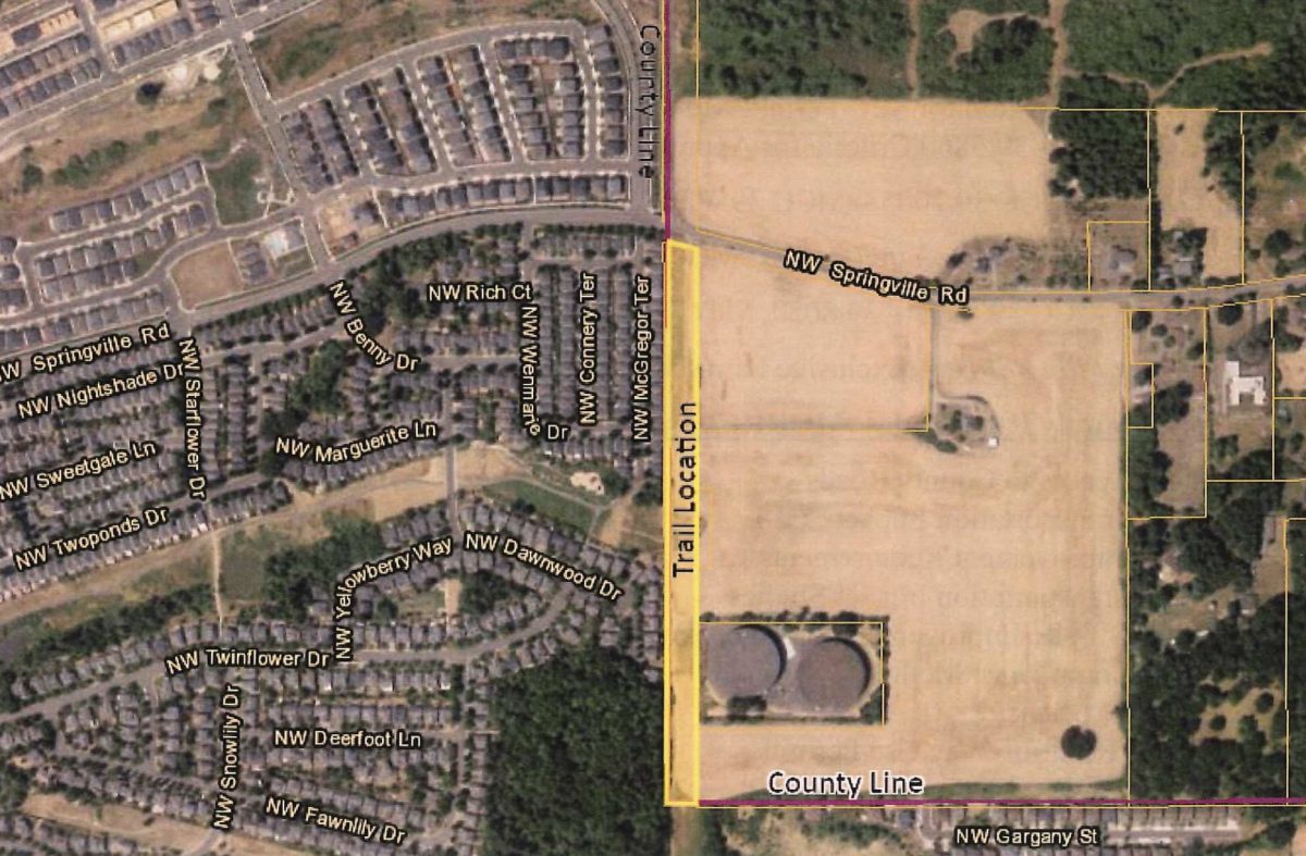
(Graphic: WH Pacific)
The new path would be located in Multnomah County on land owned by the Bonneville Power Administration that’s currently zoned for farm use only. As such, THPRD (which operates in Washington County) had to apply for a conditional use permit with the Multnomah County Land Use Planning Division.
“I am appalled county staff would produce a 60-page report and develop recommendations without ever consulting with the [Multnomah County Bicycle and Pedestrian Citizen Advisory Committee].”
— Andrew Holtz
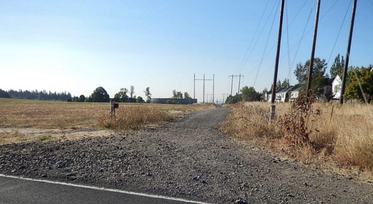
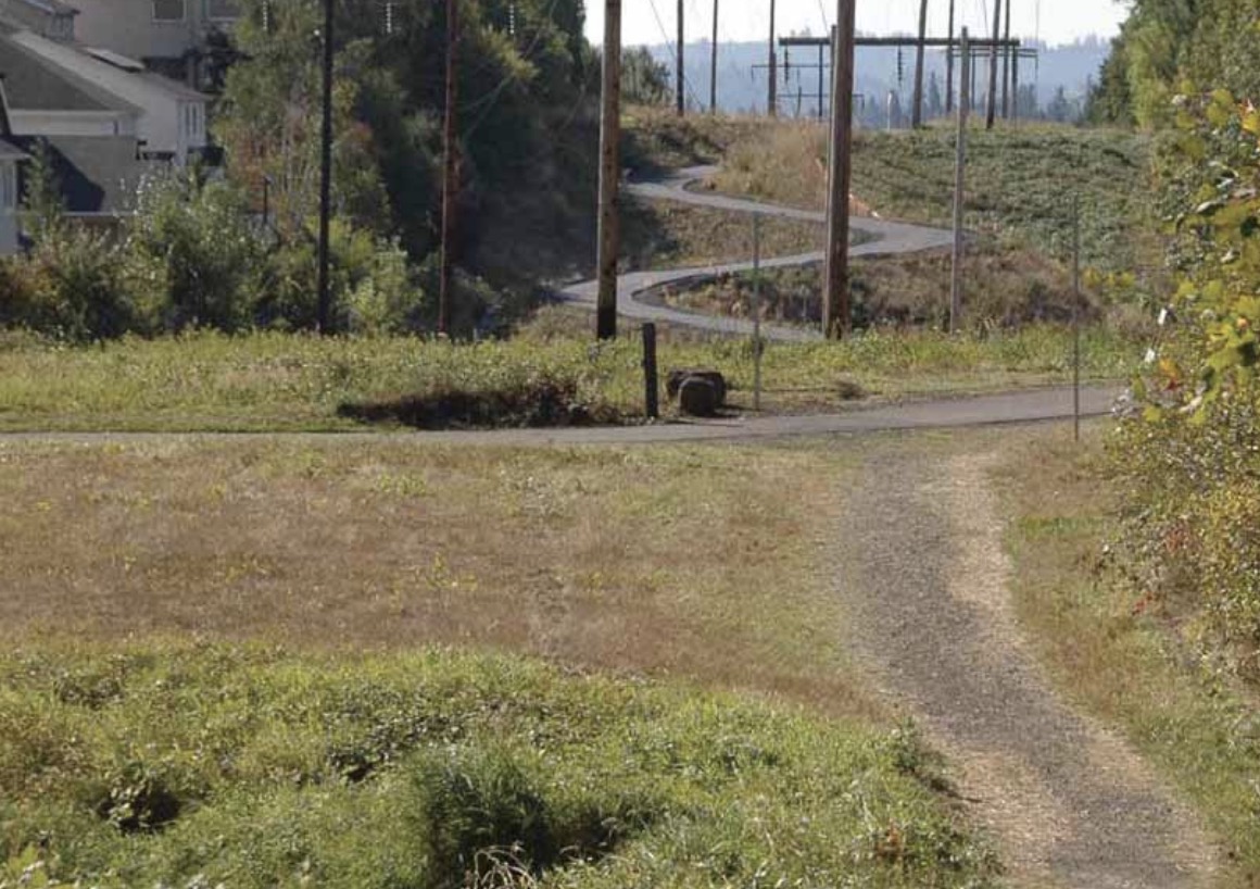
As proposed by THPRD, the path would be used by an estimated 366 people per day and would be 10-feet wide and have a 2-foot wide gravel shoulder. It would run north-south between the Rock Creek Trail and Springville Road with Kaiser Woods Natural Area to the west and a farm to the east. The location already has a gravel road that’s used by walkers and bikers. (I’ve ridden it several times because it makes a safer and more fun connection than nearby roads.) As currently designed, the project would also build a new crossing at Springville Road to connect to paths north of the street that have been built as part of recent residential construction (the area around this proposed path is booming).
Andrew Holtz has been a Multnomah County cycling advocate for decades and has been a member of the County’s Bicycle and Pedestrian Citizen Advisory Committee for 17 years. He emailed me last night (speaking for himself and not the committee) to say it’s “infuriating” that a land-use hearing on such an important project would take place without the committee’s knowledge.
Holtz has ridden on the existing road and said he’s excited for the changes this project would bring. “It seems obvious to me that improving this trail segment would benefit both the safety and comfort of people walking and bicycling in this area,” he said, “especially since it would connect several existing trails in the area.”

Advertisement
“But aside from the merits of the project,” he continued, “I am appalled county staff would produce a 60-page report and develop recommendations without ever consulting with the MCBPCAC [Multnomah County Bicycle and Pedestrian Citizen Advisory Committee].” Holtz wants the county to delay making any binding recommendations until the project can be reviewed by the committee.
“At present, Land Use Planning is unable to recommend approval of the application based upon the evidence in the record— from Multnomah County staff report
Unfortunately Holtz has been told that there isn’t time for the hearing to be pushed back. According to THPRD’s consultant on the project, they contacted Multnomah County more than a year ago but county staff never got the project onto the committee’s agenda. If the committee had a chance to discuss the proposal, they might have been able to work through the concerns from County land-use planning staff.
Asked why this hearing wasn’t on the committee’s agenda, Multnomah County spokesman Mike Pullen said, “[The project] is not part of the County’s Transportation program, which the committee provides input on. The County does not bring typically bring land use cases to its Bicycle and Pedestrian Citizen Advisory Committee… The trail segment proposed by Tualatin Hills Parks & Recreation District is not a Multnomah County project and is before the hearings officer. The County’s Transportation Division has no jurisdiction over the proposed trail.”
And Friday’s hearing can’t be rescheduled, because the public has already been notified. Pullen said state law requires that land use decisions be made within a certain time frame, which prevents moving the hearing to a later date. “Any citizen, including committee members, are welcome to attend the hearing or provide comment on the proposal,” he added.
According to their staff report (PDF) Multnomah County has decided that the project’s permit application fails to meet the goals of their Comprehensive Plan by several measures.
The county’s report says the estimated number of 366 trips, “could be inconsistent with neighboring rural land uses.” On a related point, the county says the project must “primarily serve the needs of the rural area” which they interpret as serving at least 51% of “rural users”. “No data has been provided to support that the Trail will primarily serve the needs of the rural area,” the report reads. “No evidence has been provided as to the number of rural residents from the nearby Multnomah County rural areas that will use the Trail.”

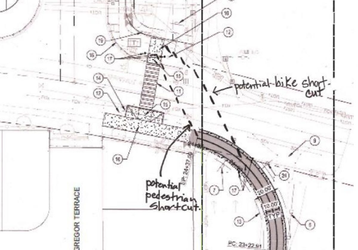
The county also listed a safety concern with the proposed new crossing of Springville Road (as seen in the graphic from the report): “Planning staff is uncertain what measures will prevent pedestrians and bicyclists from shortcutting the path before the controlled crosswalk which could lead to unpredictable crossings inconsistent with the proposed signaled crossing design located in Washington County.”
In addition to those concerns, the report concludes that THPRD hasn’t done enough to mitigate potential environmental impacts of the project, isn’t planning to plant enough trees and shrubs, and wants to erect too many freestanding signs along the path. Multnomah County also prefers a different alignment that would keep the path fully inside Washington County and be routed through a natural area and residential neighborhoods.
At Friday’s hearing, Multnomah County Land Use Planning Division staff will tell the hearings officer that they don’t approve of the current application. They plan to share a list of recommended changes to the proposal that could lead to approval.
The case will be decided by a third party land use hearings officer. The hearings officer hears public testimony at the hearing, considers the facts of the case, and then renders the County’s final land use decision. That decision can be appealed to the Oregon Land Use Board of Appeals (LUBA).
The hearing takes place Friday August 23rd in Room 103 at Multnomah County Land Use Planning Division Office (1600 SE 190th Avenue in Portland). If you care about this project and want to submit comment, email Multnomah County Deputy Planning Director Adam Barber adam.t.barber@multco.us.
— Jonathan Maus: (503) 706-8804, @jonathan_maus on Twitter and jonathan@bikeportland.org
Never miss a story. Sign-up for the daily BP Headlines email.
BikePortland needs your support.

