(Photo: Terry Dublinksi-Milton)
This guest post is written by SE Uplift Neighborhood Coalition Co-Chair Terry Dublinski-Milton and Mt. Scott-Arleta Neighborhood Land Use & Transportation Chair Matchu Williams.
We have Southwest in Motion, Central City in Motion, Northwest in Motion and East Portland in Motion. It’s time for Southeast in Motion, or what we call Southeast in Active Motion, or SEAM.
SEAM is a grassroots, transportation prioritization effort that we want the City of Portland to get behind. Our goal is to join — or “SEAM” together (get it?) — the infrastructure gaps that isolate the 50,000+ residents of “middle-southeast Portland” — south of Powell in all directions and centered on the Brentwood-Darlington and Woodstock neighborhoods. This includes bikeways, crossings, bus routes, and gravel roadways. If we do this in places that are close to jobs, community services, businesses and educational opportunities, we’ll have an active transportation network that will give us a chance to reach our mode share goals. A SEAMless network of safe connections to Lents, Mt Scott-Arleta, Woodstock, the Orange MAX line and Milwaukie will also help integrate diverse communities.

Nearly every area of transportation south of Powell is substandard or non-existent. Powell and Holgate are both High Crash Corridors and have no bike facilities — yet they provide the precious few, continuous east-west connections. The only bike lanes that are up to modern safety standards are 52nd Ave north of Woodstock and the Foster Streetscape project; however, both are unprotected and only the minimum six-feet width allowed by code. While Willamette Boulevard and Rosa Parks Way in north Portland recently received wider, buffered bike lanes during repaving, SE 52nd south of Duke was re-striped with the same narrow 1990s era, door zone bike lanes in an area where speeding is common and parking is underutilized along a steep hill.
The rest of the region has broken, four-foot or narrower bike lanes containing dangerous gaps. Woodstock, for example — at 82nd, 69th through 72nd, and through the commercial corridor of 52nd to 41st — lacks designated bike lanes which leave riders to negotiate with freight, other commuters, and buses. The designated bikeways in the 40s south of Woodstock and the Knapp-Ogden Bikeway are still not built or funded. They are disconnected, substandard, and not yet included in PBOT’s Transportation System Plan (TSP).
Advertisement
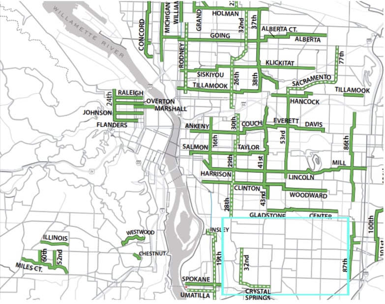
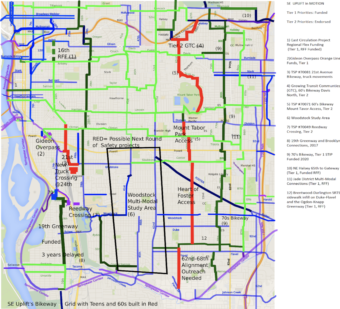
Here’s the current status of projects in the SE Uplift neighborhood coalition area:

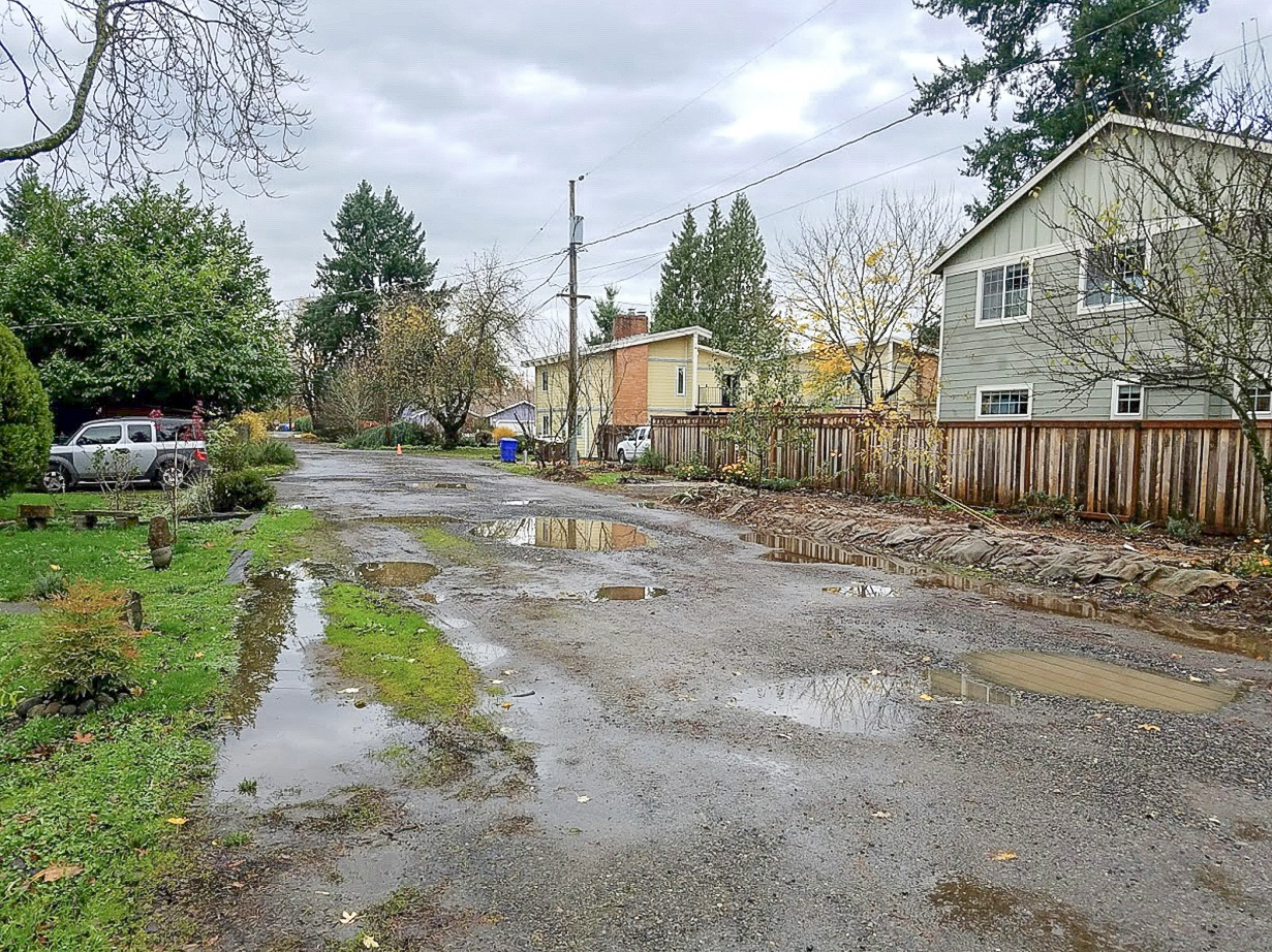
Gravel roadways in this area prevent local connectivity to parks, schools, and commercial centers. With public outreach, critical areas could be prioritized for updates using the cost-effective designs envisioned in the 2010 Roadway Not Improved report. Walking is a challenge in this disconnected environment and while Brentwood-Darlington’s successful campaign for sidewalk infill on Flavel and Duke helps, the Safe Routes to Schools program frequently directs children to substandard residential roadways without sidewalks that are filled with puddles and gravel. Access to the Woodstock Town Center will be critical if parking lots and single use stores will ever develop into a vibrant mixed use corridor. How can we have a “20-minute neighborhood” if it can’t be accessed via walking and biking?
Commuters are also burdened by the lack of adequate transit options. Demand for MAX light rail service is so high that commuters park in Eastmoreland to walk to the Bybee MAX station. Eastmoreland responded with a residential only parking permit. As a city we should make transit easy and convenient, but determining where the biggest needs are for bus service must come from the people who use it.
Transportation is not for just for the benefit of those who drive an automobile. It serves everyone including underrepresented demographics: people of color, people with disabilities, and recent immigrants. More diverse than Portland as a whole, 30 percent of the residents in the area from 72nd and 82nd between Duke and Flavel identify as Latino, compared to 9.8 percent citywide. 27.2 percent of the students at Woodstock Elementary identify as Asian-American with Brentwood-Darlington schools reporting 13-18 percent. Median income generally decreases as you travel east from McLoughlin Blvd. The drop is significant past 72nd where the median income is $37,881 compared to the city average of $55,003 (Source: ACS 2011-2015 5-Year Estimates).
All three Portland Public Schools within Brentwood-Darlington (Whitman, Woodmere, and Lane) receive Title I funds and 24 percent of the students at Woodmere Elementary are English Language Learners. In addition, though there are disparate nodes of commercial potential, no one single commercial corridor exists. Thus, connecting Lents Town Center, Woodstock Town Center, and the Heart of Foster is critical for a vibrant southeast Portland.
To start this daunting task, a PBOT Planning Grant in the next budget cycle is needed for a public outreach effort that can help determine local needs and priorities.
Considering the dearth of projects in the TSP, how can we mesh these projects together into a SEAMless network?
Aside from transportation deficiencies why should this corner of SE Portland be next in the planning efforts?
Want to get involved or see what we are up against?
Join us for the upcoming Pedalpalooza Unimproved Roads Ride on June 25th at 5:00 pm. We’ll meet at Woodstock Park (SE corner at 50th & Harold) and the ride will end at our monthly SEAM meeting (7:00 pm at SE Uplift headquarters, 3534 SE Main).
— Terry Dublinski-Milton and Matchu Williams
Never miss a story. Sign-up for the daily BP Headlines email.
BikePortland needs your support.

