(Image: Google Maps)
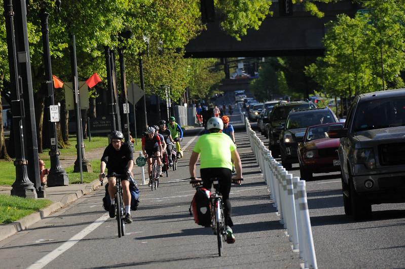
As Portland prepares to remove a temporary protected bike lane on Monday and biking advocates prepare to call for permanent improvements with a human-protected bike lane demonstration tonight, a separate discussion has been going on.
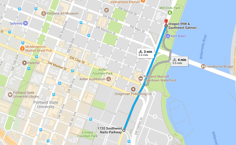
As part of last year’s voter-approved Fixing Our Streets program, the city has promised to reconstruct and repave Naito Boulevard between the Hawthorne Bridge and Interstate 405. But state law requires reconstructed roads to add bike facilities — and that stretch of Naito has never had bike lanes.
The result: The city has worked up a rough engineering concept that includes a bike path and protected two-way bike lanes between Salmon Street and Harrison Street, including on-street protected bike lanes beneath the Hawthorne Bridge onramp that would permanently repurpose one of Naito’s four auto traffic lanes for biking, at least at this crucial pinchpoint.
A new bikeway on this part of Naito would create a far more direct biking link between downtown Portland and the South Waterfront, sharply reducing the incentive for commuters and other faster-moving transportation bikers to use the riverside path in Waterfront Park or the walkway alongside the RiverPlace development, an area where biking-walking conflicts are technically forbidden but common and sometimes dangerous.

It’d also let people comfortably bike much closer to Portland State University, nearly connecting the city’s No. 1 biking destination to a continuous low-stress bikeway network through the central city … though only if the protected bike lanes remain on Naito between the Hawthorne and Steel bridges.
In other words, this concept makes much more sense if the “Better Naito” bikeway, or something like it, is made permanent.
In interviews Thursday, city officials stressed that they haven’t yet done the extensive outreach that would have to happen before advancing the concept. It’s certain that this concept, if circulated more widely, would draw the attention of the Portland Business Alliance, which has made a campaign of opposing the temporary lane conversion north of Salmon — which means that the plan probably wouldn’t happen unless the city felt other Portlanders or institutions were likely to strongly support it.
“At this point, we are in the early stage of design, with a lot of uncertainty about what is technically feasible and what elements might be worth including in the project,” Art Pearce, the city’s group manager for planning, policy and projects, wrote in an email. “Not every paving project allows us to recreate the traffic flow in an area, but in this case, we are able to analyze the potential to use one travel lane to provide safer bicycle and pedestrian access.”
Advertisement

Pearce said that in addition to the bikeway mandated by state law, the city is looking for ways to improve travel for all modes. Northbound autos sometimes back up on the way up Naito, interfering with Portland Streetcar service on Harrison, half a mile south of the Hawthorne Bridge. A new signal at the Hawthorne Bridge, also proposed as part of the city’s concept, would let cars move through faster and clear the way for streetcar passengers, too. (On the downside for people biking, it’d also create a new stoplight for people crossing the Hawthorne.)
“It’s a complicated part of town,” Pearce said. “We’re trying to do a hard thing and we’re trying to do it well.”
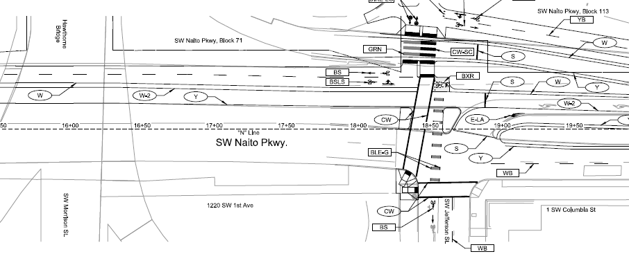
BikePortland was sent a copy of the city’s engineering sketches Wednesday by someone not affiliated with the city. The sketches show the extent of effort the city has so far invested in a concept that’s been quietly public for months. Here’s the public project description from the Fixing Our Streets website:
This project is examining the feasibility to include a 2-way separated bike path between SW Harrison and SW Clay Street on the east side. Additionally, the project is examining the feasibility of incorporating an on-street, 2-way bike facility between SW Clay and SW Jefferson; a full pedestrian signal at SW Jefferson with connections to the Park and a 2-way on-street bike lane connection north of Jefferson. All of these improvements will increase safety and efficiency while decreasing conflicts between drivers, buses, and people on bikes and on foot.
“Staff determined early on that pedestrian crossings on this section of Naito (between Jefferson and Harrison) were inadequate and bike facilities were non-existent,” Pearce said. “This section of Naito has long been identified as a multimodal priority: it’s a city walkway and a major city bikeway.”
Pearce suggested that given the need for some sort of improvements, it makes sense to “come up with the smartest, best design for this busy corridor. Our current design features a raised, separated two-way cycle track and sidewalk along the east side of Naito between Harrison and Jefferson. It shortens crossing distances for pedestrians, upgrades signals, and adds a new crossing at SW Jefferson serving the new courthouse and the Waterfront bowl.”
“It’s too early to say what the project will look like,” Pearce concluded. “We’re hoping to build it in 2018.”
— Michael Andersen: (503) 333-7824, @andersem on Twitter and michael@portlandafoot.org
Never miss a story. Sign-up for the daily BP Headlines email.
BikePortland needs your support.