(Image: Google Street View)
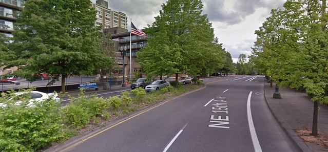
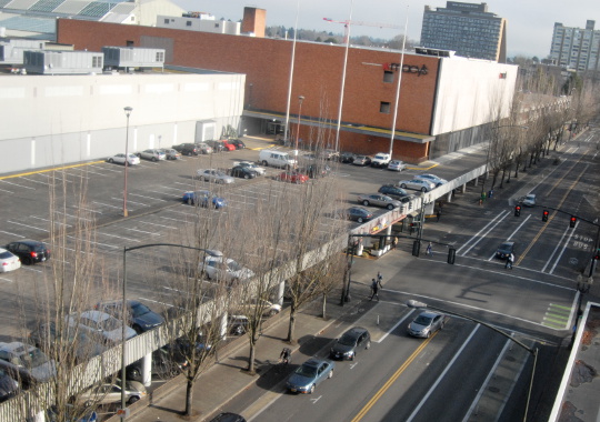
The divided four-lane street that runs between the Holladay Park Plaza senior-housing skyscraper and the Lloyd Center Mall is about to get a lot easier to cross.
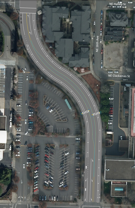
For most of the distance between Northeast Multnomah and Halsey streets, two of the four current general travel lanes on Northeast 15th/16th will be converted to massive five-foot-wide cross-hatched buffers. The bike lanes, meanwhile, will be widened from five feet to seven. Finally, a zebra crosswalk and median refuge will also be added between the Holladay Park Plaza tower, just east of 15th/16th, and the mall parking lot, just west.
The link is significant to the city’s biking network because the rapidly developing Lloyd District currently offers no low-stress biking connections between the Multnomah Street protected bike lane and the neighborhoods to the north, including the commercial district on Broadway and Weidler.
15th and 16th is currently so “overbuilt” with excess traffic capacity, city traffic engineer Andrew Sullivan said Wednesday, that even if auto traffic on the street were to double, the planned restriping wouldn’t lead to any additional travel delay for people driving compared to what they see today.

(Click here for full PDF, including the block between Halsey and Weidler.)
The crosswalks are being built now; the restriping will take place after the street comes up for regular repaving this July. The infrastructure budget of about $40,000 comes from the local business association, Go Lloyd, which receives about half of the district’s parking meter revenue to spend on projects that reduce the need for driving.
Sullivan and project manager Chris Armes said the restriping will improve walking safety by removing the “double threat” that occurs whenever a street has two lanes in the same direction. When one car yields to someone in a crosswalk, a second car sometimes won’t.
“He says, there’s no way. The mall’s not going to support this. And there’s a silence in the meeting, and we’re like, Oh shit, this is it.“
— Kiel Johnson, local resident on project committee
The city had previously considered its standard treatment for such streets these days, a rapid-flash button-activated beacon, but discarded that concept because Go Lloyd couldn’t afford it.
But the one-lane design will actually be better than a beacon, Sullivan said.
“Rather than doing one small improvement with a really big price tag, it actually benefits people no matter where they decide to cross,” he said.
The design will essentially result in 12-foot-wide buffered bike lanes, maybe the widest such in the city. Sullivan said the city decided against physical protection to keep the project quick and simple.
“If it becomes a problem where people are driving in the bike lane, that kind of thing, we can always come in with operational funding and put in signs, striping, more planters,” he said.
Like on nearby Multnomah Street, the new southbound bike lane will end as it approaches the intersection, being replaced with a right-turn lane marked with a sharrow. Sullivan said this so-called “mixing zone” was installed because bikes will have to mix with motor traffic anyway because TriMet’s No. 8 bus, which uses this stretch, has a stop north of Multnomah on 16th.
“Portland State University’s ‘Lessons From the Green Lane Project’ study looked at mixing zones similar to those proposed on this project and found that they have a very good safety record in low-speed environments such as NE 15th/16th Ave,” Sullivan wrote. (On the other hand, the same study found that, actual safety aside, 25 percent of current bike users feel generally unsafe while pedaling through the mixing zones on Multnomah.)
Advertisement
Neighborhood advocate: Redesign only got consensus because it wasn’t seen as a bike project

Kiel Johnson, a Lloyd District resident and biking advocate who took part in the meetings planning for this project, said he believes the plan nearly died when Dennis Henderson, the Lloyd Center Mall’s operations director, learned in a neighborhood meeting that it would reduce the number of auto lanes on a nearby street.
“He says, there’s no way. The mall’s not going to support this,” Johnson recalled. “And there’s a silence in the meeting, and we’re like, Oh shit, this is it. You could just see the panic in everyone’s face.”
But Johnson said the other people on the committee, all of whom favored the project, explained to him that it was the traffic signal, not the number of traffic lanes, that actually restricted the street’s capacity. Then the group walked outside to look at the street.
“There was already, like, a place where people had trampled the vegetation,” Johnson said. “You could see that there was a pedestrian island defacto there. … And by the time we’re outside, the guy from the mall is making suggestions and he’s on board. … I think maybe he just felt a little caught off guard.”
Johnson said it was a lesson for him in how to sell a project to skeptical neighbors.
“I think if the city had put on the meeting and said, ‘Okay, we’re going to put on this road diet,’ it wouldn’t have worked,” said Johnson. “I think the biggest thing was there’s already a community group there that was all on board with this project, and it was the community asking for it and not the city trying to make it happen.”
Another key factor in getting the mall’s approval, Johnson thought: no one mentioned bicycling.
“The whole meeting, it wasn’t about bikes at all; it didn’t talk about bikes or how this would make things better for bikes,” he said. “Which I think is so sad.”


