(Photos: M.Andersen/BikePortland)
Thanks to TriMet’s nearly completed Orange Line, the main bike route to the South Waterfront got smoother this week.
But as we discussed in a post last week, there are still significant complications with the bike connections to Portland State University that could have been solved if it had been possible to run a bike/walk/skate path on the new MAX viaduct.
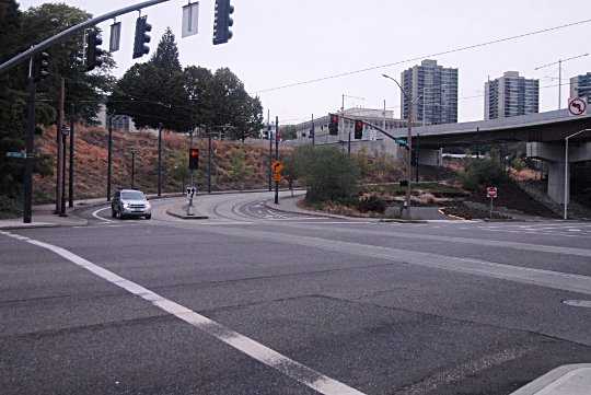
I spent a while in the area last night, comparing the various route options created by the new northwest/southeast path that now links Moody Avenue and Sheridan to Harbor Drive and River Parkway. Let’s start with the good news.
Almost everybody who bikes into the South Waterfront should probably be using this path now.

(Image and commentary by Ted Buehler)
It cuts the corner between Moody and the Hawthorne Bridge landings and lets you skip two traffic signals, including an awkwardly signaled intersection and a bunch of streetcar tracks.
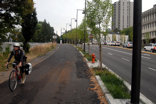
Most people biking to the South Waterfront from downtown or the east side head south through Waterfront Park until they reach this intersection (Harbor Way and Montgomery), then turn left. But as of this week, it really makes more sense to obey the wayfinding sign and go straight ahead:
Harbor Way dead-ends into a mixed-use path…
…which proceeds on the east side of Harbor Drive…
…and reaches the path built by TriMet for this purpose and opened this week.
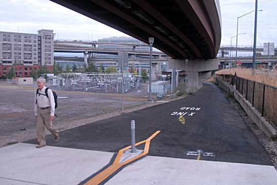
Heading down this way, you’ll get a quick signal and straight shot across Sheridan into the Moody cycle track rather than dealing with the long signal and diagonal crossing across streetcar tracks that have been in use for the last few years.
Nice!
OK, now, the bad news…
Advertisement

It’s still slow and complicated to bike from Tilikum Crossing to PSU.
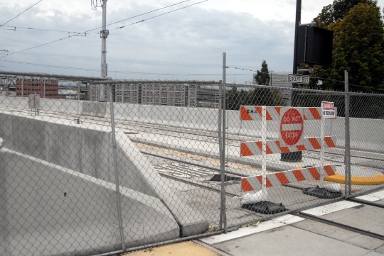
Last week, reader Ted Buehler argued that by far the best way to get to Portland State University from TriMet’s new bridge (and therefore from much of Southeast Portland) would be to bike or walk up the viaduct alongside the rails and busway … if only there were a path on that viaduct.
“It’s a Grade A Platinum Route from PSU to SE Portland,” Buehler had written in a comment thread about the apparent decline in biking rates among PSU students. “But not open to bikes.”
It’s not clear how hard it would have been to actually open that path to bikes. But Buehler is right.
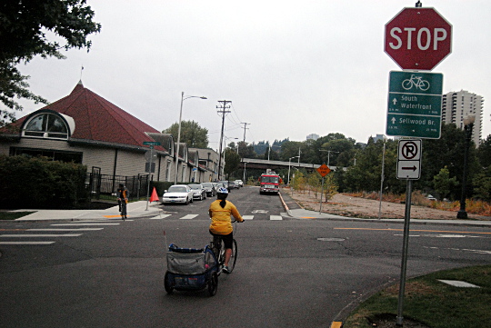
Let’s take the best existing route one step at a time, starting this time at the bottom of the hill, near the South Waterfront and the west landing of Tilikum Crossing. Here’s the view across Sheridan from the end of Moody’s awesome raised, separated cycle track:
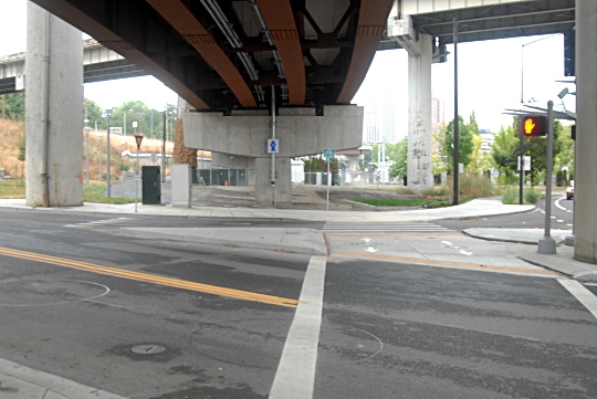
There are new signs here urging people to turn left. They should!
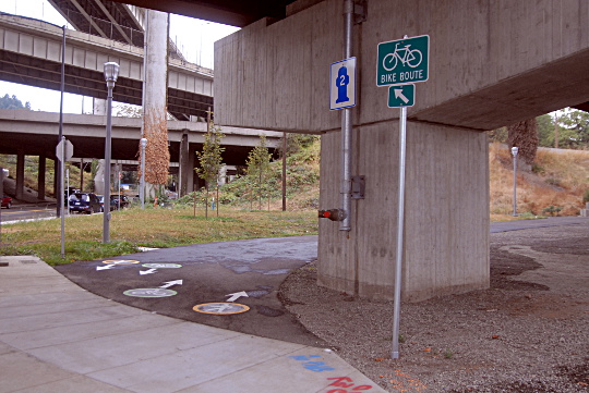
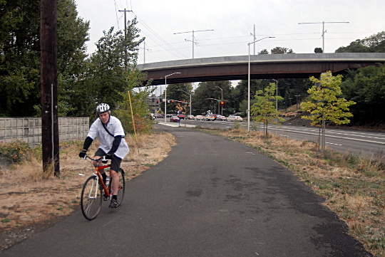
From there you can proceed up the path, just west of a power station and a vacant lot that seems sure to be a future Midnight Mystery Ride destination…
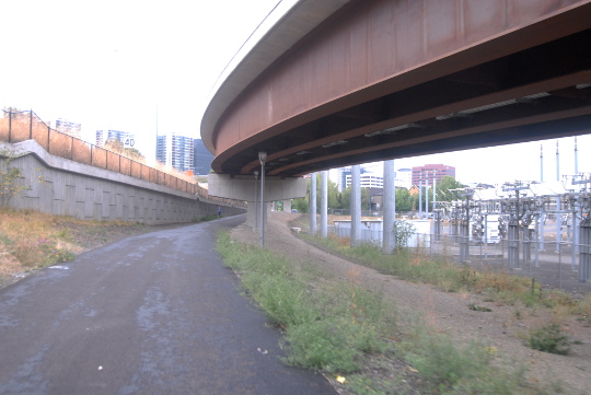
…and up to Harbor Drive, the stub of 1950s expressway that remained after Governor Tom McCall successfully led an effort to replace most of it with Waterfront Park.
From there, someone biking uphill has to make a two-stage cross using the pedestrian signals, one of which requires a push button, into the bike lanes on Harrison Street alongside the combined streetcar/traffic lane. Those curve around to reach Naito Parkway, at which point you can continue straight onto Harrison and into the PSU area…
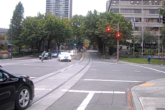
…unless sharing an uphill traffic lane with cars on a divided four-lane boulevard next to the streetcar tracks isn’t your thing. In that case, your best bet for reaching the much more comfortable Lincoln Street bike lane would be to turn left and wait through a long signal cycle to head over this crosswalk and onto the sidewalk here:

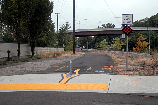
At the top of this incline, you’ll reach the new bike/walk crossing onto Lincoln. What’s that on your left?
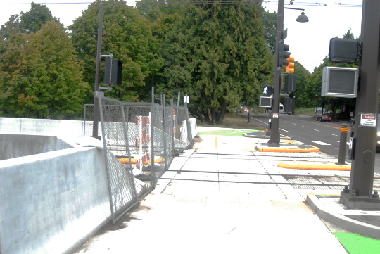
It’s the top of the new MAX viaduct that curves straight up from the bridge landing.
I timed myself biking up and down the legal route. It took 5:38 uphill, much of it waiting for the left turn crossing signal onto Naito from Harrison, and 3:01 downhill.
As for biking the viaduct, I would estimate (purely hypothetically) that it might take a similar rider about 2:28 uphill and 1:54 downhill, assuming that rider were proceeding carefully to avoid any track conflicts.
None of this is to overstate the importance of a minute or three in the big picture of someone’s bike trip. Like so much of Portland’s bike infrastructure, it’s good enough to serve those who are already riding, and it was certainly affordable. In a rail project that wound up furiously cutting $62 million at the last minute to make ends meet, that may have been necessary.
In an email Thursday, TriMet spokeswoman Mary Fetsch wrote that physical space was a problem, too.
“Designing a structure wide enough to include acceptably wide multi-use paths was not feasible due to the need for the structure to pass between freeway columns — the space between the columns limits the maximum width of the structure,” she wrote. “Even if possible within the physical space, a structure that wide would have added an estimated $5 million to the structure’s cost and necessitated access ramps to the structure in its southern section.”
Regardless, the bigger problem with the route TriMet settled on instead, compared to an MUP similar to the MAX viaduct, is that it’s the sort of thing that takes eight photographs to explain. Compare all these twists and turns through the shadows of highway and rail viaducts to the simplicity of “head up this path and it takes you straight there.”
That’s the sort of amenity that only money can buy.