to be ridden just north of the Scappoose-Vernonia Hwy.
(Photos by J. Maus/BikePortland)
When the sun comes out around here in January, folks that enjoy bicycling take full advantage. This past weekend was a real gem weather-wise, and I’m sure I wasn’t the only one who grabbed the opportunity for some two-wheeled adventure. What I found were some off-the-beaten-path backroads that I enjoyed so much I’ve decided to share them here on the Front Page.
—
Wanting to do my first century of 2014, I ventured over to RidewithGPS.com (a site — based right here in Portland! — that I could not live without these days) to map out one of my oldies but goodies — the Portland-Vernonia-Scappoose loop. This is a fantastic loop that I highly recommend.
About 60 miles in, just a few miles north of Vernonia Lake on Nehalem Highway, the route begins heading back to Portland. It’s at the junction of the Nehalem and Scappoose-Vernonia highways that I decided to try something new.
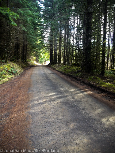
After riding quiet Washington County farm roads and the carfree Banks-Vernonia Trail for several hours, the thought of riding 20 miles on the Scappoose-Vernonia Highway didn’t appeal to me. It’s not a terrible place to ride, but there isn’t much shoulder and knowing that the area is full of great backroads makes staying on the pavement seem rather boring by comparison. Some of you might have ridden (or heard of) the Crown-Zellerbach Trail that runs alongside the highway (we wrote about it back in May). That’s a nice ride, but I wanted to find something new. The sun was shining, I had confidence in my bike, my GPS device, and my legs, so I figured I’d leave my pre-determined route and do some exploring.
The best part of my day started after my GPS device beeped: “Off-course”.
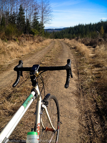
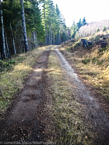
Just a half-mile or so on the Scappoose-Vernonia Hwy (east of the Nehalem Hwy junction), I turned north onto Pittsburg Road. The name comes from a nearby, unincorporated town that was named after Pittsburgh, Pennsylvania by a settler named Peter Brous in 1879. The road itself is a mix of hard-packed dirt and some gravel that climbs about 1,100 feet in just over six miles.
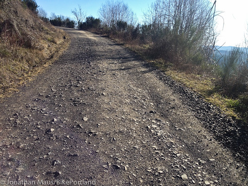
Off the highway, I rode in peace, without constantly glancing over my shoulder. Backroads are my favorite roads. I love the solitude and the added challenge of riding my “road” bike (a Cielo Sportif Classic with 28 mm tires) through the varying types of dirt (hard-pack, loose, dry wet, flat, off-camber) and rocks (small loose gravel to the embedded rocks as seen in the photo below).
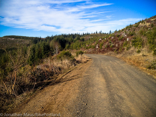
Near the summit, Pittsburg Road took me right to the southern tip of the Forest Grove District State Forest and Baker Point (an old fire lookout) at an elevation of about 1,800 feet. From there, the views toward the south were fantastic. I continued east along the ridge for a few more miles. Then, just before dropping into a valley that would loop me back (south) to Scappoose, I was rewarded with grand views of Mt. St. Helens and Mt. Adams.

As I headed south I left Pittsburg Road and found my way into a valley and onto Wilark Road. Suddenly the Clatskanie River tumbled nearby and I wound my way between clear-cuts, creeks, ponds, and forested groves. Wilark eventually turns into Alder Creek Road, which I then followed a few more miles south. It was at about mile 74 that the road became paved, right at the small rural community of Spitzenberg.
At this point — with about 14 miles of dirt/gravel backroads behind me — I could choose whether to take the highway or the Crown Zellerbach Trail back to Scappoose. Getting short on time, I opted for the highway. It was only six miles to Scappoose and it’s all downhill, so sharing the road wasn’t too bad.
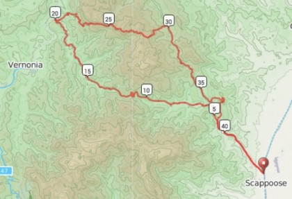
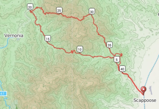
It wasn’t until I met back up with the C-Z Trail that it dawned on me what a nice loop this would make. Combine this Pittsburg-Wilark-Alder Creek logging road route with the C-Z Trail and you’ve got a fun adventure that is nearly 100% off the highway. RidewithGPS.com says the loop would be 43 miles with about 4,300 feet of climbing. There are plenty of places to park in Scappoose near the start of the C-Z Trail, or for those of you who are up for it, it’s about 25 miles on Highway 30 from Portland. Here’s the loop in map form:
This whole area, on both sides of Scappoose-Vernonia Hwy, is full of great dirt roads that are perfect for cycling on. I can’t wait for the longer and warmer days of summer to really get to know them better.
Note: The logging roads in this area are open to public recreational use under the management and ownership of private timber companies. Follow the rules posted on signs along the way. I would also recommend riding this on weekends when there aren’t active logging operations.
For more info, check out these routes on RidewithGPS
– Vernonia-Scappoose Century
– Crown Zellerbach Trail-Baker Point Loop