“People should be aware of the realities of what happens on the Vancouver Waterfront, where the transit stations are at 100 feet. People can’t visualize that. They can’t make sense of that. That’s 10 stories into the air!”
That was Oregon Walks Executive Director Zachary Lauritzen during an interview with BikePortland yesterday. Oregon Walks is a member of the Just Crossing Alliance, a large coalition of advocacy groups working to “right-size” the Interstate Bridge Replacement (IBR) Program. The IBR will add new lanes to five miles of freeway and enlarge seven interchanges of Interstate 5 between Portland and Vancouver. It’s estimated to cost $7.5 billion and many (including Lauritzen) believe it will ultimately cost $10-12 billion.
With that price tag, members of the JCA feel like we shouldn’t settle for anything less than world-class cycling and transit facilities.
With just five days left in the all-important public comment period for the project’s Supplemental Draft Environmental Impact Statement (SDEIS), the JCA has released a four-page “Active Transportation and Transit Vision” (PDF) and they want everyone in the region to amplify their concerns via an official comment on the project. The vision document points out the inefficient use of space in the current design and the need to “future-proof” the biking and transit facilities.


Lauritzen and several other coalition members formed an Active Transportation Working Group (separate from the full JCA coalition) to take a closer look at the biking, walking, and transit elements of the project. Other members include The Street Trust, Bike Loud PDX, Bridgeton Neighborhood Association, and advocates from Vancouver.
To be clear, the JCA isn’t working to stop the project. They want to make it less bad.
That transit-station-in-the-sky Lauritzen warned me about, is just one of several things he and his group are deeply concerned about. The bike path for instance, is on the opposite (east) side of the new MAX light rail transit line and there’s no elevator to get folks from the Vancouver waterfront up to it.
If the project is built with the design currently being proposed by Washington and Oregon departments of transportation, people biking north and south would be forced one mile out-of-direction. That’s because the IBRP team has made the bike path route down a half-mile spiral ramp near downtown Vancouver and the waterfront. Lauritzen says they call it the “Vancouver dip.”

The JCA want the biking and walking path to be on the same side as transit (to take advantage of multimodal options) and they want the path to remain elevated all the way to the last transit station (at Evergreen Blvd).
“Those two things [bike and transit routes] have to be together. That path needs to be with the transit, so people can step off of the MAX and get on their bike, ” Lauritzen said. “It’s called ‘multi-modal transportation’ for a reason.” “What the plans are now is you step off the MAX, you go out of direction underneath the road, up some stairs, then on some ramps and then you’re on the path.”
There’s already an elevator the MAX station in the plans, which is another reason the JCA workgroup wants the bike path next to it. The IBR team has planned the bike path on the east side because of what they say are space constraints on the west side, where the new, wider freeway is already forcing them to demolish several buildings.
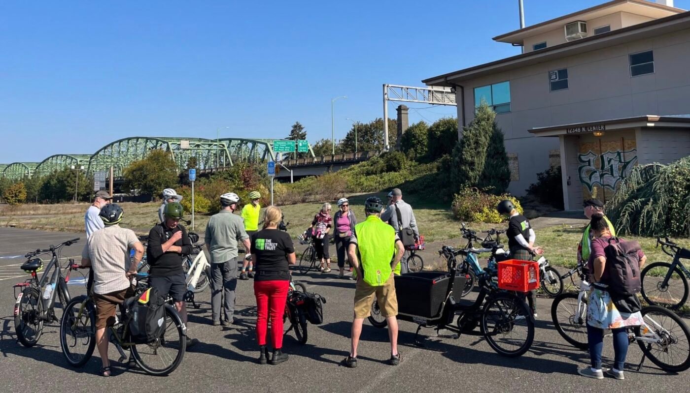
The Street Trust, Oregon Walks, and other groups helped lead a bike ride to get an in-person, up-close look at what the IBR plans have in store. Lauritzen said the group stood at a spot on Hayden Island and looked north at the highest point on the lift mechanism of the current bridge. “That’s where the new bridge is going to be, and people [on the ride] were just like, ‘It’s going to be that high?’ People were blown away.”
Another takeaway from the bike ride was that gaps in the existing bike network at the edges of the project boundary must be addressed. The IBR team likes to talk about the new protected bike lane on Expo Road, but on the other side of the project, the multi-billion dollar design would drop bicycle riders onto dangerous sections (“no man’s land” JCA says) of NE Marine Drive and Martin Luther King Jr. Blvd.
The IBR project team is leaning on transit and biking traffic to help meet its GHG and environmental goals, but the JCA Active Transportation working group believes it will take much better designs to get people to use those modes.
Lauritzen says getting a high volume of public comments into the official record is key to forcing the hand of the project team to address these concerns. His group doesn’t have the threat of killing the project to give them political leverage, but if enough people amplify active transportation concerns, it could give IBR partner agencies pause.
“The bridge design has to be approved by all the jurisdictions — Metro, TriMet, City of Portland, etc., — and those entities have very specific active transportation, transit, climate and VMT [vehicle miles traveled] goals,” Lauritzen said. “We are saying, ‘If you don’t follow our recommendations, you’re going to get to the end of this project and you’re not going to be able to those partners in the face and say, ‘These are going to happen.’ So make those changes now, make these investments now in your design, so that on the back-end you can approve this’.”
Lauritzen says every comment counts. Even if it’s just a few sentences.
You can submit comments here. For a full guide to commenting created by The Street Trust click here. Deadline for comments is November 18th. If you’d like help making a comment, JCA is hosting an online town hall and teach-in on Zoom tomorrow at 6:00 pm. Register for that event here.


