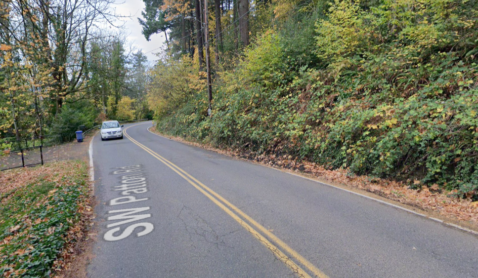
I’ve got a pretty strong stomach, but it lurched when I read BikePortland regular Mark McClure’s comment about his recent experience walking down SW Patton. Apparently the Apple Maps walking instructions led him to a disappearing shoulder on this unwalkable road. Where did Apple think it was going to send him, Scholls Ferry? The horror.
There were several stretches where I could barely find a shoulder to walk on. In a few cases, I had to cross SW Patton from the left side (facing oncoming traffic) to the right side to even find the shoulder. The crossings where I had poor sight visibility were especially unnerving.
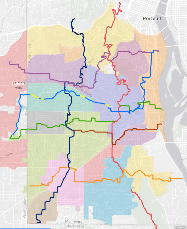
Folks, don’t rely on Silicon Valley to mediate your southwest walking experience. Instead, turn to your friends at SW Trails PDX. What would have helped Mark was the SW Trails Urban Trails arcGIS map which guides you to “low traffic streets, parks and key unbuilt rights-of-way linking walkers to schools, shops, parks and public transit.”

There are many lovely walks in SW Portland, in some ways it is a walker’s paradise, but don’t go it alone. Most southwest collectors and arterials don’t have sidewalks—on either side of the road. (At 26%, Southwest’s sidewalk coverage on collectors and arterials is less than half that of East Portland). Chasing disappearing shoulders by making multiple crossings is, unfortunately, the norm on the larger roads here.

Happily, almost 30 years ago a small group of plucky residents set out to provide an alternative to the second-class status of the walker in this auto-centric environment. What they built is a true grass roots organization fueled by a lot of volunteer labor. Today, SW Trails has a walking map of nearly fifty miles of wayfinding-signed trails, and their accomplishments include conceiving and securing funding for the 4T trail loop (Train, Trail, Tram and Trolley).
In addition to their twice-monthly guided group hikes, SW Trails responded to pandemic disruptions by launching a series of 35 self-led hikes covering over 200 miles of unique SW Portland hikes.
Mark, I’m glad you made it home okay. I hope you, and everyone else, can find time this summer for a SW Trails self-guided hike through Southwest Portland.