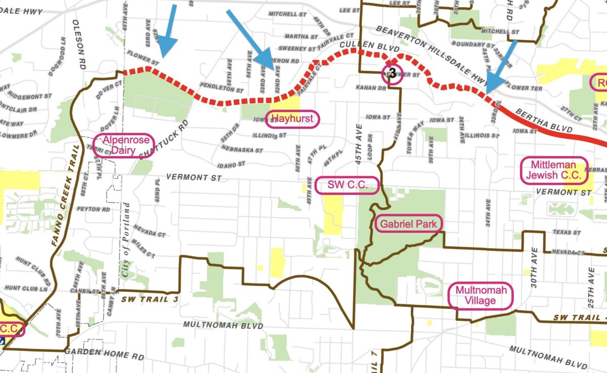
There’s more good news for the Red Electric Trail: Portland City Council will accept a $750,000 grant at their meeting this week that will go toward planning three segments of the future path.
When complete, the Red Electric will be a major east-west artery in the regional path network that will connect the existing Fanno Creek Trail in Beaverton to the Willamette Greenway Trail in Portland’s South Waterfront neighborhood. The 16-mile route follows the historic Red Electric train line which operated for 15 years before closing in 1929.
First adopted by city council as a concept in 2007, work on the project was nonexistent until last year when the city broke ground on a $4.7 million carfree bridge between SW Bertha Blvd and SW Capitol Highway. That project was paid for by a mix of federal grants and local system development charges.
Advertisement
The $750,000 that the Portland Parks & Recreation Bureau will accept at the council meeting Wednesday comes from the American Rescue Plan Act (ARPA) which was approved by Congress to address pandemic impacts.
Parks will use the funding to complete 30% design drawings for three trail segments (shown via blue arrows above): the Alpenrose Dairy site segment, the segment east of Alpenrose Dairy between SW Shattuck Road and SW Cameron Road, and the properties near 3304 SW Bertha Blvd.
“The trail is an important regional connector long planned for construction, and which will benefit local populations impacted by the Covid-19 pandemic,” states the council ordinance, “including public school children at Hayhurst Elementary, park users of Pendleton Park, preschoolers at the Southwest Parent-Child non-profit Co-op, the Marquis Vermont Hills post-hospital long term care facility, and gardeners at the Vermont Hills Community Garden.”
This path (once it’s built) will have even more value and impact for these southwest communities because the area lacks sidewalks and bike lanes and has almost no dedicated “all-ages” infrastructure for walking and biking.
While these funds won’t build a path. “The design drawings will be very helpful in allowing PP&R to advance construction of the designed trail segments in the future,” the ordinance says.
— Download a map of the trail and learn more at SWTrails.org.

