
(Photos: Josh Ross)
Years ago, when I started to stretch out my riding into longer days, I had a real fascination with the Banks-Vernonia trail. I loved the idea of carfree bike riding in such a beautiful part of the region. I have fond memories of driving up to Vernonia when my son was small enough to ride in a trailer and spending time riding with the whole family on the path. Today, it’s still every bit as beautiful as I remembered it and still well worth a trip.
Back in September BikePortland reported on the final connection between the Crown Zellerbach Trail (a.k.a. “the Crown Z” or just “CZ”) and the start of the Banks-Vernonia Trail. I read that story and realized I’d never done it as a loop. I have a different loop I do that heads north before curving back when it hits the ridge overlooking the Columbia River, but I’d never curved west toward Vernonia. About a week after that story ran, I decided it was time to experience it for myself.
Here’s how it went…

As always, I started in southeast Portland and made my way along Foster on the relatively recent road diet and bike lanes. Since this opened it has become an important connection for me. The more recent addition of wands to protect right hooks has helped further calm the area and the controversy around it seems to have died down a bit. Businesses seem to be happy and I use it to connect to Clinton and the Eastbank Esplanade for access to the Steel Bridge.
Once across the river I took Naito Parkway to Highway 30. I know “Dirty 30” has a bad rap, but I find it useful. Yes, it’s far from ideal, especially the closer you are to Portland. There’s a wide shoulder that’s often full of trash ready to cut up a tire. There’s also a lot of fast-moving traffic. It’s loud and not the nicest place to ride but that doesn’t mean you should avoid it at all costs. Many cyclists in Portland think nothing of riding above Highway 30 on Skyline. Skyline has a lot of traffic, no shoulder, blind turns, and automotive enthusiasts speeding through them. In my opinion, it makes Highway 30 seem tame by comparison. Once you get past Sauvie Island it gets more rural and wide-open and really beautiful, and the views improve the farther north you go.
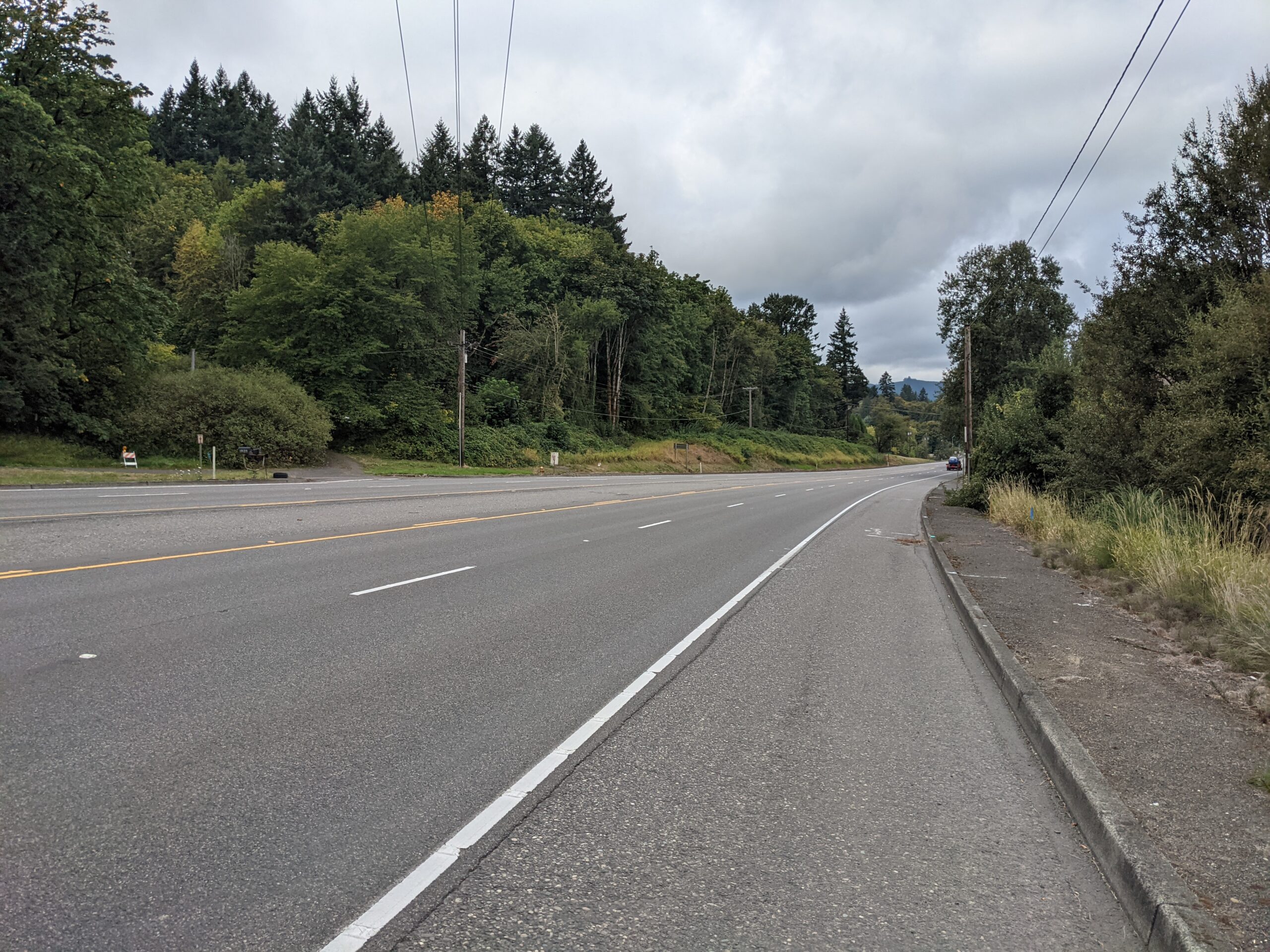


I stayed long and low on my bike for this section of the ride. Look to the right for beautiful views but this is in many ways the ride to the ride. There’s no good way to loop through the trails from Portland without spending your time riding with traffic along a highway. Fear not, there’s a drastic changing when you hit Scappoose.
Advertisement

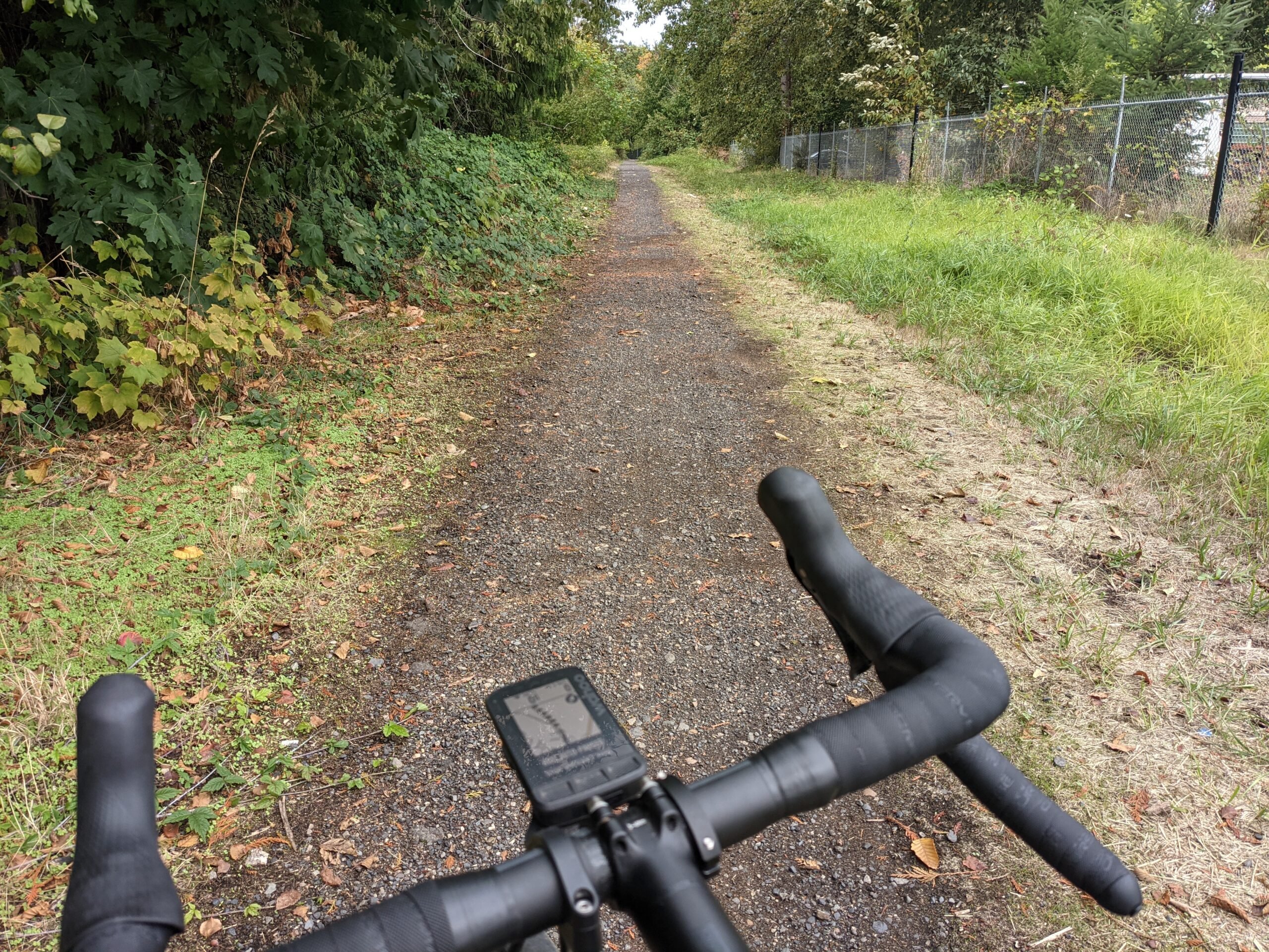
When you make the left across Highway 30 at the Scappoose-Vernonia Highway about 20 miles north of portland look to the right to pick up the Crown Z trail. It’s likely that any GPS head unit will have a hard time distinguishing between the highway and the trail, so keep an eye out. Once you are on the trail, suddenly the feel of the ride changes. My day here was typical for the early fall in this part of the world. It started overcast, but not too cold.
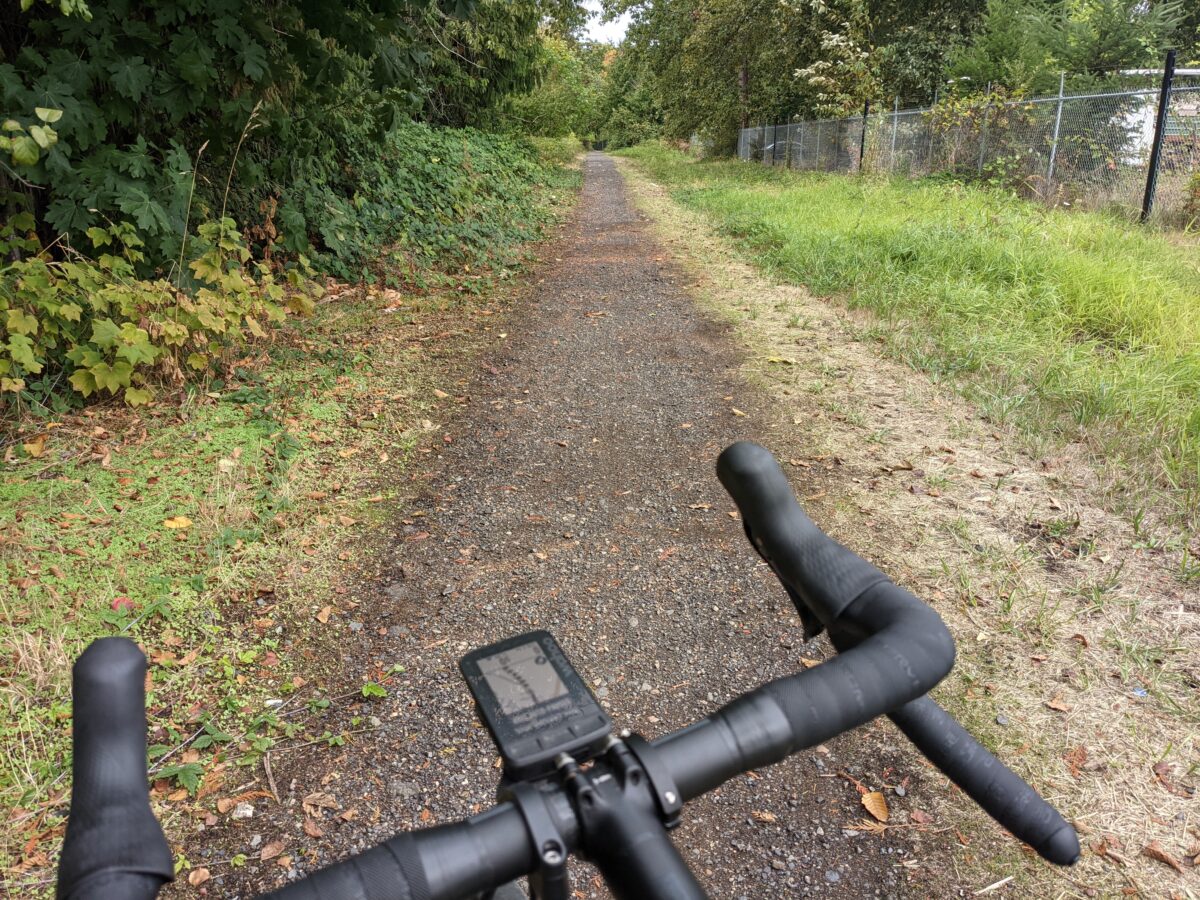
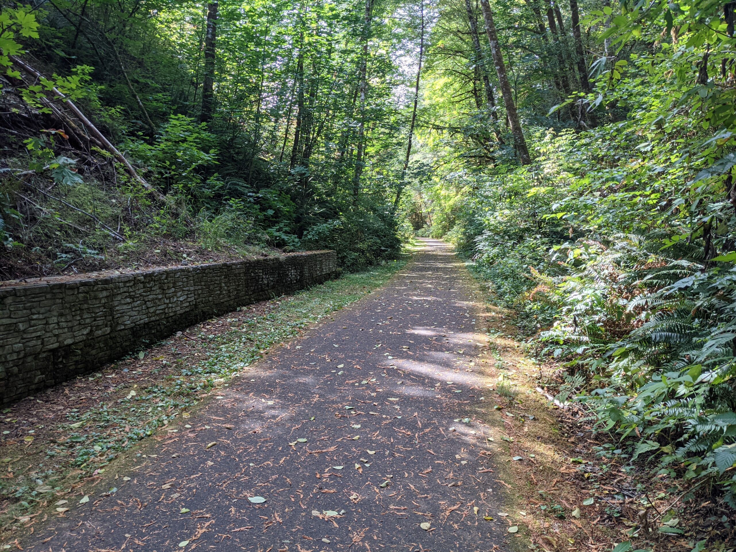
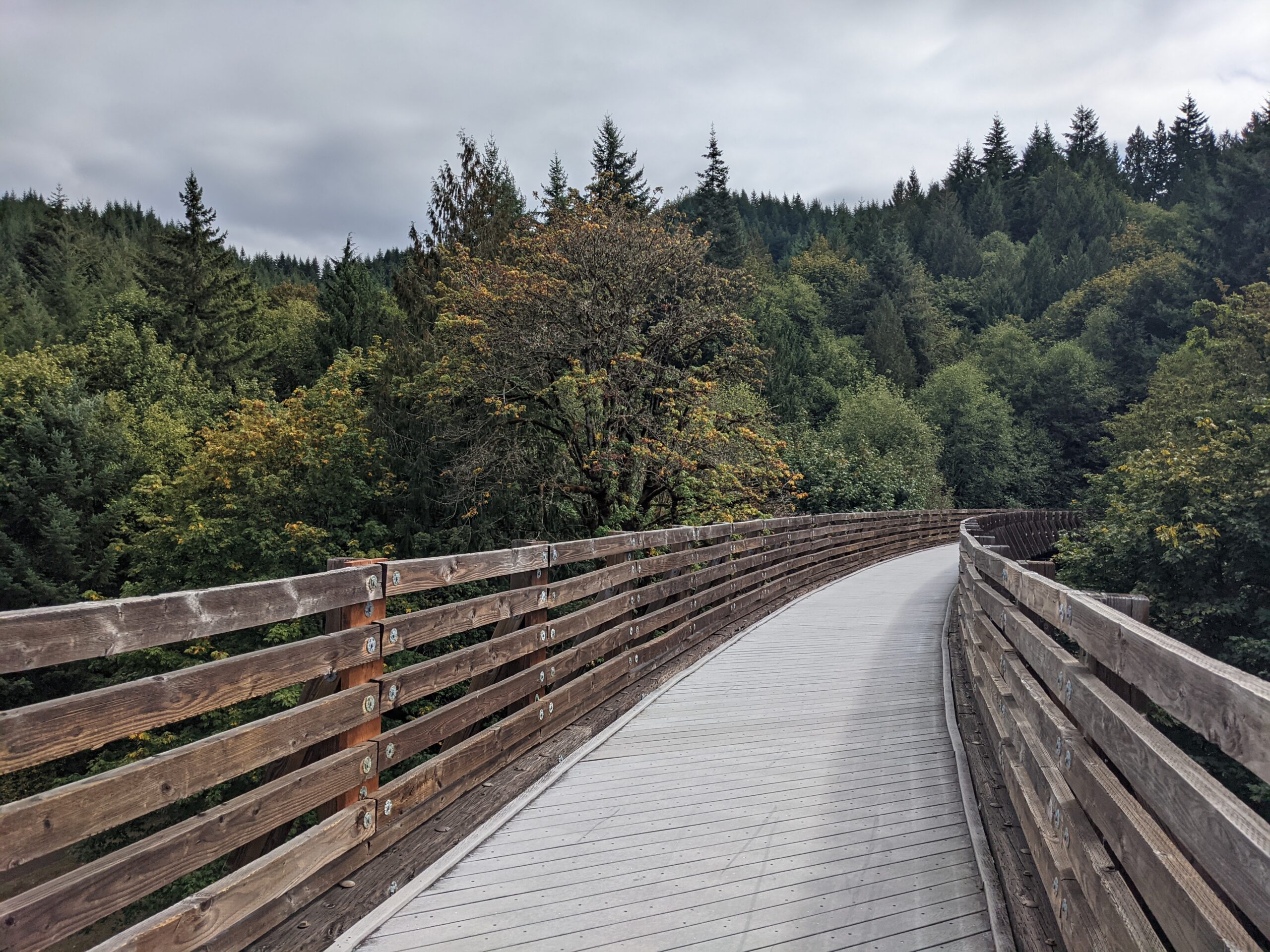
The Crown Z trail is beautiful. There’s less exposed dirt than you’ll find in Forest Park so you don’t get nearly as dirty. There are also fewer large rocks. It feels a lot like many people’s favorite Forest Park climb, Saltzman, and you’ve got 20 miles of this beautiful riding to soak up. The trail parallels the road so you do sometimes catch glimpses through the trees, but traffic is low and everything smells fresh, clean, and green. It feels like everything wonderful about the Pacific Northwest.

There is a fair amount of climbing but most of it isn’t steep. You’re climbing out of the river valley and for the next 12 miles or so it’s generally up. Expect 2-4% gradients until the last mile and half. That last section is around 8% then you get to enjoy a long descent.
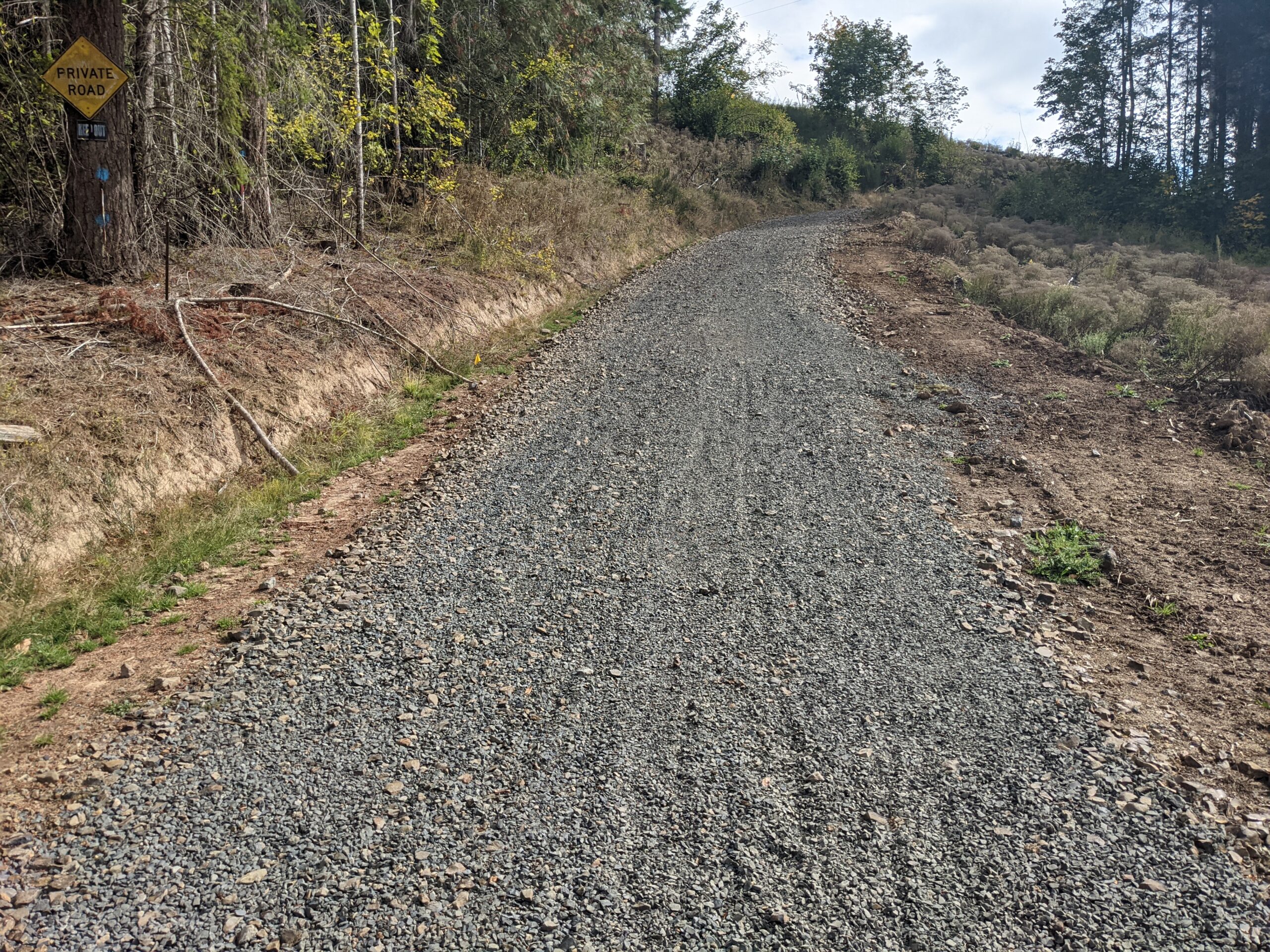
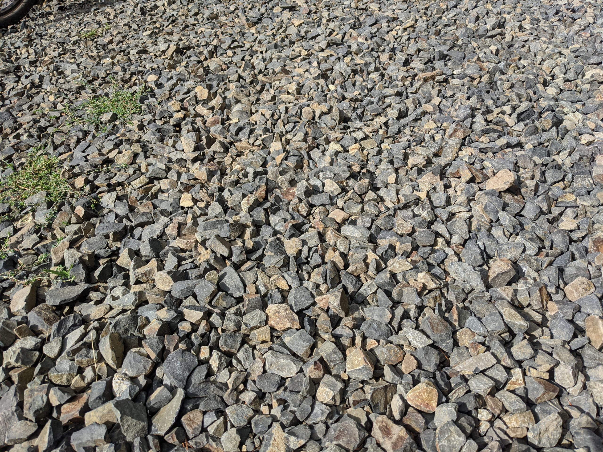
At the top of the climb, you cross the highway and the trail changes. Instead of a beautiful, isolated, trail there are turns that need observation and it feels like shared space. Eventually you’ll cross the highway again and this is where things take another drastic turn. Up until this point the ride would have been fine on a road bike with even 25mm tires. As you cross the highway the surface suddenly becomes sharp, chunky, gravel. You will not want to be on a road bike although I managed on 650x38mm Panaracer tires.
Advertisement

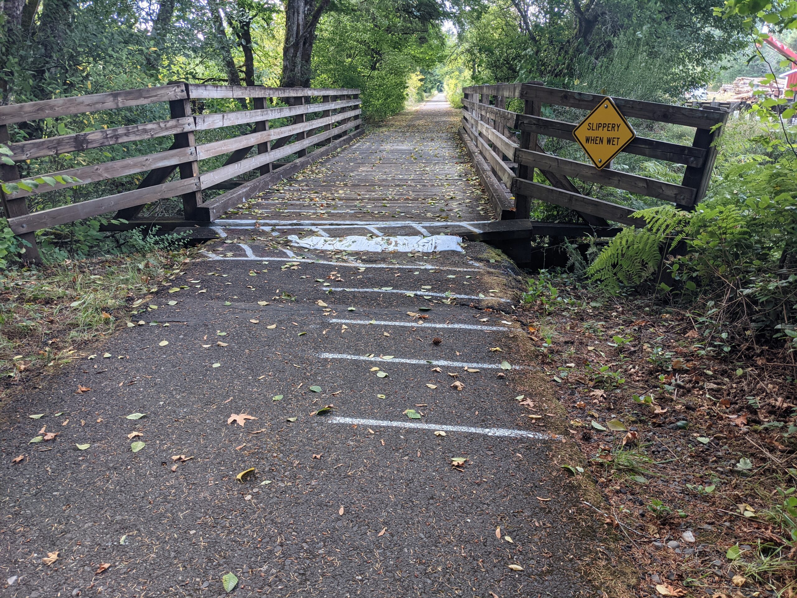
Not only do you find yourself on this new road surface, but it’s a stiff climb. There are pieces as steep as 11% over the next mile and half. Once you start to descend the road surface will improve. The very last section is absurdly steep and is covered the same sharp, loose, chunky gravel. There are those who could ride this on a drop bar bike but given how short it is, I walked it. The three miles you will have just finished are the least pleasant part of the ride and they dictate the equipment choices for all of it. At the bottom you’ll find one of the new signs.
That sign marks the end of the Crown Z trail and the beginning of the long descent back to Banks. From here it’s a short ride through town to connect with the Banks Vernonia trail. Then you can say goodbye to auto traffic again. Grab some lunch in Vernonia if that’s your style!
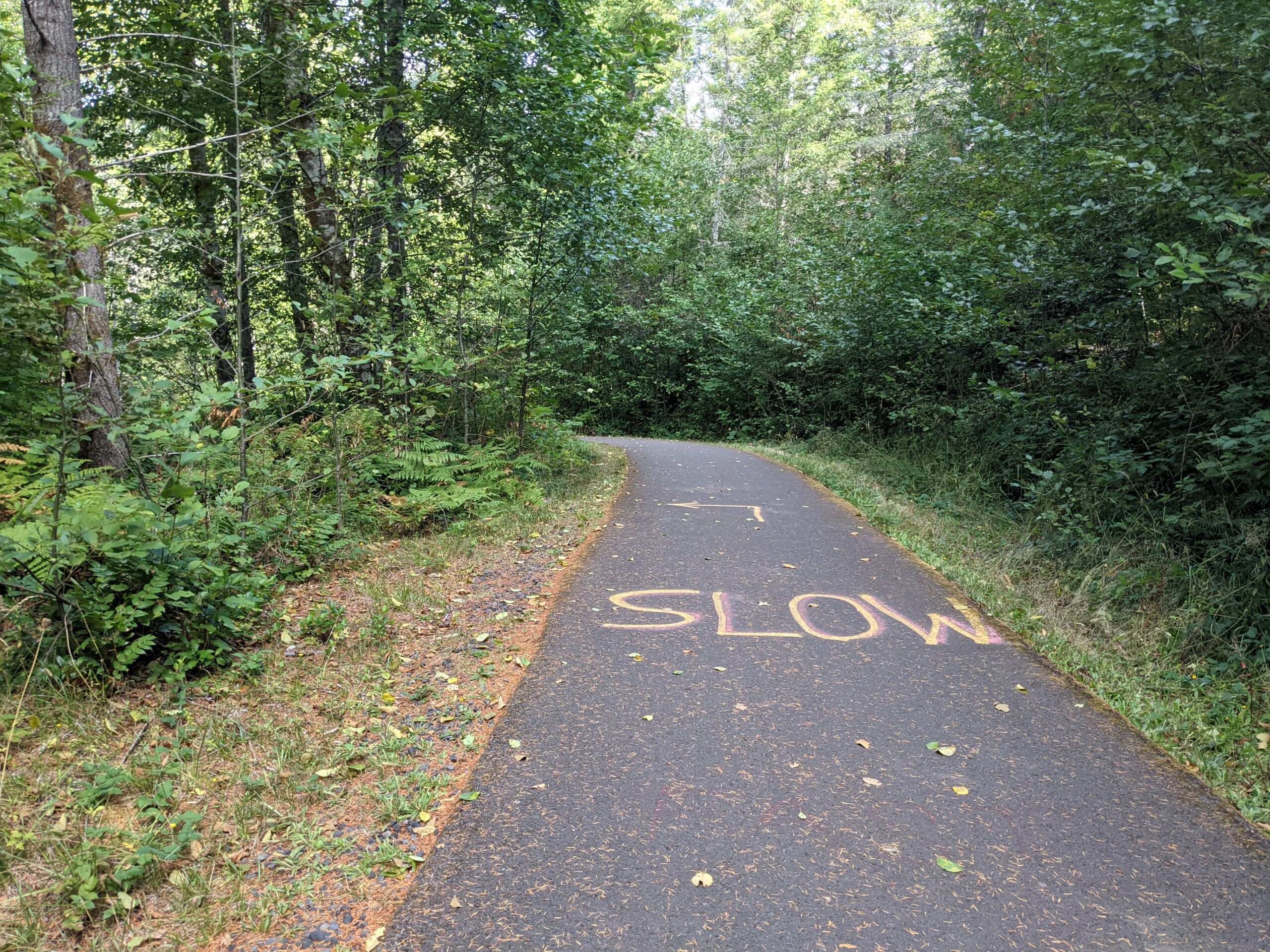
The Banks Vernonia trail is a beautiful trail of a different kind. Still very Pacific Northwest but just a little different flavor. As you leave Vernonia you do spend awhile on a gentle climb. Pay attention to the signs warning about sharp turns. There are some very sharp turns and if you are coming the other direction watch for the helpful paint on the trail surface.
You also need to stay attentive throughout the Banks Vernonia trail. The surface is not in good shape and there is always a root or crack looming that could catch a tire. I actually passed a woman lying on the ground having just crashed in exactly the way I feared. I took a moment to make sure her bike was useable but left her and her partner to decide if she had a broken collarbone to go along with what was certainly a head injury. Be careful.
Once you get to Banks you’ll find yourself in wide open farmland. There’s not really a wrong turn that’s possible as everything will get you where you want to go. Follow my route if you’d like but I did encounter road construction. After turning off of Helvetia onto Phillips Road there was a paving project and a blocked road. Not an issue with a gravel bike on a weekend but worth mentioning.
The only decisions you’ll need to make in this part of the ride is which road to take across Highway 26, and then how to ride up-and-over the ridge of Forest Park. I used the RideWithGPS heatmap function and ended up taking Old Cornelius Pass Road to Skyline before descending Newberry and making my way into town.
The joy of this route really comes down to the beauty of the two trails. There’s not a perfect way to loop it all but it’s not impossible. The most unfortunate piece is the 3 miles of chunky gravel just before Vernonia and I took some pictures to help you plan for that section. Let me know if you think you’ve got a better route to connect to the trails. Enjoy the ride!
— Josh Ross, @josh_ross on Twitter
— Get our headlines delivered to your inbox.
— Support this independent community media outlet with a one-time contribution or monthly subscription.