
At long last, two of Oregon’s best cycling trails have been connected. Earlier this month, crews and volunteers from the City of Vernonia and Columbia County quietly filled the final gap that remained between the end of the Crown Z Trail (a.k.a. Crown Zellerbach Trail or just “the CZ”) and the start of the Banks-Vernonia Trail.
It’s not the 100% carfree alignment we still pine for, but it’s the next best thing…

Thanks to new investments and installations of signs and trailhead facilities, it is now easy to ride a bike on a mixed-terrain route through lush farms and forests for 45.2 miles between the banks of Multnomah Channel east of Scappoose, to the farming community of Banks in Washington County.
Along the entire route, only 0.7 miles are shared with drivers on Highway 47 — and it’s a stretch in a residential area that has very wide shoulders and a relatively low speed limit.
When you combine this progress with recent momentum on the Salmonberry Trail the picture of a Columbia River-to-Oregon Coast Range bike route comes into focus.
Crown Z Trail volunteer and advocacy leader Dale Latham was at the ribbon-cutting one year ago that marked the completion of the Crown Z. Since then he says volunteers and city staff from Vernonia and Columbia County have taken several key steps:
Advertisement


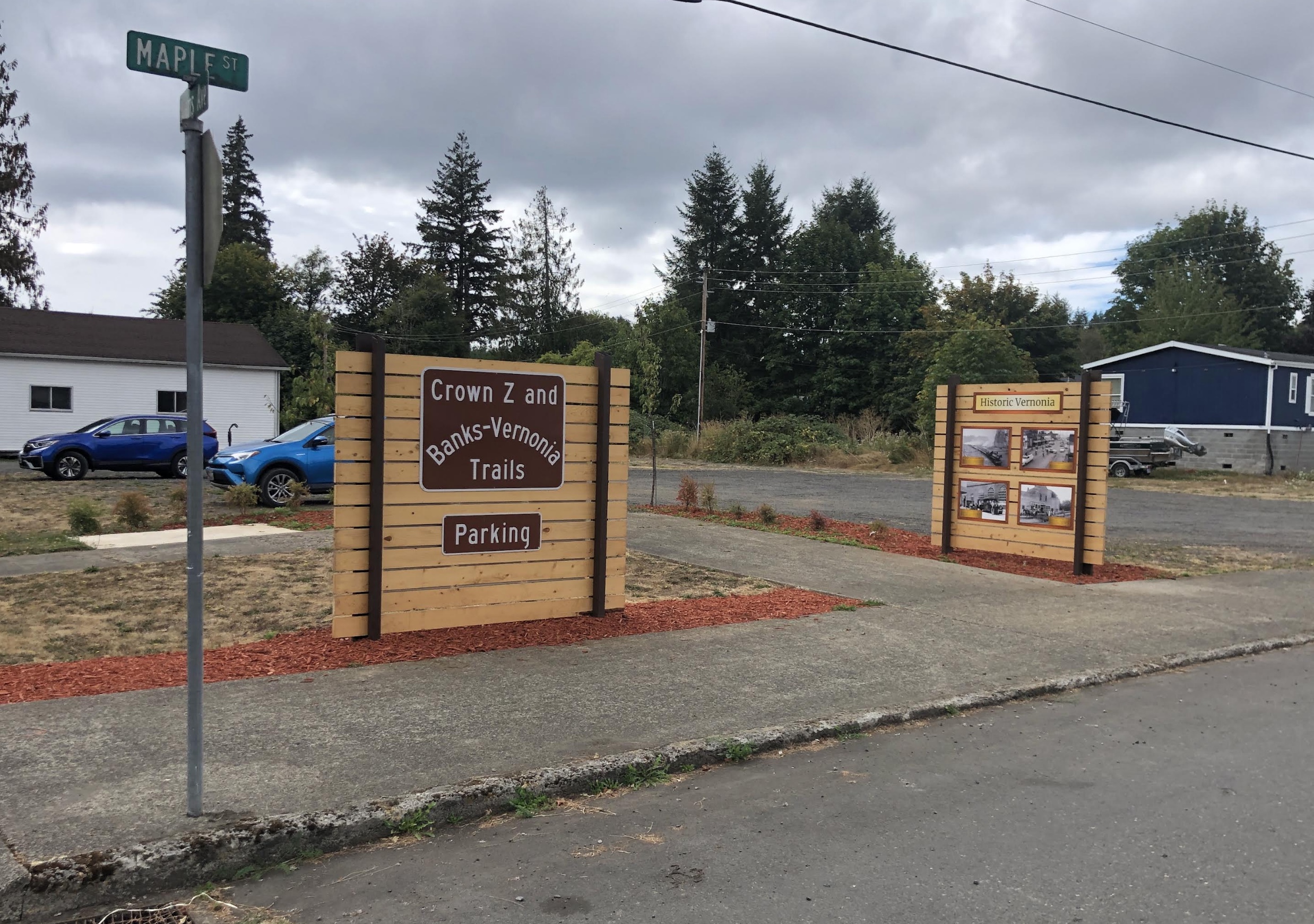
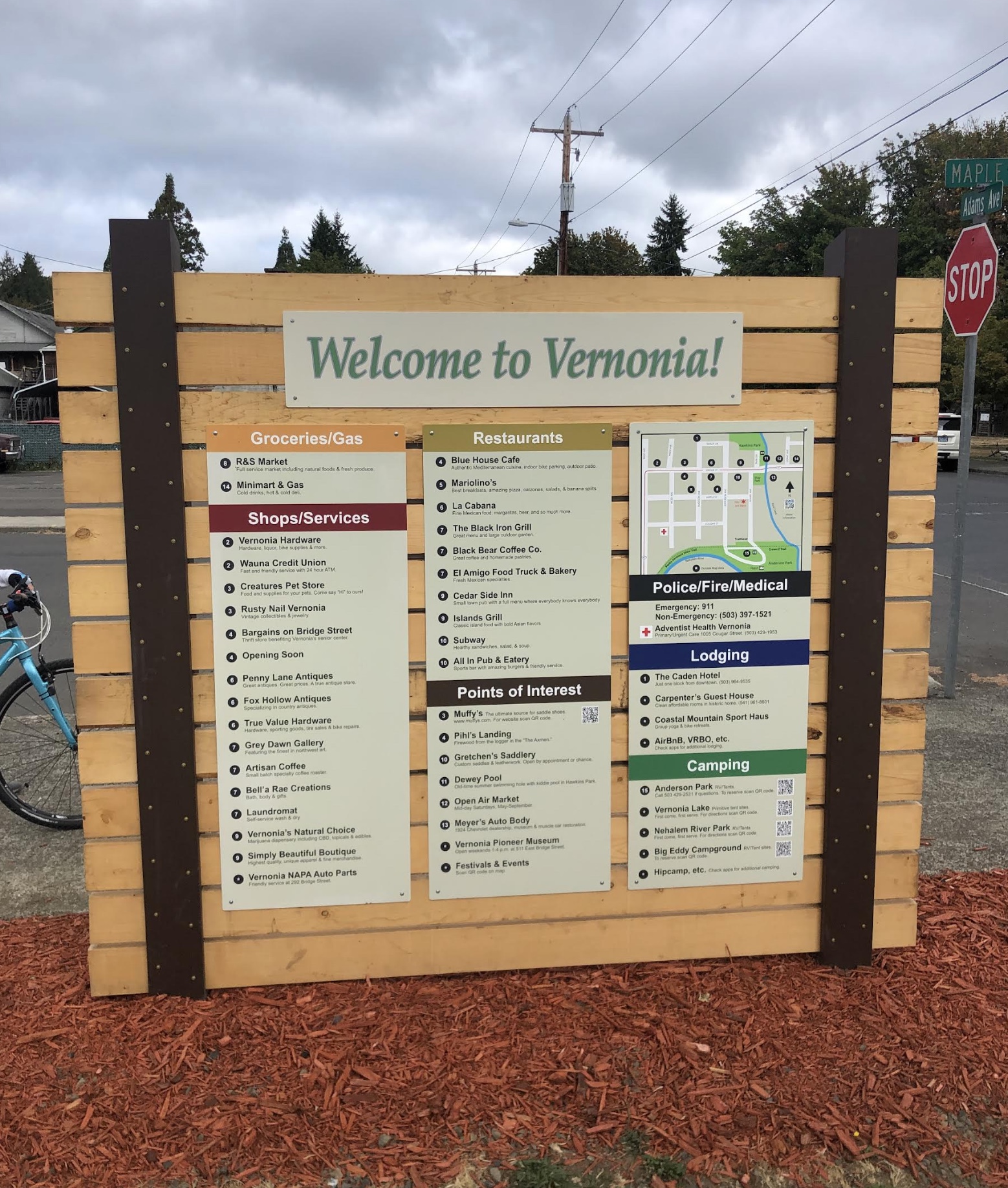
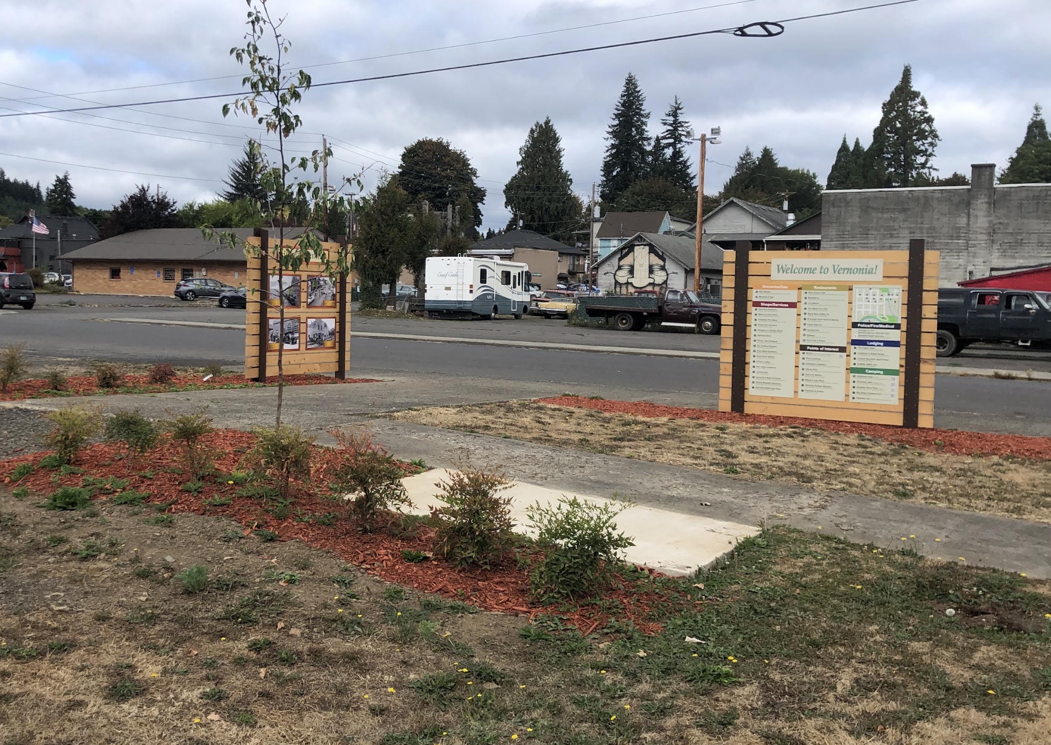
A new parking area and trailhead has been established in downtown Vernonia just a block from where the trail goes through Anderson Park (a great place to camp by the way) at the corner of Adams and Maple. The trailhead includes maps, an interpretive exhibit, and street signs to help orient trail users. There are also signs to direct drivers from Highway 47.
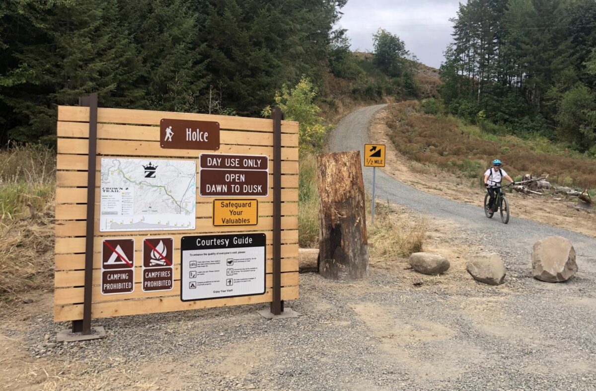
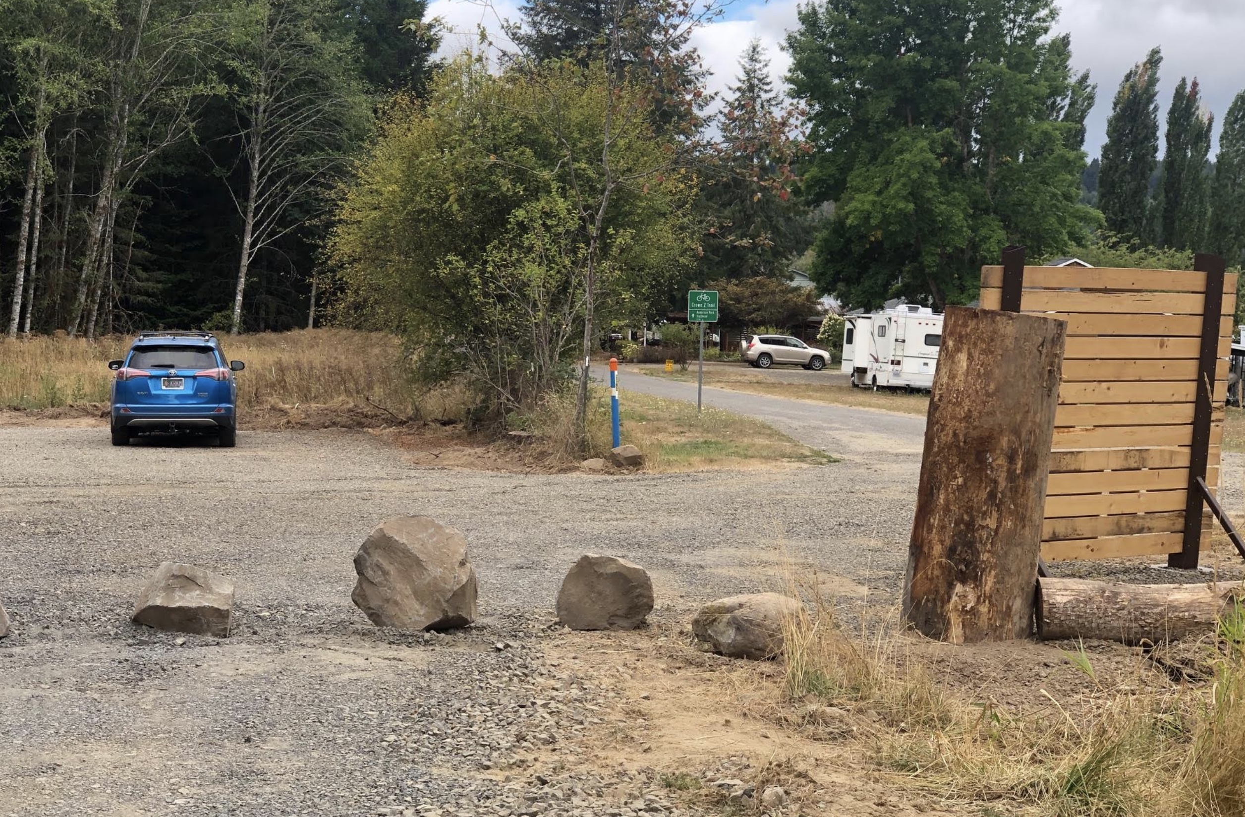
— A new parking area and new signage has also been installed at the Holce Trailhead, which is the western end of the Crown Z at the end of E. Knott Street.
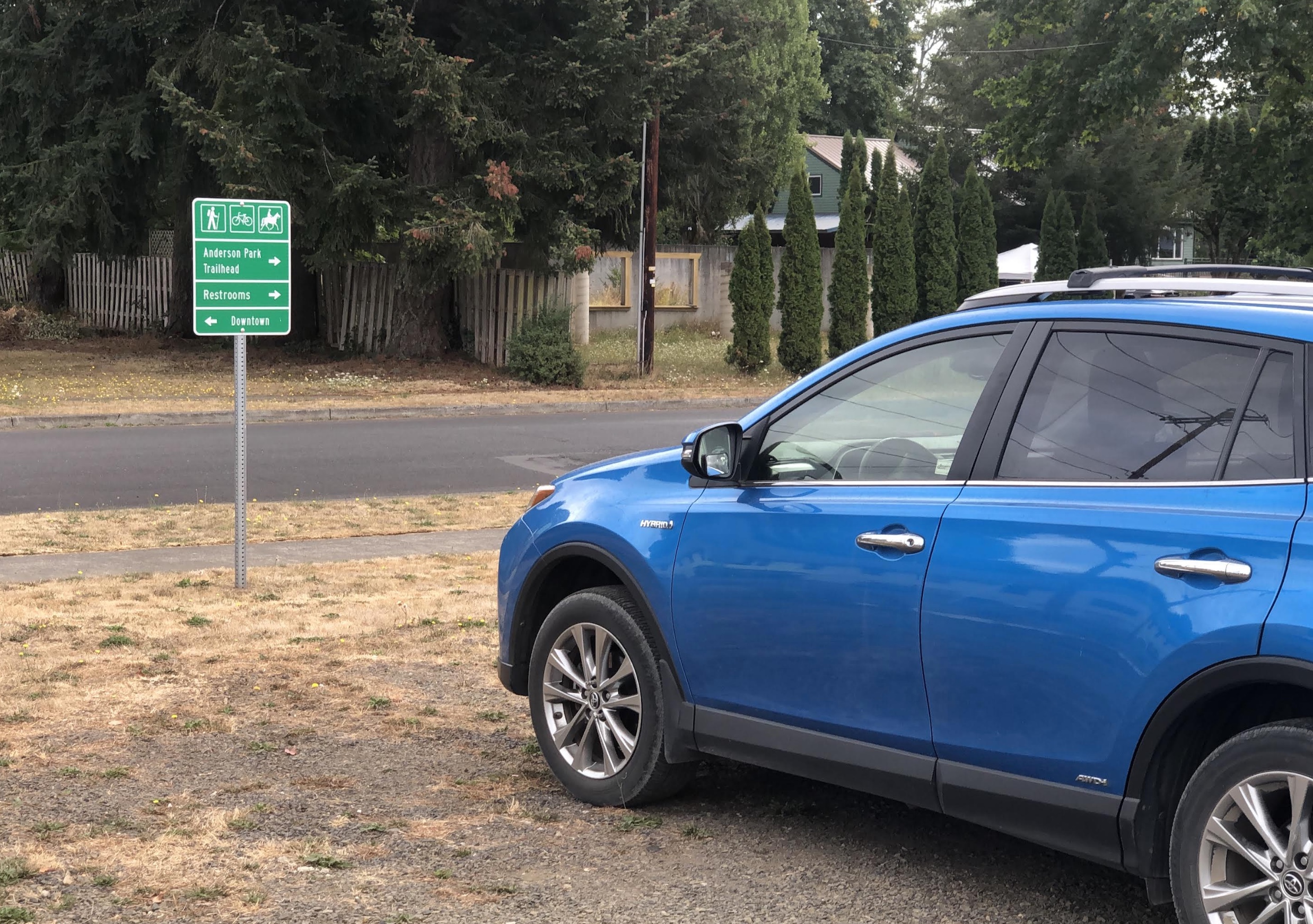
— To help people find their way on the 1.5 or so miles from the Holce Trailhead to the start of the Banks-Vernonia (at Vernonia Lake), and to make drivers aware of the presence of trail users, the City of Vernonia has installed about a dozen road signs.
— A revamped website at CrownZTrail.com includes a new trail map, trail guide, tons of photos, and an extensive history of the trail.
The investments of time and money it took to connect these two trails was made possible with funding from the Columbia Economic Team, Columbia County, the City of Vernonia and Travel Oregon. Installation was done by Columbia County Parks staff. The Crown Z Trail Citizens Advisory Committee and many volunteers provided countless hours of work to create the signs. The Columbia County Museum Association, the Vernonia Pioneer Museum, and several volunteers also contributed significant time to design signs for the project.
A few notes of caution before you head out: Cell coverage is spotty to non-existent on most of the Crown Z, so make sure to download a PDF of the official Crown Z Trail brochure or download the GPS to your device; and note that the new section between Wilark and Holce trailheads (2.5 miles or so) has some sections of gravel that hasn’t been packed-down much yet so expect loose conditions and a few very steep sections where walking might be a good idea.
Fall is an amazing time to ride this route, so fire up your map, pump up your tires, pack a few snacks and have at it!

— Jonathan Maus: (503) 706-8804, @jonathan_maus on Twitter and jonathan@bikeportland.org
— Get our headlines delivered to your inbox.
— Support this independent community media outlet with a one-time contribution or monthly subscription.