(Photo: Lisa Caballero)
The gentle curves the trolley required to make its turn encourage the sloppy lefts and cross-intersection diagonals that plague both intersections today.
Story by Lisa Caballero.
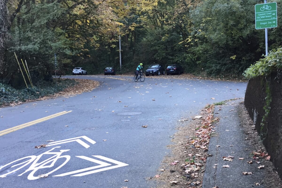
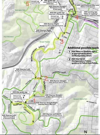
One of Portland’s loveliest unofficial neighborhood greenways is set to receive new pavement markings and wayfinding signs. Upper Southwest Montgomery Drive is the gentler, calmer alternative to SW Vista Ave for riders en route to the legendary Fairmount Loop and Council Crest.
Idyllic as it is, first time riders of this route abruptly find themselves two-thirds of the way up the hill, facing busy SW Patton Rd with no idea how to proceed. When the rider does manage to find SW Greenway Ave, they have to navigate a tricky intersection with well-known traffic control problems. One neighbor described it as “the intersection where everyone thinks they have the right-of-way.”
Advertisement

(Source: PBOT)
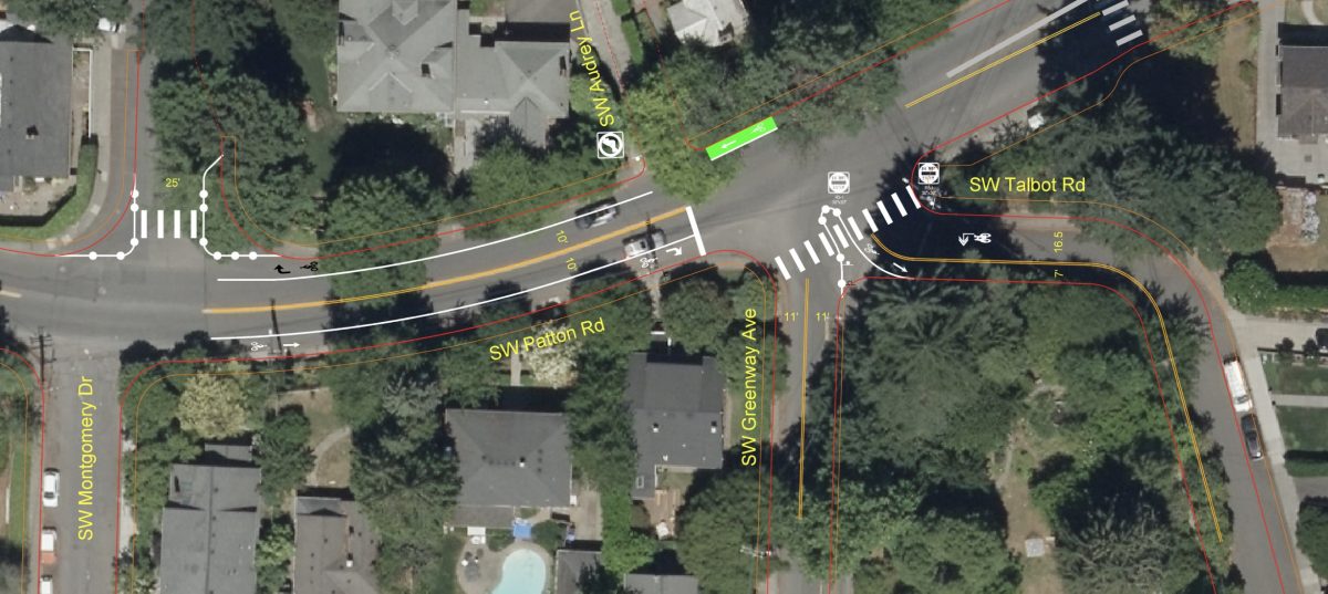
The difficulties with the Patton-Greenway-Talbot intersection (and Vista-Patton-Broadway directly east of it) arise from having been built over the track of the old Vista trolley line to Council Crest. The final leg of the trolley line jogged west off of Vista onto what is now SW Greenway Ave. The gentle curves the trolley required to make its turn encourage the sloppy lefts and cross-intersection diagonals that plague both intersections today, as well as the poor sight lines.

(Source: PBOT)
Portland Bureau of Transportation Neighborhood Greenway Program Manager Scott Cohen realized that by combining two projects from the Southwest in Motion (SWIM) plan — the Montgomery Wayfinding project and a Safe Routes to School-identified crossing enhancement at Greenway Ave — he could arrive at a better intersection design.
The project attempts to rationalize the intersection. In other words, it coaxes its irregular shape into more of a standard box. This improves sight lines for all intersection users and makes turning behaviors more predictable. Some of the changes are subtle; such as the extension of the eastern Patton Rd centerline further into the intersection, and the relocation of the northbound Greenway stop sign to the new zebra crossing. Both serve to tighten the intersection box which should make it easier for bicycle users riding north on Talbot or Greenway to make their presence felt at Patton.
The project garnered a lot of neighborhood interest. The Southwest Hill Residential League Transportation Committee (corresponding neighborhood association) met on-site with neighbors and packaged all the feedback up for PBOT staff. In response to this input, PBOT made design changes to their original plan. The plan is not yet complete and small changes may still be made, but it’s coming along nicely. Some sharrows and signage have already been installed. More significant striping and hardscape changes (curb extensions, median island) will be done in spring 2021.
This combined project is one of several area bike projects on the SWIM project list aimed at achieving the connected bikeway network described in the Bicycle Plan for 2030. Other projects include improvements to SW Fairmount, SW Hewett and the Talbot-Patton-Humphrey intersection.
— Lisa Caballero has lived in southwest Portland for 20 years. She’s on the Transportation Committee of her neighborhood association, the Southwest Hills Residential League (SWHRL), and she is passionate about improving the active transportation infrastructure in southwest hills.
— Get our headlines delivered to your inbox.
— Support this independent community media outlet with a one-time contribution or monthly subscription.

