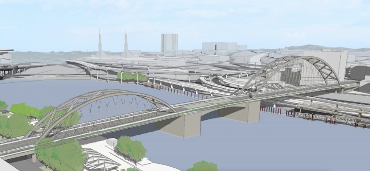
If all goes according to plan Multnomah County will begin work on a new “earthquake ready” Burnside Bridge in 2024. On Monday, the community task force charged with decided what that bridge will look like reached a big milestone by choosing the “long span bridge” alternative.
Here’s more from the County:
The long span bridge alternative (PDF) would replace the existing bridge in the same location and alignment. The long span alternative has the fewest support columns of four alternatives that were studied. Fewer columns avoids costly construction in geotechnical hazard zones near the Willamette River and restricted spaces between lanes of Interstate 5 and the Union Pacific Railroad tracks on the east side.
Task force members cited these reasons for choosing the long span alternative:
— Best for seismic resiliency – locating fewer columns in liquefiable soils gives it the least risk from soil movement during an earthquake
— It is the lowest cost of four build alternatives ($825 million compared to as high as $950 million for the most expensive option)
— The reduced number of columns also benefits Waterfront Park users, crime prevention, and preservation of the Burnside Skatepark
— Additional deck width over the river provides a safer facility for bicyclists, pedestrians and other users
— Reduced impacts to natural resources due to fewer columns in the water.
The long span option was chosen over other alternatives that included a a retrofit of the existing bridge or a new extension ramp onto NE Couch that would have replaced the existing curve. The final design isn’t decided yet (that process begins this fall).
Advertisement

“I’m very surprised to not see bus-only lanes in both directions while we give four lanes to cars.”
— Catie Gould, PBOT BAC member in a September 2019 meeting
Also this week, the task force decided to not build a temporary bridge during the construction phase. That bridge would have cost $90 million and task force members felt that the minimal travel time savings the temporary bridge would provide did not justify its cost, additional in-water impacts, and the extra two years of construction it would require.
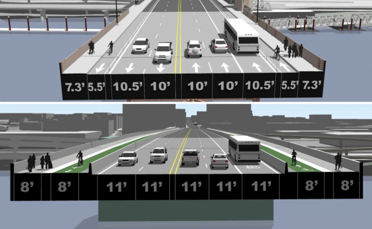
According to potential cross-sections provided the County, the new bridge will come with 8-foot wide protected bike lanes, that’s 2.5 feet wider than the current bikeway. The space for driving would also increase from five lanes and 51 feet today to five lanes and 55 feet on the new bridge.
When County staff presented their plans to the PBOT Bicycle Advisory Committee in September 2019, some committee members were skeptical about the need for so much driving space. Catie Gould said, “Why would we expand the auto lanes? I’m very surprised to not see bus-only lanes in both directions while we give four lanes to cars.” And David Stein said, “This will be the bridge we’re stuck with for the next 96 yrs. 8 feet in each direction [for bike riders] is not going to be enough… I don’t understand given the Climate Action Plan that’s in place why we’re going to dedicate 75% of our space to private automobiles.”
And committee member (and Portland mayoral candidate) Sarah Iannarone pushed County staff to consider an alternative that doesn’t assume dominance by car and truck users. “I want people to see a car-light alternative to show the savings we would get by not having to have car lanes… I think there are a lot of ways to do this project if we don’t privilege the automobile.”
The next opportunity for public input will be an online open house and survey to be released in August. Construction is expected to begin in 2024 and last about four-and-a-half years.
— Jonathan Maus: (503) 706-8804, @jonathan_maus on Twitter and jonathan@bikeportland.org
— Get our headlines delivered to your inbox.
— Support this independent community media outlet with a one-time contribution or monthly subscription.

