(Photo: Jonathan Maus/BikePortland)
With Metro laying groundwork on two major funding initiatives, advocates with the 40-Mile Loop say the time is now to make a substantial investment in the paths, roads, and trails that get people to the Columbia Slough Watershed.
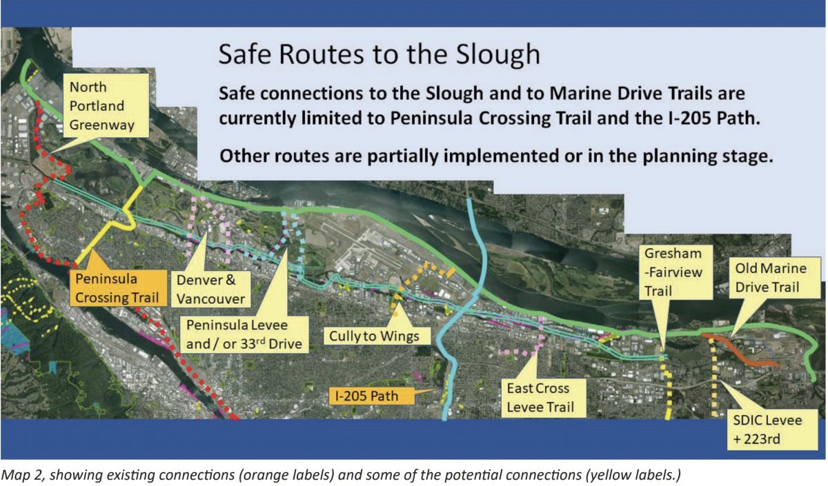
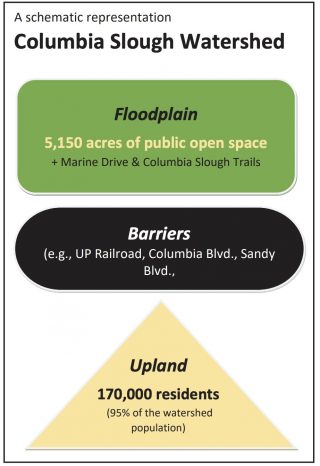
Retired Portland Parks & Recreation manager Jim Sjulin is shopping around a concept known as Safe Routes to the Slough. According to his five-page case statement (PDF) there are 27 parks, open spaces, and natural area properties in the 5,200 acres that make up the Columbia River Flood Plain — between Kelley Point Park at the tip of St. Johns to the Sandy River Delta near Troutdale.
The problem is, 95 percent of the 180,000 people who live in adjacent neighborhoods are effectively cut off from biking and walking to these areas due to a lack of infrastructure and/or the presence of dangerous roads and highways.

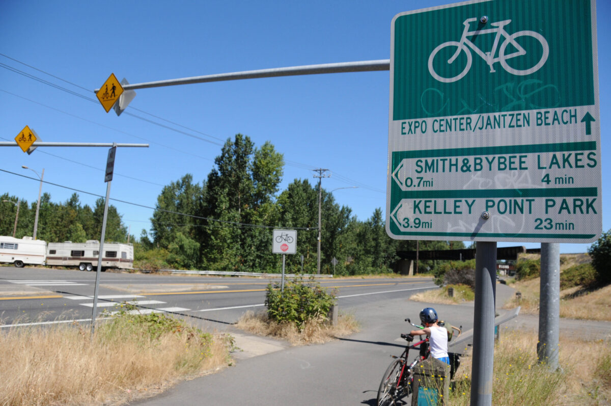
Think of trying to ride a bicycle to Kelley Point Park, Whitaker Ponds, or the Sandy River Delta. Now think of whether or not you’d do that with an eight-year-old or an eighty-year-old. Probably not, due to bikeway gaps and having to deal with major crossings like Columbia Blvd, Sandy Blvd, Airport Way, and so on.
Advertisement
“Over the 20-mile length of the watershed,” reads the case statement, “now only two non-motorized access routes connecting upland residential areas to natural areas and parks in the floodplain: The Peninsula Crossing Trail and the I-205 Bike Path.”

The timing is good for 40-Mile Loop to present this concept because Metro is about to put a renewal of their parks and nature bond on the ballot this year. And next year, Metro will present the region with a major transportation infrastructure investment bond.
Sjulin says while most people think of trails, paths, bike lanes and roads as one integrated system for getting them from A-to-B, agencies are siloed into “recreation” and “transportation” projects. He sees Safe Routes to the Slough as an opportunity to combine these needs into one package.
For their part, Metro — who convinced voters to pass natural area bond measures in 1995 and 2006 and local-option levies in 2013 and 2016 — says they plan to spend less on acquiring properties this time around, and more on getting people to existing properties. That’s a perfect fit for the 40-Mile Loop’s idea. Another way this project fits with Metro’s goals is that the area surrounding the Columbia Slough watershed is home to some of the lowest-income and most racially diverse census tracts in the region.
Borrowing from language used in previous Metro bond measures, the 40-Mile Loop recommends making the Columbia Slough Watershed an official “target area” for investment.
If you think this is an effort worth supporting, consider emailing your thoughts to Metro via metrocouncil@oregonmetro.gov.
— Jonathan Maus: (503) 706-8804, @jonathan_maus on Twitter and jonathan@bikeportland.org
Never miss a story. Sign-up for the daily BP Headlines email.
BikePortland needs your support.

