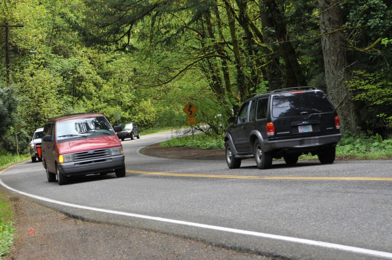
(Photo: J. Maus/BikePortland)
Everyone’s buzzing about the opportunity to tell Multnomah County what to include in their 20-year Roads Capital Improvement Plan (RCIP). OK, maybe it’s just all the activists in my feeds and inbox. Either way, they know a good thing when they see it.
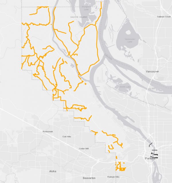
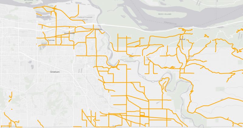
![]() The County is a sleeper agency. Even though they manage only about 1/8th the road mileage of the City of Portland, the County’s roads happen to be some very important bike routes. And as an agency, they’re much more accessible than their larger cousins at the city, region, or state level. For those reasons alone, the RCIP is ripe for input and we should embrace the opportunity to influence it.
The County is a sleeper agency. Even though they manage only about 1/8th the road mileage of the City of Portland, the County’s roads happen to be some very important bike routes. And as an agency, they’re much more accessible than their larger cousins at the city, region, or state level. For those reasons alone, the RCIP is ripe for input and we should embrace the opportunity to influence it.
So: What does the RCIP include? It doesn’t include the County’s bridges over the Willamette River; but it does include some of the most popular streets for cycling on the west side. Ever ride up NW Cornell and Thompson to Skyline? That’s the County. Ever climb NW Newberry or McNamee? County. And the beloved Sauvie Island loop? Yep, that’s their jam too. They also own lots of the great backroads surrounding Corbett and Troutdale near the Sandy River.
Here’s a detailed map of the roads included in the RCIP.
Why is this on the BikePortland Front Page? Because the County is putting together a project list and we are their eyes and ears as to how they can make these roads better for bicycling. “This is the first time in decades that the County is really digging in to understand its roads and make an in-depth plan,” states the County website. “Many more people live here now than 10 or 20 years ago, and more get around without a car.”
Advertisement

The type of projects that the County says could be included in the RCIP are things like, “widening shoulders for people walking and biking”, intersection safety projects, or new multi-use paths.
Personally, I’m going to request that the County designate sections of Skyline Blvd (between Thompson and Old Cornelius Pass) as a “Bicycle Safety Corridor”. As such, I want them to add: more signage calling out the designation, paved bicycle turnouts every few miles, and I’ll even mention my hope for a new policy of doubling traffic fines inside the corridor boundary.
Jessica Engelman, former Chair of Bike Loud PDX said she asked the County to include: separated biking and walking paths from the Springwater/Blue Line MAX Station to Oxbow, Dodge, and Milo McIver Parks; and a separated bike/walk loop around Sauvie Island.
Jessica also had these positive things to say about the online open house itself: “I’m really impressed with whomever at Multnomah County composed this survey, since they already ask a lot of questions about active transportation and safety priorities; it implies the county is poised to do some great things with the right public support. This is a vision-setting survey, so be creative and bold!”
What are your ideas? Please let them know or you lose your right to complain later.
If you’d like to learn more and talk to County officials about the RCIP, swing into the offline open house coming up at Skyline Elementary School on Tuesday (4/10) 6:30 pm.
The County will finalize the project list by end of this year. Check the RCIP fact sheet for more info. And don’t forget to take the online open house before April 15th.
— Jonathan Maus: (503) 706-8804, @jonathan_maus on Twitter and jonathan@bikeportland.org
Never miss a story. Sign-up for the daily BP Headlines email.
BikePortland needs your support.