
Bikeway gaps really get on Portlanders’ nerves. That much is clear.
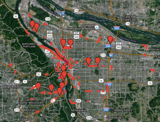
The week after Jonathan and I suggested that people enter their least favorite gaps on a Google Map, the map has 120 items scattered around the Portland area.
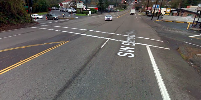
Gaps like this one, at SW 24th and Barbur, where a bike lane dead-ends into a right-turn lane on what is usually a five-lane state highway, and vanishes completely on the other side of the street to make room for a woody hillside:
Advertisement

Or this part of Southeast Woodstock Street, where one of Portland’s best little business districts is apparently incompatible with a bike lane:

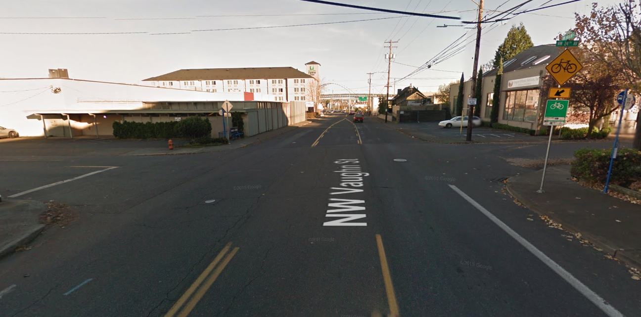
Or this odd block of NW Vaughn, where the bike lane becomes a few sharrows in a left-hand lane rather than connecting to the useful northbound bike lane on 14th.
This is a resource we’ll definitely use to inform future coverage. Maybe it’s even one that city staffers will be able to use, both to make sure their maps are correct — the project was partly inspired, after all, but the fact that the gap where Martin Greenough was killed in December was a straight blue line on the city map — and to find spots where small bits of work could deliver big payoffs.
Thank you for helping us with this project.
— Michael Andersen, (503) 333-7824 – michael@bikeportland.org
BikePortland can’t survive without paid subscribers. Please sign up today.