The first numbers are rolling in from the first comprehensive analysis of the country’s first connected bicycle boulevard network, and they show some clear problem spots.
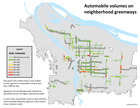
The side-street bikeways are known in Portland as neighborhood greenways to capture their appeal as places to walk, jog, shoot hoops and so on. But the City of Portland’s project shows that six — inner SE Clinton, SE Lincoln near 53rd, NE Tillamook near Grant High School, SE 86th near Powell, inner Northwest Johnson and upper NW 24th — clearly fail national standards for auto counts on bike boulevards.
The national standard, created by Portland and other cities in the form of the NACTO Urban Bikeway Design Guide, says “bicycle boulevards should be designed for motor vehicle volumes under 1,500 vehicles per day, with up to 3,000 vpd allowed in limited sections of a bicycle boulevard corridor.”
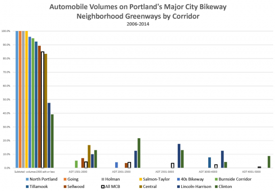
More than 10 percent of counts on the Clinton and Lincoln/Harrison greenways between 2006 and 2014 cross that red line, as well as about eight percent of counts on Tillamook.
Most of the Clinton and Lincoln/Harrison routes don’t even make it into the green zone. Less than half of their motor vehicle counts were below 1,500.
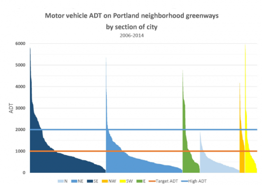
As for Northwest Portland’s small network of greenways, high-traffic stretches on 24th and on Johnson mean that 10 percent of counts in the entire quadrant exceed 3,000.
Portland Bicycle Planning Coordinator Roger Geller presented the findings Monday at the Oregon Active Transportation Summit, noting that the system included points with “higher-than desired traffic volumes pretty much across the board.”
He described inner Southeast and Northwest as “a real problem area” for neighborhood greenways.
The study also found high traffic on much of the 130s neighborhood greenway, which hasn’t yet been built. Geller said those stretches are likely to get bike lanes instead.
Advertisement
The data also showed some clear bright spots. Every single auto count on the North Portland, Going, Holman and Salmon/Taylor greenways measured fewer than 1,500 motor vehicles per day. That’s thanks in some cases to traffic diverters that make the streets impassible to cut-through auto traffic while still allowing local car access.
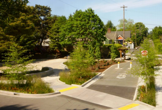
(Photo: City of Portland)
The city’s findings so far echo concerns from advocacy groups BikeLoudPDX and the Bicycle Transportation Alliance that Southeast Clinton Street in particular is a bikeway in name only and is failing to attract the new bike users necessary for the city to meet its auto reduction goals.
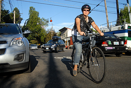
However, Monday’s findings also showed something else: despite those problems, Southeast Clinton Street near 26th Avenue has become as popular a place to bike (at least among the people who currently ride bicycles) as it is to drive.
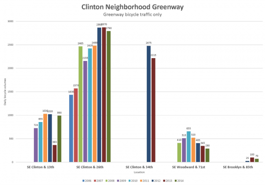
That raises a different question: if many people are making do with the sub-par biking conditions on Clinton, is it more important for the city to spend its limited time, money and political capital expanding the greenway network elsewhere?
“Northwest and East Portland are not too happy right now for our greenways, and we could probably be doing better citywide,” Geller said Monday.
(Photo: M.Andersen/BikePortland)
Another major safety issue isn’t addressed by these figures: traffic speed. Portland Active Transportation Division Manager Margi Bradway, who conceived the neighborhood greenway analysis project last fall, said data about auto speeds on neighborhood greenways will be ready for public release in a few days.
Geller said the full neighborhood greenways report might or might not include recommendations for action to Portland City Council. He wasn’t willing to commit Monday to a release date.
“We will have the report in the future,” Geller said. “It’s really complex and there’s a lot of issues to address.”

