
(Photos: J. Maus/BikePortland)
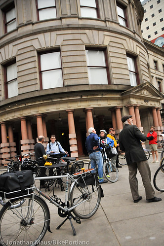
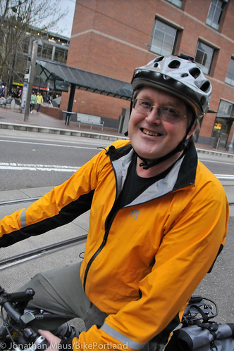
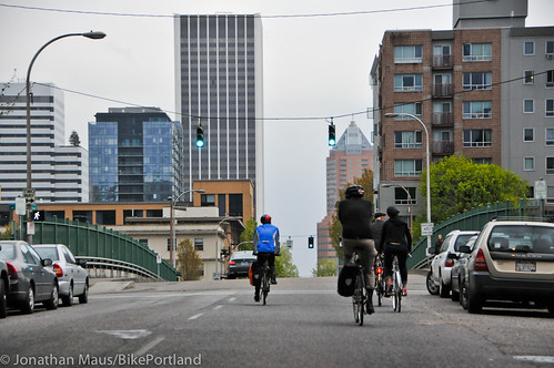
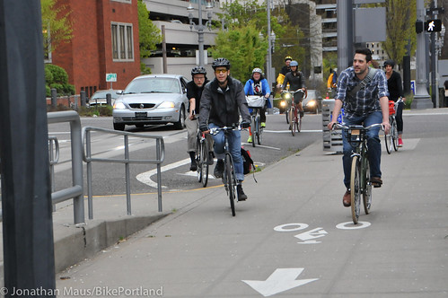
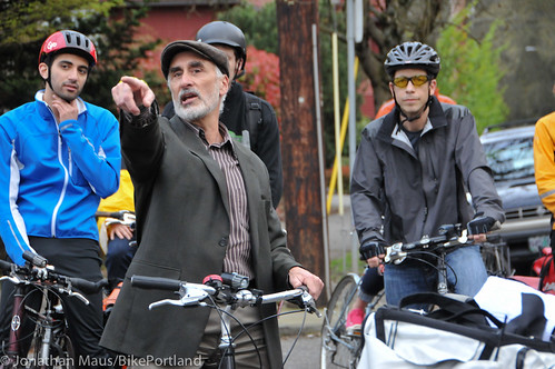
Tuesday night I took part in the annual bike facility tour led by Portland Bureau of Transportation bike coordinator Roger Geller. Once a year, instead of sitting around a table on the second floor of City Hall discussing projects and policies, members of PBOT’s Bicycle Advisory Committee (BAC) get on their bikes. The goal of the tours is to see the good, the bad, and the ugly of current conditions and discuss how things might look in the future.
Past rides have covered northeast Portland, the central city, and east Portland. Tuesday’s ride was focused on southwest Portland.
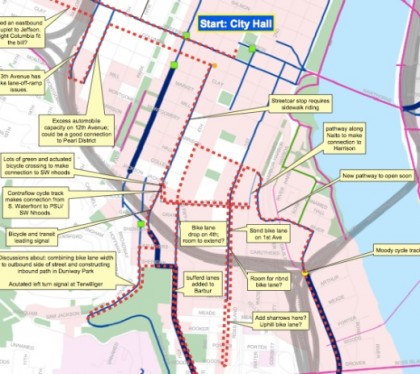
Here’s a map of our route with notes by Geller (PDF here):

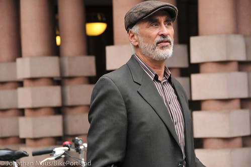
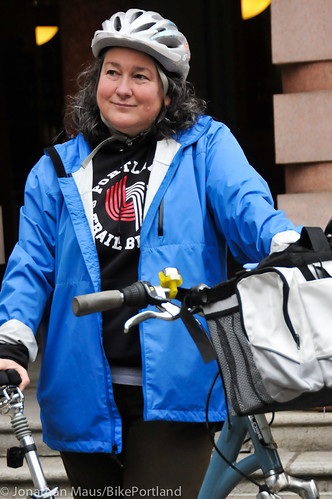
This is the fourth time I’ve followed Geller around on one of these tours. And in some ways, he’s the perfect guide (although I wish he’d slow down a bit!). Mr. Geller has been working on bicycle planning at PBOT since 1994, so he’s been around the block a few times. He’s also the official staff liaison to the BAC, so there’s a certain rapport and respect that’s been established between him and the committee members over the years. Other notables on the ride included: Ian Stude, the director of transportation and parking services at Portland State University; Nick Falbo, urban planner with Alta Planning + Design and SE Foster area neighborhood activist; Joshua Cohen from Fat Pencil Studio; Jeff Owen, the active transportation planner at TriMet; Roger Averbeck, stalwart southwest Portland neighborhood advocate; Carl Larson, advocate with the Bicycle Transportation Alliance; Rob Sadowsky, executive director of the BTA; and Suzanne Veaudry Casaus, chair of the BAC.
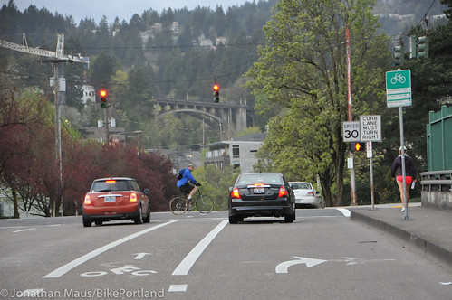
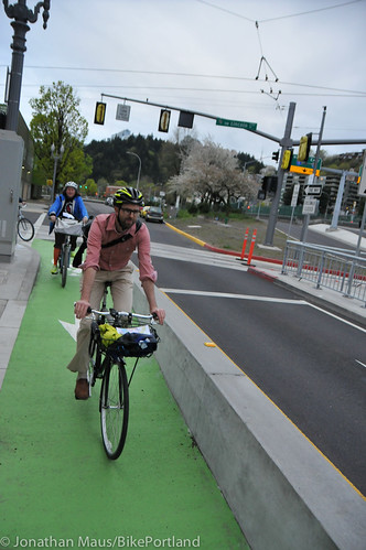
We started the tour in front of City Hall and headed westbound on SW Jefferson. For such a key westbound route, several of us noted how the bike lanes on Jefferson are pretty narrow. As we crossed I-405 the bike lane switches to the left to make room for a right-turn only lane at SW 14th (see below). Geller said there’s a proposal on the table to get rid of that lane, add on-street auto parking and install a bike box.
We also noted the newly painted buffered-bike lanes on SW 14th (I’ll share more about that project soon in a separate post)…
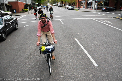
We then made a u-turn and headed eastbound on Columbia. This one-way street would make a nice bikeway couplet with Jefferson; but it currently has no bikeway facility of any kind so we took the lane…
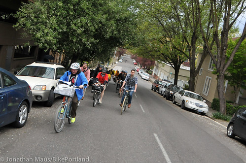
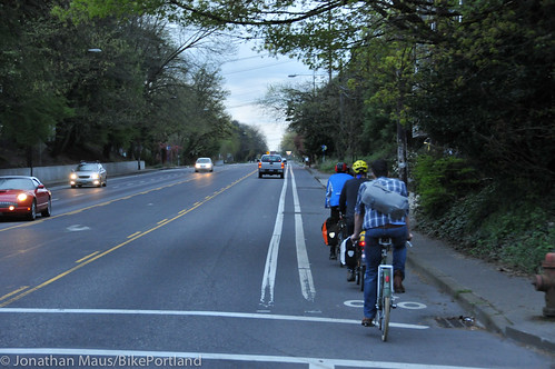
The next facility we sampled was the bike lane on SW 13th. It’s nice to have it, but the presence of freeway on-ramps and abrupt dropping of the bike lane leave something to be desired. From 13th, we explored SW 12th. Similar to Jefferson/Columbia, 13th and 12th could be a great bikeway couplet that would enable good cross-town connections. Despite its meager left-side bike lane, we all rode in the right lane (which is technically illegal!) and noticed how much space is available for a wide — possibly even protected — bike lane. (PBOT had a plan a two years ago that would have done exactly this, but opposition from business interests tanked the project.)
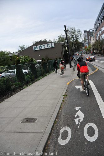
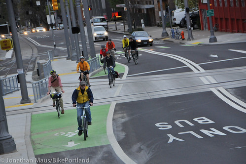
From there we rolled east to SW 5th, where we then headed south toward where the new MAX Orange Line is being constructed. I generally avoid SW 5th because I don’t like sharing the narrow lane with people in cars. But south of Jefferson it has a bike lane. This could make it a good connection to southwest Portland; but the bike lane isn’t as good as it could be. South of Mill, the bike lane is routed onto the sidewalk to avoid a streetcar stop (a stop Geller said was supposed to only be temporary). This is a high volume walking area so putting bikes into the mix isn’t the best solution.
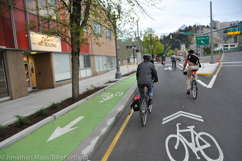
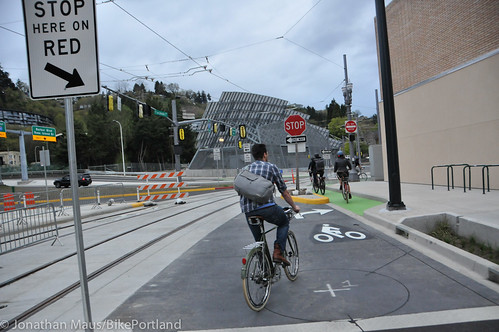
The bike lane begins again and takes you all the way to SW Jackson where TriMet has been busy creating new bike markings and facilities along with the new MAX line. We looked into the bike-related changes along the new MAX line last month; but this was the first time I’d actually seen some of it in person.
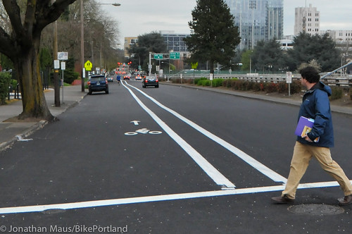
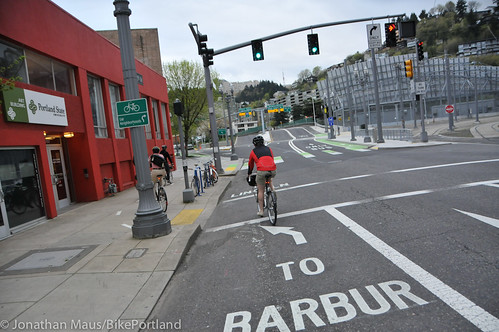
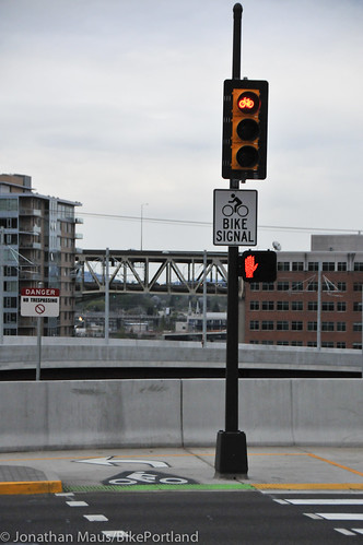
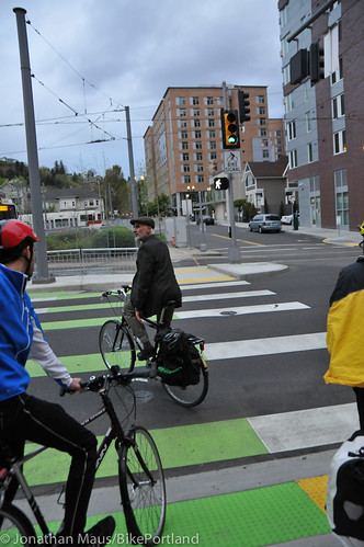
As you approach Jackson on a bike you’re greeted with big pavement markings that say “To Barbur” or “To Lincoln”. To get to Barbur, you’re directed up onto the sidewalk. You then use a new bike-only crosswalk and bike-only signal to cross 5th and connect to the bike lane on the right side of the street.
The bikeways should be simpler and more direct. Geller put it best when he said, “This is a very complicated area. It’s just weird.” That being said, Geller added that while it’s confusing the first time around, people are likely to figure it out. Eventually.
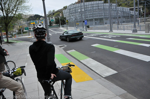
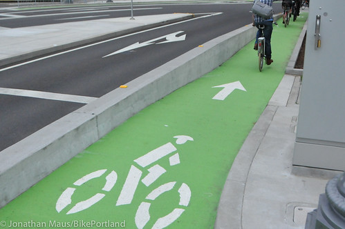
Interesting to note that these new facilities show PBOT’s new standard of using the color yellow for walking and green for bicycling. You can see this in the design of the curb ramps and crosswalk striping below…
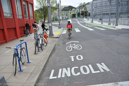
At Jackson, if you continue south on the left side of the street and follow the “To Lincoln” pavement marking, you’re put into a shared lane. You then follow sharrows to head eastbound on Lincoln until you get to Naito.
Just before Naito, we took a right and headed south on SW 1st. This could be a good north-south connection, but it doesn’t connect safely to Barbur and the bike lane drops after SW Arthur. Geller wondered whether this street could use additional bike lanes and/or sharrows.
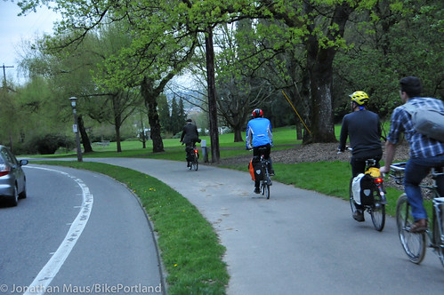
We the made a u-turn and headed back to SW Lincoln. We turned right on Lincoln and came to Naito Parkway, where the new MAX line will continue on a nice, new bridge. Unfortunately bikes won’t. Geller said it would have been a complex engineering task and an additional $5 million “we didn’t have” to include a bikeway on the bridge. So instead, bikes are directed onto a new, 14-foot wide multi-use path along Naito to the east side of Harrison to make the connection to south Waterfront.
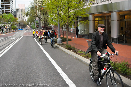
From Naito, we made a u-turn and headed back up Lincoln to try out the new, short section of contra-flow protected bike lane that takes you back to SW Jackson. We then crossed 5th and headed south on Barbur.
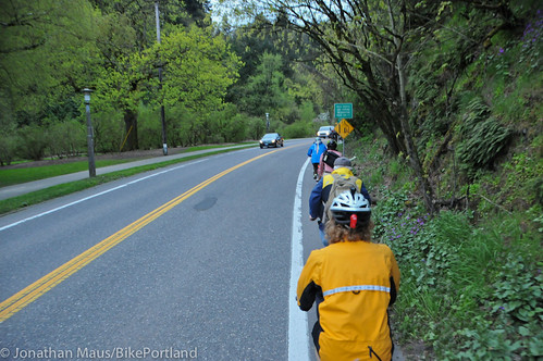
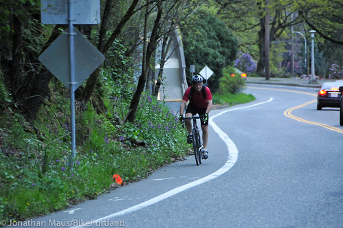
Geller wanted to show us the bike lanes on SW Terwilliger. Currently, they’re quite narrow and Terwilliger is a high-volume road (for both biking and driving). Geller said there are discussions underway to widen the outbound (toward OHSU) bike lane by removing the inbound (toward downtown) lane and replacing it with a wider, separated path in adjacent Duniway Park.
We then rode a ways out on SW Barbur to sample the buffered bike lanes before heading back into downtown. I peeled off at this point, but others continued down into South Waterfront. Before the ride ended, they passed by the soon-to-be opened pathway that will connect the end of the SW Moody cycletrack to Harbor street near Tom McCall Waterfront Park (thus avoiding the zig-zagging through the Riverplace district).
I hope you enjoyed this little tour. I learned a lot, as I usually do when I hang out with Geller and the folks on the BAC. I also realized there are a lot of bikeway issues bubbling up in southwest Portland these days, so stay tuned for more coverage.
CORRECTION: The original version of this story said that bicycle traffic would be directed onto a “sidewalk” at Naito and Lincoln to connect to SE Harrison. That was wrong. TriMet/PBOT have built a new, 14-foot wide path to make the connection into south Waterfront.