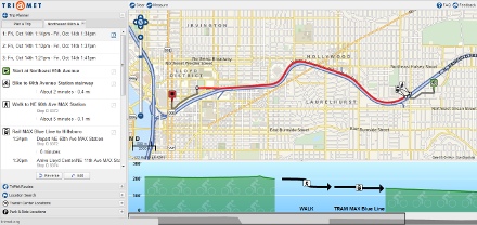
special sneak preview of the tool today.
(Photo: Michael Andersen)
This guest post is by Michael Andersen of Portland Afoot, PDX’s 10-minute newsmagazine and wiki for transit commuters.
Already known internationally for its top-notch website and pioneering use of open data, Portland’s transit agency is about to take another leap toward making low-car life easy and intuitive.
With the launch of its new Regional Trip Planner – that’s the link to the latest version, which will go live on TriMet’s website tomorrow – TriMet will be the first American transit agency whose website uses open-source software to plan trips the way low-car humans do: by figuring out the best combination of bike, train, bus, foot and even, eventually (gasp) automobile.

“Multimodal functionality is a highly requested feature that not even Google can offer,” said Bibiana McHugh, the TriMet data specialist who led TriMet’s three-year effort, at a presentation Friday.
Using the interesting new “bicycle triangle” tool developed by TriMet’s team, you’ll be able to choose a balance among speed, safety and elevation changes, letting you customize the trip to your preferences and energy level.
Carolyn Young, TriMet’s outgoing executive director for marketing and communications, predicted that the new planner “is going to be the envy of the transit industry.”
Last week, Jonathan laid out the basic functions of the new planner, which was funded by two grants from Metro and executed by a team of in-house developers and interns and a contract with Open Plans (a nonprofit you might also know as the publisher of Streetsblog). Some new nuggets we learned Friday:
- The trip planner will soon include bike parking: TriMet bike and rides, city bike corrals and even bike staples.
- It already features Zipcar locations right on the map, and might eventually be able to tell you whether a particular Zipcar is available. To find this, click “carshare” in the lower left of the new map.
- Within the next year to 18 months, partnerships with nearby agencies C-Tran, SMART and CHERRIOTS will let you plan transit and bike trips all the way from Battle Ground, Wash., down to Salem.
- In two years or so, you’ll even be able to build an auto trip to the nearest park-and-ride into your trip plan. TriMet is in talks with the Portland Police Bureau about gathering data on street directionality, speed limits and other necessary details.
- Third-party applications – the sort that could, for example, let you use your mobile phone to calculate the flattest bike route over Alameda Ridge – can’t yet plug into the system. That’s one of the many features that McHugh said will be introduced in the coming months, with new features every couple weeks.
The new trip planner won’t immediately replace TriMet’s familiar, proprietary version; TriMet expects to run them both in parallel for “three to six months,” McHugh said.
In the meantime, McHugh’s eager for input from early users. Have at it.
Portland Afoot’s October issue visited Silicon Valley to reveal seven secrets about the future of carsharing. BikePortland readers can subscribe for $10 a year with discount code BIKEPORTLAND.


