
Someday, you’ll be able to type two addresses into your computer and get customized directions for traveling between them — by bike. The addresses could be in the same city, or across the country. You could choose between different kinds of routes, or find out how to transfer to the bus or train for a leg of the trip.
That’s the dream, anyway. And it’s a dream being chased by a small, but determined band of bike-loving programmers and mapping experts across the country.
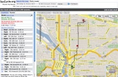
The idea of online bicycle route planning is at least as old as the advent of online driving direction programs such as MapQuest, and Portland became the epicenter of its realization in 2005 with the debut of byCycle.org.

and Donohue in 2006
(Photo © J. Maus)
ByCycle.org is the brainchild of Wyatt Baldwin and Lauren Donohue. The award winning site provides trip directions by bike between any two addresses in Portland, (as well as in Milwaukee, Wisconsin). Users can choose “normal” or “safer” routes.
The byCycle.org project is on hold while its founders earn a living doing other things (Baldwin now works for TriMet). But they have made its code open source and posted a guide for anyone with the zeal and resources to create a similar service in other cities.
The question that first comes to mind when the idea of online bicycle route planning comes up is: What about Google? One man, Peter Smith, has made it his mission to lobby Google to do just this. His blog, Google Maps Bike There, gathers signatures on a petition and tracks news and rumors in the world of online trip planning.
In 2008 Smith reported a rumor that the city of Austin, Texas was working with Google to implement an online bicycle route planner, but there have been no updates since then, and Google keeps extremely close-lipped about any plans it may have.
The challenges to implementing an interactive bike route planning system in one city, much less nationally are huge, according to Aaron Antrim, owner of Trillium Transit Internet Solutions, a company that helps municipalities put their transit data into the format accepted by Google Transit.

in Southeast Portland that he
co-founded in February.
(Photo © Elly Blue)
Antrim, whose passion for all things involving online trip planning data is manifest, sat down with me over a beer one afternoon to explain all the issues. It’s far more complicated than you’d think, he says — even if Google were to decide to take the reins. The software is already out there, but “the real challenge for a bike trip planner is the lack of data.”
For comparison, Antrim says, look at how Google Transit works. Google provides the user interface, but requires participating municipalities to standardize and publish their data, called Google Transit Feed Specification (GTFS).
Transit agency data usually exists in some form that can be formatted to fit with GTFS. What doesn’t yet exist is the equivalent sort of data for bikes — A “GBFS.” This is in part because U.S. cities do not have agencies that deal with bikes in the same way that, for instance, TriMet runs Portland’s transit system.
“The real challenge for a bike trip planner is the lack of data.”
— Aaron Antrim, Trillium Transit Internet Solutions
So bicycle data is managed by individuals, startups, and innovative city agencies, if at all. Just getting the raw material is the first challenge. Only three companies provide street mapping data in the United States — two of them, Tele Atlas and NAVTEQ, have pretty much cornered the market, and are used in driving directions provided by MapQuest and Google, and for the wayfinding devices in newer cars.
The third source, Tiger, is derived from the census and is lower quality, but available for free. This is what Metro uses for their maps, including their bike map — from which byCycle.org’s data is derived.
Tiger’s data is usable, byCycle.org’s Baldwin told me in an interview, but requires a lot of massaging for functionality, as it doesn’t take into account any bike-related infrastructure, or other basic factors such as one-way streets.
“Routing is really complex,” says Baldwin. There are a million little things to think about with the data, and the process of working out the kinks is still ongoing. Today, much of byCycle’s data is edited based on user feedback and the legwork of a friend of Baldwin’s who rides all over Portland with a GPS unit mounted to his bike, mapping new routes and manually entering data in places where the bike-specific infrastructure deviates from auto routes.
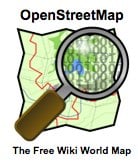
One potential source for bike route data is Open Street Map (OSM), a repository for mapping data that works like a wiki — anyone, from a national transportation agency to individuals with GPS units on the back of their bikes, can add or edit map data for anywhere in the world. OSM also has a special overlay for bike infrastructure and is, Antrim says, where Google engineers generally refer anyone who asks about bike and walk trip planning.
But the data available is only as good as what has been uploaded — and in many places in this country, bike route data simply doesn’t exist. Antrim says he would love to see the League of American Bicyclists make map data a consideration in their Bicycle Friendly Community awards program. In the meantime, OSM is often updated through company-hosted mapping parties (Chris Smith recently wrote in PortlandTransport about attending one of these). OSM also makes software available that shows undocumented streets so that intrepid users can fill in the blanks.
Another problem with bike map data, according to Antrim, is that there is no universal classification for bike routes. The European Union has a standard classification, but in the United States it’s still a free for all. A “bike boulevard” in one city might be called a “bikeway” or a “low traffic street” in another. There are standard classifications, but as Antrim says “there are many variables in what goes into making a facility, so classifying that is a challenge.”
There are a handful of other online bike mapping systems out there. About a year ago Ride the City launched in New York City. Based on Open Street Maps, the program is similar to byCycle.org, with some different features, such as specially marking streets with and without bike lanes, and displaying bike shops along your route.
Most are like the international Bikely.com or Minneapolis’ new Cyclopath.org, invite users to enter their favorite bike routes for others to try. While useful resources, these are not interactive trip planners which will give you customized, door-to-door directions.
One of the most promising avenues for advancement is multi-modal trip planning, producing seamless directions involving transfers between multiple modes. Multi-modal planning had, like byCycle, its watershed moment here in Portland in 2005, when Google Transit, in conjunction with Trimet, introduced the possibility of multi-modal trip planning. And last summer, TriMet unveiled its own feature that incorporates door-to-door directions for trips that involve both walking and transit.
The only interactive, multi-modal online trip planner out there that includes bicycle routing is in Atlanta, Georgia, and called A-Train. It was developed by David Emory, a city planner for Atlanta, who volunteered hundreds of hours of his time developing software that plans trips using combinations of transit, walking, and biking. For bicycling directions, the user decides how much weight he or she wants the program to give the three criteria of safety, elevation, and distance.
A-Train’s software, a package called 5 Points, will eventually be made freely available to other transit agencies and advocates. Last year a TriMet representative told BikePortland that the agency is very interested in Emory’s software and are waiting for it to become open source so that they can take a serious look at integrating it into their own mapping (currently they use an ill-matched variety of different tools).
What may be needed for national mapping, says Baldwin, is for someone to take the lead the way TriMet did in 2005, when data managers spent six months working with Google to create Google Transit. Together they worked out a strong local model that has since been applied to other cities as the gold standard (more on that in a recent Portland Mercury story).
A strong bicycle trip planner that could be applied in municipalities nationwide would likewise need to be fleshed out and troubleshot in one location with a committed local partner. So far, all efforts towards this end have been ahead of their time. But the moment may be arriving.
Bicycles are taking off as a mainstream mode of transportation, and agencies are starting to take notice and begin to tackle infrastructure needs in a structured way.
Google has also begun to take a conspicuous interest in bike infrastructure, using tricycle-mounted cameras to capture bike trails for their Street View feature.
And rumors, which ebb and flow constantly on this topic, are starting to turn up again that Google is testing a bike route planning service, due for release “real soon now.”
Like Open Street Map, Google gathers data from the public — but unlike OSM, the data becomes proprietary once in Google’s hands. All the other possible national templates are open source, but small-scale developers are not able to pay for licenses to use the higher-quality data from the two big mapping companies. Either way, the work that needs to be done to make map data bicycle-specific and to standardize infrastructure typology is legion. It’s anyone’s guess right now what the future will hold.