A major re-think of land use policy and transportation infrastructure in a section of southeast Portland could be transformative. How much so remains to be seen.
As we reported back in August, the Lower Southeast Rising Area Plan, a joint effort from the Portland Bureau of Transportation and Bureau of Planning & Sustainability, is an attempt to “address the historic lack of infrastructure investment in parts of Southeast and East Portland.” The plan focuses on SE 52nd Avenue from Woodstock Boulevard to Flavel Drive and SE 72nd Avenue from Woodstock Boulevard to the Springwater Corridor, encompassing the Brentwood-Darlington neighborhood and parts of the Ardenwald-Johnson Creek, Lents, Mt. Scott-Arleta, and Woodstock neighborhoods.
Since last August, PBOT and BPS have come up with several scenarios for both community development and transportation changes in the area, which they outlined this week in a detailed online open house and video presentation.
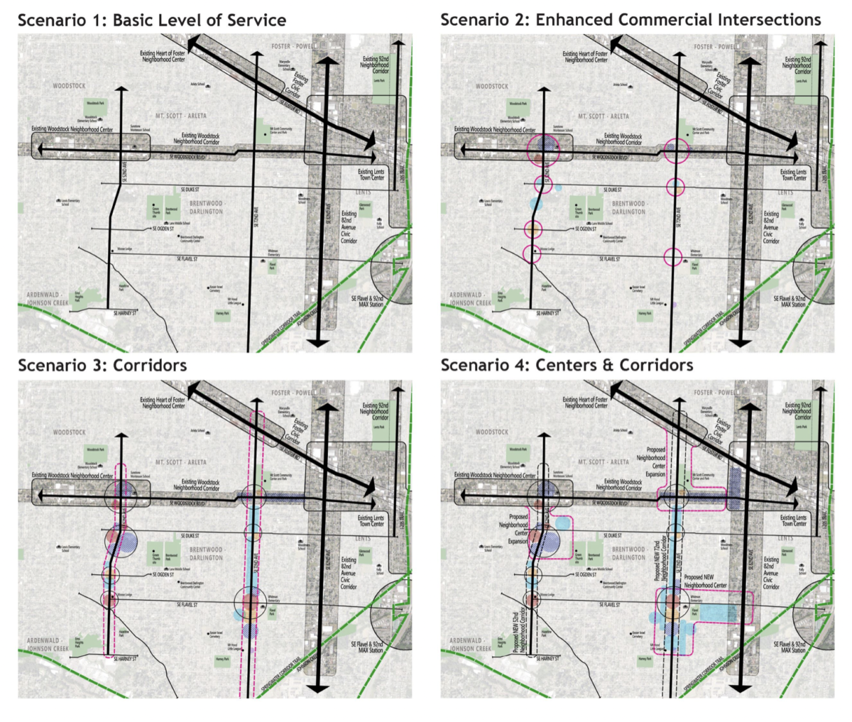
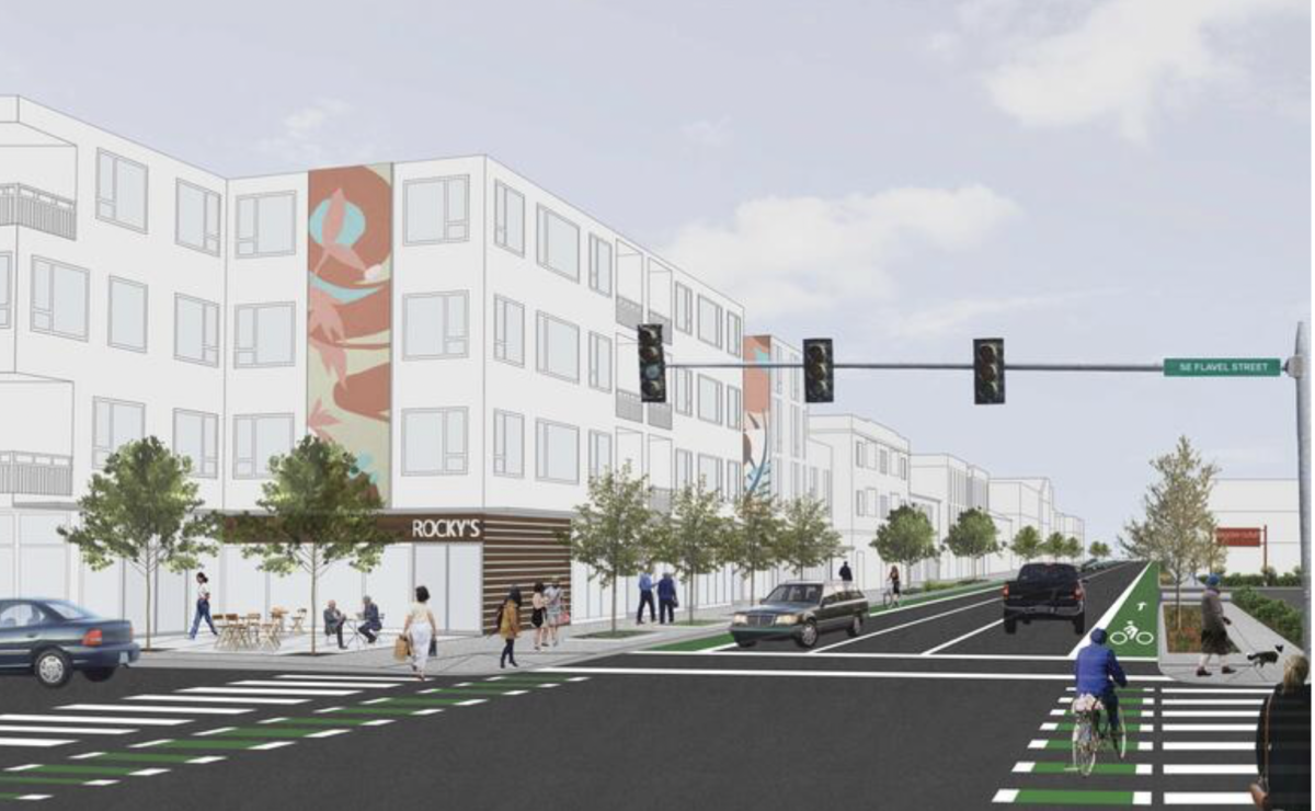
The four Community Development Scenarios (above) “illustrate different land use and community development futures” for the focus areas of SE 52nd and 72nd Avenues and vary in the level of changed they’d trigger. At one end of the spectrum, the city suggests building on current land use patterns to create new multi-unit housing and enhancing existing commercial sites. At the other end, SE 52nd and 72nd Aves would undergo dramatic changes that would enable significant mixed housing and retail development potential (see lead graphic above).
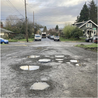
As far as transportation changes, the plan acknowledges this area has insufficient bike lanes and sidewalk gaps (or none at all). This leads to wasted potential for better active transportation in these neighborhoods because, as the draft plan states, the area has a “compact street grid provides opportunities to move throughout the area without a vehicle.”
For example, the Springwater Corridor trail, a major east-west biking corridor, should be easily accessible for people who live in lower southeast. But because of the bike system gaps, many people have to go completely out of the way to get to it safely.
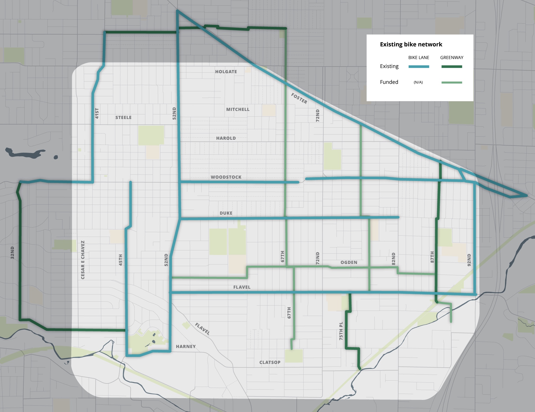
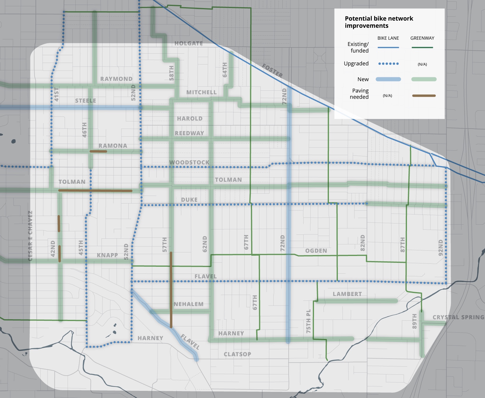
(Existing versus potential bike network.)
While people biking around other parts of the city have ample neighborhood greenway options, there are precious few greenways in this part of town, and the bike lanes are often located too close to car traffic with only a very slight barrier for separation.
Planners say they’ve received feedback “about the need to improve street conditions for walking and biking as well as to calm/slow motor vehicles” and have developed a list of potential projects to address these concerns.
Some of these potential projects include adding crossings on a large stretch of Holgate Blvd, filling the bike lane gap on Woodstock Blvd between SE 69th and SE 72nd, and doing sidewalk infill in many places in the area. The plan also includes bus system changes that would create more continuous transit access across Woodstock, 72nd Ave and Flavel St.
Now PBOT and BPS want feedback to learn just how bold they should be with future changes. Take a look at the survey and online open house where you’ll learn more about existing conditions and the scope of what’s possible. The final plan is expected to go in front of City Council for adoption the end of this year or beginning of 2023.

