A long awaited plan from the Portland Bureau of Transportation recommends a slew projects that could set the stage for major changes to a key east-west corridor.
When the Columbia Lombard Mobility Corridor Plan kicked off over two years ago, we said it could unlock massive potential. Now that it’s been released for public review and comment, has the plan lived up its promise? The plan recommends several exciting projects that would definitely move the needle for cycling and create new places to ride where few – if any – people dare ride today.
Here are a few highlights of the plan…
Columbia Blvd
PBOT’s main goal with Columbia is to recognize its importance as an industrial and freight-centric corridor, while making it safer for everyone. In this plan, Lombard is the street where they recommend more cycling-centric changes, but there are a few projects on Columbia that are very notable (as we think about this plan, keep in mind that Columbia is owned by PBOT and Lombard/US 30/Killingsworth is owned by the Oregon Department of Transportation).
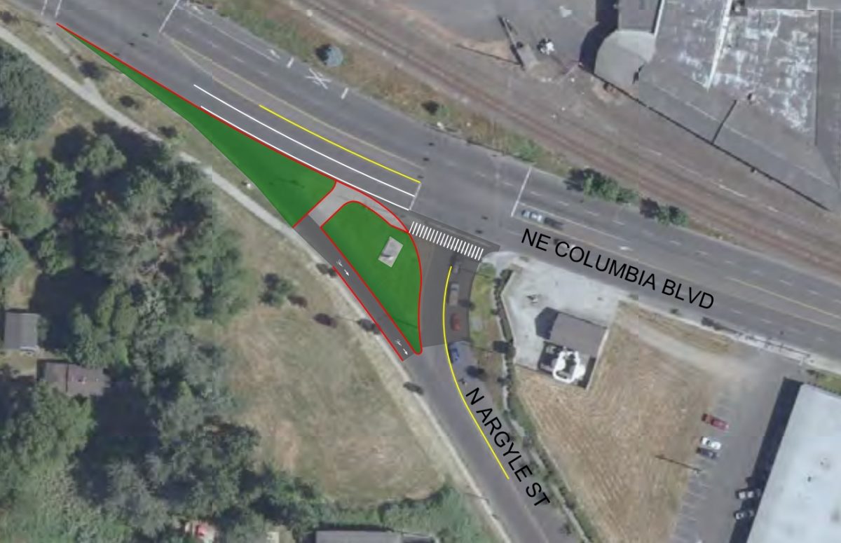
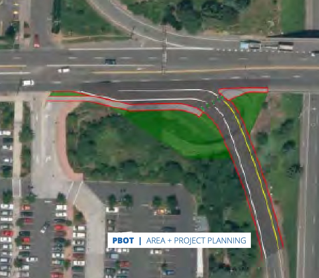
Just north of Kenton Park, PBOT wants to reconfigure the Columbia/Argyle intersection. The plan calls for removal of the eastbound slip lane from Columbia to Argyle. This would create a much safer condition to the existing path/sidewalk on the south side of Columbia. This path goes all the way to St. Johns where you can connect to other paths (via a signalized crossing at N Portsmouth) all the way out to Kelley Point Park.
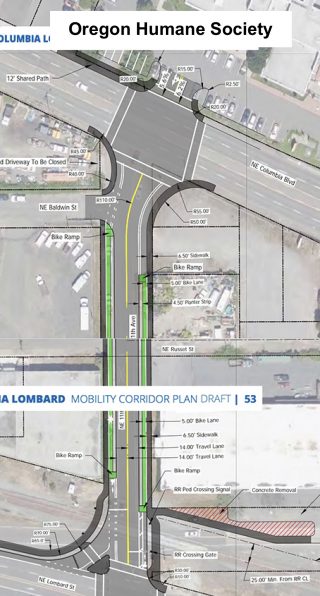
Safer access to Oregon Humane Society is long overdue! This popular destination has been held hostage by dangerous road conditions for way too long. PBOT’s plan would redesign NE 11th between Lombard and Columbia with a new striping, medians, bike lanes, and other changes. OHS has agreed to re-align their main entrance to 11th so folks don’t have to navigate an off-set crossing of Columbia to pick up their pets.
Advertisement
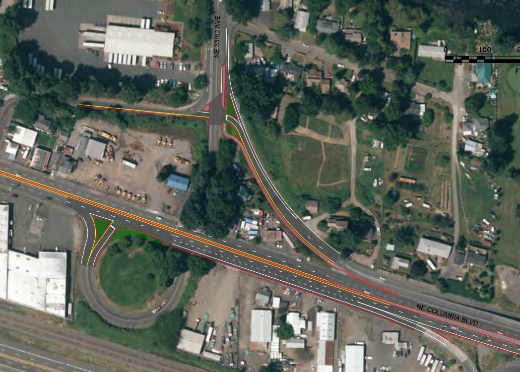
This is a big one. NE 33rd is a key north-south connection to the Marine Drive bike path. Getting over Columbia is stressful in both directions. In the near-term PBOT wants to improve the bike lane to avoid the need to merge across NE 33rd Ave when headed northbound. They’d also re-stripe Columbia and make changes to the NE 33rd Drive corkscrew so that riders don’t have to share a lane with high-speed drivers.
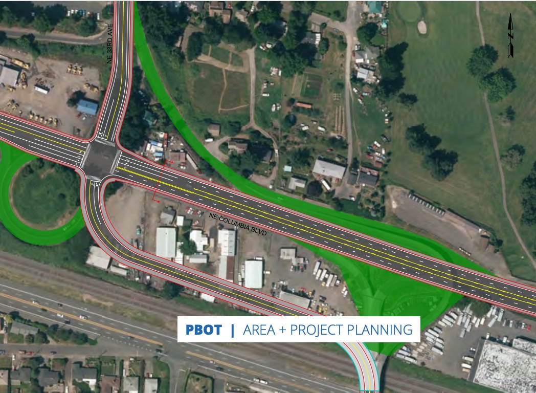
In the long-term, PBOT’s plan would dramatically reconfigure this interchange. They’d get rid of the flyover and the corkscrew ramp and direct everything toward a much safer and more predictable, 4-way signalized crossing of Columbia. “While this project would be expensive and have substantial right-of-way impacts, it would also simplify traffic movements, allow for continuous bicycle/pedestrian facilities…” the plan states.
Lombard St (US 30 Bypass)/Killingsworth
Because it is less industrial, Lombard offers more potential for bike facilities. On the flipside, it’s maintained by the Oregon Department of Transportation and still carries a high volume of freight traffic, so adding bikeways will require careful negotiations and planning.
One of the first recommendations that caught my eye was to remove the cloverleaf pedestrian ramp over the I-5 southbound on-ramp near Fred Meyer. This iconic structure is really neat, but it’s also a relic of the past. This crossing of I-5 is currently horrible, so it’s good to see PBOT put forward plans to reduce turning radii and tame drivers.
Unfortunately, PBOT has not chosen to endorse bike lanes and a road diet on Lombard between NE Mississippi and NE Martin Luther King Jr (below). Despite a terrible crash history, rampant speeding, and community support, PBOT says, “the road width and current traffic volumes make this difficult.” “Reducing four lane roads to three motor vehicle lanes and adding bike lanes would improve safety for all road users, but based on current traffic volumes (~13,000 vehicles in each direction) this would have a high impact on travel times, intersections and parallel routes,” they continue.
In the near-term, PBOT says this section of Lombard should be restriped with a wider centerline and parking should be prohibited on the north side. They’d also add a few left-turn pockets (at N Albina for instance).
While they don’t have the guts to reduce driving capacity right now, PBOT that when traffic volume drops below 10,000 vehicles per direction, a road diet and bike lanes would be considered. This stance begs the question: How will we meet our mode share goals if we are unwilling to proactively re-allocate roadway space from driving and toward other uses?
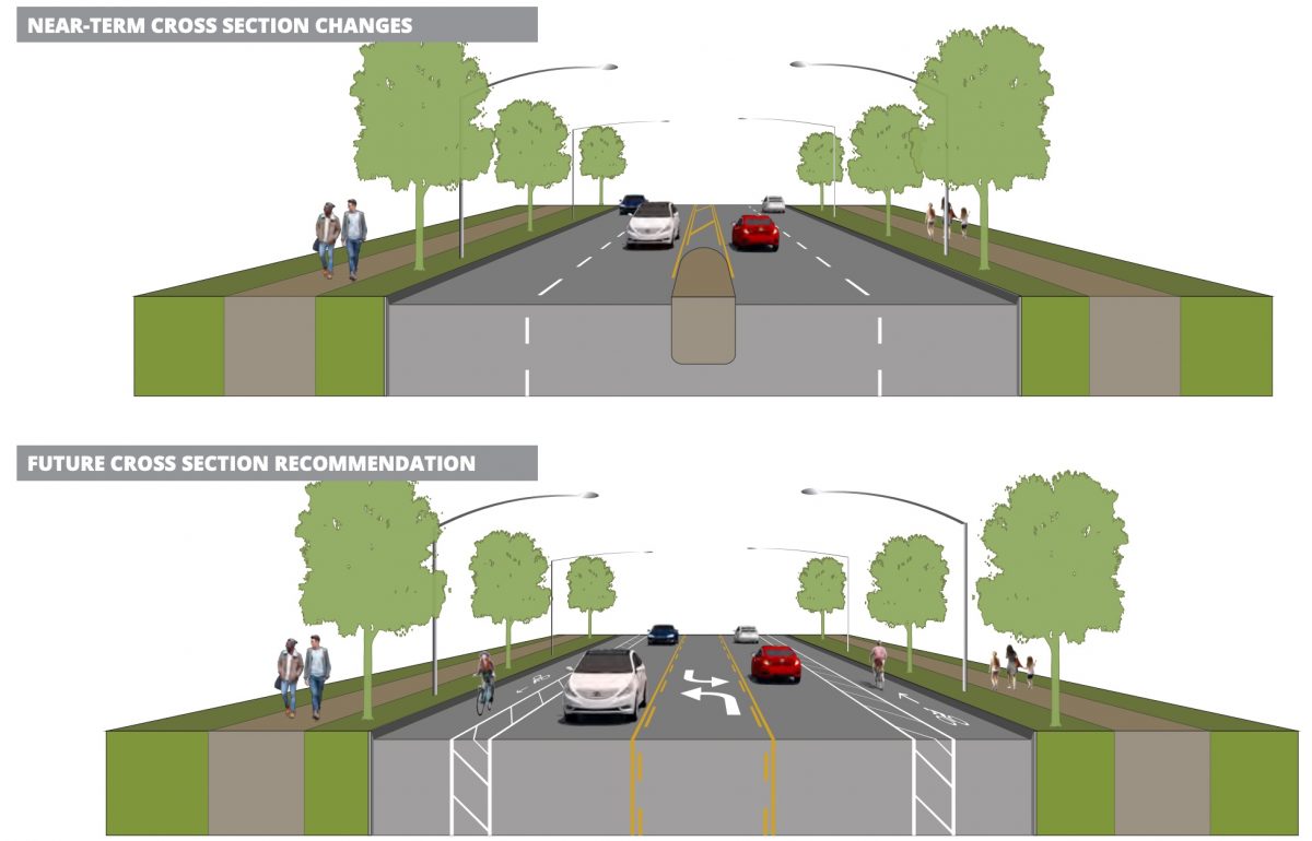
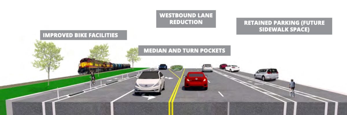
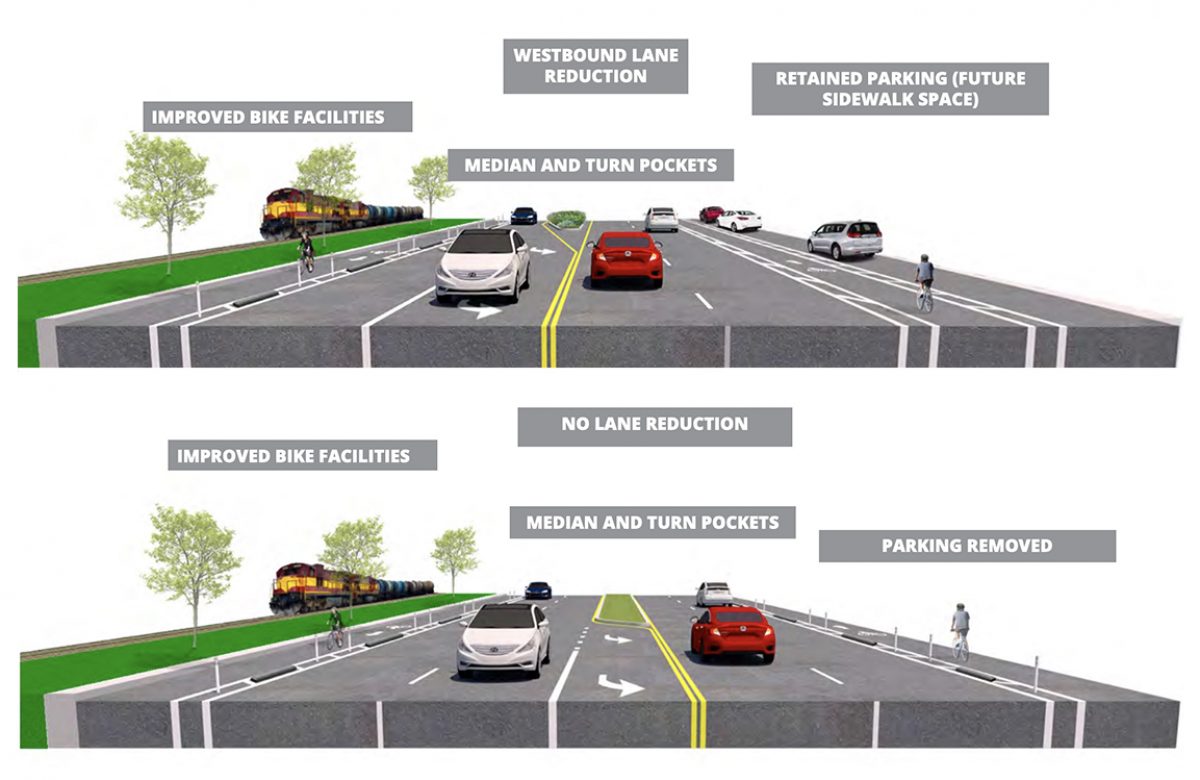
On a brighter note, I was happy to see a recommendation for wider, protected bike lanes on Lombard between 11th and 60th (although we’d need to make them much more protected if we want people to ride in them). PBOT has shared two options for further consideration.
Option 1 would reduce driving space in the westbound direction. “While this reduces the capacity of the road for motor vehicles, it still allows traffic to flow consistently at most times of the day,” the plan reads. It would maintain on-street parking on the south-side with an eye toward the future where the parking could be converted to a sidewalk or more robust, grade-separated bike lanes.
If the driving lane reduction in Option 1 isn’t feasible, PBOT has created Option 2 . This would add a center median and maintain two driving lanes in each direction “In this scenario,” the plan states, “it is even more critical to separate bike facilities from traffic and reduce the high rates of speed through signal timing, speed reader boards, and automated enforcement.”
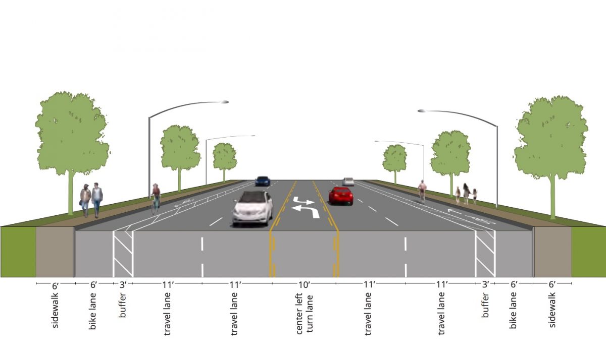
East of 72nd, PBOT would restripe the lanes to create space for wider, buffered bike lanes. (It’s unfortunate to see buffered bike lanes on a major arterial context like this without physical protection. For some reason PBOT is still not placing concrete in these buffered areas as a default.)
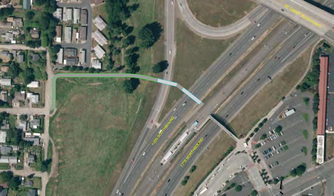
Adjacent to I-205, PBOT recommends a new carfree bridge over the freeway to connect the Sumner neighborhood to the Parkrose/Sumner Transit Center. This would eliminate the need for people on foot and bikes to use Sandy or Killingsworth and create a new connection to the I-205 path.
These are just a sampling of what’s in the plan. PBOT’s other recommendations include a new bridge over I-5 at N Winchell and new sections of the Columbia Slough Path.
While they’re still just concepts at this point, they now have the full weight of PBOT behind them. From here it will be up to project advocates (like you) and city staff to find funding and push further to get them implemented. For more details and to share comments, see the project page at Portland.gov. The plan is expected to be adopted by City Council in the coming months.
— Jonathan Maus: (503) 706-8804, @jonathan_maus on Twitter and jonathan@bikeportland.org
— Get our headlines delivered to your inbox.
— Support this independent community media outlet with a one-time contribution or monthly subscription.

