(Graphics: Multnomah County)
There’s an issue with the forthcoming Burnside Bridge that is vexing county and city planners: How to connect bicycle riders on the east side of the Willamette River up to the new protected bike lanes on the bridge deck – and vice versa.
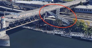
The Eastbank Esplanade is a crucial north-south cycling route that’s currently all but cut off from the Burnside Bridge and the bustling central eastside. Few bicycle users will carry their vehicles up the long flights of stairs that exist today. And if they do, they are dropped on the south side (eastbound) of the bridge and unable to access the westbound bike lane unless they skirt across several lanes of traffic.
Multnomah County (the agency that owns the bridge) wants to make it easier for bicycle riders (and walkers, wheelchair users, scooter riders, and so on) to get on and off their $825 million bridge and they need to have a better connection in place before they break ground in 2024. The current concept is a ramp with switchbacks on the south side of the bridge that would connect to the Esplanade where the staircase is today. And similar to those stairs, it would give bicycle riders only limited access the bridge.
If you were coming eastbound into downtown, you’d have to go against traffic on the bridge to access the ramp. You’d have similar problems if you were on the Esplanade and wanted to go downtown. Both scenarios would require some combinations of dangerous crossing and/or out-of-direction travel.
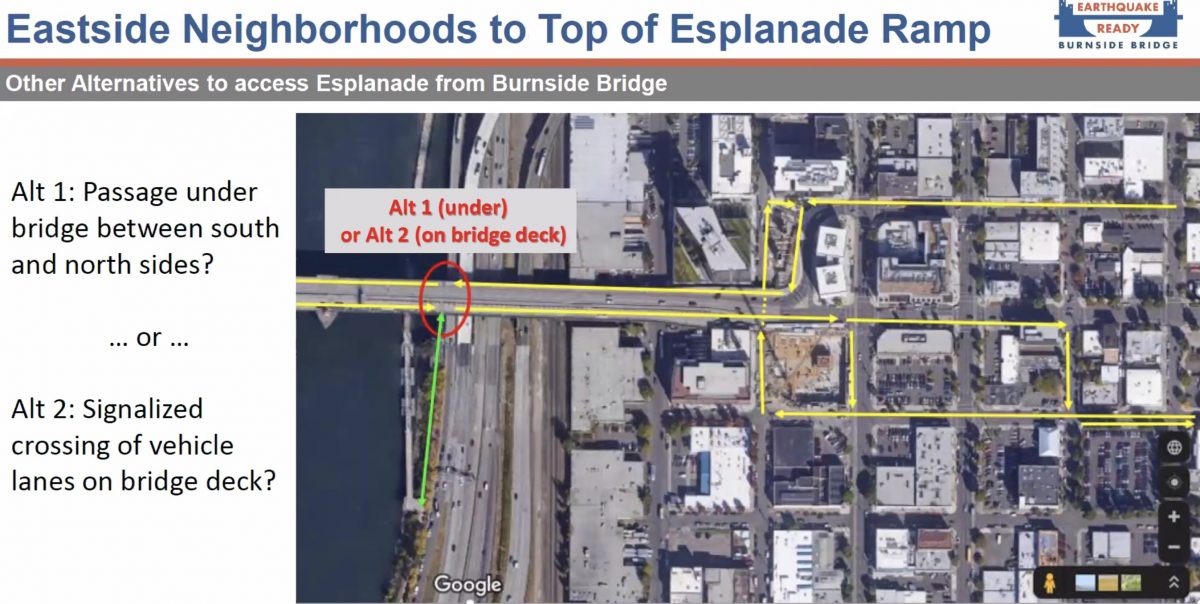
At last night’s Portland Bureau of Transportation Bicycle Advisory Committee (BAC) meeting, a consultant working with the county asked committee members for their input on two options (see below): extending the ramp under the bridge to the north side, or adding a signalized crossing on the bridge from the south to north side. The options were presented by the project’s technical lead Steve Drahota of HDR, Inc.
Advertisement
Extended ramp crossing under the bridge
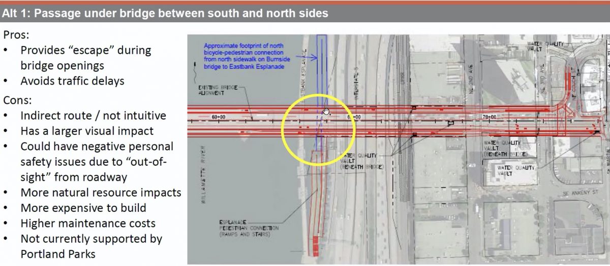
Drahota referred to this as an “under-bridge passageway” that would connect the proposed ramp on the south side to the north side of the bridge. It would be similar to the ramps near the Steel Bridge, but with more vertical gap, it would need three switchbacks instead of two.
A slide Drahota shared showed only two “pros” and a “whole lot of cons.” On the plus side, it wouldn’t impact bridge traffic at all and it would give path users a route to bail out when bridge lifts occur.
On the negative side, the extended ramp would be quite long in order to remain ADA compliant (5% gradient or less) and move people the 50 feet up from the river and across the 115-foot wide bridge. And as many of you know from experience on the I-205 path, underpasses can feel unsafe especially if there are people living on them. Drahota also mentioned that the ramp structure would be more costly to build and maintain and would not be aesthetically pleasing.
Signalized crossing on bridge deck
The County seems to be favoring the option of a traffic signal on the bridge. The signal would give people a safe way to cross the bridge and Drahota said, “We feel this provides a much more intuitive route.” He also rattled off a list of reasons it’s a better option than the extended ramp: It’s a more intuitive connection, it provides better visibility/public safety than an underpass, and it would be cheaper to build.
The downsides of the signal are that it could delay bridge traffic and the bike lane design would have to include waiting zones for people as they queue for the light.
——
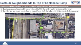
Drahota and PBOT Bike Planner Roger Geller also shared last night they’ve discussed two-way bike traffic on the south side off the bridge — either for the entire bridge span or just between Martin Luther King Jr Blvd and the ramp access point.
Drahota said a two-way facility on the south side would be challenging, but not impossible. “Adding a two-way facility across the bridge is not cheap,” he said. “It does build in a pretty hefty price tag. But from a feasibility standpoint, it’s feasible.”
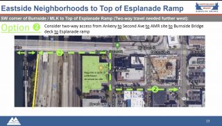
He pointed to width constraints at the Burnside/Martin Luther King Jr. Blvd intersection that wouldn’t provide enough space to create a two-way bike lane on the south side and maintain a bike lane on the north side (of course he makes that calculation while maintaining the vast majority of the road width for standard lanes). Drahota said another option might be to bring bike traffic from SE Ankeny and build a ramp at the location of a building on SE 2nd Avenue that’s slated for development.
There’s also the possibility of removing all non-driving traffic from the north side and putting it on the south side. A two-way bike lane and sidewalk on one side of the bridge makes some connections easier, but it would also come at the cost of losing a bike network connection on the north side of the bridge.
“What do you lose by giving that up? If you don’t have a westbound facility on the north side?” Geller asked rhetorically, “Sure we can make it work two ways on the south side, but that’s the question we need to answer.”
The County is still early in the design phase of the project and these conversations will continue in the coming months. Stay tuned for more coverage and opportunities to share your feedback. Learn more at the County’s website.
— Jonathan Maus: (503) 706-8804, @jonathan_maus on Twitter and jonathan@bikeportland.org
— Get our headlines delivered to your inbox.
— Support this independent community media outlet with a one-time contribution or monthly subscription.


