One of the projects we’re most excited to follow this year is a complete remake of NW Flanders Street into a low-stress bikeway between Naito Parkway and NW 24th. And yes, it will come with a new carfree bridge over I-405. We can hardly wait! Since there’s been significant progress on them recently, I figured it was time for a check-in.
A continuous, (hopefully) high-quality, east-west bikeway that connects such a large number of housing units, jobs, and destinations has vast implications for our city. If we get it right, it could become a marquee project and serve as a blueprint for how Portland can move the needle on transportation and a whole host of other issues (public health, climate change, equity, community-building, air quality, affordability, economic development, and so on) that great cycling infrastructure intersects with.
The Flanders Bikeway
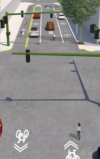
The NW Flanders Bikeway project launched last fall and PBOT has made considerable progress. It’ll probably be summer before the design and outreach process is complete, and construction isn’t slated until 2020; but proposals are out and things are beginning to take shape.
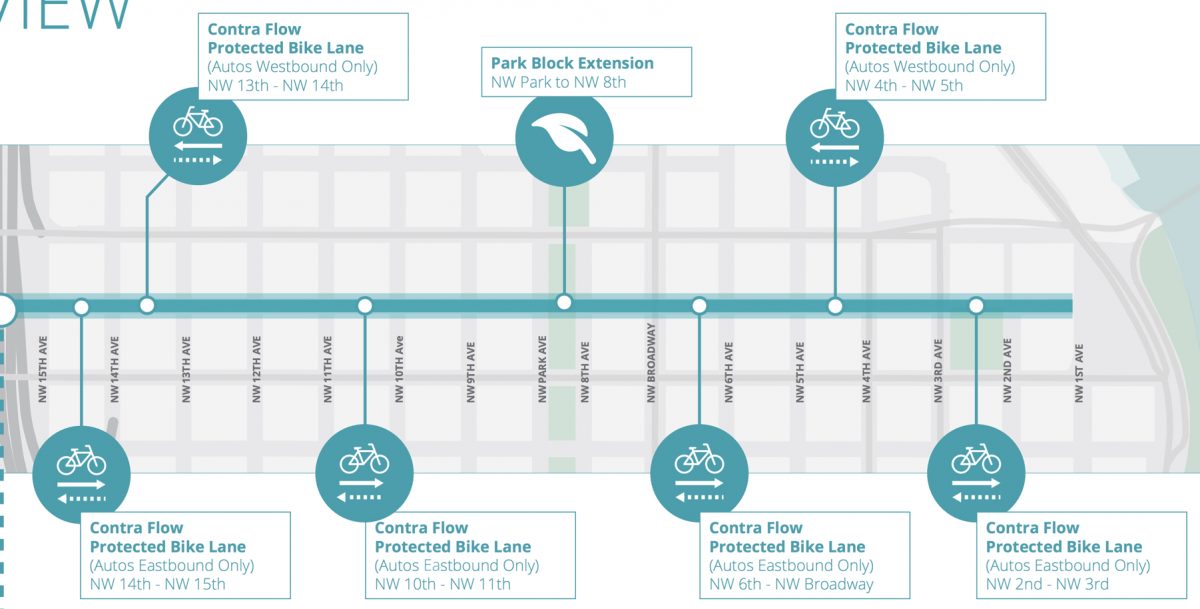
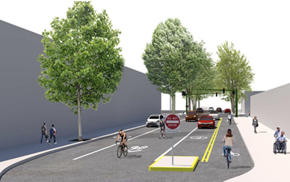
Between I-405 and Waterfront Park PBOT has proposed six sections where car drivers will be allowed to go only one-way. This “converging one-way” design is an attempt to divert auto users off of Flanders and/or discourage them from using it at all. Where drivers will only have one direction of travel, the bikeway will be either shared (in same direction of auto travel) or via a protected “contra-flow” bike lane.
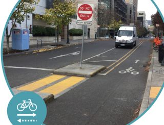
This isn’t an entirely new design for PBOT. They’ve already installed one block of it on NW Marshall between 10th and 11th (right).
These one-ways are in addition to the proposal to extend the North Park Blocks across the street between NW Park and 8th, which will create a dead-end for drivers.
Here’s how the converging one-way proposal looks so far (click to enlarge, and note the proposed curb extension on 14th and elsewhere):

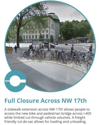
West of I-405, PBOT has proposed a full closure for drivers across NW 17th in order to provide a safer entrance to the Flanders Crossing Bridge. There would be a new traffic signal at 16th to get people onto the bridge (and a new signal at 14th) Here’s the image and copy they’ve used in outreach documents to explain the idea:
There would be another semi-diverter at 21st.
Advertisement
The Flanders Crossing Bridge
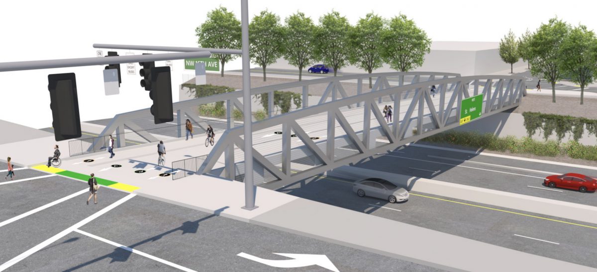
This $6.4 million bridge will be the centerpiece of the bikeway. With construction slated for late 2019, it will hopefully be done around the same time as the bikeway. We’ve covered the bridge a lot in the past so see the archives for all the background. Today we want to share the most recent drawing and proposals. As you can see in the drawing above, bicycle users will be in the middle two lanes and walkers will use sidewalks on the edges. When we last wrote about the design the space was going to be split equally with four, six-foot wide lanes. The sidewalk will be separated by a mountable curb or some other material.
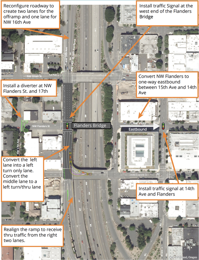
Here’s a look at how the bridge integrates with the bikeway (the green lines on the left are the NW 17th element we mentioned above):
Because the bridge and its connections to the bikeway are located in such a dense street grid with freeway ramps and lanes nearby, PBOT has had to do quite a bit of wrangling with ODOT to come up with an acceptable plan. There are still operational issues to hammer out, but here are the other elements of the projects that PBOT is proposing to help make it it all fit together (an expanded view of the graphic above).
This is all very exciting. Of course the plans could change depending on how the outreach process goes. Stay tuned for opportunities to weigh in.
— Jonathan Maus: (503) 706-8804, @jonathan_maus on Twitter and jonathan@bikeportland.org
Never miss a story. Sign-up for the daily BP Headlines email.
BikePortland needs your support.

