(Photos: M.Andersen/BikePortland)
This post is part of Gap Week, a special series made possible by our sponsors and subscribers.
Portland has a problem: like most U.S. cities, it’s been losing middle-wage jobs, especially the kind you can get without a fancy degree.
Many of the middle-wage, blue-collar jobs that remain are spread in industrial centers along the rivers with limited public transit access. And one of the most important clusters is one in Northeast Portland that many Portlanders know well: Portland International Airport.
Including airport and airline workers, groundskeepers and staff at on-site hotels and restaurants, the airport employs 10,000 people. (For comparison’s sake, downtown’s central business district – south of Burnside, north of Jefferson – contains about 45,000 jobs, mostly with white-collar duties.) That’s not to mention thousands of others who work on industrial-zoned lands nearby or at the big Cascade Station retail complex just to the east.
And as a recent city study shows, these jobs draw overwhelmingly on an area with virtually no north-south public transit service: East Portland.
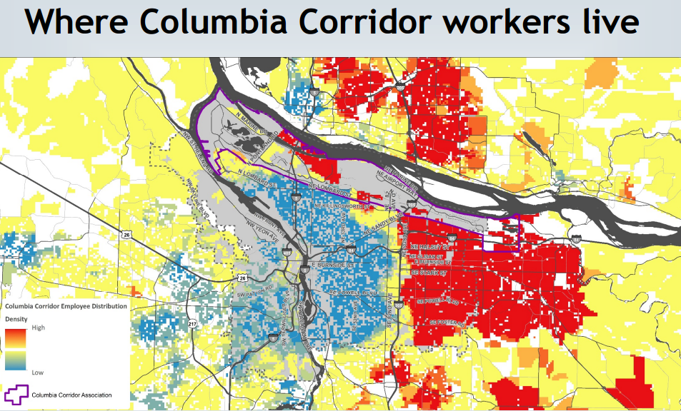
Though the MAX Red Line runs to the airport terminal, its frequency peters off fast in the evenings. And there is no other bus service to the airport area, in part because the jobs there are so spread out that it’s hard to reach them on foot from a bus stop.
If only there were some type of ultra-low-cost personal vehicle that could help lower-income Portlanders reach the sorts of jobs that could make them middle-income Portlanders.
Network context
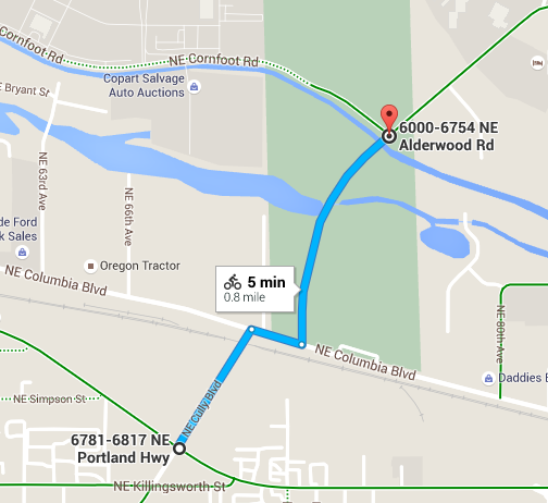
As we reported in 2014, there are several plans afoot to improve bike access to the airport from the south. But according to Zef Wagner, an associate planner with the Portland Bureau of Transportation, one stands out as achievable in the relatively near future: Cully-Columbia-Alderwood.
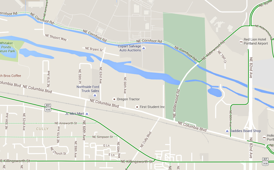
South of Killingsworth, Cully Boulevard has one of the city’s nicest bike lanes. It’s elevated and parking-protected, and it connects to various east-west bike routes including Killingsworth, which offers a rideable (though stressful) crossing of Interstate 205. The city recently recognized Cully’s importance by striping a new bike lane on Cully between Killingsworth and Portland Highway.
Advertisement

North of the Columbia River Slough is another fairly good network, including Alderwood Road and Cornfoot Road, which plug into decent biking connections around the airport area.
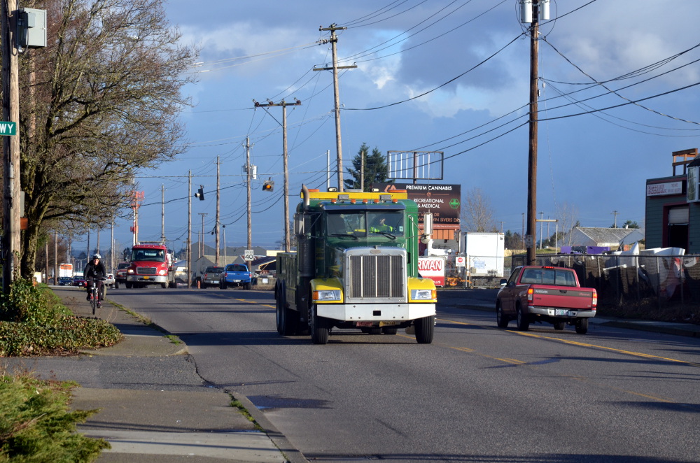
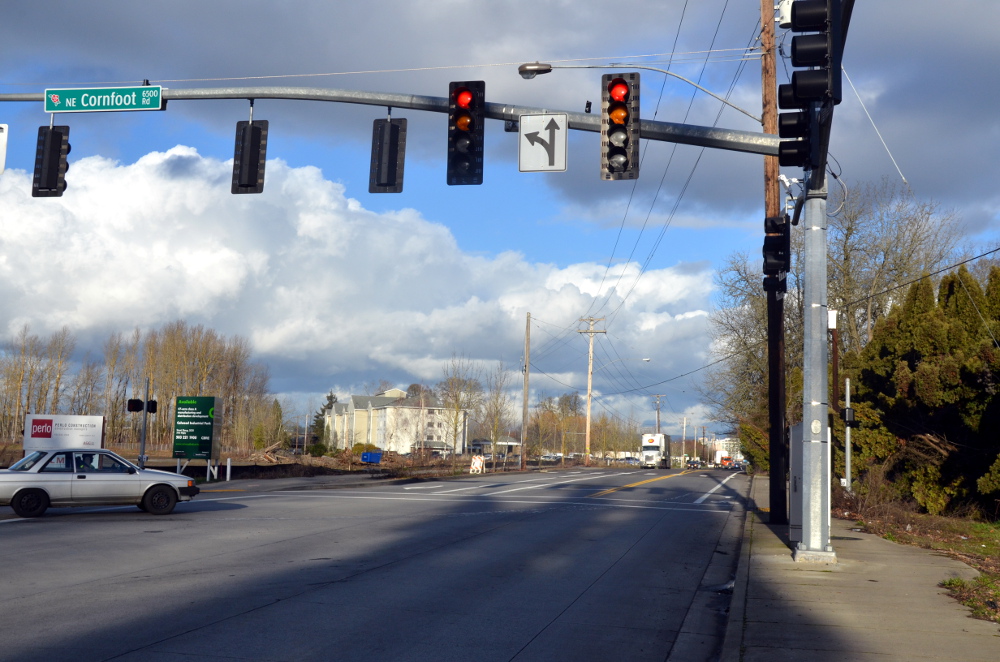
For people on bikes, the big problem is the stretch of Cully and Alderwood between Portland Highway and Cornfoot, including about two blocks of Columbia Boulevard.
Existing conditions
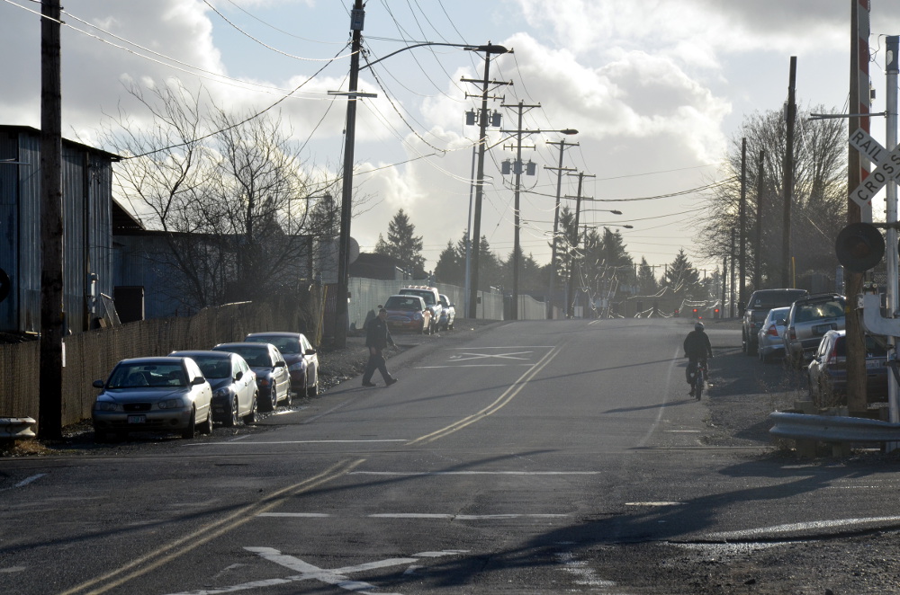
The above photo is looking south down Cully from Portland Highway — note the decently wide curbside bike lanes connecting south across Killingsworth in the background.
But back up a bit and Cully’s bike lanes become narrow striped shoulders…
…which at points become unrideably narrow and torn-up shoulders across the entrances to several industrial yards:

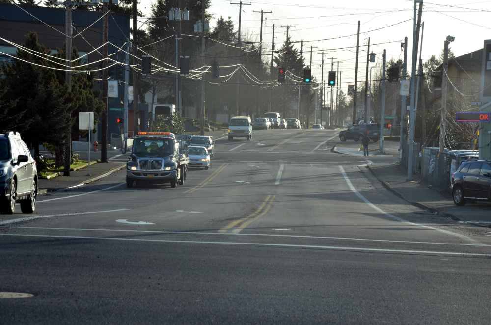
In the background of the north-facing shot above, you can see the T intersection where Cully meets Columbia Boulevard. Columbia is a picture-perfect road-dieted street here: a fairly constant flow of traffic in one lane in each direction with a center turn lane. It’s safe and efficient to drive on, but nobody left room for bikes on Columbia.
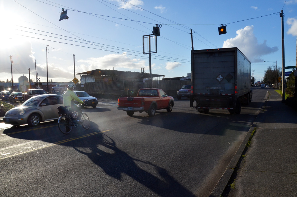
Traffic moves at 35 to 40 mph; at one point on my visit I saw a pickup use the center turn lane to make a blind pass around a big truck it had been following. (For his trouble, the man driving the pickup got to proceed at the same 35 mph in front of the big truck instead of behind it.)
Street corners meet Columbia at shallow angles, making it hard to know who’s about to turn and inviting people to take the corners at speed.

Despite that, I was a little bit surprised to see three people biking on this two-block stretch of Columbia in the 15 minutes I was there at about 3:30 p.m. Thursday. Even with fast-moving trucks everywhere and no infrastructure, it’s such a useful connection that bold riders already use it.

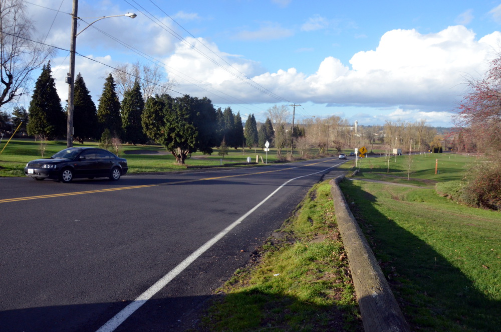
The key street north of Columbia is a half-mile stretch of Alderwood that crosses two branches of the Columbia Slough and connects to Cornfoot. Here’s what the street looks like just north of Columbia (facing north):
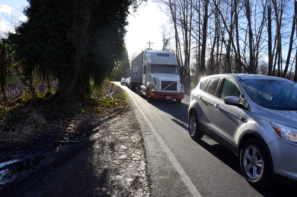
Even the shoulders vanish as the road goes through a patch of woods:
But just north of those woods, Alderwood meets up with Cornfoot and gets a bike lane that goes all the way to the airport.
The missing link here is a four-fifths-of-a-mile stretch on these three streets that could connect the whole airport area to Northeast Portland’s neighborhoods:
What the future holds
More than any of the other gaps we’ve focused on this week, the solution to this problem is money.
Appealing, comfortable bike links here would require two new signalized crossings: Cully/Columbia and Alderwood/Columbia. (Cully currently has flashing yellow lights; Alderwood just has a stop sign.) All three streets would also require shoulder repairs and bikeways — ideally buffered or separated from traffic, given the speed and size of the autos here.
Fortunately, some of the money is already on the way, and the rest of the project is a decent candidate for more money.
City spokeswoman Hannah Schafer said in an email Tuesday that the Port of Portland (the public agency that runs the airport) has already received funding for a new signal at Alderwood and Columbia. Sidewalks and bike facilities on part of Columbia will be part of that project.
“There is strong interest at both the City and Port in finding funding for the other signal at Cully/Columbia, and one upcoming possibility is the next round of Regional Flexible Funds,” Schafer continued. “RFF projects must benefit Active Transportation and/or Freight—and this project would benefit both.”
“If both traffic signals were built, we would have bicycle facilities for that two-block segment,” Schafer said.
That leaves the stretches on Cully and Alderwood.
Alderwood has the best prospects: a $2.5 million multi-use path between Columbia and Cornfoot is project #40027 on the city’s proposed transportation system plan project list. It’s slated to be built in the next 10 years, but isn’t funded yet.
The battered stretch of Cully between Portland Highway and Columbia Way is a lower priority for the city. It’d cost $4 million and is also on the proposed TSP project list (it’s #40037), but not until after 2026.
These short connections are expensive. But again, they have a lot of payoff in affordable job access, which makes them good candidates for outside grants. If the city keeps these projects on its TSP list or accelerates the one on Alderwood — public testimony is being accepted until March 22 — Portland could get a vastly improved bike connection to its airport.
Stay tuned for the conclusion of Gap Week, where we’ll share readers’ submissions of their own worst bike lane gaps.
— Michael Andersen, (503) 333-7824 – michael@bikeportland.org
BikePortland can’t survive without paid subscribers. Please sign up today.