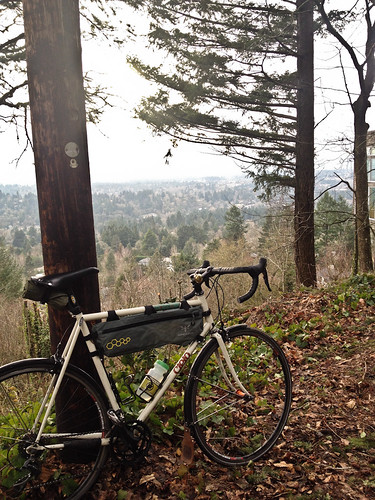
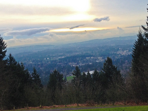
Washington County from SW Fairmount Blvd.
(Photos by J. Maus/BikePortland)
This post is part of our SW Portland Week.
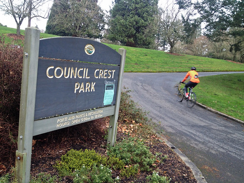
Council Crest: If you live in Portland and like to ride bikes, chances are you’ve heard of this legendary destination. When I first heard about it, I recall how it garnered mythical status — as if its summit would rise above downtown Portland like a snow-capped Himalayan peak.
While it pales in stature to the major summits of the world, its status to locals is undeniable. At 1,071 feet, it’s the tallest peak in the vaunted West Hills stretching north-south above Portland and the Willamette River on one side, and towering over the vast rural lands of Washington County on the other.
It’s certainly not the hardest climb, nor the most beautiful, but there are many reasons why Council Crest is such a popular destination: It’s proximity to downtown and inner neighborhoods, it’s quirky history (a streetcar line used to take city folk to an amusement park at the summit), the views from the top, and the wonderful road that wraps around it just to name a few. In the past few years I too have become one of its biggest fans. From my office downtown, I’ve learned several different ways to incorporate it into my weekly riding habit.
Since it’s SW Portland Week, I figured this would be a great excuse to showcase the route and share it with those of you who haven’t checked it out yet.
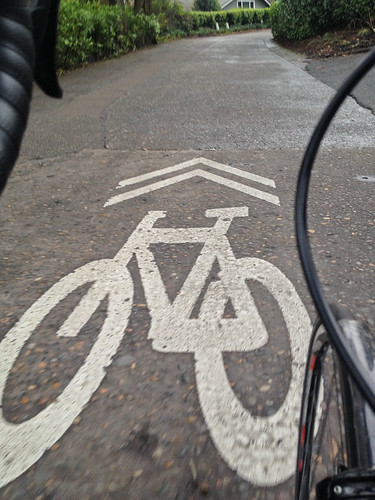
Hop on SW Broadway and head south. You’ll get a glimpse of the protected bike lanes near Portland State University before connecting to SW Terwilliger. That’s one thing I love about this ride. In just a few minutes from the stress of downtown, you can escape into the open road. Terwilliger is far from a quiet country road, but with SW Barbur and I-5 running parallel to it, it tends to have only moderate traffic as it winds through Marquam Nature Park.
Advertisement

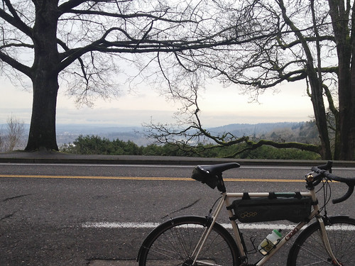
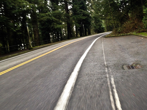
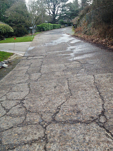
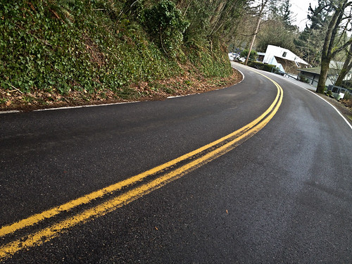
A few miles on Terwilliger and then the real fun starts. Hang a right on SW Westwood Drive and enjoy two miles and about 450 of climbing on cobbled and bumpy narrow roads. Once the climb is done (for now), SW Fairmount Blvd beckons with its smooth curves and million-dollar views around every one of them.
You’ll want to leave a little in the tank when you hang a hard right on SW Talbot Terrace and begin the ascent up to Council Crest Park. Wind up to the very top, take a look at the views, and then come careening back down.
At this point, you could just drop right back into downtown Portland via SW Vista Ave and SW Montgomery. But if I can spare a few more minutes, I like to head north after the summit and make my way onto SW Hewett Blvd. Hewett will drop you out at Sylvan and Highway 26. You’ll have to use sidewalks to get to SW Skyline and you’ll soon be pointed upward again. This section of Skyline is narrow and has relatively high traffic. Fortunately you’ll only be on it for 0.8 miles before turning onto SW Fairview Blvd.
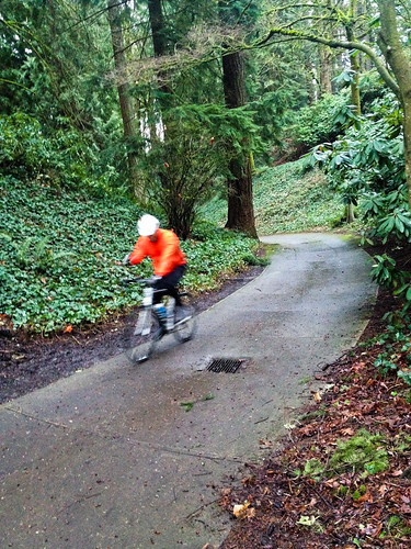
Now the final descent begins. Take Fairview to SW Knights, then hang a hard right onto Kingston. Watch for potholes here and there as you zoom downward through the forest, passing Oregon Zoo habitats, an archery range, and the Rose Garden. Hop onto SW Sherwood and continue your descent and you’ll pop out at a water reservoir. Now you’ve got to watch your route closely to find the secret path that will lead you to W Burnside (I think Zoobombers call this section of path “bobsled”.)
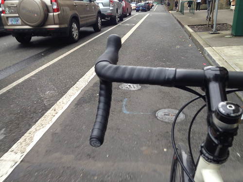
Once on Burnside, enjoy a bit of high-traffic, urban riding (it’s fun with the right attitude) and then hang a soft right on the big green lane on SW Stark to complete the loop. This is such a great ride, and with good fitness you can do it in well under two hours.
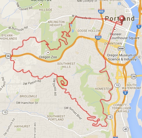
Check out the route via RideWithGPS.com.
We’ll be here in Southwest all week! And join us Friday afternoon for a BikePortland Get Together and social hour at the Lucky Labrador Public House in Multnomah Village (7675 SW Capitol Hwy) from 4:00 – 6:30pm.