
Twice in the last few weeks I’ve ridden my bike along an unfamiliar route. Both rides were enjoyable; but the key difference was how difficult it was to find my way.
On the first ride, through an area where I’ve lived and ridden regularly for the past four years, I had to bring a personal tour guide. On the second ride I navigated an area I had not seen from a bike seat in nearly a decade, along a route I was not familiar with; but I did it completely solo, with no tour guide and no map.
I live in Tigard and regularly travel to downtown Portland via the Beaverton Transit Center, but I had never ridden my bicycle between the latter two locations. Whenever I was traveling from Beaverton into Portland I had a choice: stick with the bus and train schedules I’m familiar with, or ride on a route where I’m likely to get lost.
In an effort to step outside my comfort zone, I called my friend Harmony Bliss (before you ask, she acquired her unique name through marriage, not directly from her parents) and asked if she could share her experience of commuting on a bike over the hill and on the multi-use path adjacent to Highway 26.
Harmony agreed to meet me in Beaverton and lead me on a ride into Portland.

but where will we end up on the other end? How do you even find this path without a guide?
She started us out heading north along Lombard Avenue and we weaved through neighborhoods as she called out out upcoming turns so I could anticipate where we’d be going. Occasionally we’d take a break from riding so she could reorient me to where we were on the map.

In the end, the ride was surprisingly pleasant, including a section on Highway 26, and the elevation gain was much less challenging than I had anticipated.
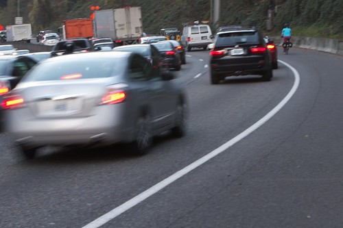
when cars are driving slowly at rush hour.
I’m looking forward to riding it again, but I’m not sure if I could duplicate the route on my own without more practice. The Highway 26 multi-use path is a good connection for bike traffic; but I was shocked at how hard it is to find from surface streets.
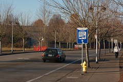
Harmony and I only caught a glimpse of one way-finding sign on our ride. We noticed exactly zero directional signs in Beaverton and it wasn’t until we were five miles from downtown that we finally encountered the first and only sign pointing us to Portland. Can you even imagine the tables being turned? Ever heard of a freeway or auto-centric arterial with such little signage?
Contrast that experience with a ride I took recently in an unfamiliar part of Eugene.

like to ride today?
After a ride around Eugene with two people familiar with the city’s bike routes, I was left to venture out on my own to visit Co-Motion Cycles, located on the opposite side of town from where we parted ways.
It’d been more than 10 years since I’d ridden any significant distance in Eugene and I was unfamiliar with the route I’d be taking. When I brought up my concerns during the ride with friends they tried to put me at ease with instructions like, “Just head east and you’ll find your way.”
At first I didn’t believe them (I have a terrible sense of direction), but in the end my ride was as simple as they said it would be.
I was even able to take an unplanned detours to visit a local businesses, all without needing to look at a map or directions on my phone.

The route I took to Co-Motion was mostly along the Fern Ridge Path, an east-to-west corridor that passes through neighborhoods and crosses a number of busy roads.
Each time the trail stops in a neighborhood there’s a sign pointing you in the direction where it picks back up again. When the trail crosses busy streets the path either splits in two, one way going under the road and the other crossing it at street level, or there are signs directing you to where the trail begins again on the other side.

find where a trail starts back up on the other side of a road.
It made me think back to my ride with Harmony. How many years ago would I have tried riding from Beaverton to Portland if I knew there were signs to lead me?
Stepping outside my personal concerns for a minute, another thought hit me: how many people want to ride a bike around Washington County, but choose not to because they can’t find their way?