


County bike map.
Washington County has a new bike map, and it’s a must-have for anyone with plans to enjoy the fantastic rural roads, trails, and towns west of Portland.
I used the map extensively on a recent trip out to Stub Stewart State Park and Vernonia and it was key in helping me find a low-traffic route on bucolic farm roads north of Hillsboro. The best part is that the map is free thanks to the Washington County Visitors Association.
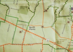
The map itself is printed on tear and water-resistant paper. It shows roads as far east as the Tillamook State Forest, south to Newberg, and north to just below Vernonia. Campsites, wineries, transit centers (MAX is your gateway to bike adventure) farm stands, bike shops, museums and other places of interest are labeled. And, like any bike map worth the paper its printed on, the new map features color-coded roads so you know what you’re getting into.
As an added bonus, there are also four featured loop rides, complete with their own inset maps, elevation profiles, GPS coordinates, and descriptions.
Washington County says the map has proved so popular, they had to enter into a second print run just one month after it was published back in May.
You can download PDFs of the map here (front) and here (back).
Learn how to get your free copy of the map on the Washington County Visitor’s Association website.